Category: BoulderCAST Daily (Page 12 of 465)

This page contains an index of our BoulderCAST Daily forecast updates. If you are NOT a Premium member, you will only see a tiny sample of this content below. Subscribe to BoulderCAST Premium to gain access to all of our daily forecasts which get published every morning.

Premium BoulderCAST Daily – Sat 08/15/26 | A Dual Threat of Flash Flooding and Severe Storms Today

The Front Range is under a dual threat today and tonight as monsoonal moisture remains quite elevated to start our weekend. A continuous plume of deep moisture will inherit eastern Colorado through Sunday, though the greatest risk of widespread flash flooding is today. Along with that, there is a severe risk, which we'll get into later. Temperatures with the storms …

Premium BoulderCAST Daily – Fri 08/14/26 | Monsoon Storms Continue into the Weekend

The flash flood risk will continue today and much of the weekend. However, the most widespread storms are expected later again this afternoon and evening, with somewhat more scattered activity this weekend. As the monsoon moisture continues to be a force this weekend, high temperatures will remain on the cool side in the upper 70s to lower 80s. Today, storms …

Premium BoulderCAST Daily – Wed 08/12/26 | Today’s Heat Is the Finale — Cooler, Wetter, & Less Smoky Days Lie Ahead

Today is the day we've all be waiting for! A much‑needed pattern shift— one that's been six sizzling, bone‑dry weeks in the making — is finally beginning to take shape across Colorado. The atmosphere has been locked in a stubborn ridge pattern since early July, suppressing moisture, amplifying the heat, and leaving the Front Range with little more than passing …

Premium BoulderCAST Daily – Tue 08/11/26 | Cooler, Wetter Weather Takes Over Through the Extended

High pressure remains parked to our south and west this morning, basically centered right over the Four Corners. That placement is giving us a textbook monsoon setup on GOES-East water vapor: subtropical moisture surging north into the Desert Southwest, then hooking east across Utah and into the Western Slope. It’s the long‑way‑around route into Colorado, and as usual, upstream terrain …

Premium BoulderCAST Daily – Sun 08/09/26 | Heat and Smoke Continues; Watching a Late-Week Cool Down

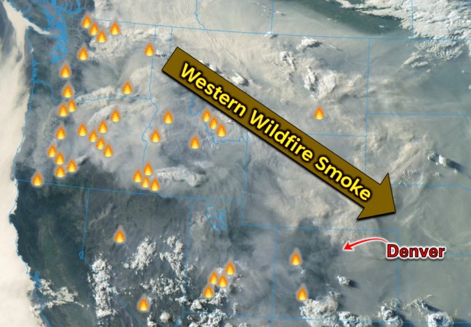
Hot and smoky is the theme again for our Sunday. The current weather alerts are unchanged from Saturday with Air Quality Alerts and a Heat Advisory in effect for the Front Range cities. Highs in the upper 90s will be typical once again today through Tuesday. Smoke levels continue to be a concern this afternoon and evening. Total column smoke …

Premium BoulderCAST Daily – Sat 08/08/26 | Clouds, Virga Breezes and Thick Smoke May Keep Us Just Shy of 100°

Hot, smoky, and stubborn — that’s the theme again today as the Four Corners heat dome tightens its grip over Colorado. Near‑record highs are still on the table, but the atmosphere is throwing us just enough curveballs to keep the forecast interesting. GOES-East imagery continues to show west–northwest flow pouring into the Front Range, with a subtle uptick in mid‑level …

Premium BoulderCAST Daily – Fri 08/07/26 | Smoke‑Soaked Heat Dome Intensifies Heading Into the Weekend

The persistent Four Corners heat dome will remain firmly entrenched through the weekend, keeping our synoptic pattern effectively locked in place. Under this stagnant ridge, broad subsidence continues to dominate the area, compressing the lower troposphere, warming the boundary layer, and suppressing vertical motion. For the Front Range, that translates to two main impacts: heat and smoke, both of which …

« Older posts Newer posts »