This week’s snowstorm was definitely one to remember! We review the BIG snow totals and take a look at how the ingredients came together perfectly to produce the biggest and most widespread dumping of snow for our area in nearly four years.
Author: BoulderCAST Team (Page 35 of 45)
This post had major contributions from at least two members of our team. The more meteorologists the better, right?

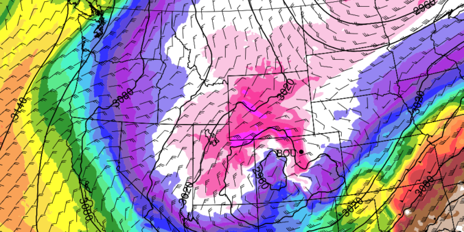
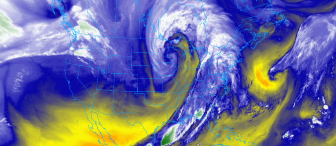
We’ve already had nearly three feet of snow in Boulder this season and just about a foot and a half in Denver. The action over the last six weeks has been fast and furious to say the least, but the individual storms so far haven’t been all that memorable. This is about to change! No storm so far this winter will match the caliber of the one bearing down on the Front Range right now. We discuss the set-up, timing and snow amounts expected to fall by Tuesday evening. Let’s jump right in to the very snowy forecast!

Several waves of light snow and a dash of freezing drizzle impacted the Denver Metro area over the last 36 hours resulting from a slow-moving storm system to the southwest. We take a look at snow totals, the beautiful weekend ahead, and the strong possibility of another cold air outbreak headed our way early next week.
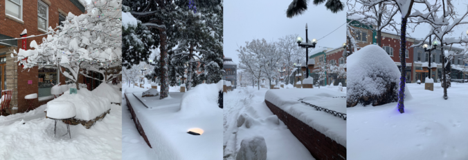
UPDATE (Friday Nov 22 at 12PM): Added discussion of official snow totals and map.
Gorgeous weather will take hold across the Front Range for the weekend with highs in the 60’s and 70’s. However, another Arctic airmass is gearing up to plunge southward spreading across the eastern two-thirds of the country Sunday into Monday. We take a look at the latest forecast, including when we expect the cold air to arrive in Denver and the outlook for wintry precipitation.
From start to finish, the early season Arctic airmass which overtook eastern Colorado this week has been truly remarkable! The prolonged period of fluffy snow and historically cold temperatures may not be matched the rest of this winter. We take a look back at the wild ride Mother Nature took us on over the last five days and check the snow totals from the second snow event wrapping up Wednesday morning.
There’s no rest for snow-lovers these days! Just as one snowstorm comes to an end, another one is already taking shape to impact the Front Range Tuesday into Wednesday. We take a look at snow totals from the first wave and discuss the evolving forecast for part deux!
UPDATE (7:00 PM Mon 10/28/19): Added our official snowfall forecast map to the end of the post!
PREMIUM UPDATE (7:00 AM Tue 10/29/19): We do a quick check on how the forecast looks this morning as snow begins to fall and bitter cold temperatures push in from the north. Click HERE to read.

As advertised, Wednesday night’s winter storm was a quick-mover! From the first snowflakes to the last ones, only about eight hours elapsed as the tightly-wound storm passed across Colorado. What it lacked for in duration, it made up for in intensity…in some areas. We take a look at the highly-variable snow totals from across the Boulder and Denver area and provide a brief post-mortem on the now-departing storm system. Continue reading
Snow is on the way as a speedy winter storm is set to impact the area Wednesday evening and night. We discuss the tricky set-up that is making for a difficult snow forecast in some areas. Of course, we do give our initial expectations for snowfall amounts as well!

Live View of Boulder

Current Conditions

Live Radar

Recent Premium Posts

BoulderCAST Daily – Sun 12/14/25 | A warmup after the chilly yesterday afternoon
🌡️ Warmth Returns with no sight of snow: Highs return close to 60 …
BoulderCAST Daily – Sat 12/13/25 | Highs in the 60s this weekend!
🌡️ October Warmth in December: Highs typical for late October will be in …
This Weekend in Colorado Weather: The December that has felt like October continues with bone dry warmth persisting into next week
🌬️ Two more breezy days ahead with gusts 15–25 MPH before the jet …
3-Day Forecast

Trending Content

© 2025 Front Range Weather, LLC