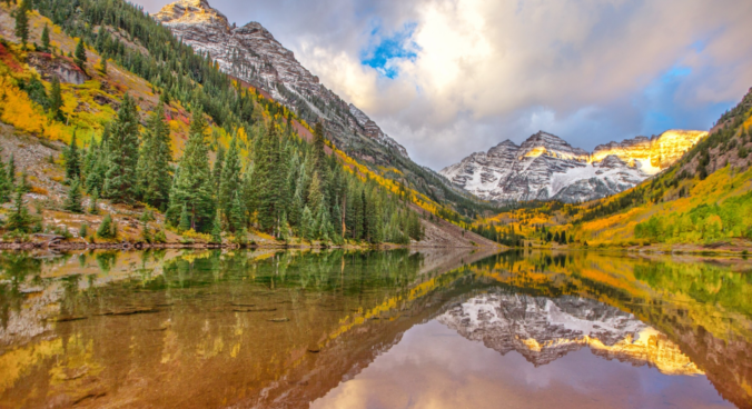
September 2021 will go down as one of the overall hottest on record for the Front Range, and not much more. Other weather highlights during the month included a multi-day late-summer heatwave, continued smoky skies from the California wildfires, the first snow for many Mountain locations, dismal precipitation for much of the state, and one measly day that could pass for autumn. Here’s a quick and colorful recap of our weather during September and how it relates to climatology.
Author: BoulderCAST Team (Page 24 of 45)
This post had major contributions from at least two members of our team. The more meteorologists the better, right?
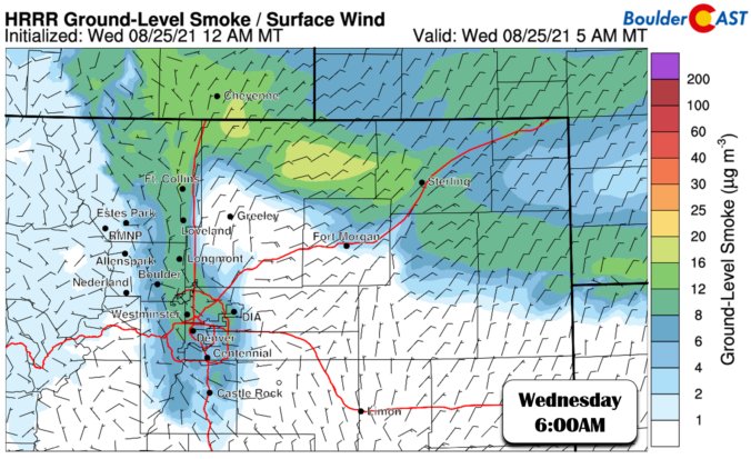
We’ve gotten many inquiries this summer about our newly added smoke forecast products. We thought it would be useful to share this information as the questions that have been asked are recurring and universal.
If you have additional questions, please post in the comments.
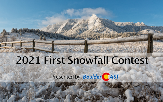
7th Annual BoulderCAST First Snowfall Contest
*Contest is now closed to entries*
Are you eager for the first snow of the season? Have you already waxed your skis and purchased your Epic Pass? Our first big snow could be right around the corner! Mother Nature threw us a giant curve-ball last year with our earliest accumulating snowfall on record in Boulder and 2nd earliest in Denver on September 8, 2020, but what’s in store for 2021? We provide a brief overview of Boulder’s first snowfall climatology, discuss the snowfall forecast for coming weeks and months, and then pose a question…“When will Boulder’s first measurable snow occur this year?” Submit your guess for a chance to win an assortment of prizes. Those who get closest to the date of our first snow win..
Continue reading
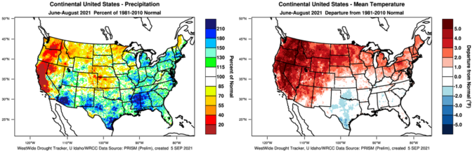
Meteorological summer begins on June 1st and runs through August 31st. With that end date now having come and gone, the official numbers are in for Summer 2021! Let’s take a look at how Boulder, Denver and Colorado as a whole did this summer in terms of temperatures and precipitation. We also check in on how our state fared compared to the rest of the country. If you like seeing data displayed on graphs and maps, this post is for you!
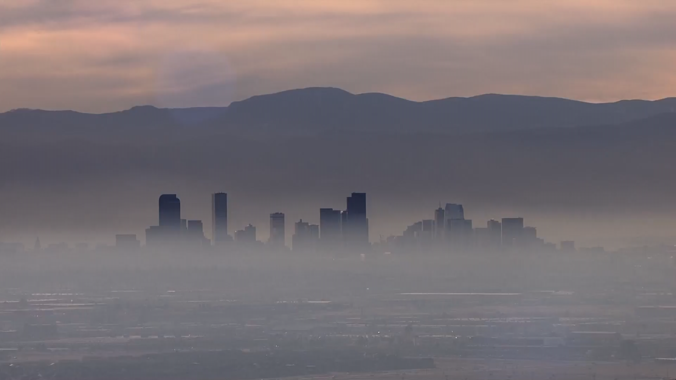
August 2021 across the Front Range was defined by its poor air quality and tenacious smoky skies which were mostly caused by out-of-state wildfires. Other weather highlights during the month included a rotating thunderstorm which prompted tornado sirens, lots of red smoky sunsets, a sprinkle of summertime snow in the Mountains, and the landfall of Category 4 Hurricane Ida sixteen years to the day after Hurricane Katrina. Here’s a quick and colorful recap of our weather during August and how it relates to climatology.
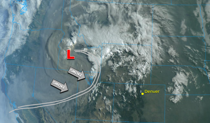
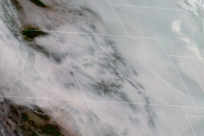
Sure…it has been fairly smoky already this week across our area, but it’s about to get a whole lot worse! An extremely smoke-laden airmass is poised to invade the entire state of Colorado late Friday night. The cause? An upstream low pressure system has been hard at work gathering up literally ALL the smoke from massive wildfires burning in California, the Pacific Northwest and southern British Columbia…and guess what? That low pressure system is headed our way!
After more than two consecutive weeks of hot weather, the pattern is set to shift following the passage of a welcomed cold front Friday evening! While not directly tied to the monsoon, storm chances will ramp up considerably in the near-term. Unfortunately, at the same time weak winds aloft under high pressure will introduce a real risk of flash flooding over the next few days with recent wildfire burn scars at the highest risk (Calwood, Cameron Peak, etc.). We discuss some historical context for July’s weather so far, when the cold front will arrive, how chilly it will be the next few days, and expected rainfall totals by the end of the weekend across the Front Range.

Live View of Boulder

Current Conditions

Live Radar

Recent Premium Posts

BoulderCAST Daily – Tue 01/13/26 | A thick blanket of high clouds won’t stop us from reaching the 60s again
☁️ Thick cloud deck overhead — Moisture streaming in aloft brings widespread mid‑ …
BoulderCAST Daily – Sun 01/11/26 | A mild Sunday with readings reaching the 50s
🌤️ Mild & Melty Sunday: Light winds and patchy clouds, with lingering snowpack …
BoulderCAST Daily – Sat 01/10/26| Widespread sunshine and moderating temperatures this weekend as our recent snow melts off
🌤️ Calm Saturday: Winter storm systems have departed the state, leaving behind a …
3-Day Forecast

Trending Content

© 2026 Front Range Weather, LLC