
Author: BoulderCAST Team (Page 20 of 45)
This post had major contributions from at least two members of our team. The more meteorologists the better, right?
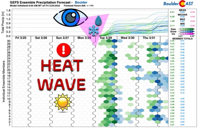
Absolutely gorgeous weather is taking shape for the weekend ahead with temperatures forecast to soar towards to the 80-degree mark in the Denver area. A few of these days could be record-setting for the region! As always, the warmth does have a planned expiration date as the next spring storm system will arrive around Tuesday with rain, snow and colder temperatures in tow.
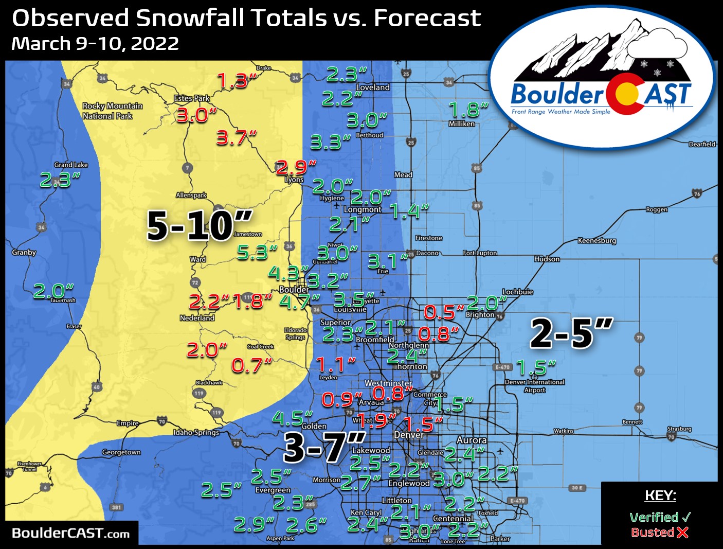
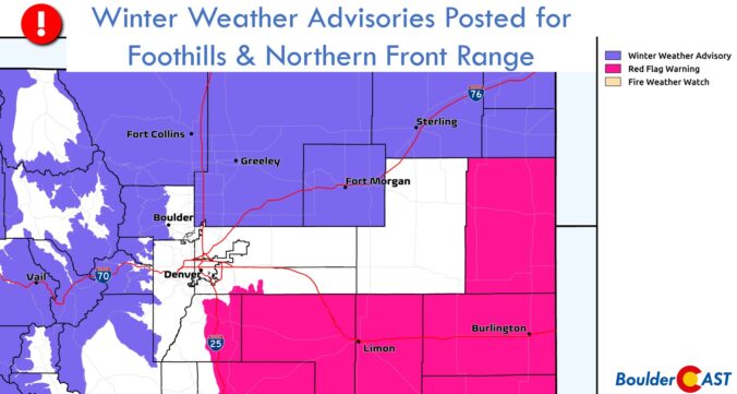
Nothing is ever easy in Front Range weather! The incoming spring, or shall we say winter, storm remains a very challenging forecast as models struggle to resolve where the heaviest precipitation will fall Wednesday into Thursday, the precise timing on when rain will change to snow, and exactly where temperatures will bottom out at overnight. All of these factors are coming together to make for a complicated blend of moderate to heavy rain and soupy snow this evening into Thursday. Most models would have us believe a deluge of precipitation is about to unleash on the Denver area, but there are some red flags. We discuss the latest on this evolving storm which is sure to create quite the mess for everyone over the next 36 hours.
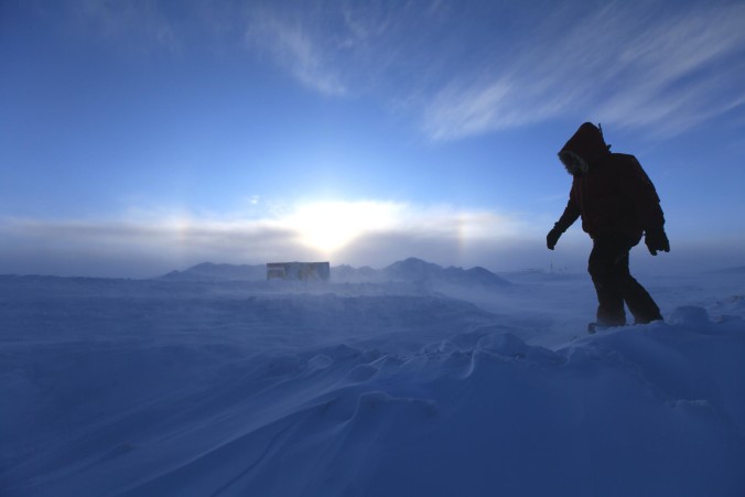
Mother Nature just won’t cut us a break in 2022! Can you believe that another Arctic blast is headed our way with more snow and even colder temperatures. The Arctic front arrives before dawn on Wednesday and will be followed by an extended period of snow. Snow could be heavy at times Wednesday afternoon into the evening, and may not fully wrap up until Thursday afternoon. We discuss the setup, timing, and likely snowfall amounts as another frigid airmass ominously descends on the Front Range.
Premium Storm Update (3/9/22 7:00AM): Overnight model runs have further confirmed the chance for scattered heavy snow bands to develop Wednesday afternoon and evening. We discuss the latest on the storm as snow has already begun falling from Boulder County northward. READ HERE
Our warm weather streak is still on-track to come to an end Friday evening after sunset, with isolated thundershowers followed by rain changing to wet snow overnight into early Saturday morning. In this brief update, we discuss the timing of everything, potential accumulations, and look ahead to Sunday as a colder system will enter the picture bringing more snow.
February picked up up right where January left off with a flurry of snowfall! February 2022 was the 3rd snowiest and 4th wettest on record in Boulder — just what we needed to help with the ongoing severe drought. Here’s a quick and colorful graphical recap of our weather during February and how it relates to climatology.

Live View of Boulder

Current Conditions

Live Radar

Recent Premium Posts

BoulderCAST Daily – Sun 01/11/26 | A mild Sunday with readings reaching the 50s
🌤️ Mild & Melty Sunday: Light winds and patchy clouds, with lingering snowpack …
BoulderCAST Daily – Sat 01/10/26| Widespread sunshine and moderating temperatures this weekend as our recent snow melts off
🌤️ Calm Saturday: Winter storm systems have departed the state, leaving behind a …
BoulderCAST Daily – Fri 01/09/26| Snow ends quickly this morning with a quieter weekend in store
❄️ Overnight snow bands: A second push of upslope after midnight sparked narrow …
3-Day Forecast

Trending Content

© 2026 Front Range Weather, LLC
You must be logged in to post a comment.