


After our second snowy weekend in a row, things will stay quiet across the Front Range for much of the upcoming week with seasonal temperatures and lots of sunshine. However, that will change late-week as a quick-hitting Arctic cold front will surge south across the area. This front will likely be accompanied by at least a little bit of wintry precipitation, but the cold won’t stick around long at all. We also look ahead to several more devastating atmospheric river events set to slam California — their remnant moisture will likely spread into our Mountains to further bolster statewide snowpack. Read on for all the details.
Author: Ben Castellani (Page 74 of 358)
Ben grew up in southwestern Pennsylvania and holds both a bachelor's and a master's degree in Meteorology, the latter being from CU Boulder. His hometown received nearly three feet of snow from the Storm of the Century back in March of 1993, sparking his initial interest in impactful weather. Ben currently works on remote sensing and data analysis software at NV5 Geospatial Software in Boulder.


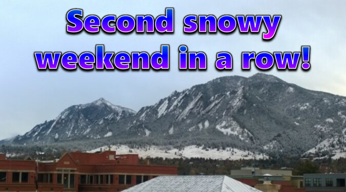
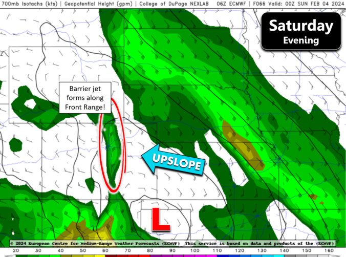
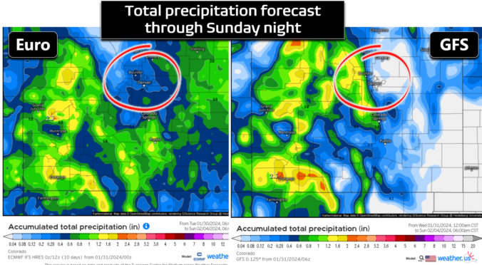
After a largely quiet work-week with seasonal temperatures and dry conditions across most of the Front Range, winter weather will make a return for the second weekend in a row! A series of disturbances will impact Colorado over the next couple days seeding the return of snow to the area. Winter weather will come in two parts — the first Friday night with locally heavy convective snowfall expected. A second wave of more widespread, but lighter snow will develop Saturday behind a weak cold front. Let’s take a look at the latest forecast for Super Bowl weekend, including our expected snowfall totals and the timing of the worst travel conditions.

Live Radar

Trending Content


Recent Premium Posts

BoulderCAST Daily – Wed 11/11/26 | Mild Days Ahead, But There Are Signs of a More Active November Soon
☀️ Warm & Quiet — Sunshine dominates through Thursday with highs rising from …
BoulderCAST Daily – Tue 11/10/26 | Clouds Increase Today, But Colorado’s Dry Pattern Rolls On
🌤️ A Few More Clouds Today – Mountain wave clouds are developing along …
BoulderCAST Daily – Sun 11/08/26 | Mild November Weather Continues, Even With A Cold Front Midweek
☀️ Sunny and warm for early November – Temperatures in the middle to …
© 2026 Front Range Weather, LLC