Author: Ben Castellani (Page 73 of 358)

Ben grew up in southwestern Pennsylvania and holds both a bachelor's and a master's degree in Meteorology, the latter being from CU Boulder. His hometown received nearly three feet of snow from the Storm of the Century back in March of 1993, sparking his initial interest in impactful weather. Ben currently works on remote sensing and data analysis software at NV5 Geospatial Software in Boulder.

Premium BoulderCAST Daily – Tue 02/27/24 | A Pacific storm is racing through today with gusty winds and a chance of spotty snow showers

The leading edge of the trough and strong cold front are working south and east across Colorado this morning. The best lift is shown to be just north of our area and up across the Mountains. As of writing, the cold front is closing in quickly on the Denver Metro area --- it's probably already through by the time you …

This Week in Colorado Weather: February 26, 2024

The upcoming week will offer what we consider classic Front Range springtime weather with high fire danger Monday preceding a snowy system on Tuesday. Latest model guidance keeps amounts on the light side for the Metro area, but the Mountains will see heavy snow, strong winds and dangerous travel. Things turn quiet for the second half of the week, but another storm system is expected to bring more snow for the upcoming weekend. Let’s take a look.
Continue reading

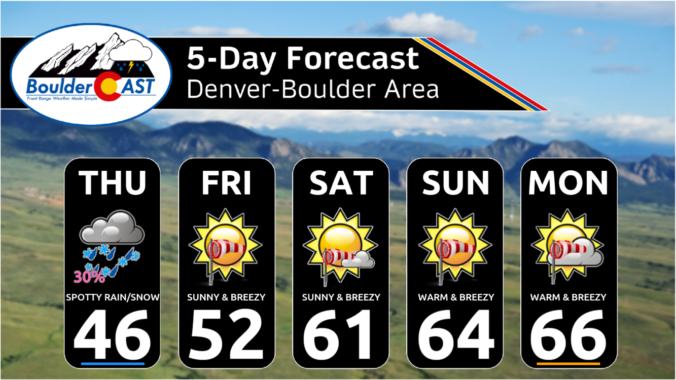
Premium This Weekend in Colorado Weather: Cool & showery on Thursday, but the weekend ahead will be wonderful (if you can mind the breeziness)

Though it is difficult to tell, the "ongoing" storm system is about to let loose its last hurrah across the Front Range on Thursday as the final piece of the mid-level disturbance drops across northern Colorado during the day. This minor feature can be seen in this morning's GOES-East water vapor animation below --- it's across south-central Wyoming right now. …

Premium BoulderCAST Daily – Wed 02/21/24 | A beautiful first half of the day, but spotty rain/snow showers will be around this evening through Thursday

Yesterday's high temperature in Boulder was 66°, our warmest reading in over three months (since November 17th). Most of the lower elevations met a similar fate on Tuesday with highs across the board in the 60s for eastern Colorado below 6,500 feet elevation. As nice as the weather was yesterday, all good things must come to an end --- notable …

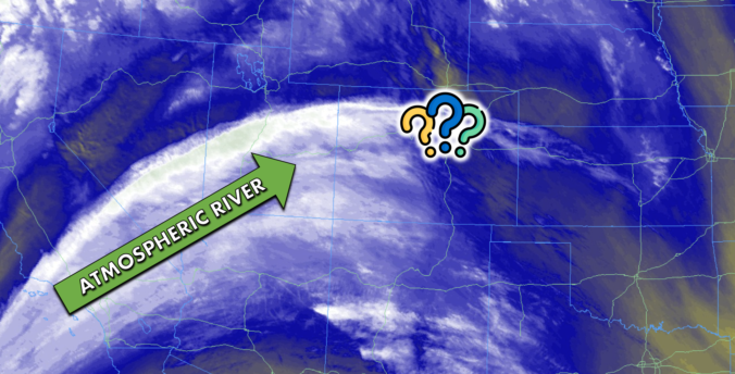
Premium BoulderCAST Daily – Tue 02/20/24 | An atmospheric river is flowing directly into Colorado this week, but will it lead to any precipitation?

The left-over moisture from an ongoing atmospheric river event in California is surging directly into Colorado and across the Front Range this morning from the southwest. This deep pipeline of subtropical moisture can be easily discerned on this morning's GOES-East mid-level water vapor satellite animation: Widespread rain and snow are falling across California today --- the heaviest rain is expected …

Premium BoulderCAST Daily – Wed 02/14/24 | Light mountain snow through the day, but things stay quiet down here

Today will be predominantly quiet east of the Continental Divide, despite there being a weak shortwave disturbance passing through Colorado in the westerly flow. This feature is shown in the 500mb vorticity forecast animation below. After the shortwave passes, brief ridging will move in tonight with clearing skies. With this shortwave overhead, there will be a few more clouds around …

Premium BoulderCAST Daily – Tue 02/13/24 | Staying pleasant the next few days before a cold front arrives Thursday evening

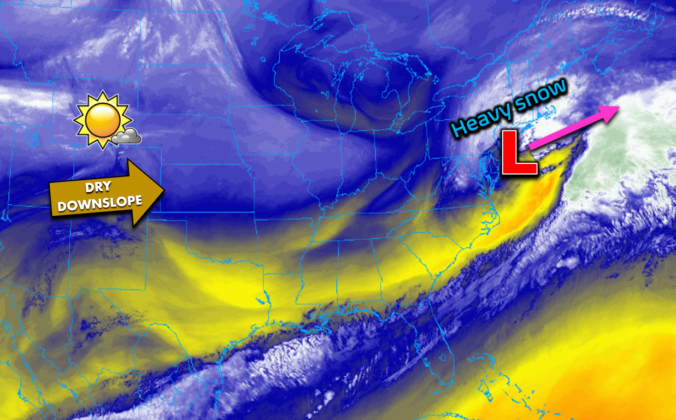
West-southwesterly downslope flow will continue today across Colorado with basically no changes expected in our weather, other than being a few degrees warmer than our Monday. GOES-East satellite imagery shows the setup across the nation. The storm which brought us snow Friday into Saturday is now producing heavy snow in New York City and Boston. Here in the Front Range, …

« Older posts Newer posts »