Author: Ben Castellani (Page 72 of 303)
Ben grew up in southwestern Pennsylvania and holds both a bachelor's and a master's degree in Meteorology, the latter being from CU Boulder. His hometown received nearly three feet of snow from the Storm of the Century back in March of 1993, sparking his initial interest in impactful weather. Ben currently works on remote sensing and data analysis software at NV5 Geospatial Software in Boulder.

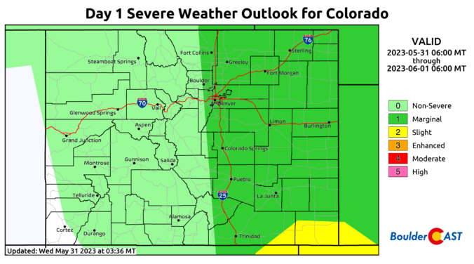
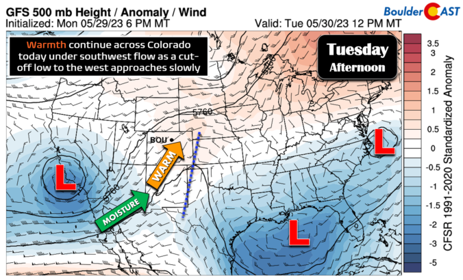

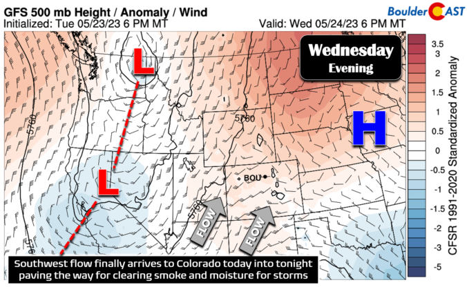

The story since late last week has been the infiltration of smoke into the Front Range from distant but numerous Canadian wildfires. That trend will unfortunately continue early in the week with light to moderate smoke sticking around through at least Tuesday or Wednesday leading to degraded air quality. Fortunately, the pattern will shift midweek whisking away the smoke and changing the headlines to rain and thunderstorms for a few days. Let’s take a look at what is sure to be another interesting week in Colorado weather!
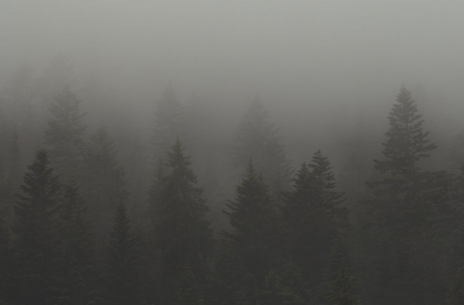
Wildfire smoke roared into the Front Range late Thursday night like a freight train — well if those were somehow silent and made up of tiny cancer-causing particles! Air quality and visibility have both tanked across the entire Denver Metro area as a result. Yuck! We discuss where all this smoke is coming from and when it may actually clear out.

Live View of Boulder

Current Conditions

Live Radar

Recent Premium Posts

BoulderCAST Daily – Sun 05/31/26 | Dry and warm today but rain chances increase this week
🌦️ Overall dry and warm Sunday, though cannot rule out a very widely …
BoulderCAST Daily – Sat 05/30/26 | A stray shower today as most activity resides well east of Denver
🌦️ Spotty showers today, mainly well east of the Denver Metro area, where …
BoulderCAST Daily – Fri 05/29/26 | A Marginal Risk of Severe Isolated Storms
🌦️ Spotty showers this afternoon, mainly noon and 4 PM, with highs in …
3-Day Forecast

Trending Content

© 2026 Front Range Weather, LLC