Author: Ben Castellani (Page 49 of 303)
Ben grew up in southwestern Pennsylvania and holds both a bachelor's and a master's degree in Meteorology, the latter being from CU Boulder. His hometown received nearly three feet of snow from the Storm of the Century back in March of 1993, sparking his initial interest in impactful weather. Ben currently works on remote sensing and data analysis software at NV5 Geospatial Software in Boulder.
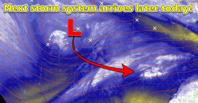
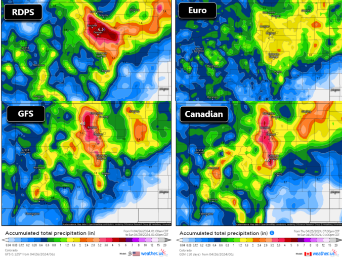
A developing Four Corners low pressure system will move across southern Colorado this weekend producing a prolonged period of moist upslope flow into the Front Range. While temperatures will (fortunately) be too warm for snowfall across the lower elevations, anywhere from 1 to 4″ of rainfall is expected to dump on our area. Where temperatures are colder, the higher Foothills and Mountains could see over 2 feet of snow from this system as well. Here’s our latest thoughts on the incoming soggy rain (snow) storm!
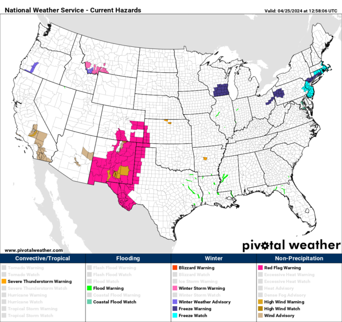
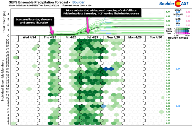
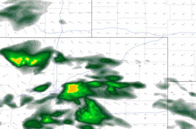
After another round of spring snow over the weekend, the pattern will stay somewhat active across the Front Range this week, but with the warmer late April temperatures translating to only rain chances for the lower elevations. Unfortunately it looks like the gloom will stick around into the upcoming weekend as well. Let’s take a look.

Live View of Boulder

Current Conditions

Live Radar

Recent Premium Posts

BoulderCAST Daily – Sun 05/31/26 | Dry and warm today but rain chances increase this week
🌦️ Overall dry and warm Sunday, though cannot rule out a very widely …
BoulderCAST Daily – Sat 05/30/26 | A stray shower today as most activity resides well east of Denver
🌦️ Spotty showers today, mainly well east of the Denver Metro area, where …
BoulderCAST Daily – Fri 05/29/26 | A Marginal Risk of Severe Isolated Storms
🌦️ Spotty showers this afternoon, mainly noon and 4 PM, with highs in …
3-Day Forecast

Trending Content

© 2026 Front Range Weather, LLC