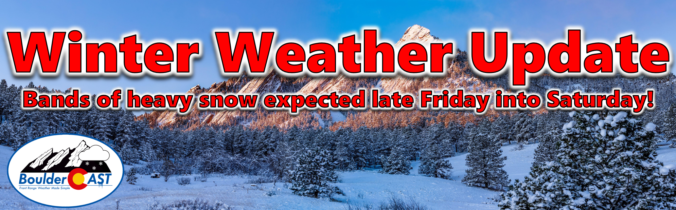
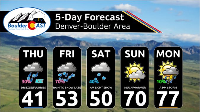
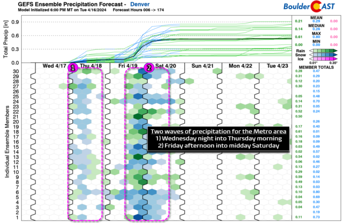
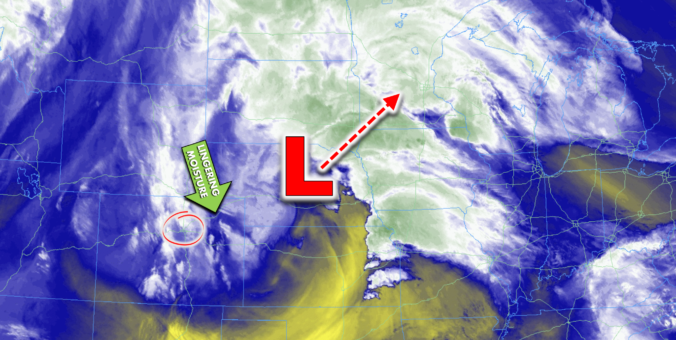
After a month long hiatus, widespread accumulating snowfall will return to the Front Range late Friday as a classic jet-forced banded snowfall event unfolds across the area. While final snowfall totals will undoubtedly vary from location to location, we discuss the latest details of the springtime snowflakes knocking on our door, including when things will commence and expected travel impacts.
Author: Ben Castellani (Page 50 of 303)
Ben grew up in southwestern Pennsylvania and holds both a bachelor's and a master's degree in Meteorology, the latter being from CU Boulder. His hometown received nearly three feet of snow from the Storm of the Century back in March of 1993, sparking his initial interest in impactful weather. Ben currently works on remote sensing and data analysis software at NV5 Geospatial Software in Boulder.
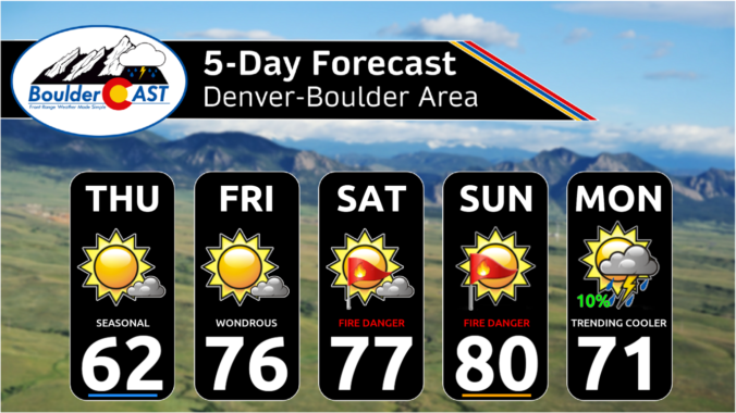
After the very windy weekend, our weather in the Front Range will turn much quieter for the week ahead. Temperatures will fluctuate between the 50s and the 70s throughout the week with only one minor chance to pick up any precipitation. The upcoming weekend will see temperatures soar towards 80 degrees with fire danger unfortunately on the rise. Read on for all the details.

Live View of Boulder

Current Conditions

Live Radar

Recent Premium Posts

BoulderCAST Daily – Sun 05/31/26 | Dry and warm today but rain chances increase this week
🌦️ Overall dry and warm Sunday, though cannot rule out a very widely …
BoulderCAST Daily – Sat 05/30/26 | A stray shower today as most activity resides well east of Denver
🌦️ Spotty showers today, mainly well east of the Denver Metro area, where …
BoulderCAST Daily – Fri 05/29/26 | A Marginal Risk of Severe Isolated Storms
🌦️ Spotty showers this afternoon, mainly noon and 4 PM, with highs in …
3-Day Forecast

Trending Content

© 2026 Front Range Weather, LLC