


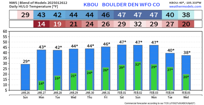
2025 has been exceptionally cold and snowy in the Front Range so far, but is that finally about to change? This week we can expect several tranquil sunny days to begin but we are watching the threat for more snow as a low-pressure system approaches from California by Thursday.
Author: Ben Castellani (Page 48 of 358)
Ben grew up in southwestern Pennsylvania and holds both a bachelor's and a master's degree in Meteorology, the latter being from CU Boulder. His hometown received nearly three feet of snow from the Storm of the Century back in March of 1993, sparking his initial interest in impactful weather. Ben currently works on remote sensing and data analysis software at NV5 Geospatial Software in Boulder.
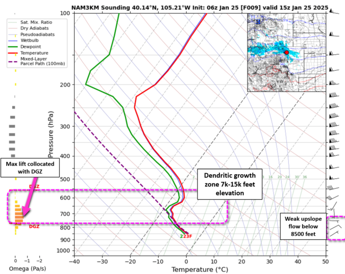
Snow began overnight across the entire Denver Metro area which has led to slick travel region-wide this morning as our temperatures sit in the teens. Generally light snow will continue in earnest through the day before wrapping up this evening from east to west. We take a look at snowfall totals so far and some of the factors influencing how much more fluffy snow is still to come.
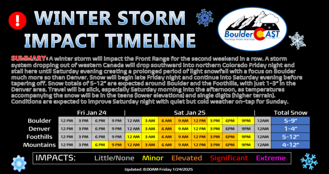
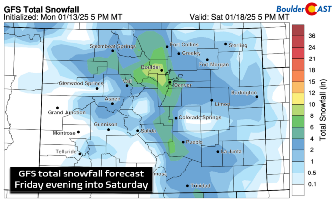
We haven’t really seen much melting of the more than a foot of snow that fell last weekend in Boulder, but additional white stuff is indeed on the way this weekend! A slow-moving storm system will bring relatively light but long-lasting snow to the area Friday night into Saturday night, with a heavy focus on the northern Front Range this time (Boulder and Larimer Counties). Some locations could see upwards of a foot of snow as temperatures plummet back into the teens for Saturday. Let’s take a look!
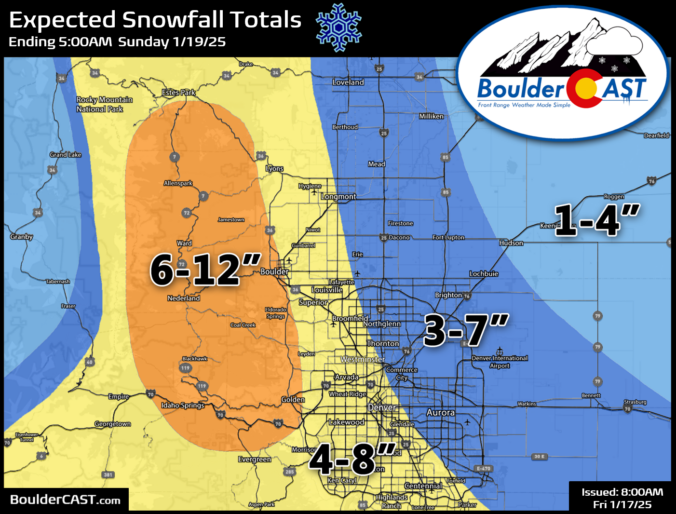
Our anticipated Arctic cold front is pushing southward across northern Wyoming right now and is on-track to arrive into the Denver area this afternoon. Snowflakes will be slightly delayed, but are expected to quickly develop early this evening impacting at least some of the commute window as travel turns very treacherous through the evening. The latest model data points to a slightly more impactful snow event unfolding, especially for Boulder County. We’ve increased snow totals in these areas. We also discuss the temperature outlook for the rest of the frigid holiday weekend ahead.
Live Radar

Trending Content


Recent Premium Posts

BoulderCAST Daily – Wed 11/11/26 | Mild Days Ahead, But There Are Signs of a More Active November Soon
☀️ Warm & Quiet — Sunshine dominates through Thursday with highs rising from …
BoulderCAST Daily – Tue 11/10/26 | Clouds Increase Today, But Colorado’s Dry Pattern Rolls On
🌤️ A Few More Clouds Today – Mountain wave clouds are developing along …
BoulderCAST Daily – Sun 11/08/26 | Mild November Weather Continues, Even With A Cold Front Midweek
☀️ Sunny and warm for early November – Temperatures in the middle to …
© 2026 Front Range Weather, LLC