Author: Ben Castellani (Page 38 of 358)

Ben grew up in southwestern Pennsylvania and holds both a bachelor's and a master's degree in Meteorology, the latter being from CU Boulder. His hometown received nearly three feet of snow from the Storm of the Century back in March of 1993, sparking his initial interest in impactful weather. Ben currently works on remote sensing and data analysis software at NV5 Geospatial Software in Boulder.
Premium This Weekend in Colorado Weather: Storms decline as the Front Range begins a sizzling heatwave

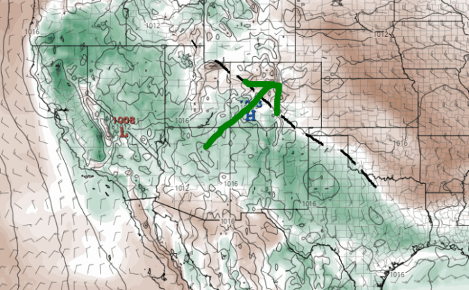
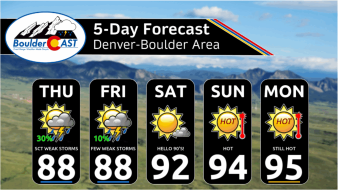
Weak westerly flow aloft continues over Colorado on Thursday, part of a broader clockwise atmospheric circulation around high pressure near the Baja. The high pressure is slowly drifting east and should settle near southern New Mexico by Sunday or Monday. As it does, it’s going to act like a shield—blocking out any big weather systems and bringing us warm, dry …

Premium BoulderCAST Daily – Wed 06/11/25 | Afternoon and evening storms return today and stick around through at least Friday

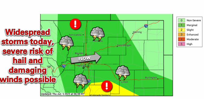
High pressure continues to slowly invade the southwestern United States which has ushered in a weak westerly flow to Colorado with more moisture flowing into the state than earlier in the week. The result will be our first real chance of rain today with spotty late-day storms developing in a more favorable environment. The HRRR model-simulated radar below shows storms …

Premium BoulderCAST Daily – Tue 06/10/25 | Gusty outflows but little to no rain from this evening’s convection

The morning will start off much like yesterday—dry air hovering over the Front Range, letting the sun shine in full force. But as the day moves along, moisture will gradually sneak in from the west, thanks to high pressure shifting ever so slightly eastward into the Four Corners region. That gentle westerly flow will help push out the bone-dry air …

This Week in Colorado Weather: June 9, 2025

Get ready for a classic early summer setup—plenty of warmth, a hint of storm potential, a bit of wildfire smoke, and maybe even the year’s first 90-degree day(s) for the Front Range. While the week starts off dry and sunny, a few scattered storms will make an appearance midweek, adding a little variety to the forecast. By the weekend, the heat cranks up as a strong ridge sends hot air northward into Colorado.

Continue reading

Premium BoulderCAST Daily – Sun 06/08/25 | Isolated supercells in the cards today, mainly after 4PM

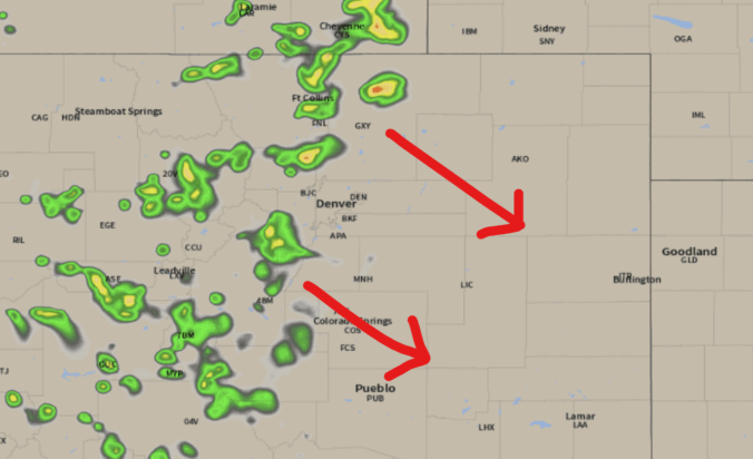
An overnight cold front has moved through northeast Colorado. Behind the front, low clouds have been forming slowly and working southward towards our area. The latest GOES-East satellite animation shows that thus far low clouds, depicted in white shading below, have only reached as far south as Cheyenne. This is well north of where models were showing. Latest model trends …

Premium BoulderCAST Daily – Sat 06/07/25 | Finally a (mostly) dry day!

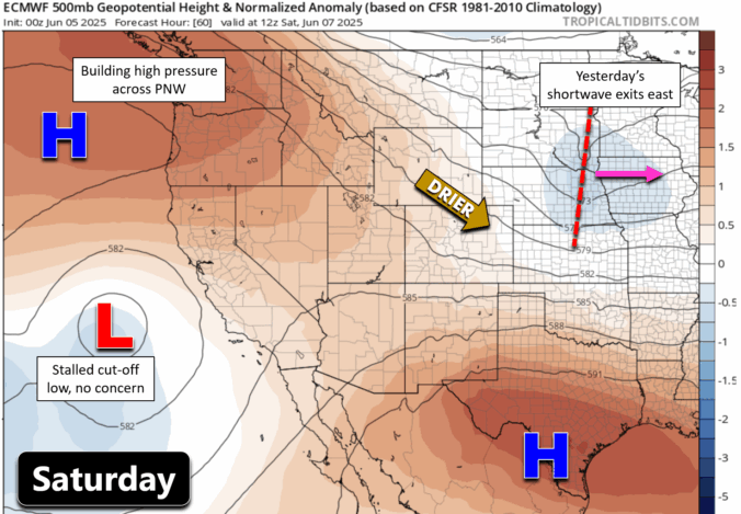
After a rainy stretch all week long, we’re finally drying out—well, mostly. Today is the first day without any shortwave disturbances moving through, which means the Boulder-Denver area is in for warmer, drier weather this Saturday. Looking at the bigger picture, yesterday’s departing shortwave is pushing across the Great Plains, and the sinking air behind it will help keep storm …

Premium BoulderCAST Daily – Fri 06/06/25 | Highs in the 60s with numerous storms, some being severe

Adisturbance to our north in Wyoming will track east-southeast into Nebraska over the next 24 hours. As it does so, it will bring strong mid-level energy across the state. This energy will peak during the daytime, fueling scattered to numerous showers and storms. A persistent easterly flow will exist across Colorado today with highs generally in the low to mid …

« Older posts Newer posts »