Author: Ben Castellani (Page 37 of 358)

Ben grew up in southwestern Pennsylvania and holds both a bachelor's and a master's degree in Meteorology, the latter being from CU Boulder. His hometown received nearly three feet of snow from the Storm of the Century back in March of 1993, sparking his initial interest in impactful weather. Ben currently works on remote sensing and data analysis software at NV5 Geospatial Software in Boulder.
Premium BoulderCAST Daily – Fri 06/27/25 | Near 90 with patchy high-based convection late in the day

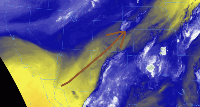
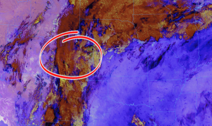
The warm and dry pattern holds steady today as a ridge of high pressure continues nudging into the region from the south and west. Water vapor satellite imagery from GOES-East paints a clear picture: a band of dry air is streaming into Colorado from the Southwest, with even drier air queued up over Baja and the surrounding deserts there. That …

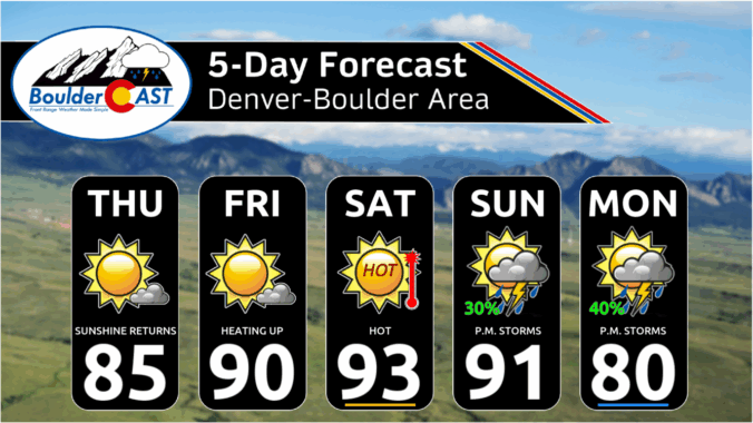
Premium This Weekend in Colorado Weather: A few hot & dry days before monsoon moisture begins to flow

SWednesday night's locally heavy rain torms got off to a slow start Wednesday, but once they got going, they made quite an impact across parts of the Boulder–Denver corridor. Things kicked off with a single, sluggish thunderstorm near Lafayette that dumped heavy rain and caused some minor flooding around the Boulder–Broomfield–Weld County junction. https://twitter.com/BoulderCAST/status/1938036738183528781   Before long, it wasn’t alone—additional …

Premium BoulderCAST Daily – Wed 06/25/25 | One last chance of storms for the week

Moisture levels are already starting to dip across the Front Range this morning compared to yesterday, as that southeasterly upslope flow begins to ease up. That means the pipeline of Gulf moisture feeding into Colorado is shutting down. Meanwhile, the sluggish trough of low pressure that’s been stirring up unsettled weather lately is set to weaken significantly today as it …

Premium BoulderCAST Daily – Tue 06/24/25 | Scattered severe thunderstorms this afternoon, hail up to 2″ the main threat

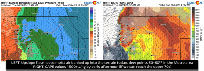
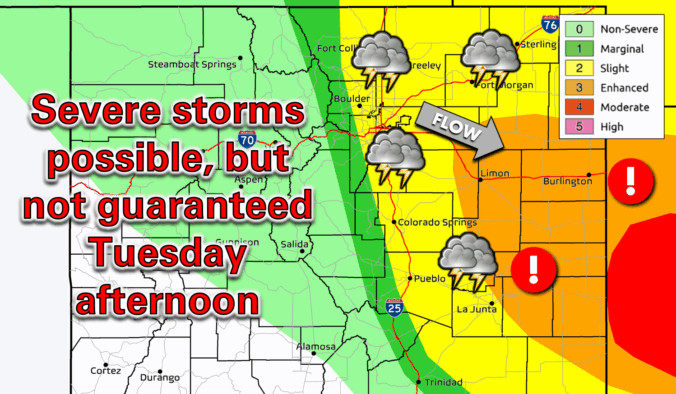
All signs are pointing toward a textbook setup for strong to severe convection across northeast Colorado today. Yesterday’s high in Boulder only reached the upper 60s following a frontal passage, and that cooler, moisture-laden airmass remains firmly in place under continued southeasterly upslope flow. Dew points hovering in the 50s across the Denver Metro are providing solid low-level moisture, and …

Premium BoulderCAST Daily – Wed 06/18/25 | A wonderful Wednesday ahead of looming record heat

Yesterday's shortwave disturbance, which spawned the punchy thunderstorms and kept highs only in the 60s for Boulder, has exited the area rapidly overnight allowing skies to clear. In fact, there isn't a single cloud left behind over Colorado, as noted from GOES-East as the sun rose this morning: Just about everyone got in on the action Tuesday afternoon, mainly because …

Forecast Update: Tracking potential quick-hitting severe thunderstorms Tuesday afternoon!

The anticipated reprieve from the heat has arrived! Low clouds blanket the Front Range Tuesday morning, and exactly how quickly they burn off today will be the key to unlocking explosive severe thunderstorm development this afternoon over our area. We discuss the latest forecast details surrounding the severe risk today, including our team’s lingering concerns, the timing of the risk, and which areas stand the best chance to see big hail Tuesday afternoon.
Continue reading

This Week in Colorado Weather: June 16, 2025

Record-breaking temperatures will be the story this week in the Front Range, though there’s plenty more to discuss. While a brief cooldown is on the way Tuesday, it comes with a catch—a chance for severe storms, depending on how quickly low clouds clear up. Then, just as we get a break, another scorching heatwave arrives on Thursday through the upcoming weekend, with several days of triple-digit temperatures that will shatter records. Let’s dive into the details.

Continue reading

« Older posts Newer posts »