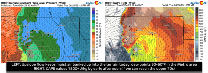
All signs are pointing toward a textbook setup for strong to severe convection across northeast Colorado today. Yesterday’s high in Boulder only reached the upper 60s following a frontal passage, and that cooler, moisture-laden airmass remains firmly in place under continued southeasterly upslope flow. Dew points hovering in the 50s across the Denver Metro are providing solid low-level moisture, and …
Meteorologists are constantly scanning the output from various operational weather forecast models looking at the upcoming state of the atmosphere. It is safe to “trust” what you are seeing a few days ahead. Beyond say five to seven days, it’s really a crap shoot.