Author: Ben Castellani (Page 252 of 301)
Ben grew up in southwestern Pennsylvania and holds both a bachelor's and a master's degree in Meteorology, the latter being from CU Boulder. His hometown received nearly three feet of snow from the Storm of the Century back in March of 1993, sparking his initial interest in impactful weather. Ben currently works on remote sensing and data analysis software at NV5 Geospatial Software in Boulder.
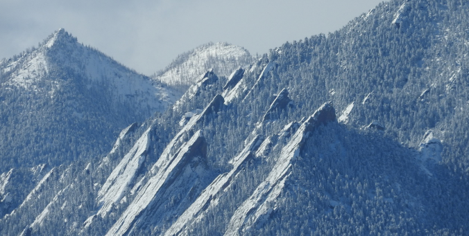
Heavy snow fell overnight across the Front Range, much more in some places than others. We review the storm totals, discuss how our forecast played out, and let you know when all of it will melt.
Read our final forecast update discussing the timing, amounts, and impacts for the approaching snowstorm and frigid temperatures.

Our weekly outlook mentioned that it would be a cold and snowy week. We cautioned that the weather models were not in good agreement on much of anything, and therefore were hesitant to believe them, despite the indication of a couple potentially impactful snow events. Today that has changed, with all the major models jumping on-board for a significant snow storm for the region beginning Wednesday afternoon and continuing through the day Thursday. We provide an initial update on what to expect for the second half of the week during what will likely be our biggest snowfall this winter season.

Following month after month of dry and warm weather, December finally turned the tide and brought colder and snowier conditions to the region. Will January continue the trend? Read on as we examine Boulder’s climatology and consider the current state of the atmosphere to give our outlook for the next month.

Live View of Boulder

Current Conditions

Live Radar

Recent Premium Posts

BoulderCAST Daily – Sun 05/10/26 | Cooler today but the 80s are not far behind
☀️ Sunshine and pleasant temperatures with upper 60s for our Sunday 🌡️ Trending …
BoulderCAST Daily – Sat 05/09/26 | Watching some late-day showers ahead of a cold front tonight
🌧️ Scattered showers this afternoon and evening ahead of a cold front setting …
BoulderCAST Daily – Fri 05/08/26 | Warmer weather takes hold
☀️ Warmer and calmer skies ahead: Expect lots of sunshine from the upper …
3-Day Forecast

Trending Content

© 2026 Front Range Weather, LLC