



Author: Ben Castellani (Page 164 of 358)
Ben grew up in southwestern Pennsylvania and holds both a bachelor's and a master's degree in Meteorology, the latter being from CU Boulder. His hometown received nearly three feet of snow from the Storm of the Century back in March of 1993, sparking his initial interest in impactful weather. Ben currently works on remote sensing and data analysis software at NV5 Geospatial Software in Boulder.

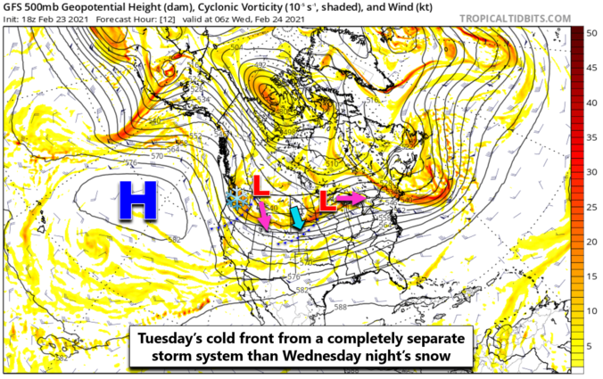
It’s been a glorious start to the week so far with highs getting back above normal on Monday and Tuesday. Even though it was quite breezy at times, temperatures flirting with 60 degrees took the chill right out of the wind. The stretch of fair weather changes very soon as two cold fronts and a taste of winter weather bear down on Colorado. A widespread, upslope-driven snowfall event is gearing-up for Wednesday evening into Thursday. Let’s take a look at the timing and snowfall amounts expected across the Front Range!
UPDATE (Wed 2/24/21 7:00AM): Updated snowfall forecast map, fine-tuning amounts and the position of the expected sharp gradient. Details of these changes are included in Wednesday morning’s Premium weather discussion, found HERE.

The nicest weather in nearly three weeks will unfold Monday and Tuesday, but snow is just a few days away! Yet another wintry system with an unfavorable track will impact the area Wednesday evening into Thursday bringing widespread upslope snow to the Front Range. We’re also watching the potential for a more significant winter storm during the upcoming weekend, but uncertainty remains this far out. Read on for our complete outlook of the week ahead.

A weak storm and associated jet streak moved across Colorado on the evening of February 20th producing bands of moderate snowfall for a brief period. Southeastern portions of the Denver Metro area were hit hardest. Let’s take a look at the totals.
Another day, another chance of light snow. The theme of this winter continues as a weak storm system blazes across Colorado Saturday evening bringing a chance of snow to the region. We’ve got some jet-forcing to deal with this time, so localized bands of heavy snow are possible, but our forecast keeps most of these south and east of Denver. Let’s take a look at the timing and snowfall amounts!
Live Radar

Trending Content


Recent Premium Posts

This Weekend in Colorado Weather: The Quiet Pattern Ends as Storm Activity Picks Up Across the West
After weeks of sunshine, mild afternoons, and storm systems repeatedly missing Colorado to …
BoulderCAST Daily – Wed 11/11/26 | Mild Days Ahead, But There Are Signs of a More Active November Soon
☀️ Warm & Quiet — Sunshine dominates through Thursday with highs rising from …
BoulderCAST Daily – Tue 11/10/26 | Clouds Increase Today, But Colorado’s Dry Pattern Rolls On
🌤️ A Few More Clouds Today – Mountain wave clouds are developing along …
© 2026 Front Range Weather, LLC