Author: Ben Castellani (Page 16 of 358)

Ben grew up in southwestern Pennsylvania and holds both a bachelor's and a master's degree in Meteorology, the latter being from CU Boulder. His hometown received nearly three feet of snow from the Storm of the Century back in March of 1993, sparking his initial interest in impactful weather. Ben currently works on remote sensing and data analysis software at NV5 Geospatial Software in Boulder.
Colorado Winter Weather Update: From Fire Danger to Snowflakes in Just 12 Hours, Then Comes a Hard Freeze

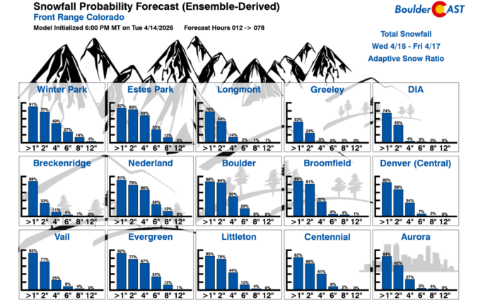
A sharp pattern shift is lining up for the Front Range to end the week, and it’s going to feel a lot different than the stretch of mild, breezy days we’ve been riding lately. Thursday brings one more round of elevated fire danger, but by tonight a much colder airmass barrels in and sets the stage for a quick burst of snowflakes Friday morning — followed by a hard freeze Friday night that may end up being the most impactful part of the whole event. Here’s what to expect as winter makes a brief, timely return to the Denver-Boulder area.

Continue reading

Premium BoulderCAST Daily – Wed 04/15/26 | Quiet Today, Fire Danger Tomorrow, Then Snow Friday

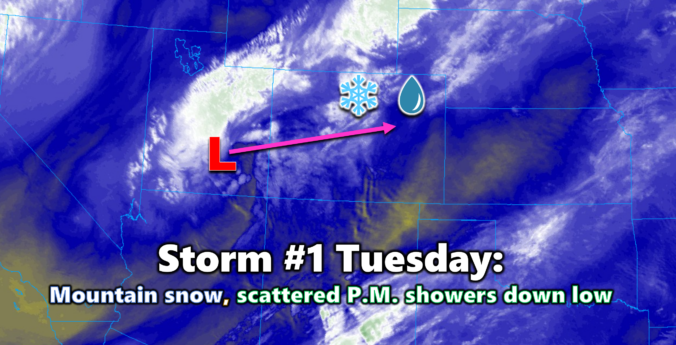
Our first storm system of the week is now exiting Colorado and lifting into the Midwest, leaving behind only a few straggling rain showers on the far Eastern Plains and pockets of very light snow clinging to the Continental Divide. Winter Park tells the real story of where the moisture actually went—just over 8 inches of new snow in the …

Premium BoulderCAST Daily – Tue 04/14/26 | A Pair of Storms on the Way: Rain Showers Today, Wet Snow on Friday

The first of two storm systems this week is sliding across Colorado today, bringing snow back to the High Country and a round of light, scattered showers for the lower elevations. Early Tuesday morning's satellite imagery shows the compact cut‑off low spinning over far southern Utah, with the center of the circulation on track to pass almost directly over Denver …

This Week in Colorado Weather: April 13, 2026

As we roll into mid‑April, the Front Range finally snaps back into an active pattern with fire danger, two storm systems, and even a shot at late‑season snow all packed into one busy week. From warm, windy days to Mountain snow and the possibility of flakes reaching the Denver–Boulder corridor by Friday, there’s a lot happening in the days ahead. Read on for all the details.

Continue reading

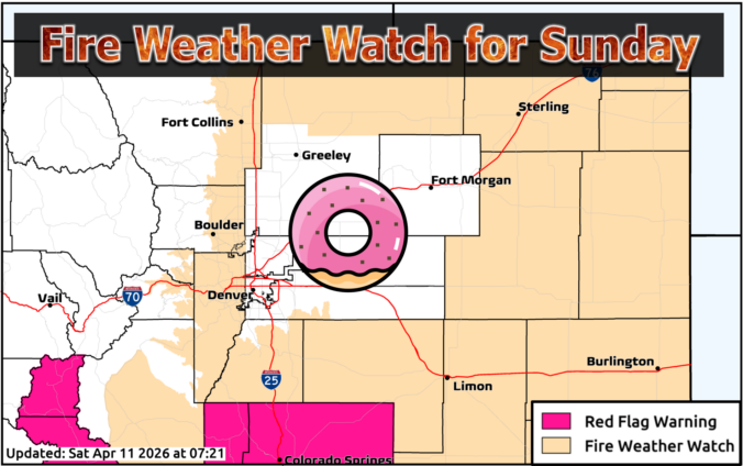
Premium BoulderCAST Daily – Sun 04/12/26 | A quiet but breezy Sunday with elevated fire danger

After several days of “late‑period” showers and thunderstorms teasing the forecast—amounting to just 0.01" in Boulder and only a trace in Denver—we finally dry out today as a much drier airmass pushes in from the southwest. GOES‑East water vapor imagery still highlights the stubborn closed low lingering just offshore of northern California, but the more relevant signal for Colorado is …

Premium BoulderCAST Daily – Sat 04/11/26 | Sporadic showers today, fire weather concerns return Sunday

Today brings another round of sporadic raindrops as our unsettled pattern continues to churn across the central and northern Rockies. A steady plume of subtropical moisture is still being funneled northward into Colorado on the eastern flank of a broad California trough. While moisture levels aren’t quite as robust as yesterday, there’s still enough juice in the column to support …

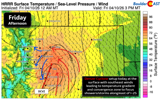
Premium BoulderCAST Daily – Fri 04/10/26 | Moisture plume arrives into Colorado fueling another round of scattered late-day showers and storms

The first rumbles of 2026 echoed across Boulder County Thursday evening as a weak, early‑season thunderstorm bubbled up over south Boulder before drifting through Superior and Broomfield and then collapsing further east. It only managed a couple minutes of rain, but the return of convective structure—lightning, updrafts, outflow winds—is a clear signal that we’re transitioning into spring mode along the …

« Older posts Newer posts »