Author: Ben Castellani (Page 15 of 304)
Ben grew up in southwestern Pennsylvania and holds both a bachelor's and a master's degree in Meteorology, the latter being from CU Boulder. His hometown received nearly three feet of snow from the Storm of the Century back in March of 1993, sparking his initial interest in impactful weather. Ben currently works on remote sensing and data analysis software at NV5 Geospatial Software in Boulder.

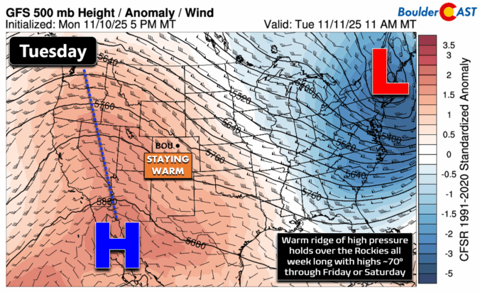
*Premium* BoulderCAST Daily – Tue 11/11/25 | Exceptional November warmth holds strong through Friday
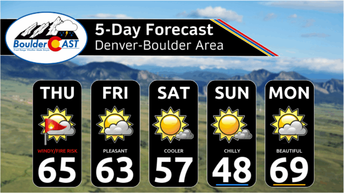
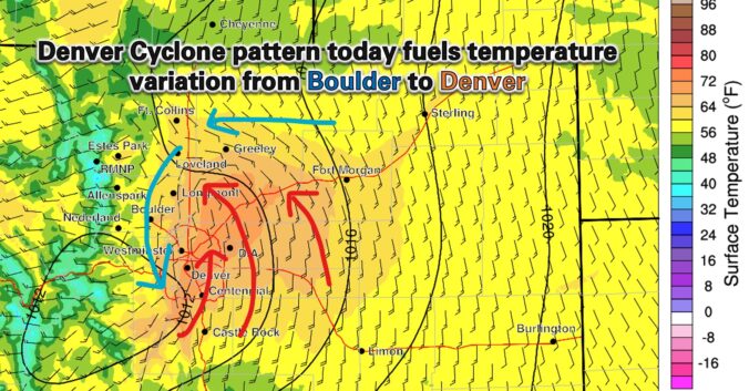
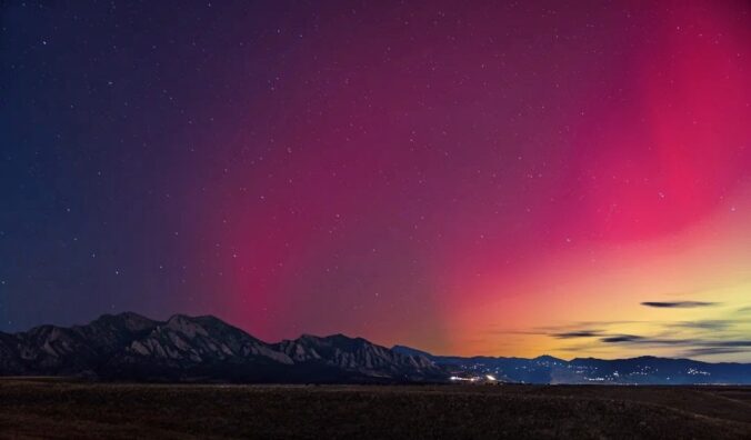
Sunday’s record-breaking November heat will give way to a dramatic cooldown on Monday, with temperatures plunging 20 to 30 degrees and wave clouds rolling in over the Front Range. The week ahead stays dry and mostly mild, but a few weak cold fronts will stir up some wind and day-to-day temperature swings. And while the forecast looks quiet for now, ensemble models are starting to hint at a colder, potentially snowier shift next week.
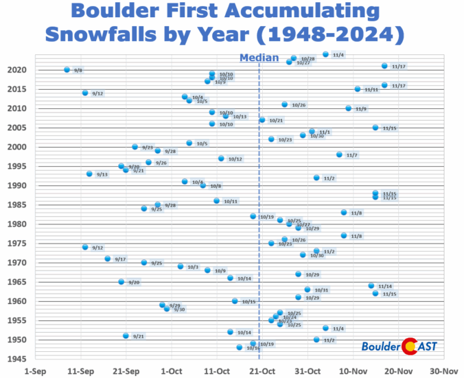
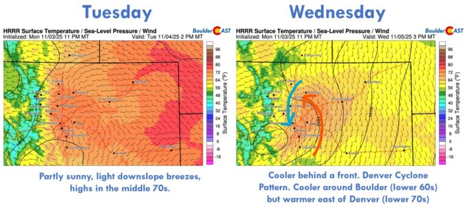
After a stretch of crisp, dry days to end the week, our weather is gearing up for a big warm-up this weekend, with near-record highs favored by Sunday. This developing warm and unfortunately dry pattern looks likely to stick around well into November. With each passing day, the odds grow that Boulder might challenge its record for the latest first snowfall.

Live View of Boulder

Current Conditions

Live Radar

Recent Premium Posts

BoulderCAST Daily – Sat 06/20/26 | Supercells on the Plains, Fire Danger in the High Country & Boulder Quiet In Between
🌩️ Severe storms fire east of I‑25 this afternoon with supercells producing 1.5–2.5″ …
BoulderCAST Daily – Fri 06/19/26 | Quiet end to the week but storms return Saturday, including a significant severe risk towards Kansas
☀️ Quiet finish to the week — Weak ridge brings sunshine, light winds, …
This Weekend in Colorado Weather: Limited Weekend Storms With the Monsoon Still Weeks Away
☀️ Quiet finish to the week — Weak ridge brings sunshine, light winds, …
3-Day Forecast

Trending Content

© 2026 Front Range Weather, LLC