Author: Ben Castellani (Page 141 of 301)
Ben grew up in southwestern Pennsylvania and holds both a bachelor's and a master's degree in Meteorology, the latter being from CU Boulder. His hometown received nearly three feet of snow from the Storm of the Century back in March of 1993, sparking his initial interest in impactful weather. Ben currently works on remote sensing and data analysis software at NV5 Geospatial Software in Boulder.

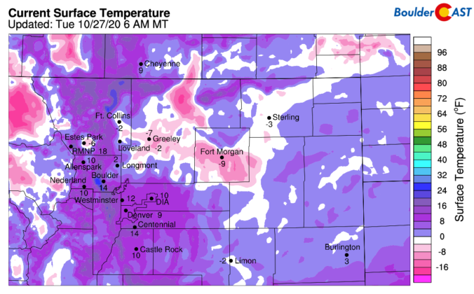
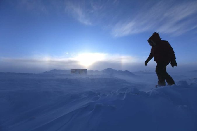
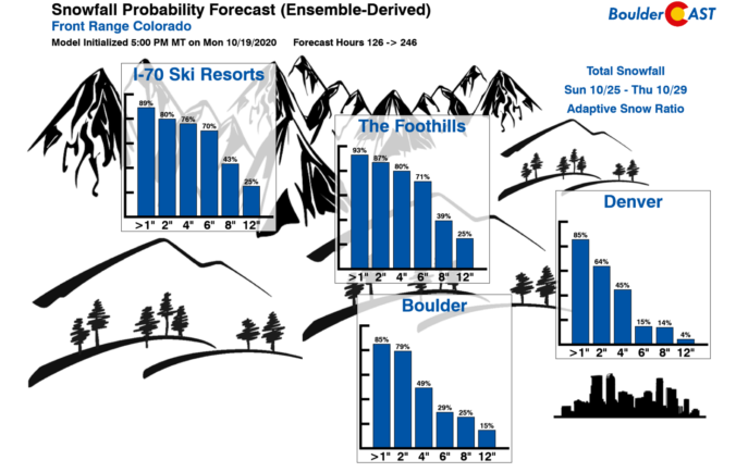
Significant weather changes are headed to the area over the next 12 to 48 hours with our second winter storm of the season taking aim on the Front Range. That’s right…don’t forget we had snow seven long weeks ago! This system will pack record-setting cold for late-October as well as widespread fluffy snowfall and embedded heavy snow bands compliments of the overhead jet stream. In this winter storm update, we discuss when the snow will arrive, how much accumulation to expect, and just how cold it will get to shatter existing records.
⦁❶⦁ It will be warmer today…really!
⦁❷⦁ Highs near 70 degrees with wave clouds, sun and smoke
⦁❸⦁ Watching the potential for low clouds and freezing drizzle Thursday night
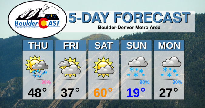
⦁❹⦁ Snow for the upcoming weekend

After an eventful weekend with two new wildfires igniting in Boulder County, the weather will become slightly less favorable for fire growth through the week in the higher terrain. Across the Plains, it will be mainly dry this week, but there are changes queuing up for the late-week period into the weekend including the potential for our first snowfall since early September!

Live View of Boulder

Current Conditions

Live Radar

Recent Premium Posts

BoulderCAST Daily – Sun 05/03/26 | Beautiful weather will transition to late-spring snow by Tuesday!
☀️ Warm Start: Expect a quiet and pleasant start to the week, with …
BoulderCAST Daily – Sat 05/02/26 | A pleasant and warm first weekend in May
☀️Warming up for the first weekend in May, with upper 60s to near …
BoulderCAST Daily – Fri 05/01/26 | Warming up this weekend
🌡️ Warming up this weekend, from the upper 50s-60 today to the upper …
3-Day Forecast

Trending Content

© 2026 Front Range Weather, LLC