Author: Ben Castellani (Page 116 of 301)
Ben grew up in southwestern Pennsylvania and holds both a bachelor's and a master's degree in Meteorology, the latter being from CU Boulder. His hometown received nearly three feet of snow from the Storm of the Century back in March of 1993, sparking his initial interest in impactful weather. Ben currently works on remote sensing and data analysis software at NV5 Geospatial Software in Boulder.


Seasonal change is ongoing across Colorado as of early Monday morning with a blustery Pacific storm system plowing across the state. Snow is falling in the Mountains with some rain across the Denver area, too. This storm system will usher in much cooler temperatures to start the week. However, warmer weather will return by Wednesday (the first official day of fall!) and continue into the upcoming weekend. For those of you hoping for snow, no news is bad news we surmise. Let’s take a look at the outlook for the weather week ahead.
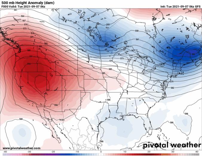
⦁❶⦁ High pressure located in southwestern Colorado continues to dominate the western half of the country
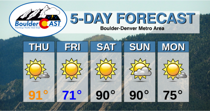
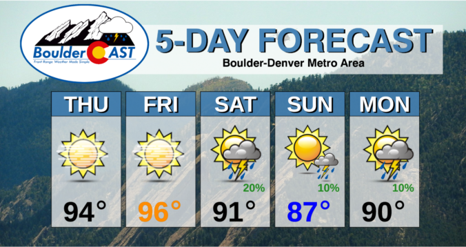
⦁❷⦁ Record highs are almost guaranteed for our area Thursday and Friday in the middle to upper 90’s
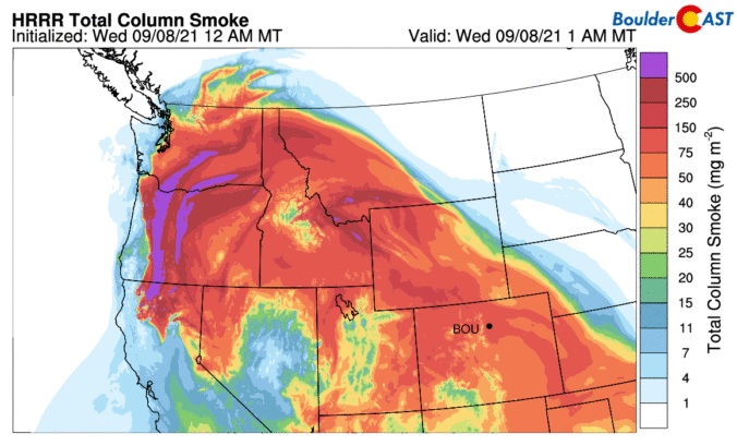
⦁❸⦁ Thick smoke will remain across the area through Friday evening but could lighten up on Saturday
⦁❹⦁ A weak cold front will bring our temperatures down a little this weekend with isolated late-day rain showers

Live View of Boulder

Current Conditions

Live Radar

Recent Premium Posts

BoulderCAST Daily – Tue 04/28/26 | Staying cool with a couple showers, the late-week storm is still the main event despite trending south
🌧️ Morning wave = main show, with light rain showers and Foothills wet …
BoulderCAST Daily – Sun 04/26/26 | Showers and some storms later today and this evening
🌧️ A wet afternoon and early evening, with showers and a few rumbles …
BoulderCAST Daily – Sat 04/25/26 | Cooler today and wet Sunday into early next week
🌧️ A wet latter part of the weekend, with showers and a few …
3-Day Forecast

Trending Content

© 2026 Front Range Weather, LLC