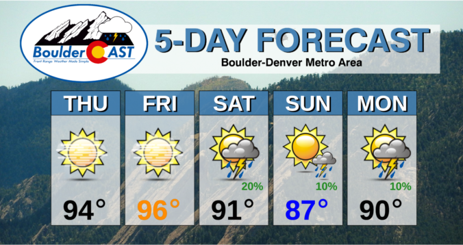
⦁❶⦁ High pressure located in southwestern Colorado continues to dominate the western half of the country
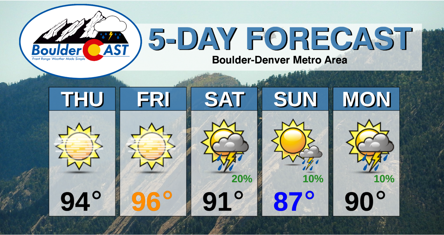
⦁❷⦁ Record highs are almost guaranteed for our area Thursday and Friday in the middle to upper 90’s
⦁❸⦁ Thick smoke will remain across the area through Friday evening but could lighten up on Saturday
⦁❹⦁ A weak cold front will bring our temperatures down a little this weekend with isolated late-day rain showers
Do you want the latest BoulderCAST Daily forecast discussion delivered to your inbox every single morning? If so, join BoulderCAST Premium where we talk Boulder and Denver weather every single day.

Detailed Forecast Discussion:
High pressure continues to be the story for the western United States as a deep trough digs towards the East Coast. The overnight water vapor imagery and 500mb analysis (below) shows that the big ridge is located in far southwestern Colorado with northwest flow evident across the Front Range. Look at all the dry air underneath the ridge! It’s no wonder we’ve barely seen a cloud this week and that cloudless trend will continue for two more days. Also of note is Hurricane Larry spinning out in the middle of the Atlantic. Larry is located about 200 miles east of Bermuda right now and is expected to move northward and potentially make a landfall in Canada late Friday or Saturday.
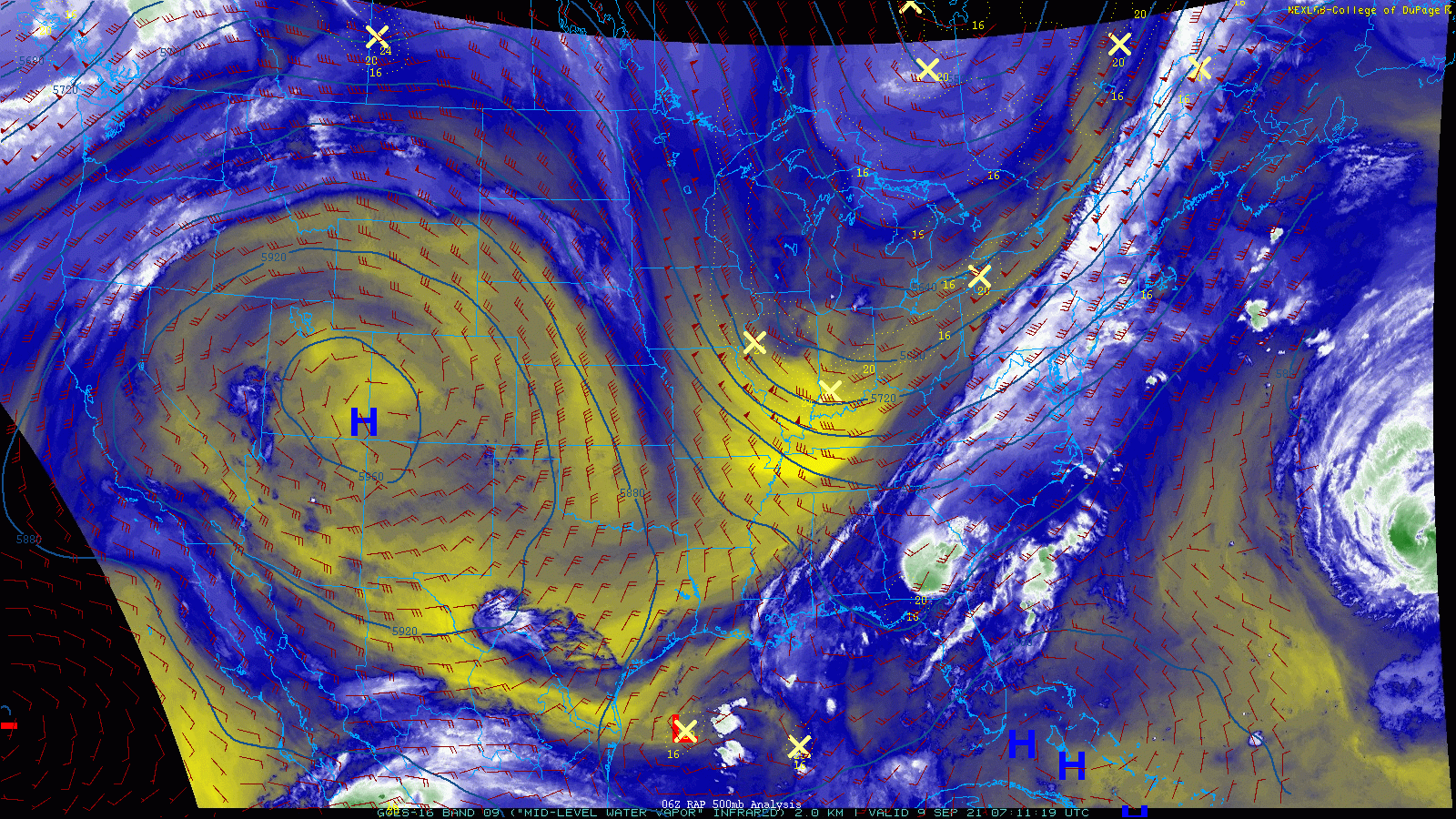
GOES-East mid-level water vapor animation from last night into early Thursday
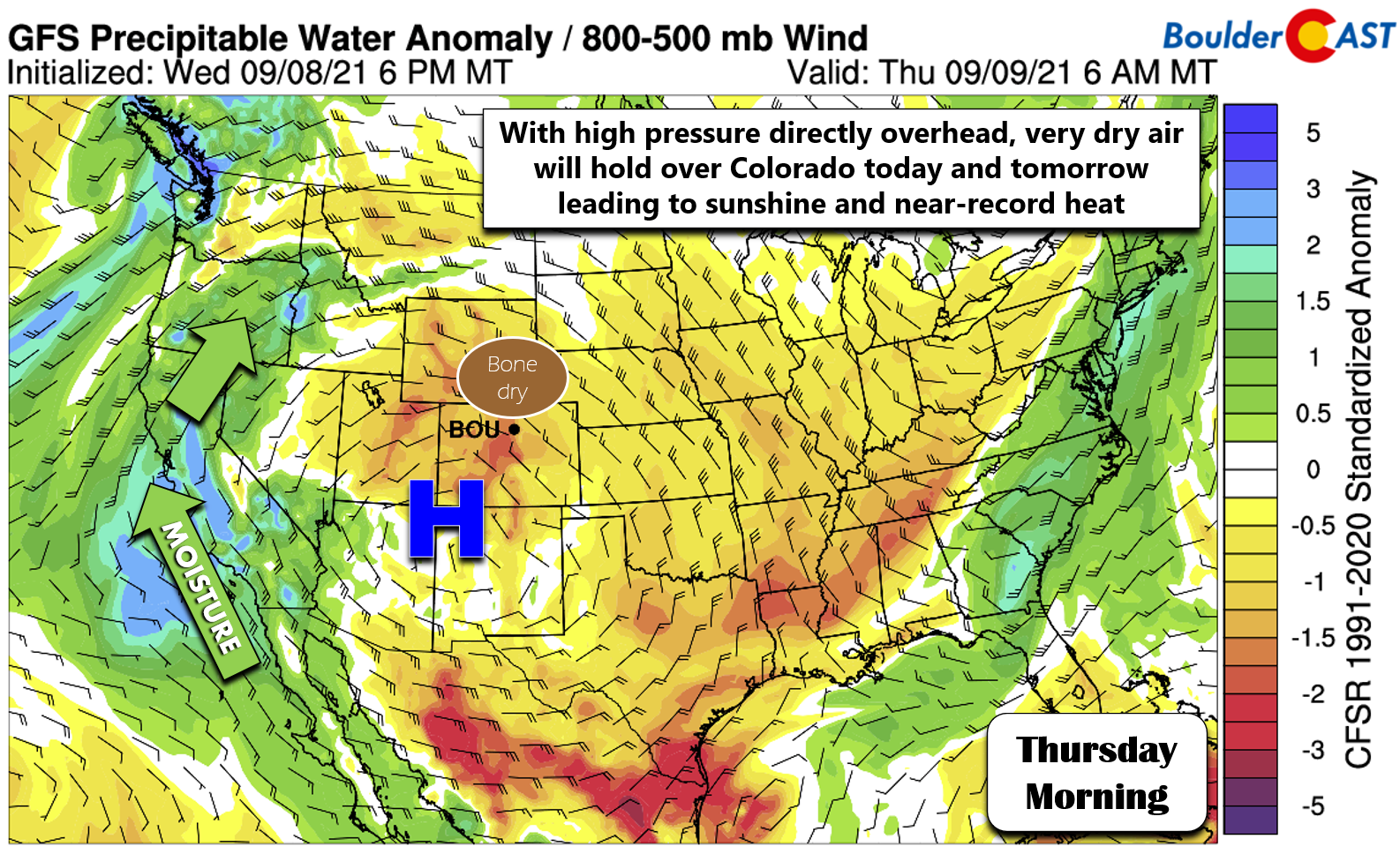
Here’s another view of the aforementioned bone dry air. This is a moisture anomaly forecast from the GFS model for this morning. Note the clockwise flow around the high pressure, the dry air in Colorado, and the return flow of moisture from the south into California and Oregon. Once the high pressure moves southeastward this weekend, this moisture will make it to our area and bring the chance of rain and more clouds for us. We’ve got a few dry and very hot days to go until then, however!
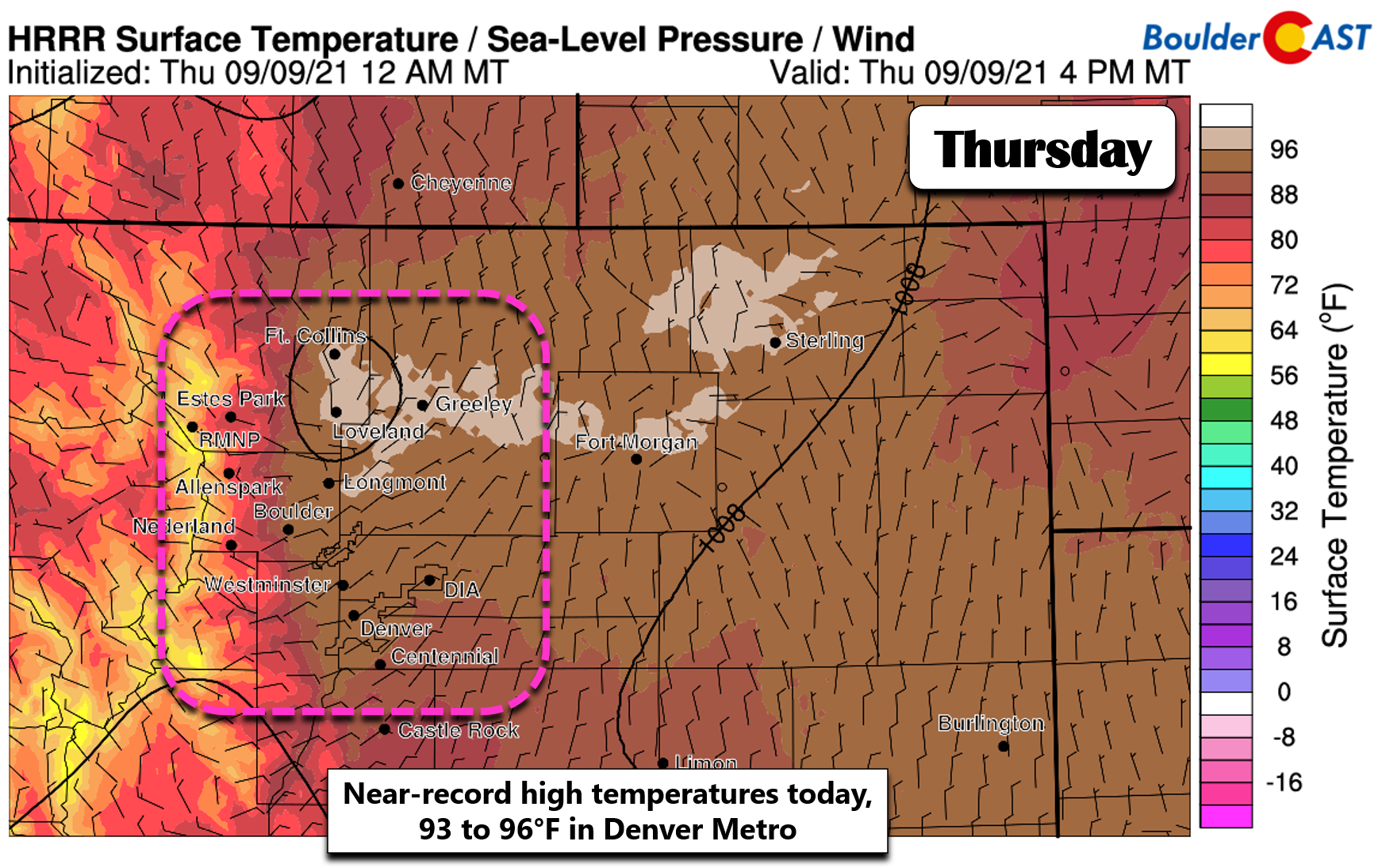
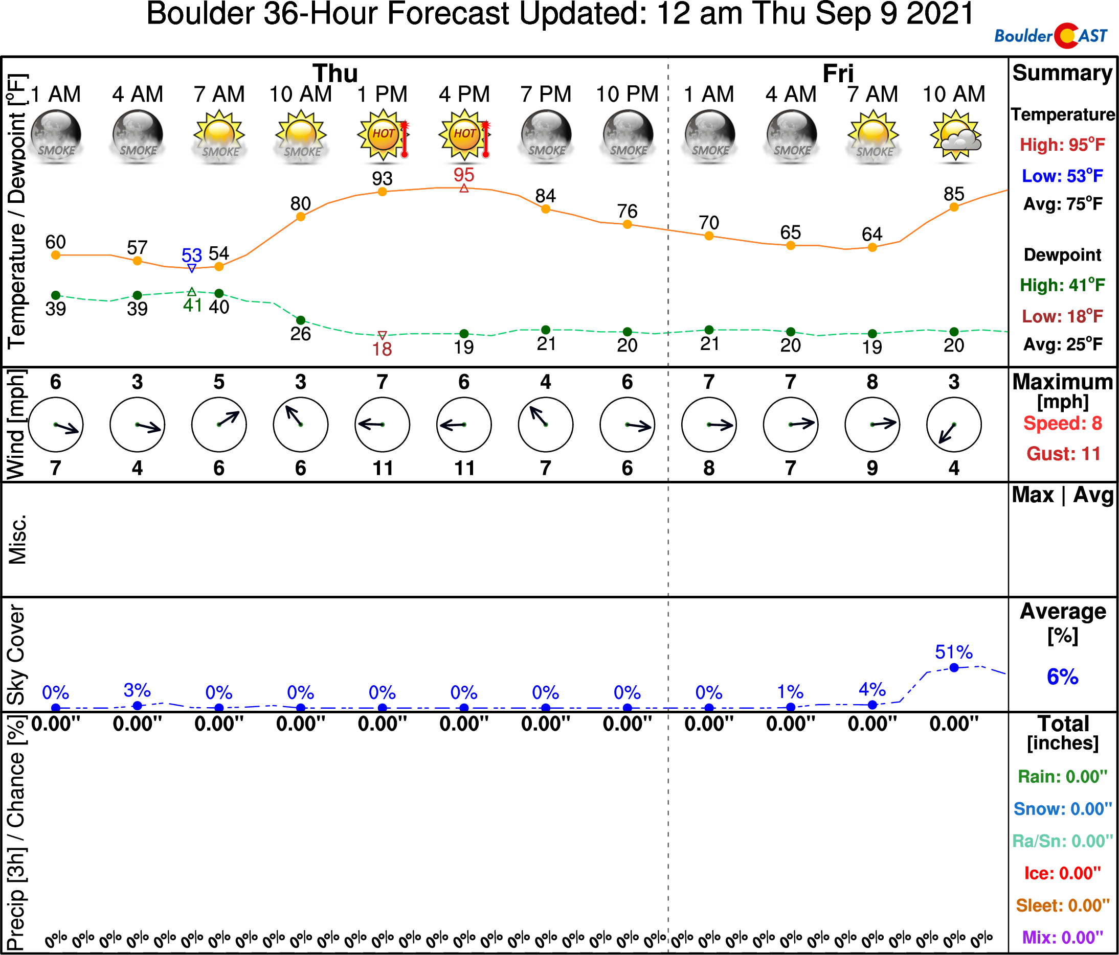
Even though we’re under a northwest flow today, that high pressure system is so anomalous at this point that record highs are very possible if not likely today across the Front Range. We’re generally looking at most areas sizzling towards 93 to 96°F this afternoon under sunny and smoky skies.
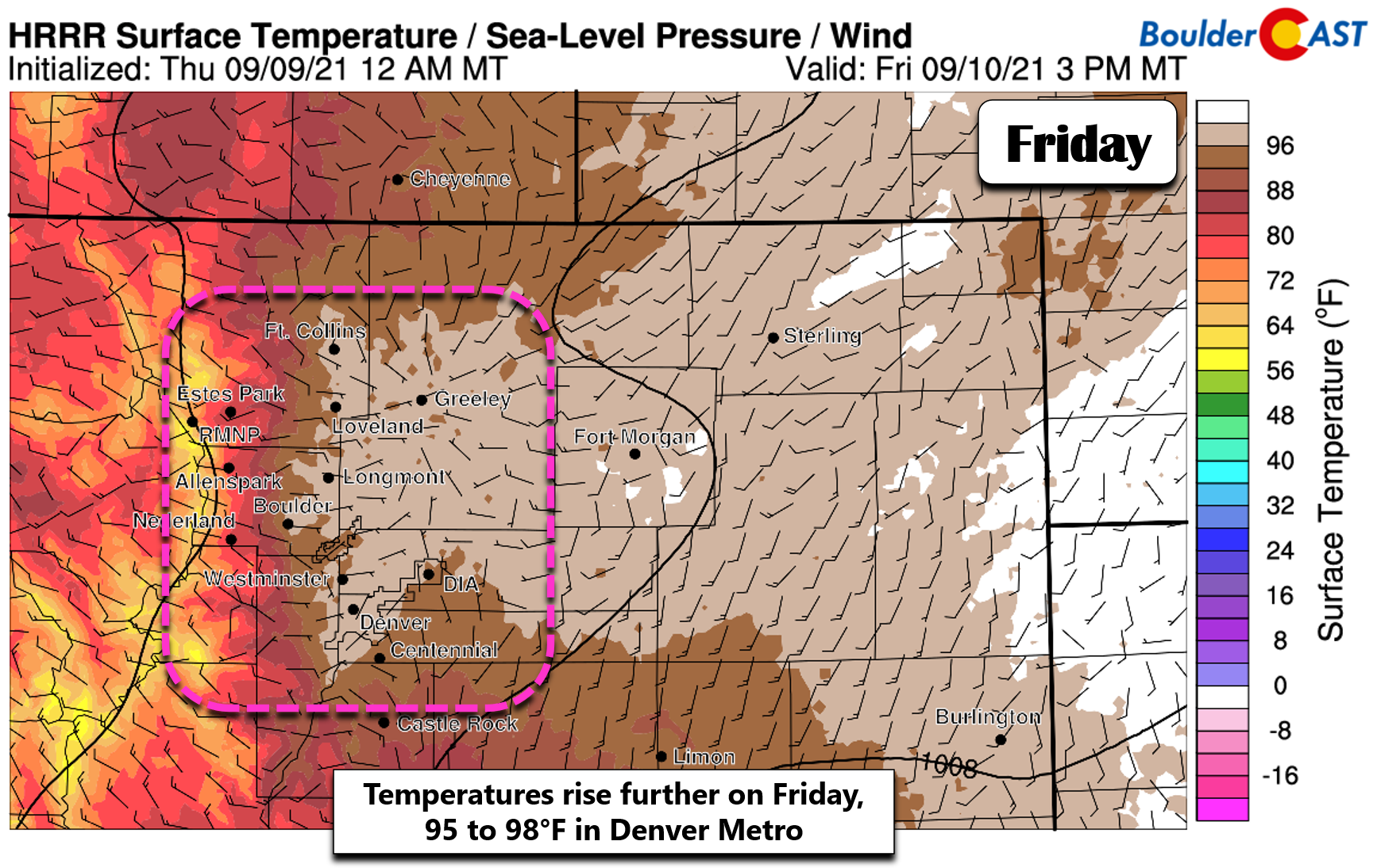
Tomorrow the high pressure center drifts further east and turns our flow to be more westerly or even southwesterly. This will crank up the oven-dial further with highs even a few degrees warmer. Friday’s temperatures will range from 95 to 98°F across the Denver Metro area. Even low 100’s are possible in portions of far eastern Colorado!
The record temperature value to beat in both Boulder and Denver today is 94°F. On Friday, the record highs are 94°F in Boulder and 93°F in Denver. With temperatures this warm, those are likely to be toppled today and nearly guaranteed to be shattered on Friday. The only slight concern we have that could throw a wrench into things is the continued thick smoke. Smoke was quite thick yesterday which caused several degrees of cooling off model predictions. This could put a potential record high today in jeopardy. NowCAST is however showing a high of 95°F in Boulder today despite the smoke.
Smoke is forecast to thin slightly on Friday so we’re quite confident that Friday will eclipse all the daily record highs across the region.
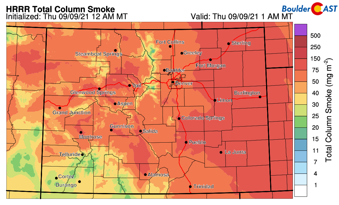
HRRR total smoke forecast for Colorado through Friday night. Lots of smoke will linger across the state.
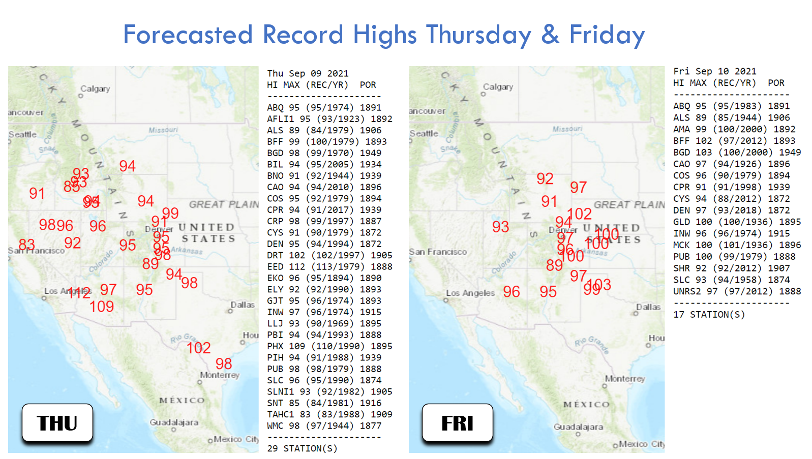
Colorado is not the only state enduring the scorching heat from this high pressure center! Many of the surrounding states will be approaching new records to close out the week as well. The maps below show potential new records to be set today and tomorrow.
After two days baking in a figurative oven, a weak cold front is projected to drop southward through our area early Saturday morning. This will cool us off a little bit, but highs are likely to still reach the lower 90’s. Storm chances will return as that moisture plume, shown earlier over California, finally reaches Colorado. Still, showers and thunderstorms will be spotty with just isolated to widely scattered storms it seems around Denver.
Sunday will be a little cooler with highs in the mid to upper 80’s and a slight chance of a late-day storm. The same goes for Monday with temperatures creeping up towards 90 degrees again. Models don’t agree well yet on the timing of our next cold front, but that could arrive late Monday or perhaps early Tuesday. This front should be a little stronger with temperatures possibly dropping back into the 70’s Tuesday or Wednesday of next week. We’ve still got at least five more days of above normal temperatures between now and then, however. Stay cool!
Remember, our daily forecasts are Premium content. Periodically, we open this forecast up to all of our readers. Today is one of those days!
Help support our team of Front Range weather bloggers by joining BoulderCAST Premium. We talk Boulder and Denver weather every single day. Sign up now to get access to our daily forecast discussions each morning, complete six-day skiing and hiking forecasts powered by machine learning, first-class access to all our Colorado-centric high-resolution weather graphics, bonus storm updates and much more! Or not, we just appreciate your readership!


You must be logged in to post a comment.