


Author: Ben Castellani (Page 11 of 310)
Ben grew up in southwestern Pennsylvania and holds both a bachelor's and a master's degree in Meteorology, the latter being from CU Boulder. His hometown received nearly three feet of snow from the Storm of the Century back in March of 1993, sparking his initial interest in impactful weather. Ben currently works on remote sensing and data analysis software at NV5 Geospatial Software in Boulder.
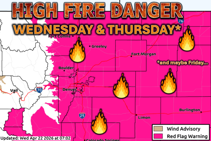
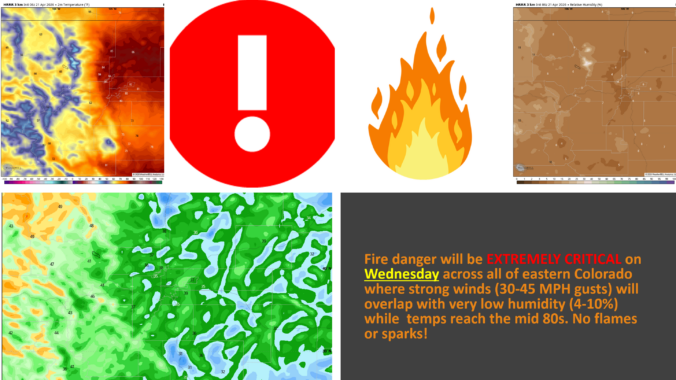
The atmosphere is gearing up for a dramatic mid‑week pivot, and the Front Range is about to feel every bit of it. We start the week under a warm, bone‑dry ridge that will send temperatures soaring and fire danger spiking—especially by Wednesday, when downslope winds and exceptional dryness are set to collide. But just as quickly, the pattern will flip. A pair of incoming troughs will drag us into a cooler, unsettled stretch of weather heading into the weekend, with several chances for much‑needed moisture and even the prospect of a few snowflakes mixing in at times. It’s a true tale of two patterns this week! Read on for all the details.
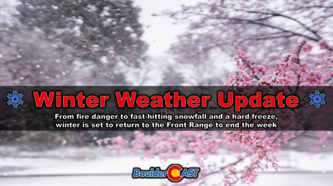
A sharp pattern shift is lining up for the Front Range to end the week, and it’s going to feel a lot different than the stretch of mild, breezy days we’ve been riding lately. Thursday brings one more round of elevated fire danger, but by tonight a much colder airmass barrels in and sets the stage for a quick burst of snowflakes Friday morning — followed by a hard freeze Friday night that may end up being the most impactful part of the whole event. Here’s what to expect as winter makes a brief, timely return to the Denver-Boulder area.
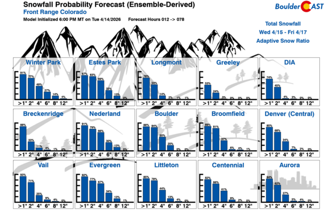
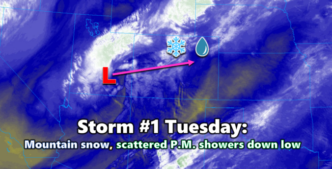
As we roll into mid‑April, the Front Range finally snaps back into an active pattern with fire danger, two storm systems, and even a shot at late‑season snow all packed into one busy week. From warm, windy days to Mountain snow and the possibility of flakes reaching the Denver–Boulder corridor by Friday, there’s a lot happening in the days ahead. Read on for all the details.


Live View of Boulder

Current Conditions

Live Radar

Latest Smoke Forecast

Recent Premium Posts

This Weekend in Colorado Weather: Autumn on Hold as Warm, Dry Pattern Dominates Early October
🌧️ Southern Colorado drenched, Front Range bone‑dry: The upper‑low parked in SE Colorado …
BoulderCAST Daily – Sun 09/27/26 | A Mild Sunday, Followed by Wet Weather This Week
☀️ Mild Sunday — Highs well into the lower 80s with a few …
BoulderCAST Daily – Sat 09/26/26 | Quiet Weather, But Wet Weather Is Brewing Next Week Tied To A Tropical System
☀️ Weekend calm — Weather is quiet this weekend in the lower 80s …
3-Day Forecast

Trending Content



© 2026 Front Range Weather, LLC