

Author: Ben Castellani (Page 106 of 358)

Ben grew up in southwestern Pennsylvania and holds both a bachelor's and a master's degree in Meteorology, the latter being from CU Boulder. His hometown received nearly three feet of snow from the Storm of the Century back in March of 1993, sparking his initial interest in impactful weather. Ben currently works on remote sensing and data analysis software at NV5 Geospatial Software in Boulder.
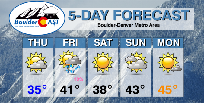
This Weekend in Colorado Weather: January 5, 2023

Another dry but cool day is expected across the Front Range as a shortwave ridge kicks through the area. A potent low pressure and associated atmospheric river event are slamming the West Coast right now. Some of the cloud cover from this massive system will be riding up and over our ridge today leading to an increase in high clouds …

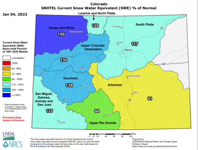
BoulderCAST Daily – Wed 01/04/23 | Drying out & warming up slowly, Mountain snowpack in great shape

Temperatures are starting out highly variable this morning across the Front Range as clear skies, fresh snow and light winds have allowed for exceptional radiational cooling in some areas. For example, as of 6:00 AM, many areas to the northeast were in the single digits and lower teens, including in Gunbarrel. However, most of Boulder and the Denver area near …

BoulderCAST Daily – Tue 01/03/23 | Staying cold & mostly cloudy

The passing of the primary low pressure across the region yesterday was a textbook case of lee cyclogenesis. The approaching low pressure from Utah died out over northwest Colorado, while a new low pressure formed and rapidly intensified in east-central Colorado near the Kansas border. Unfortunately this behavior led to the best energy and lift largely bypassing the Denver area …

BoulderCAST Daily – Mon 01/02/23 | Snow, freezing drizzle and freezing fog through the day

Overnight snowfall amounts so far range from 0.5 to 1.5" across the Denver Metro area, though there is some ice glazed in with the snow too. Officially, Boulder has reported 0.9" of snow so far. There will be a bit of a break in the action this morning until later today when the main storm system arrives and begins to …

Winter Weather Update: 2023 commences with freezing drizzle and some snow (Updated)

Happy New Year! We’re starting off 2023 unsettled with more snow! There’s no holiday rest for us meteorologists here in the Front Range as yet another southern-track winter storm is knocking on the door. This one will unfold in two phases — the first being a period of freezing drizzle/snow showers Sunday night with a second phase of snow (some heavy) developing during the day Monday. In this forecast update we talk about timing, potential snowfall totals and the extended outlook for the rest fo the week.

Update (5PM 1/1/2023): Lowered snowfall amounts and updated snowfall map based on latest guidance. 

Continue reading

BoulderCAST Daily – Fri 12/30/22 | Staying cool on the Plains today, great NYE weather tomorrow, and a snowy weekend in the Mountains

Another fairly cool day is on-tap for the Front Range with minimal melting expected of the soupy snowpack on the ground --- especially for northern Metro cities. Another atmospheric river (AR) is hammering the Oregon/California coastline and the residual moisture from that will push into Colorado later today. The animation below shows the birth of the AR over the last …

Colorado Weekend Weather Outlook: December 29, 2022

The booming, spring-like snowstorm has come to an end across the entire area rapidly overnight from west to east leaving behind a deep blanket of wet snow up and down the Front Range. Drive safely this morning as most roadways are snow-packed and/or icy! We'll discuss this amazing event in greater detail in a recap post soon. For today, though, …

« Older posts Newer posts »