Our second Arctic Blast of 2025 is already underway! The first round of bitter cold has already gripped the Front Range, with light snow falling last night and temperatures plunging into single digits this morning. However, the worst is yet to come! Another wave of Arctic air is set to sweep through later on Tuesday, bringing several inches of snowfall and eventually sub-zero temperatures to the entire area. We discuss the latest forecast details, including when this next round of snow will begin and end, expected snowfall amounts across the area, and just how cold it will get in the days ahead.
At a Glance
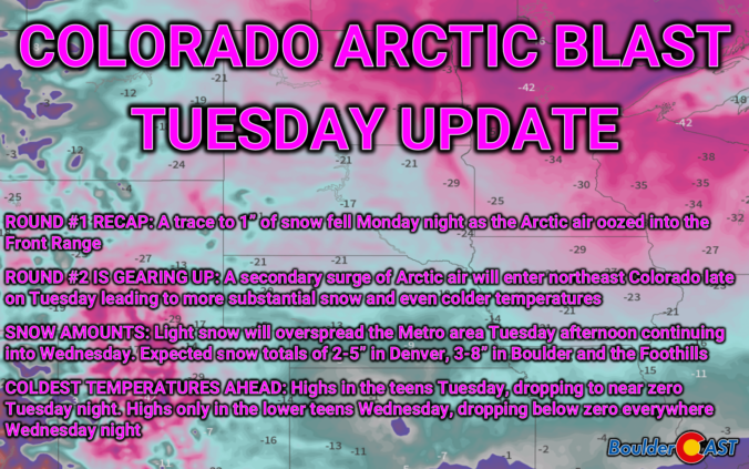
- Round #1 Recap: Bitter cold air filtered into the Front Range Monday night with temperatures now in the single digits early Tuesday. Snow totals thus far range from a trace to just over 1″.
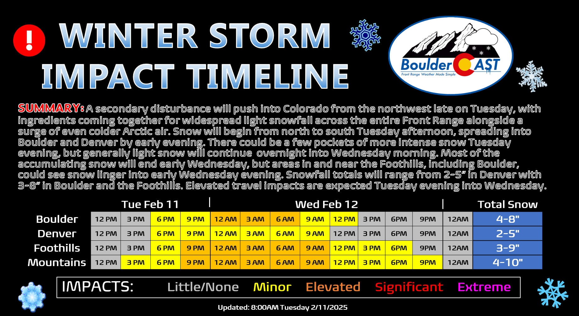
- Round #2 Inbound: A secondary surge of Arctic air will enter northeast Colorado late on Tuesday as a stronger storm system enters the region from the northwest. Light snow will overspread the Metro area Tuesday afternoon into the evening from north to south, ending during the day Wednesday.
- Expected Snow Totals Tuesday Afternoon into Wednesday: 2 to 5 inches of snow will be common across much of the Denver area, but Boulder and the Foothills can expect 3 to 8 inches.
- Coldest Air Still to Come: Wednesday will be the coldest day of the entire outbreak with highs only in the lower teens. Wednesday night the area will drop below zero, with favored cold spots north and east of Denver reaching the negative teens.

Go Premium, get all the perks.
Daily Forecast Updates
Get our daily forecast discussion every morning delivered to your inbox.
All Our Model Data
Access to all our Colorado-centric high-resolution weather model graphics. Seriously — every one!
Ski & Hiking Forecasts
6-day forecasts for all the Colorado ski resorts, plus more than 120 hiking trails, including every 14er.
Smoke Forecasts
Wildfire smoke concentration predictions up to 72 hours into the future.
Exclusive Content
Weekend outlooks every Thursday, bonus storm updates, historical data and much more!
No Advertisements
Enjoy ad-free viewing on the entire site.
The Arctic air is here, but the worst is still to come!
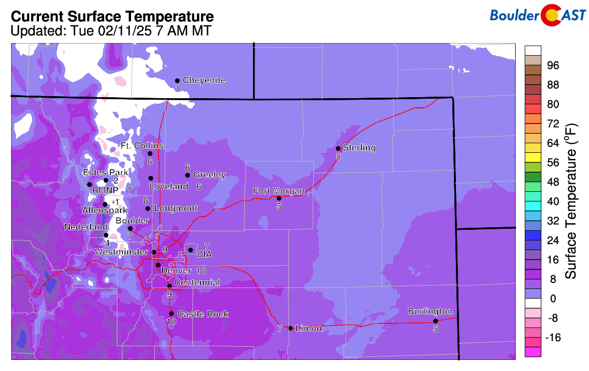
The Arctic airmass has arrived into eastern Colorado! Temperatures across the area have declined from the 30s we had on Monday afternoon down into the single digits as of writing Tuesday morning. It’s even a bit below zero just to the west in the lower Foothills!
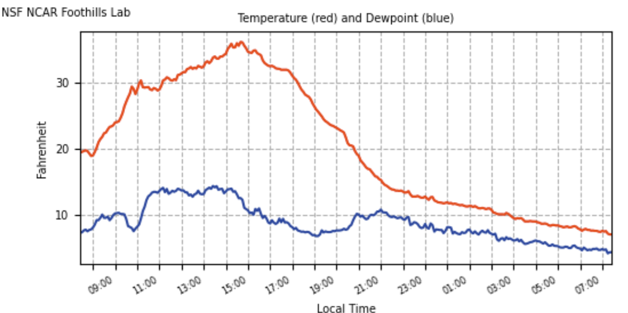
As expected, the arrival of the much colder airmass was an anticlimactic one, with this Arctic air slowly trudging into the Boulder-Denver Metro area overnight. There was no sharp drop in temperature with this event, as shown in the observation timeline below. The cold, dense Arctic air just gradually oozed in over the course of the last 18 hours.
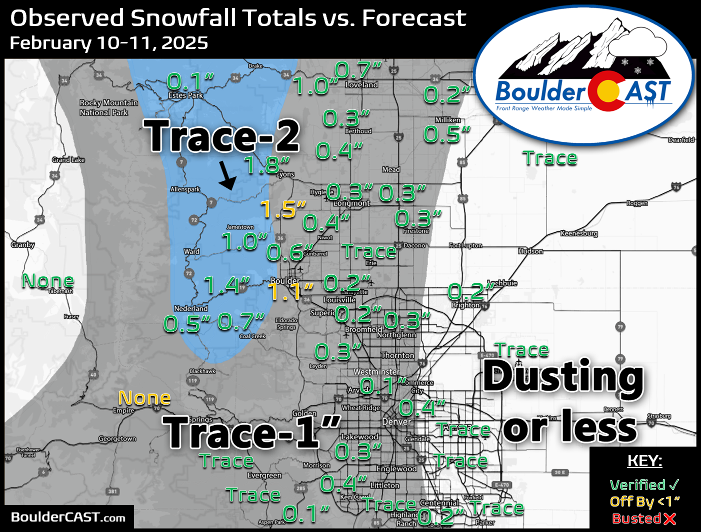
As the bitter cold air was working in overnight, it was accompanied by very light snowfall at times, forced mainly by the shallow upslope component within the Arctic airmass. In fact, as of Tuesday morning, we’re still seeing a few fine-grain snowflakes falling from the sky, but it’s barely leading to any accumulation at this point. Our snowfall forecast map for this first wave of Arctic air (issued on Monday morning) is shown below with actual storm total numbers overlaid. Green values indicate our forecast verified, Yellow values mean the observed total was just outside our forecast (within 1″), while Red was a busted forecast (there are no red in this case). Snowfall totals generally ranged from a trace to 1″ across the entire region. Locations in and near the Foothills of Boulder County received up to 1.5″ or so. Overall we had good forecast verification across the board with this initial surge of Arctic air, though it’s really hard to go wrong when the highest snowfall amount was barely more than an inch! Officially, Boulder reported 1.1″ of new snow, with just a trace recorded for Denver (out at DIA).
We’re not out of the wintery woods yet — not by a long shot! Mother Nature is just getting started with the bitter cold and snow for us. The main event of this Arctic Blast is still on-track to begin Tuesday afternoon and continue into Wednesday, with a prolonged period of light snowfall set to impact the entire Denver Metro area. A stronger shortwave disturbance can be seen in the mid-level vorticity forecast animation below working towards Colorado from the Pacific Northwest — currently located over Idaho Tuesday morning. The energy from this shortwave will enter into northern Colorado Tuesday afternoon, with favorable synoptic and upslope conditions coming together for widespread snow to form across our area, lingering through all of Tuesday night.
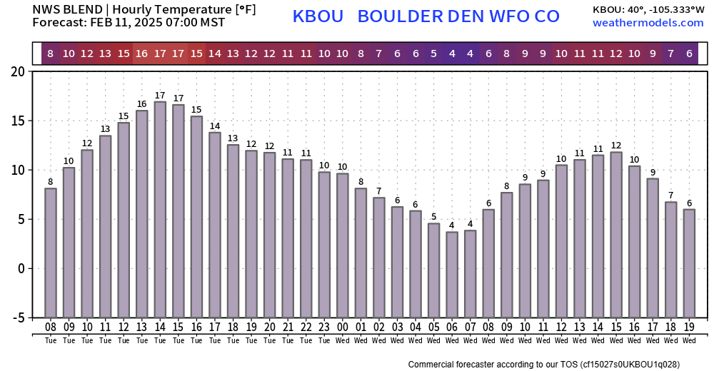
This shortwave will also drag down even colder Arctic air with it, tumbling temperatures further all the way into Thursday morning. A blended temperature forecast for Boulder is shown below. High temperatures on Tuesday should be in the mid to upper teens. Tuesday night we drop down into the low single digits. Wednesday will see a peak temperature only around 10°F — yes, Wednesday is the coldest day of the event!
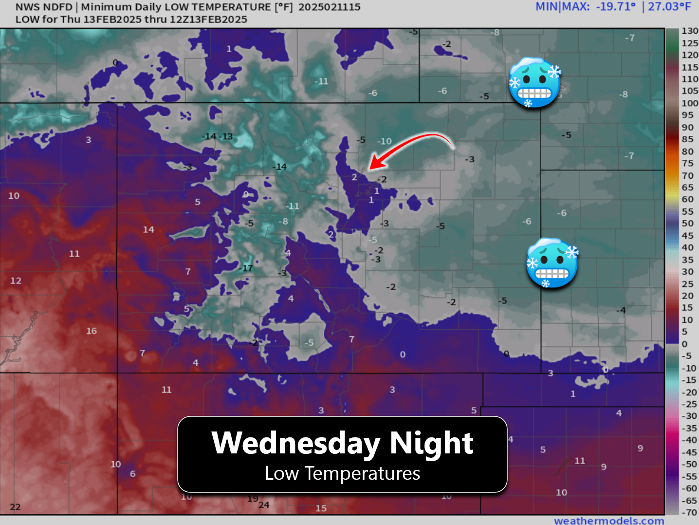
Wednesday night will see skies clear across most of the area. Temperatures will plummet to their lowest values of the event with fresh snow and clear skies, likely into the negative single digits for most, with some negative teens in favored cold spots, like up near Greeley.
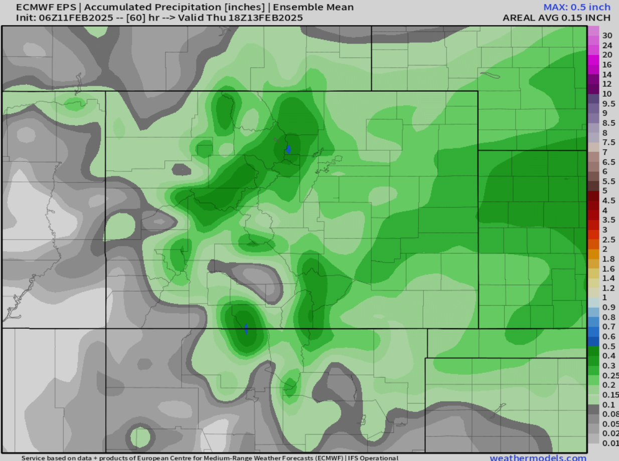
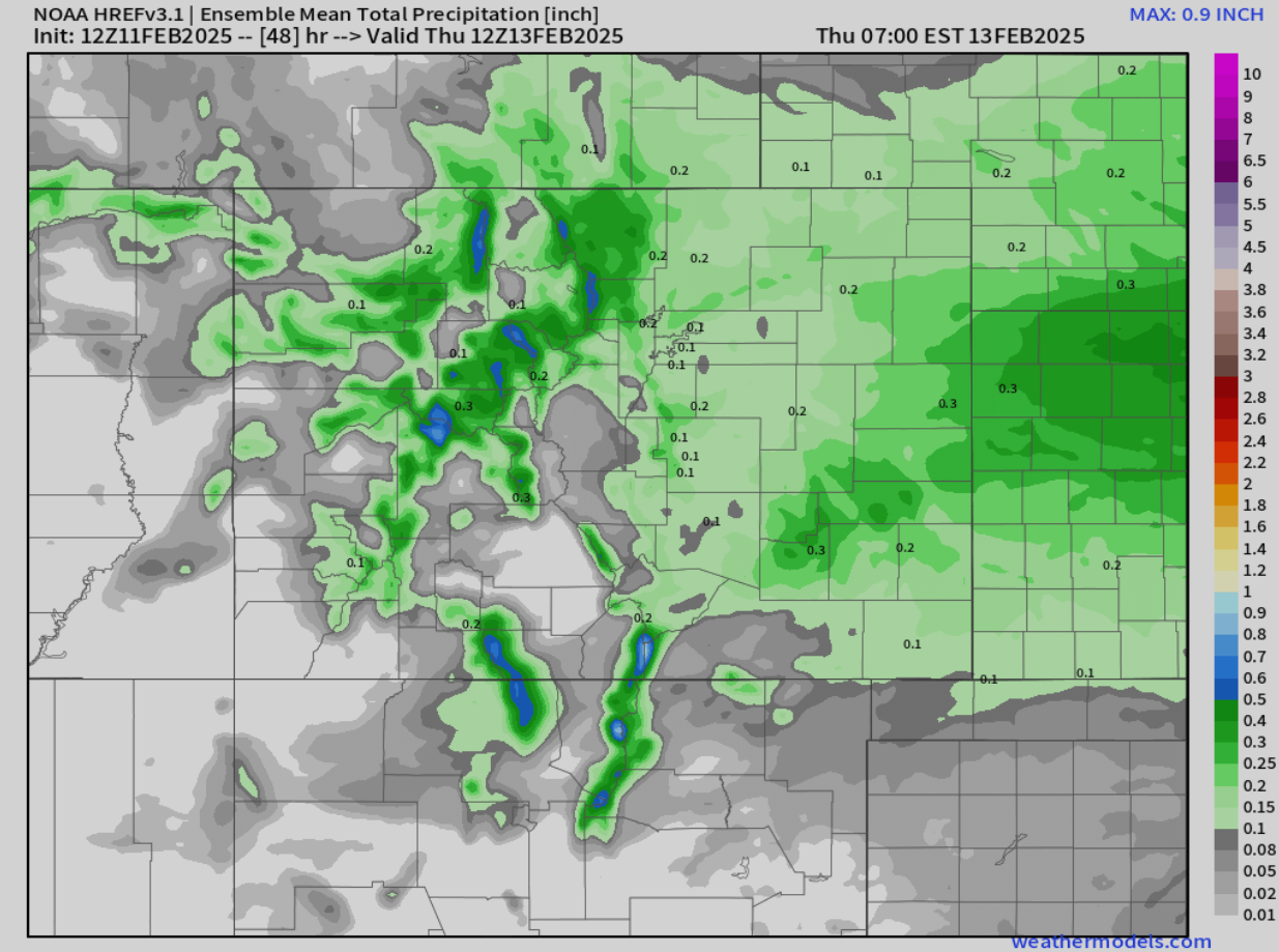
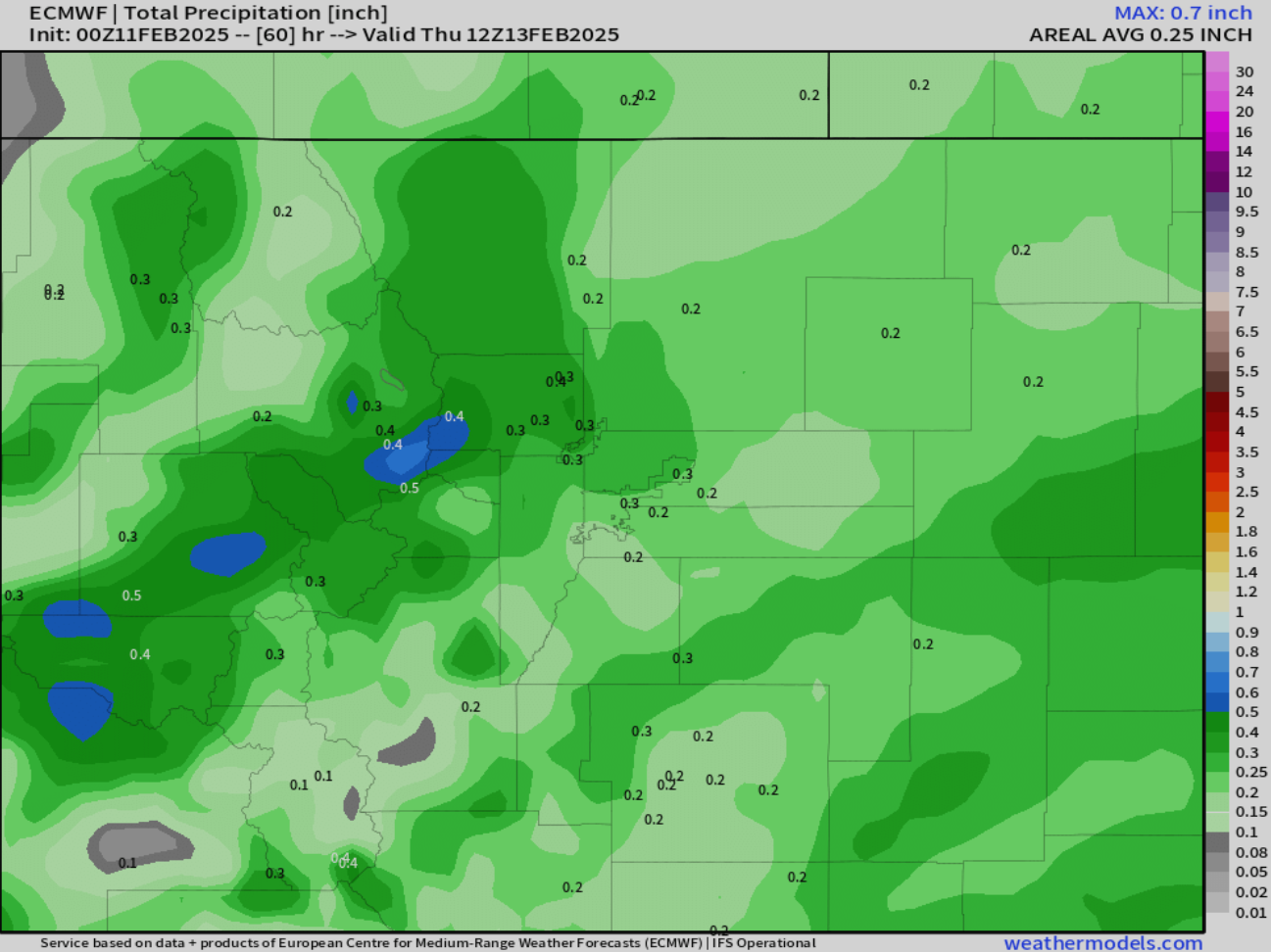
As for snow amounts, models have remained fairly consistent in that regard the last few days, with the higher terrain of Boulder and Larimer Counties most favored from this event. The European ensemble mean precipitation forecast has a spread from 0.1 inches of moisture (southeast Metro area) to around 0.4″ (west of Boulder).
This matches fairly closely with the high-resolution ensemble data, both in magnitude and spatial distribution:
Here’s a closer look at the Boulder-Denver area’s latest European model forecast:
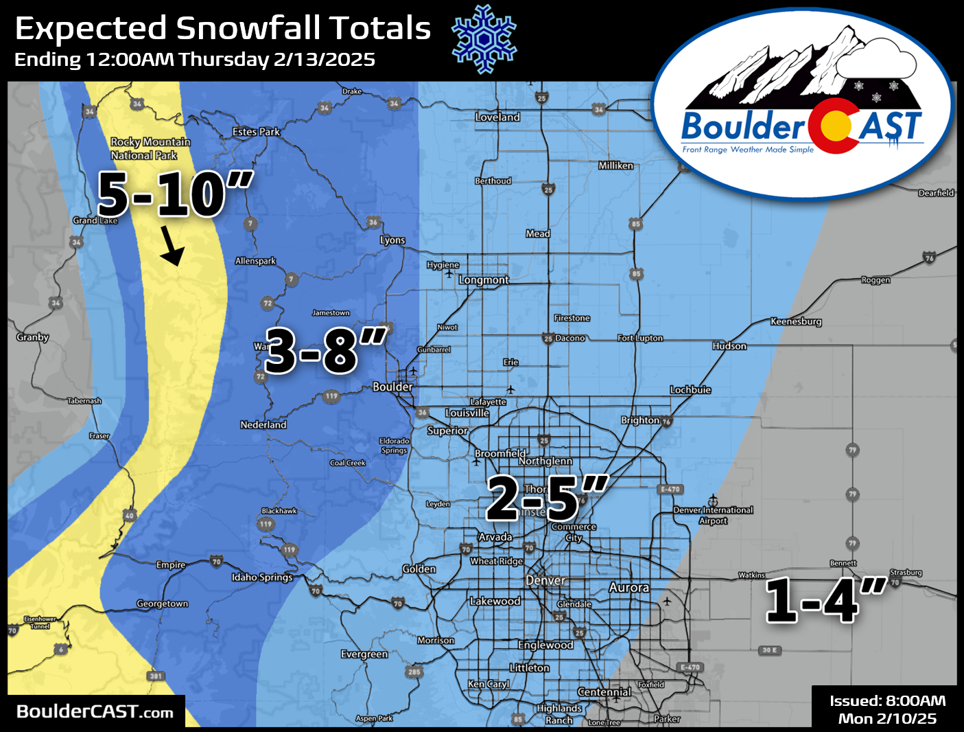
Guidance is indeed fairly consistent across the board — so we’re not expecting any real surprises tonight. This isn’t a ton of moisture, but fairly high snow ratios will provide for some decent snowfall totals across the region. Temperatures will be a tad too cold Tuesday night to get the absolute fluffiest snowflakes — look for less dendrites late Tuesday night and more plate-like crystals — but we’re still expecting ratios north of 15:1 regionwide, with perhaps some areas closer to 20:1. The Foothills will be even colder and thus will see lower ratios despite greater moisture falling there — helping to wash out some of the snowfall gradient heading west. Our snowfall forecast map for the main event of this Arctic Blast is shown below. This map covers all snow falling from early Tuesday afternoon through Wednesday evening. No changes were made to our preliminary forecast amounts (this map was issued Monday morning). In general we’re expecting 1 to 5 inches across the Denver area (lowest southeast), with higher totals of 3 to 8 inches in Boulder and the northern Foothills. Some Mountain areas could see up to 10 inches.
Light snow will begin to spread south into the area by early or mid-afternoon, impacting places like Rocky Mountain National Park and Fort Collins first. Snow should reach Boulder and Denver by early evening, right around the evening commute window. You may want to leave work a tad early if possible. Light snow will continue through the entire overnight period into Wednesday morning as temperatures fall into the lower single digits. Expect a slick commute Wednesday morning, with improving road conditions through the day as snow wanes. Snow will fully come to an end Wednesday evening, lingering longest in and near the lower Foothills, including Boulder.
Don’t forget that Wednesday night will offer up the coldest temperatures, with everyone plummeting below zero! Things will be quieter Thursday into Friday as a calmer weather pattern (briefly) scoots in from the west, with temperatures pushing back into the 30s and 40s. A remnant atmospheric river is still planned to hit Colorado late this week into the weekend with heavy snow in the Mountains. Lighter precipitation, including possible light accumulating snow, may swing into eastern Colorado Friday night into Saturday along a cold front. We’ll talk more about that system in the days ahead.
That’s all we have for this Tuesday Arctic Blast update! Stay warm, stay safe, and be sure to follow us on Twitter, Bluesky, Facebook, and Threads for impromptu weather updates in the coming days as this Arctic outbreak continues, or subscribe to get notified of our long-form updates here.
Get BoulderCAST updates delivered to your inbox:
Go Premium, get all the perks.
Daily Forecast Updates
Get our daily forecast discussion every morning delivered to your inbox.
All Our Model Data
Access to all our Colorado-centric high-resolution weather model graphics. Seriously — every one!
Ski & Hiking Forecasts
6-day forecasts for all the Colorado ski resorts, plus more than 120 hiking trails, including every 14er.
Smoke Forecasts
Wildfire smoke concentration predictions up to 72 hours into the future.
Exclusive Content
Weekend outlooks every Thursday, bonus storm updates, historical data and much more!
No Advertisements
Enjoy ad-free viewing on the entire site.
Enjoy our content? Give it a share:


You must be logged in to post a comment.