


Parts of southwest Colorado have picked up 15 to 20 inches of rain in the last 60 days, and this weekend’s storm pushed rivers across the Four Corners to historic levels with devastating results. Here on the Front Range, southwest flow kept us mostly dry again, with Sunday evening’s showers adding up to about a tenth of an inch.
The colder back half of that storm reaches us Monday. A cold front moving through this morning brings our best chance of rain from this system, though some parts of the Denver area are better positioned than others. Snow is on the way for the high country, temperatures will below normal, and another storm is approaching later this week. Here’s what to expect.
This week’s highlights include:
🌊 Flooding in the Four Corners — An atmospheric river-fueled storm caused historic flooding across New Mexico, Arizona, and southwest Colorado over the weekend. It’s the fifth big rain event in the San Juans in two months.
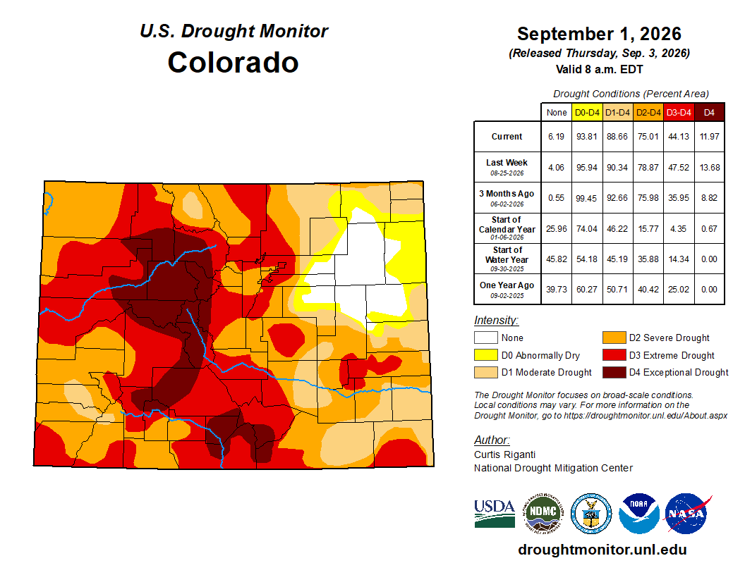
🏜️ Drought erased, at a cost — Extreme drought in southwest Colorado has disappeared in just 60 days, but the landscape couldn’t handle that much rain all at once.
🌬️ Front Range left out again — Southwest flow downsloped the Denver area once more, and Sunday evening’s rain added up to very little.
🥶 Monday cold front — A morning front brings scattered showers, chilly highs, and gusty north winds, with the best rain chances favoring certain parts of the metro.
🏔️ Mountain snow and slick passes — The high country picks up accumulating snow, and winter highlights cover most of the state’s ranges right now.
☀️ Quieter days ahead — A weaker storm passes by midweek, then sunshine and seasonable temperatures should carry us into a pleasant weekend.
DISCLAIMER: This weekly outlook forecast is created Monday morning and covers the entire upcoming week. Accuracy will decrease as the week progresses as this post is NOT updated. To receive daily updated forecasts from our team, among many other perks, subscribe to BoulderCAST Premium.

Go Premium, get all the perks.
Daily Forecast Updates
Get our daily forecast discussion every morning delivered to your inbox.
All Our Model Data
Access to all our Colorado-centric high-resolution weather model graphics. Seriously — every one!
Ski & Hiking Forecasts
6-day forecasts for all the Colorado ski resorts, plus more than 120 hiking trails, including every 14er.
Smoke Forecasts
Wildfire smoke concentration predictions up to 72 hours into the future.
Exclusive Content
Weekend outlooks every Thursday, bonus storm updates, historical data and much more!
No Advertisements
Enjoy ad-free viewing on the entire site.
W
e’re in the middle of yet another soaking storm system moving through the American Southwest. Over the weekend it brought devastating and, in places, historic flooding to New Mexico, Arizona, and southwest Colorado. The storm tapped into an atmospheric river, a long, narrow plume of deep subtropical moisture streaming northeast from the Pacific, and aimed it squarely at the Four Corners. When that much water vapor gets forced up the steep terrain of the San Juans, the mountains wring it out with brutal efficiency.
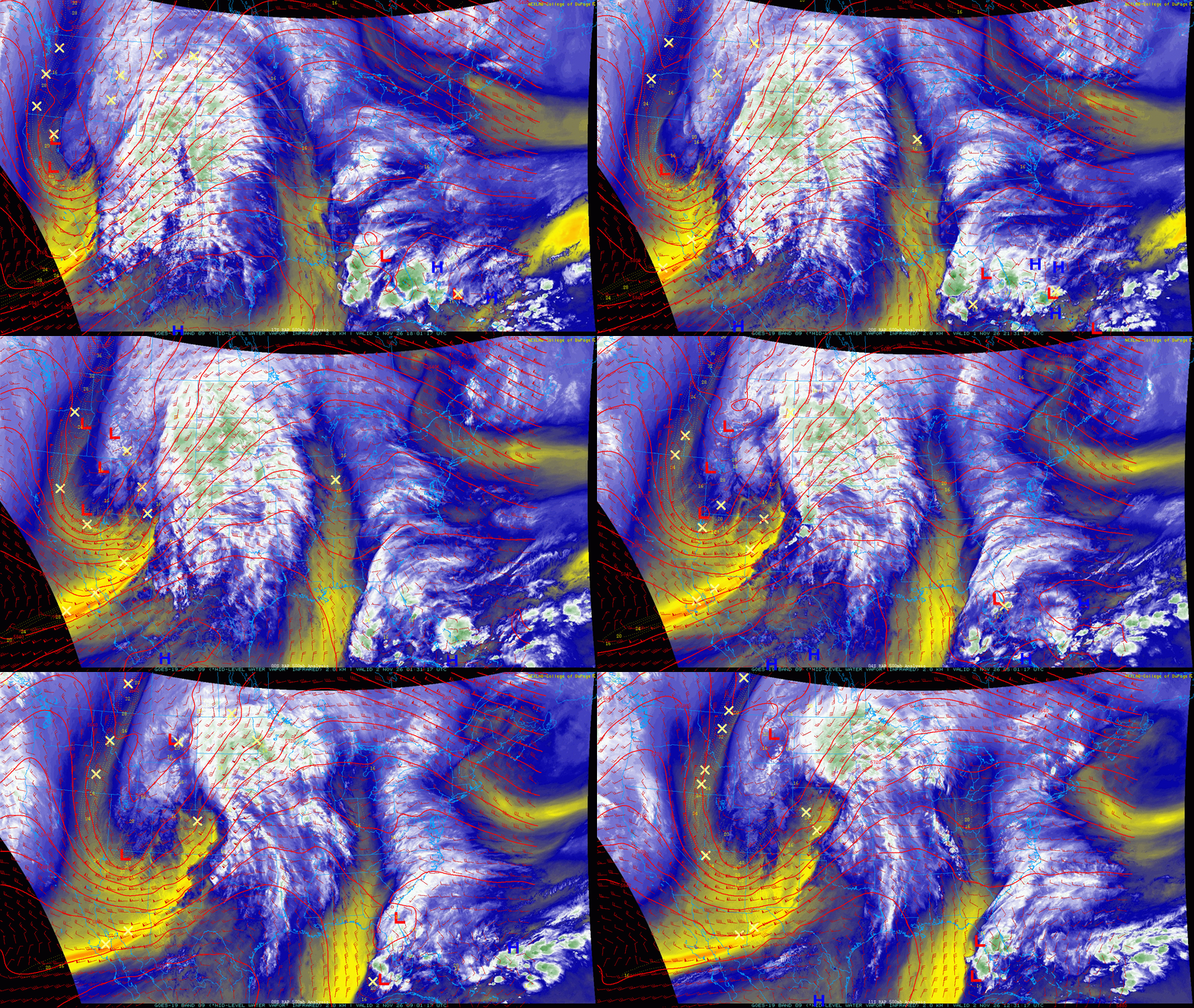
This was the fifth significant rain event to hit the San Juans in the last two months. That relentless pace is why the flooding has been so severe: soils were already saturated and creeks were already running high before this latest round arrived. The same stretch has wiped out the extreme drought in that corner of the state in just 60 days, with 15 to 20 inches of rain falling over that period. That’s more than many lower-elevation spots in Colorado see in an entire year. We’re always grateful when rain finally returns after a long drought, but Mother Nature rarely does moderation. Too often she delivers far more at once than our arid landscape can absorb. The September 2013 Colorado Flood is the textbook local example: a week of tropical moisture stalled against the Front Range turned a parched summer into a historic disaster almost overnight.
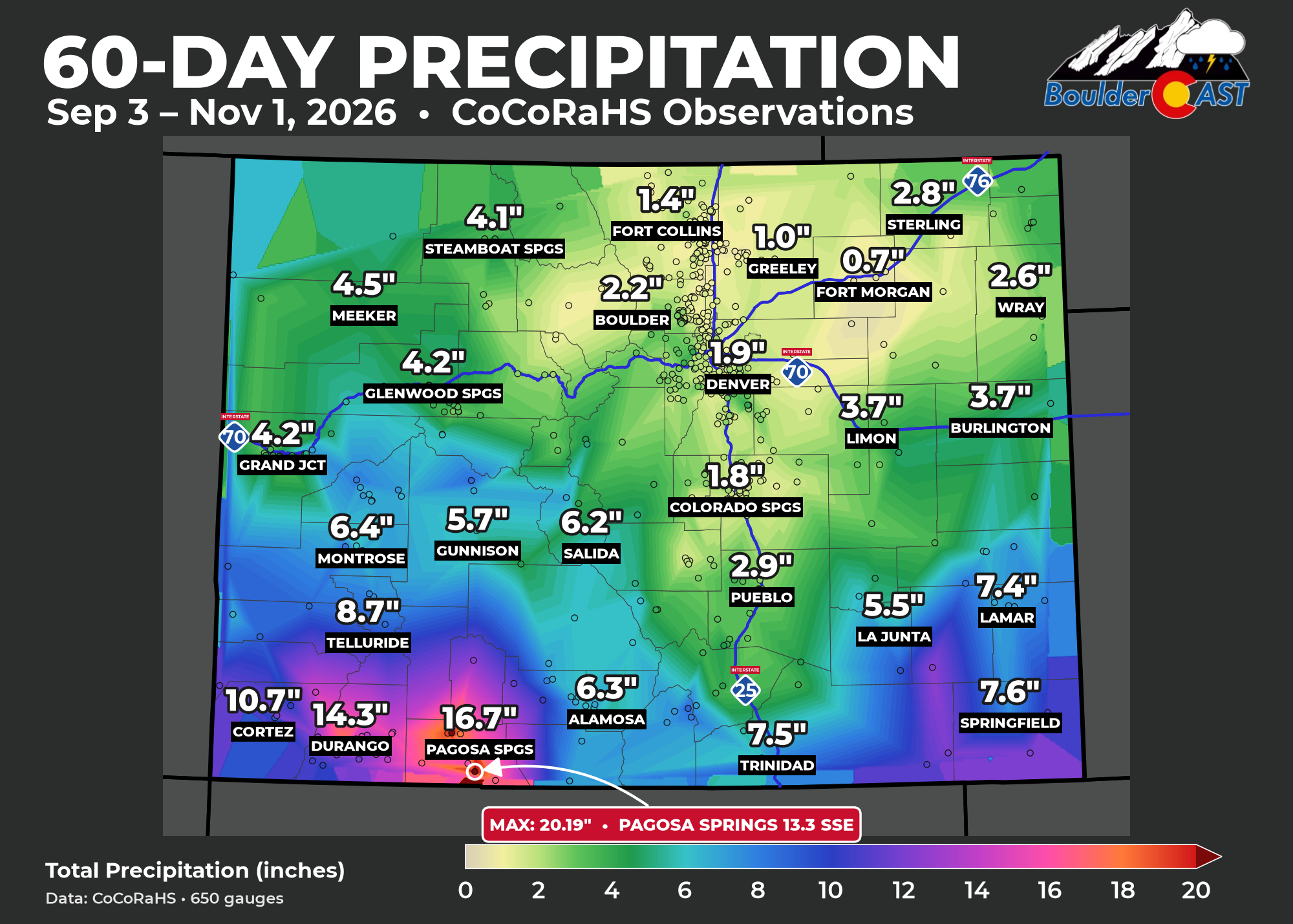
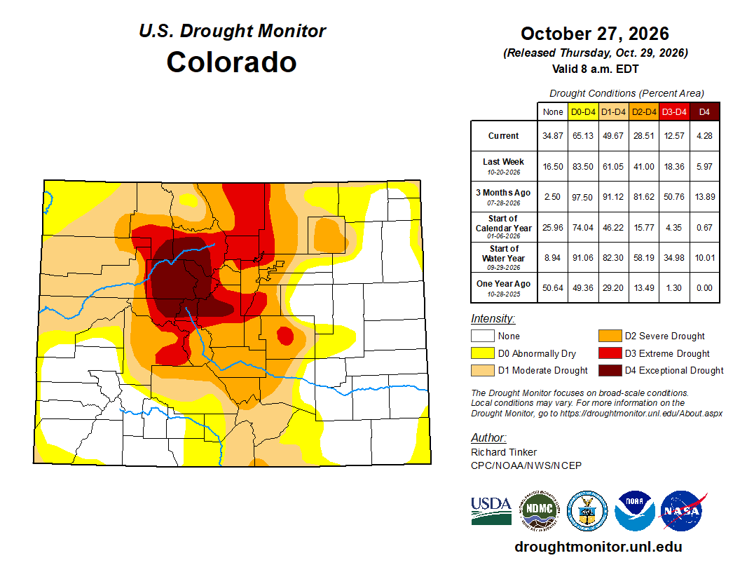
As usual, though, the Front Range got downsloped again. Southwest flow aloft just doesn’t work for us. Air coming from that direction has to climb over the multiple mountain ranges first, dropping most of its moisture on the western slopes. It then sinks down our side of the mountains, warming and drying as it descends, which is not a recipe for much rain in Boulder or Denver. We did manage a brief period of widespread light rain Sunday evening, which was a nice change, but it added up to less than a tenth of an inch for nearly everyone.
That changes a bit on Monday as the main, colder part of the storm system swings across Colorado. A cold front will move through Monday morning, bringing a second round of precipitation into the early afternoon. As of writing, the front is just north of Fort Collins and should reach the Denver Metro area between 8 and 10AM. You’ll know when it arrives! 🌬️
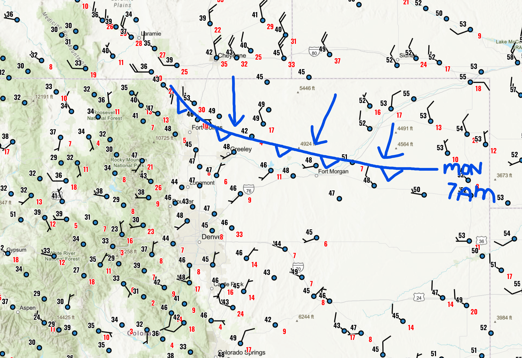
Cold frontal location Monday morning as it bears down on the Denver area
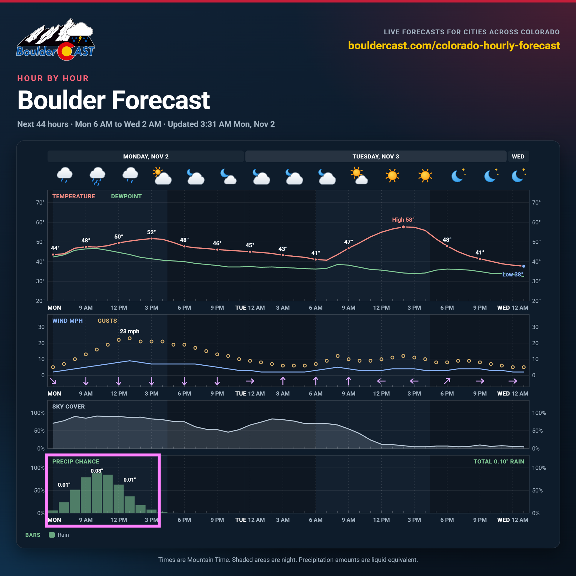
Convergence along the front will combine with some upslope flow into the Palmer Divide and the Jefferson County Foothills to set off scattered rain showers. Expect showers anytime from about 9 AM to 3 PM, with the best coverage south of Interstate 70. That’s where the northerly post-frontal winds run straight into rising terrain and get lifted up the Palmer Divide. North of I-70, rain chances are lower and things will wrap up sooner. Winds there veer to a slightly drier north-northwest direction, which brings weak downslope off the Cheyenne Ridge and the Foothills and cuts shower activity off early. Most of us will see less than 0.10″ of rain, but totals up to half an inch are possible south of Denver heading up the Palmer Divide, where the upslope will be strongest.
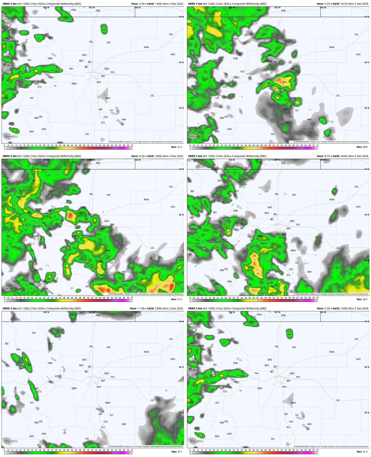
HRRR model-simulated radar animation for Monday showing developing showers over the Metro area, focused south of I-70.
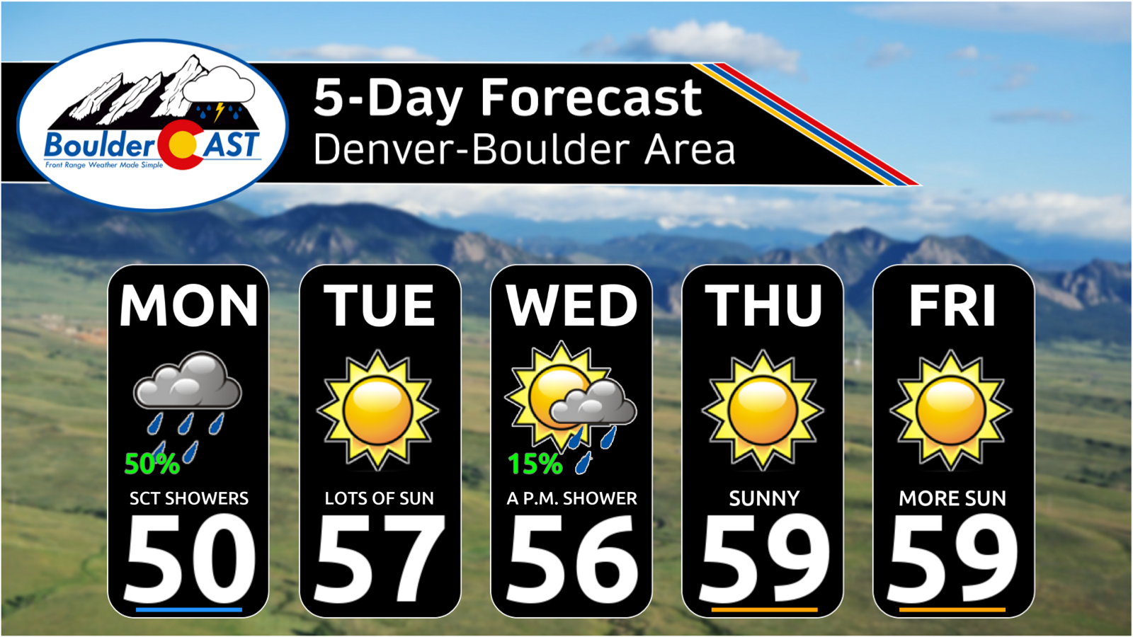
Once the showers clear out, the rest of Monday is all about the chill. Temperatures will have a hard time climbing, since daytime heating will be fighting cold air advection behind the front all afternoon. Highs should top out in the upper 40s to lower 50s across the lower elevations, about 10 degrees below normal for early November. North winds gusting 20 to 30 MPH much of the day will make it feel colder still. Even with some patchy sunshine returning later in the afternoon, it’ll be a raw, blustery day. Grab the jacket.
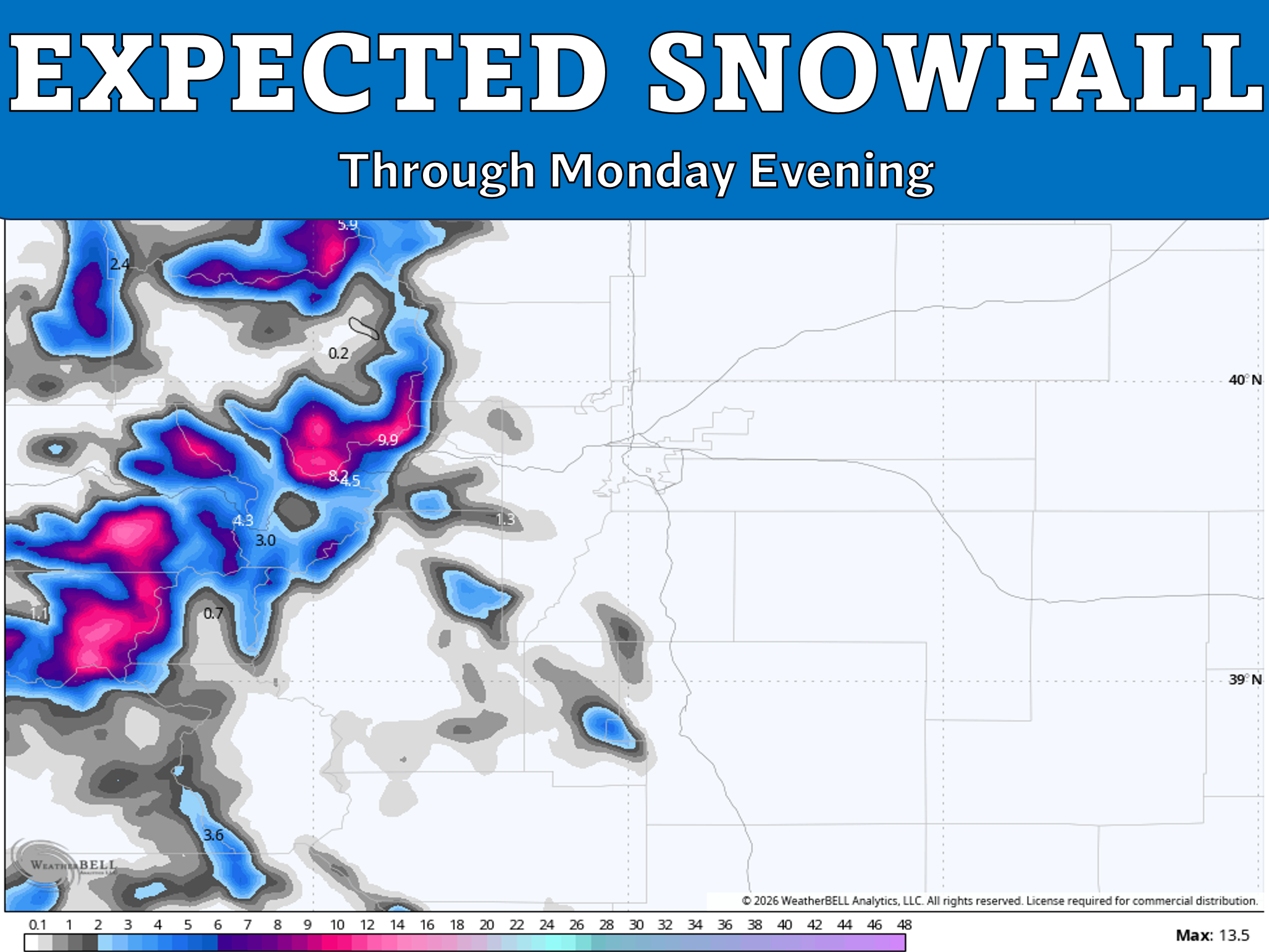
The storm will also bring a round of snow to the Mountains, and the high country along the Front Range will finally get in on the action Monday. Expect 2 to 8 inches above roughly 9,000 feet through this evening, with locally higher totals up to 10 inches. Snow levels will drop through the day behind the front, so lower mountain towns may see a few flakes mixing in too, and some of the higher Foothills communities like Ward and Nederland.
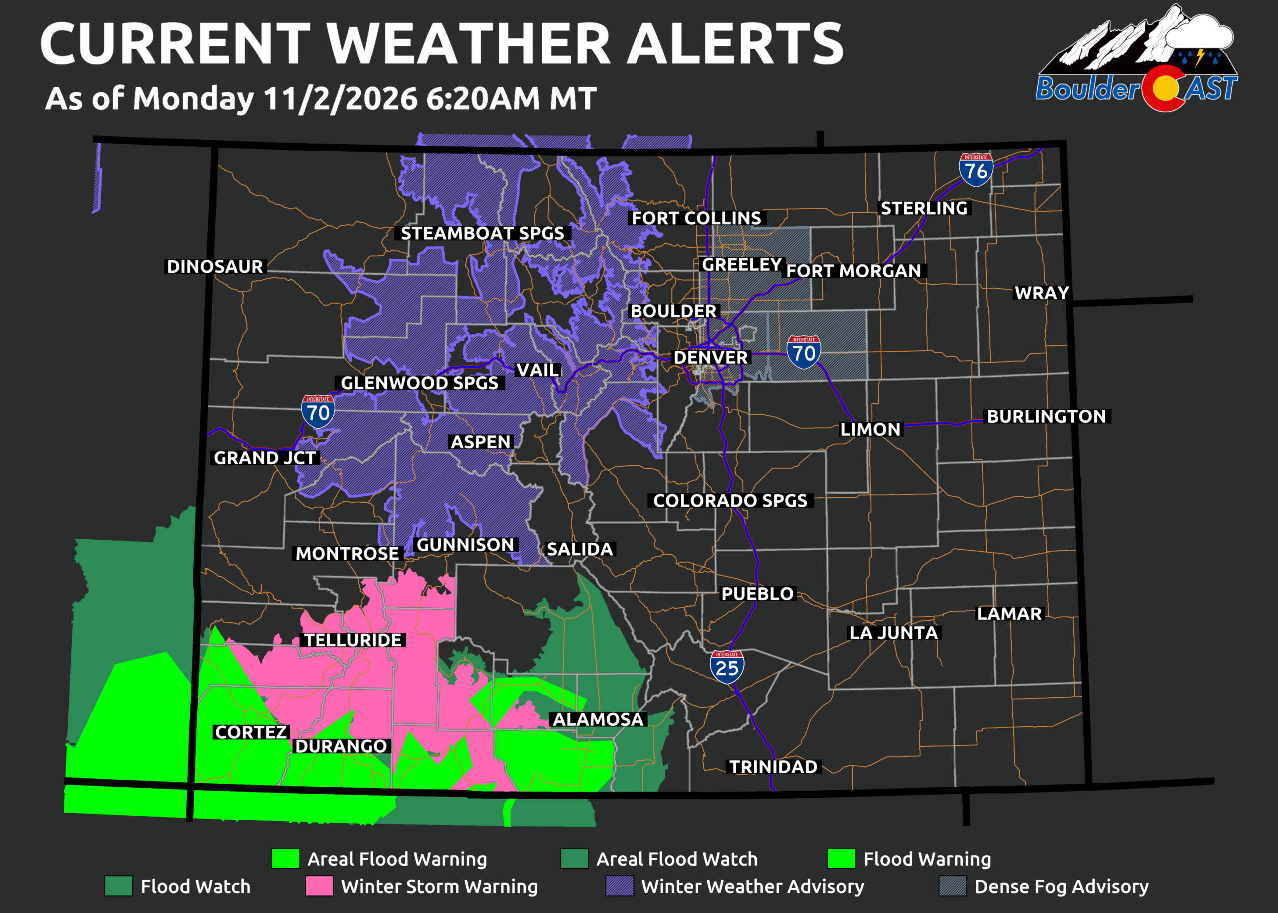
Plan on slick travel over the mountain passes Monday, including the Eisenhower Tunnel approaches, Vail Pass, Berthoud Pass, Rabbit Ears Pass, and Loveland Pass. Winter Weather Advisories or Winter Storm Warnings cover almost all of Colorado’s major mountain ranges, with the Sangre de Cristos the notable exception.
A Quieter Rest of the Week
The rest of November’s first work week will be much quieter than Monday. The early-week storm moves out on Tuesday, leaving cool air behind but plenty of sunshine to go with it.
Another Pacific storm on a southern track will come ashore in California Tuesday and move across Colorado Wednesday into Thursday. This one will be moisture-starved compared to its predecessor, without a significant tap into subtropical moisture. It will move through quickly, and its main effect will be limited to light Mountain snow, mostly across the southern half of the state.
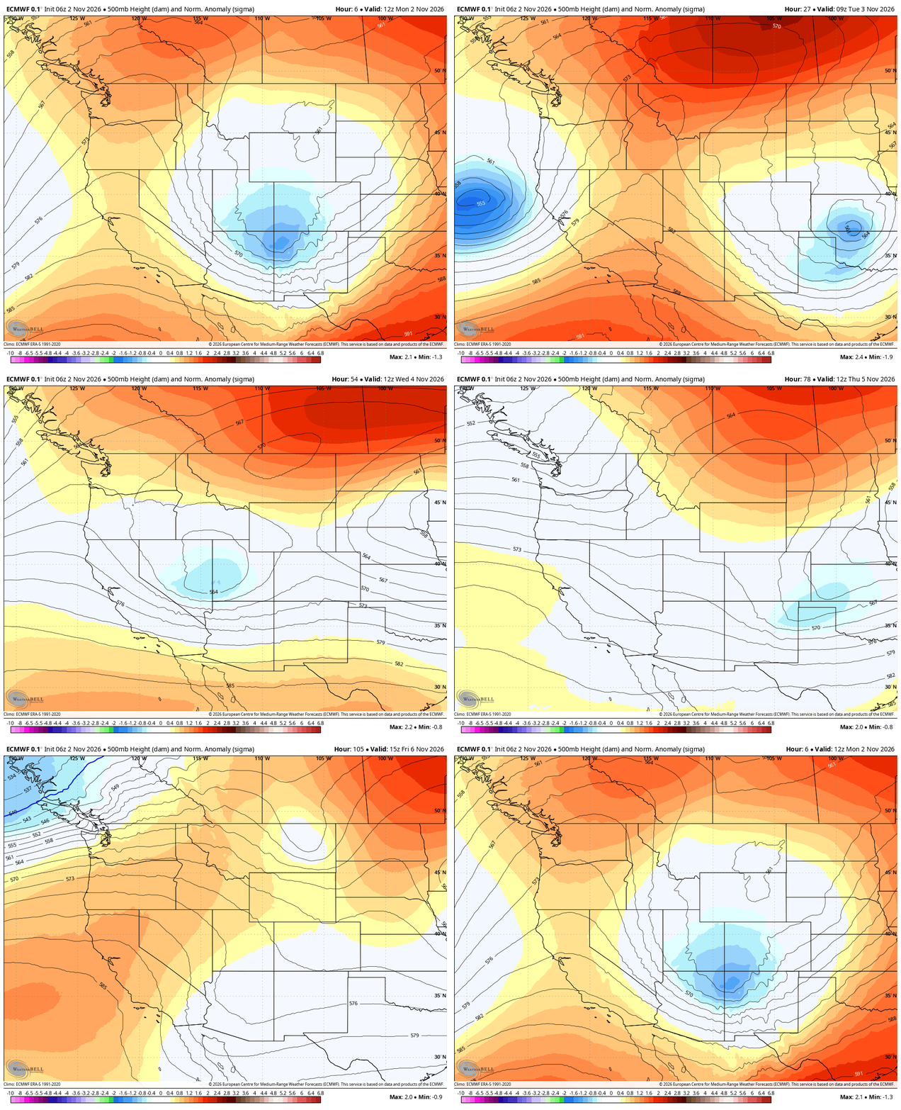
Euro model 500mb height anomaly forecast animation through the week showing Monday’s storm depart and a secondary, weaker storm for Wed/Thu.
Current guidance tracks the storm just a bit too far south to bring much precipitation to the Front Range. Still, we’re including a low-end chance of rain showers for Denver and Boulder from Wednesday late afternoon into the late evening, in case the system’s northern edge clips us. The better odds will be farther south over the Palmer Divide and into southern Colorado, closer to the storm’s track and the better lift.
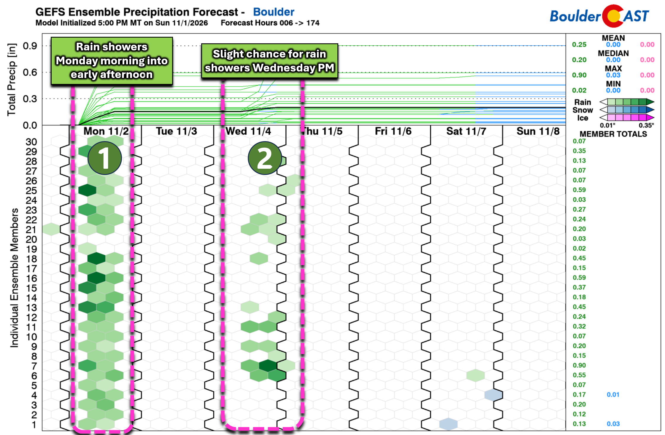
Apart from that small blip on Wednesday, the rest of the week after Monday looks sunny, with seasonable highs in the mid to upper 50s.
The weekend looks pleasant again for the Front Range, with highs near or above normal and lots of sun.
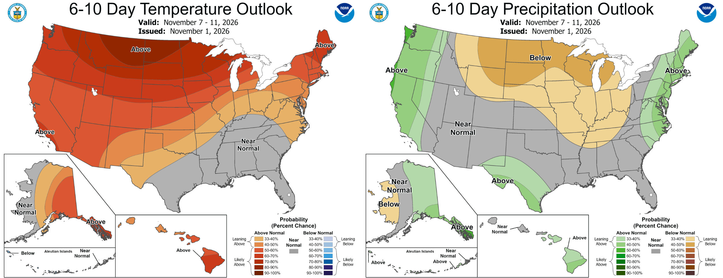
CPC outlook for the weekend into early next week. Warm conditions are favored across Colorado.
Bottom Line
So there you have it. Monday is cold and blustery with a splash of rain for some of us, a few inches of fresh snow for the high country, and then a quiet, sunny stretch through the weekend. It’s not the soaking the Front Range has been waiting for, but it’s a reminder that the pattern is changing, and November tends to keep us on our toes, historic El Niño or not! We’ll keep an eye on Wednesday’s storm in case it tracks a bit farther north than expected, and we’ll update you if it does. In the meantime, grab a jacket for Monday’s chill, take it slow on the passes, and enjoy the sunshine once it comes back for the rest of the week.
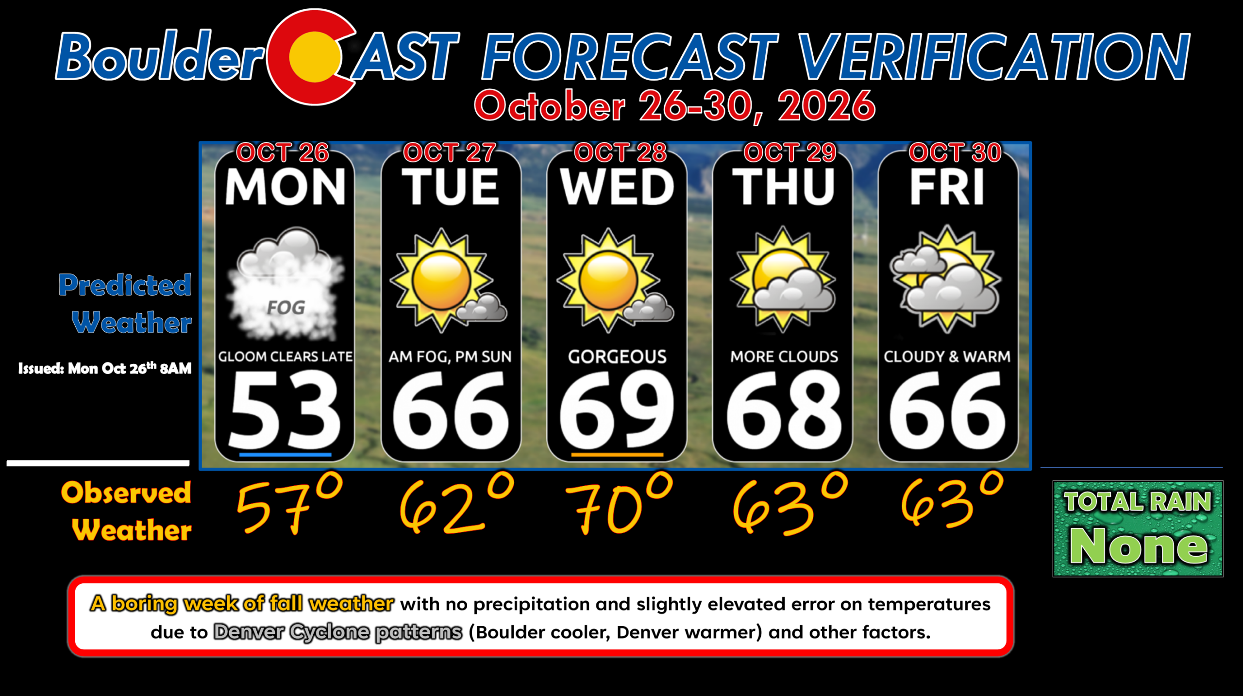
Forecast Verification: October 26-30, 2026 (Last Week)
- A boring week of fall weather with no precipitation and daytime temperatures fluctuating from the mid-50s to 70°.
- Slightly higher than usual temperature errors some days.
DISCLAIMER: This weekly outlook forecast is created Monday morning and covers the entire upcoming week. Accuracy will decrease as the week progresses as this post is NOT updated. To receive daily updated forecasts from our team, among many other perks, subscribe to BoulderCAST Premium.
Go Premium, get all the perks.
Daily Forecast Updates
Get our daily forecast discussion every morning delivered to your inbox.
All Our Model Data
Access to all our Colorado-centric high-resolution weather model graphics. Seriously — every one!
Ski & Hiking Forecasts
6-day forecasts for all the Colorado ski resorts, plus more than 120 hiking trails, including every 14er.
Smoke Forecasts
Wildfire smoke concentration predictions up to 84 hours into the future.
Exclusive Content
Weekend outlooks every Thursday, bonus storm updates, historical data and much more!
No Advertisements
Enjoy ad-free viewing on the entire site.
Enjoy our content? Give it a share!








Leave a Reply
You must be logged in to post a comment.