


The shortened work week arrives with a bit of a plot twist as Tropical Storm Marie sends a surge of deeper moisture straight into Colorado. That boost will keep scattered storm chances alive through Tuesday before a midweek cold front briefly dries us out and knocks temperatures back into more comfortable territory. But the break won’t last — late‑week heat is set to rebuild quickly, and weekend guidance is already hinting at yet another unsettled pattern trying to form, with a fresh plume of subtropical moisture lurking on the horizon. This summer’s stubborn, underperforming monsoon looks determined to limp well into September. Read on as we unpack the setup and what it will mean for weather along the Front Range this week.
This week’s highlights include:
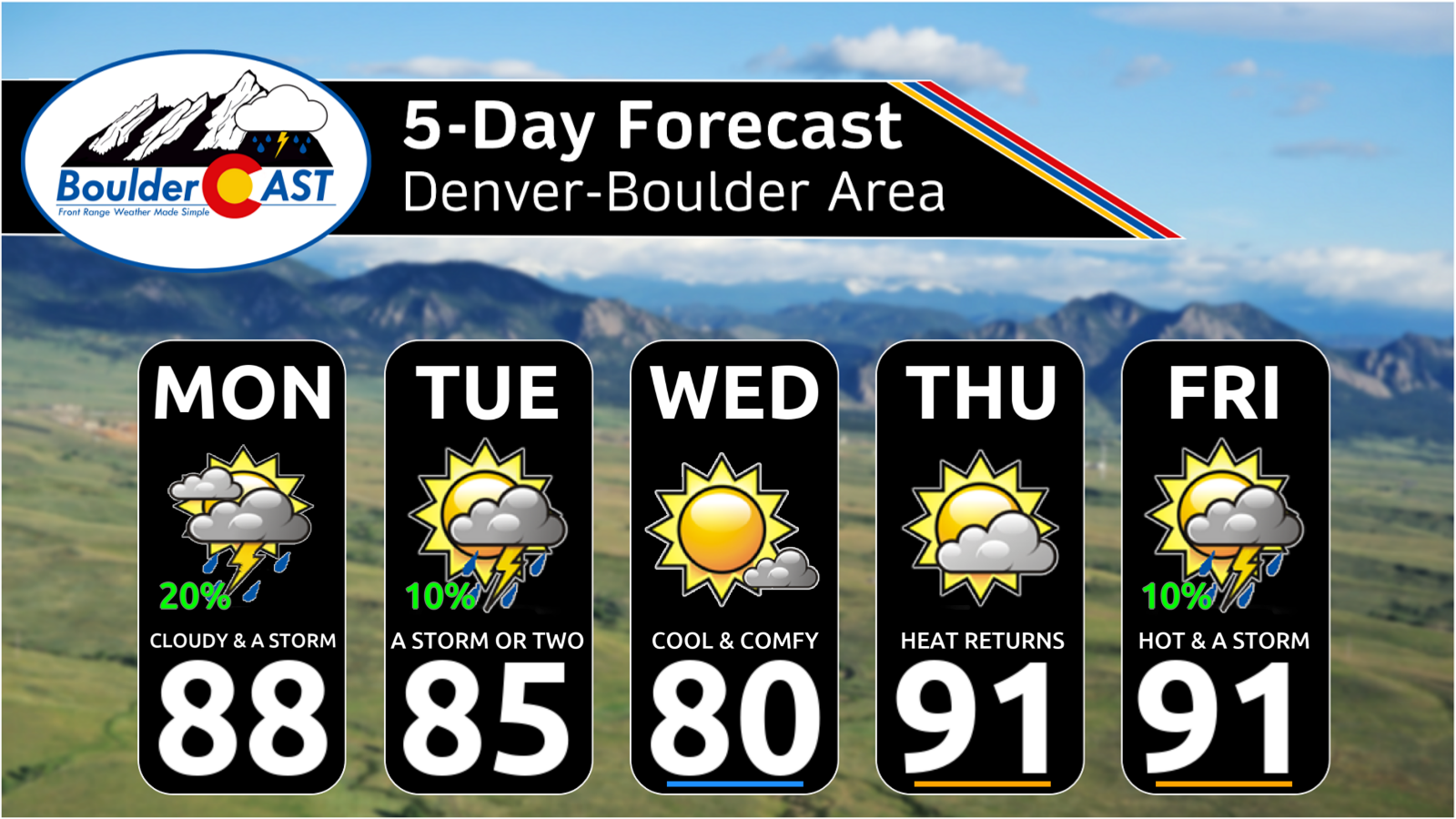
- 🌧️ Early‑week storms linger through Tuesday as Marie’s tropical moisture pulses through Colorado, keeping some afternoon/evening convection alive.
- 🌀 Tropical Storm Marie funnels mid‑ and upper‑level moisture northward, pushing statewide humidity to ~180% of normal on Labor Day. So. Many. Clouds.
- ⚡ Marginal severe risk Monday northeast of Denver, with isolated 1″ hail, gusty winds, and heavy downpours possible; most activity stays east of I‑25.
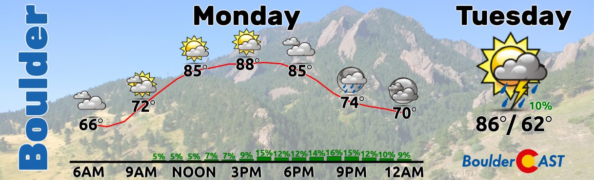
- 🌡️ Warm start: Highs in the 85–90° range Monday and Tuesday before a cold front arrives late Tuesday night.
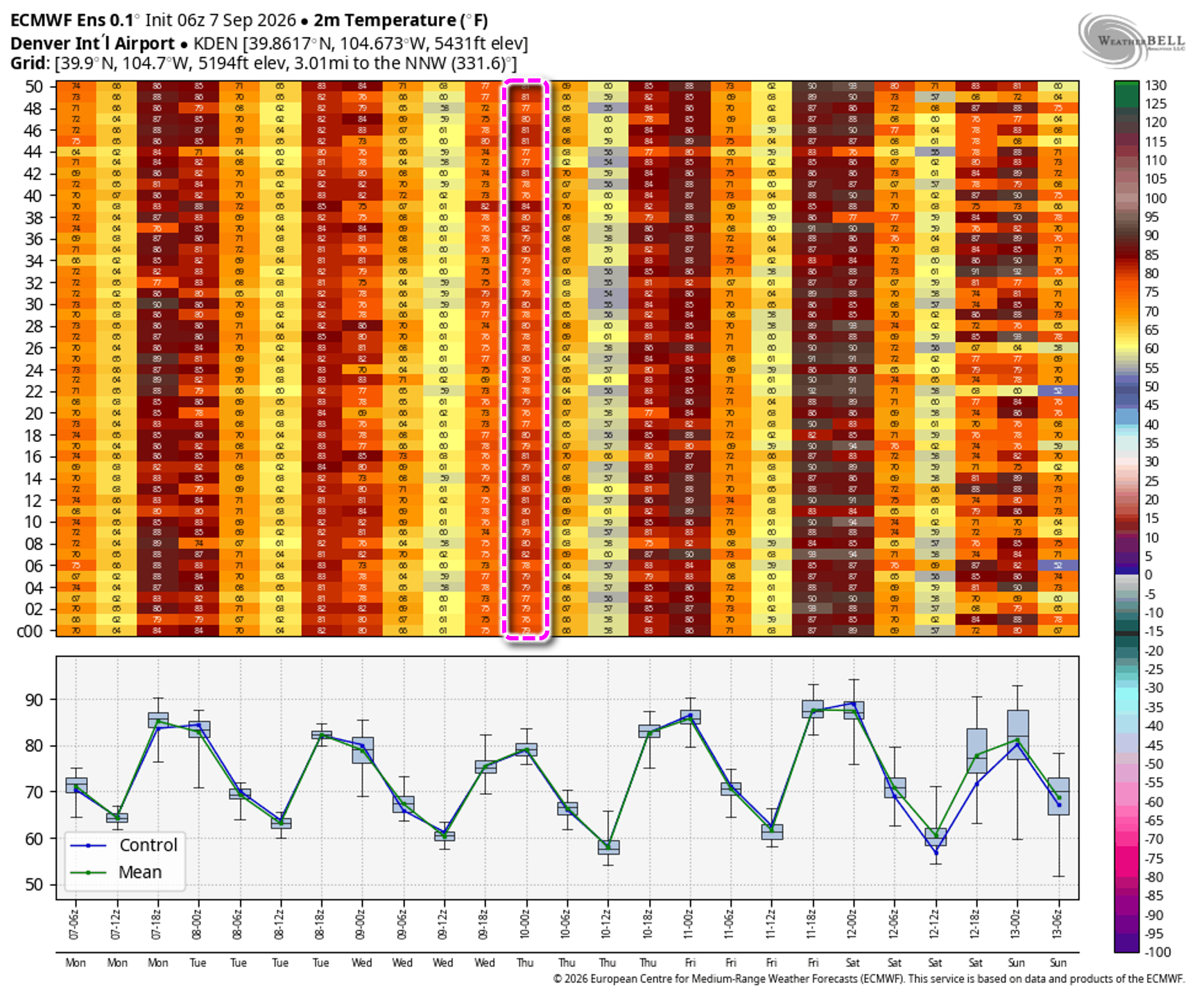
- 🍃 Cold front passage brings a brief cooldown Wednesday with highs near 80°, and many ensemble members even keeping us into the upper 70s.
- 🔥 Zonal flow returns Thursday–Friday, rebuilding heat and dryness; highs rebound into the lower 90s with minimal storm chances.
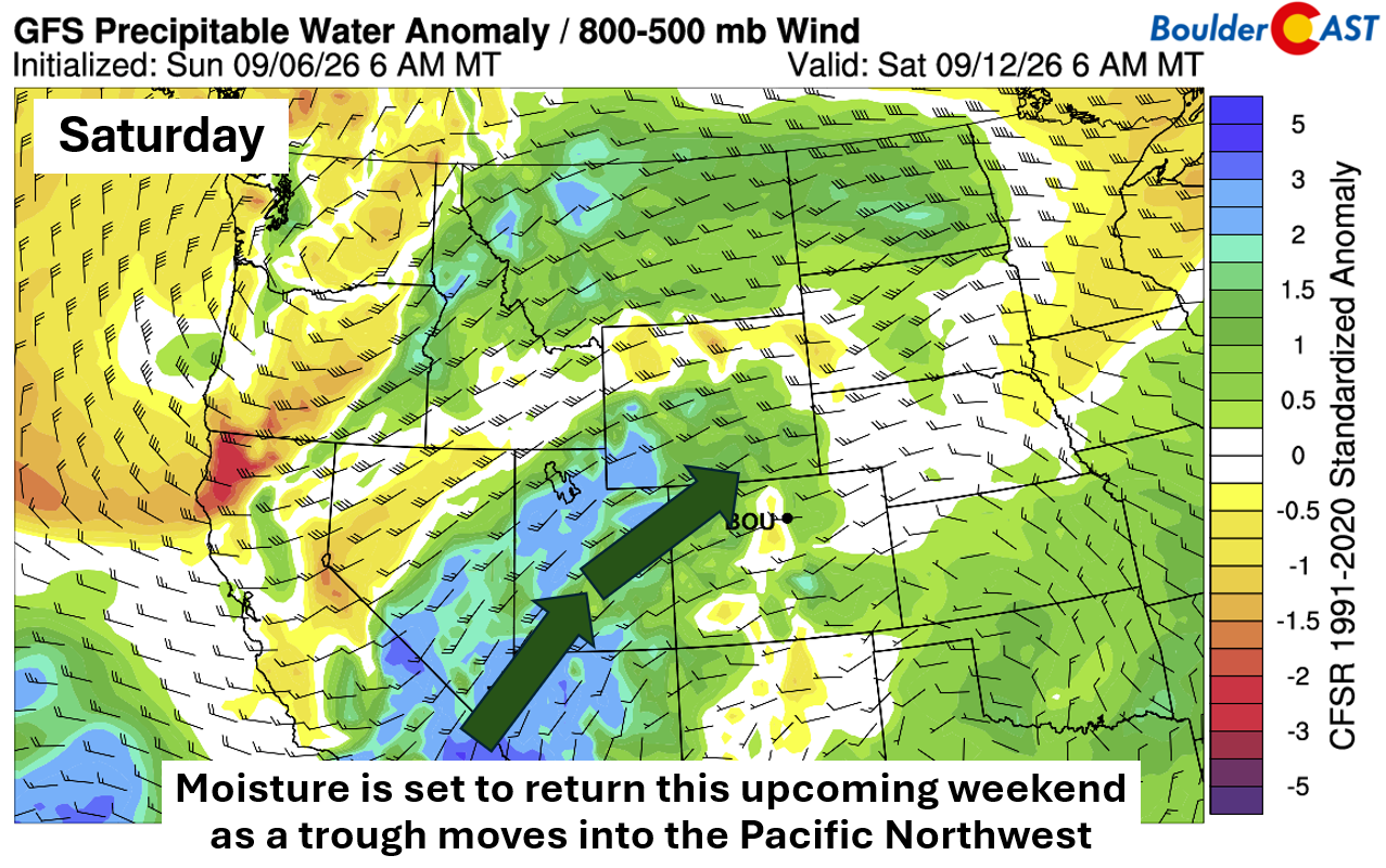
- 🌧️ Weekend trend turns wetter as Pacific Northwest troughing and New Mexico ridging reintroduce subtropical moisture — potentially tied again to Marie’s remnants.
- 🍂 Slow autumn transition continues – drought‑stressed Mountain leaves are already showing early color change.
DISCLAIMER: This weekly outlook forecast is created Monday morning and covers the entire upcoming week. Accuracy will decrease as the week progresses as this post is NOT updated. To receive daily updated forecasts from our team, among many other perks, subscribe to BoulderCAST Premium.

Go Premium, get all the perks.
Daily Forecast Updates
Get our daily forecast discussion every morning delivered to your inbox.
All Our Model Data
Access to all our Colorado-centric high-resolution weather model graphics. Seriously — every one!
Ski & Hiking Forecasts
6-day forecasts for all the Colorado ski resorts, plus more than 120 hiking trails, including every 14er.
Smoke Forecasts
Wildfire smoke concentration predictions up to 72 hours into the future.
Exclusive Content
Weekend outlooks every Thursday, bonus storm updates, historical data and much more!
No Advertisements
Enjoy ad-free viewing on the entire site.
Storm Chances This Week Are Front-Loaded
This shortened work week kicks off with continued afternoon and evening showers and storms, very much in line with what we saw Sunday. Isolated to widely scattered convection will linger along the Front Range through Tuesday. Before diving in, the BoulderCAST team wishes you a relaxing and restorative Labor Day.
Tropical Storm Marie’s Moisture Plume Pulses Through
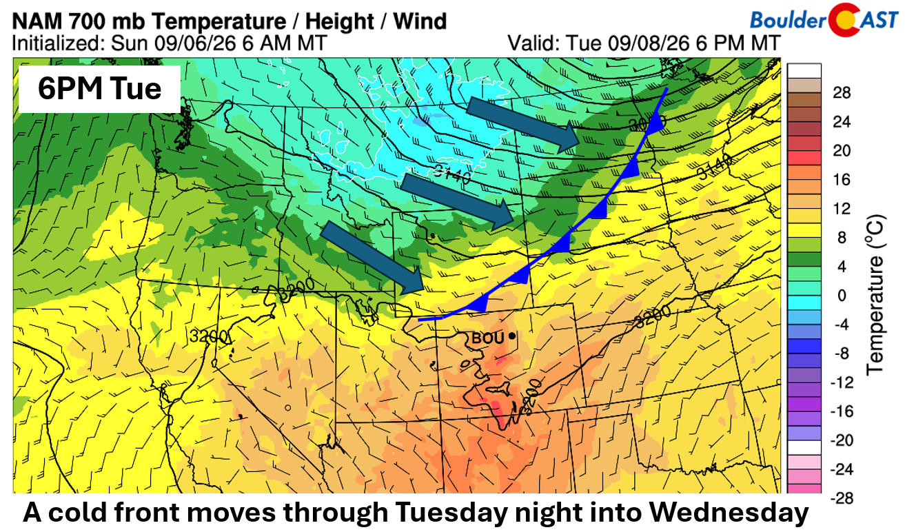
A broad northwestern U.S. trough stretches from Montana into Washington on Monday, sliding east into Canada by midweek. As this evolution unfolds, a cold front will sag south out of Wyoming late Tuesday into early Wednesday, briefly enhancing storm chances before ushering in a drier pattern.
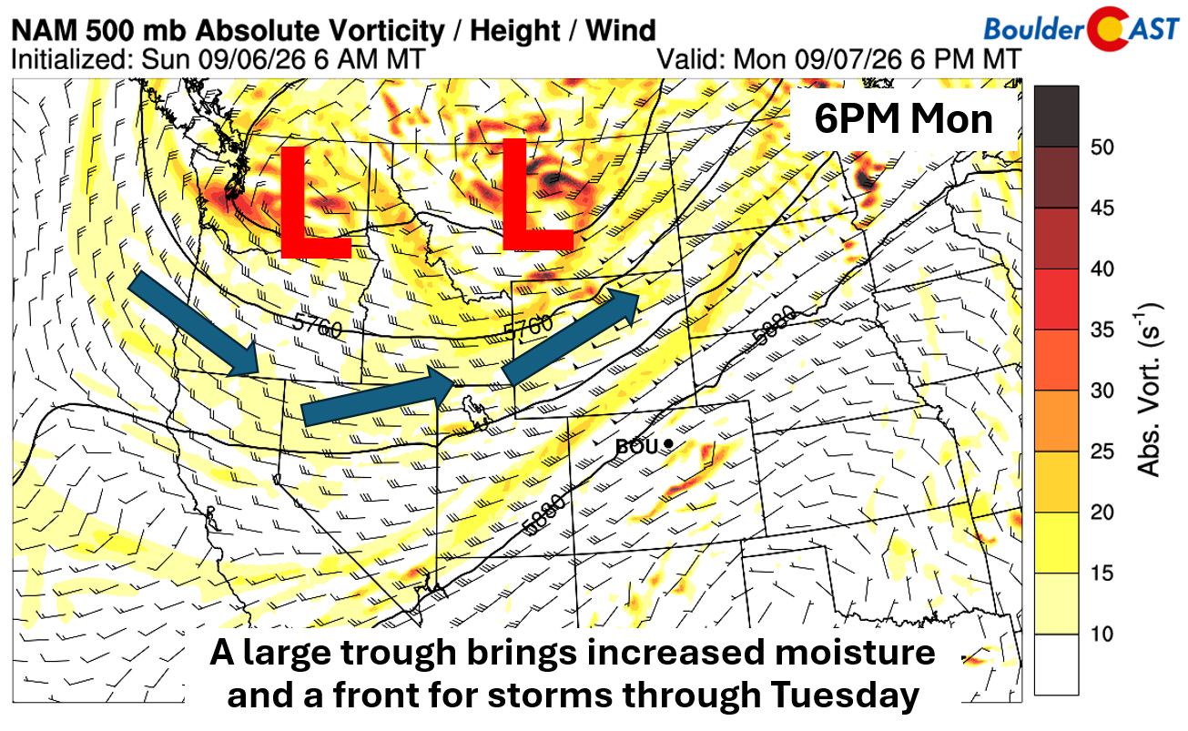
Guidance places the front Tuesday evening from the Dakotas into southern Wyoming, with its passage locally expected sometime overnight. Behind it, temperatures dip comfortably to near 80° by Wednesday — a short reprieve from the persistent late‑summer heat.
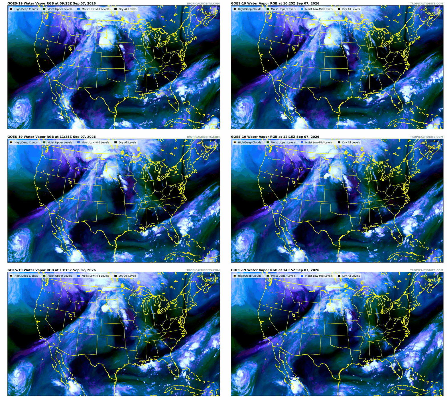
The moisture fueling Labor Day and Tuesday’s storms is tied directly to Tropical Storm Marie off the Baja coast. The stalled Pacific Northwest trough is effectively siphoning Marie’s mid‑ and upper‑level moisture northeastward into Colorado.
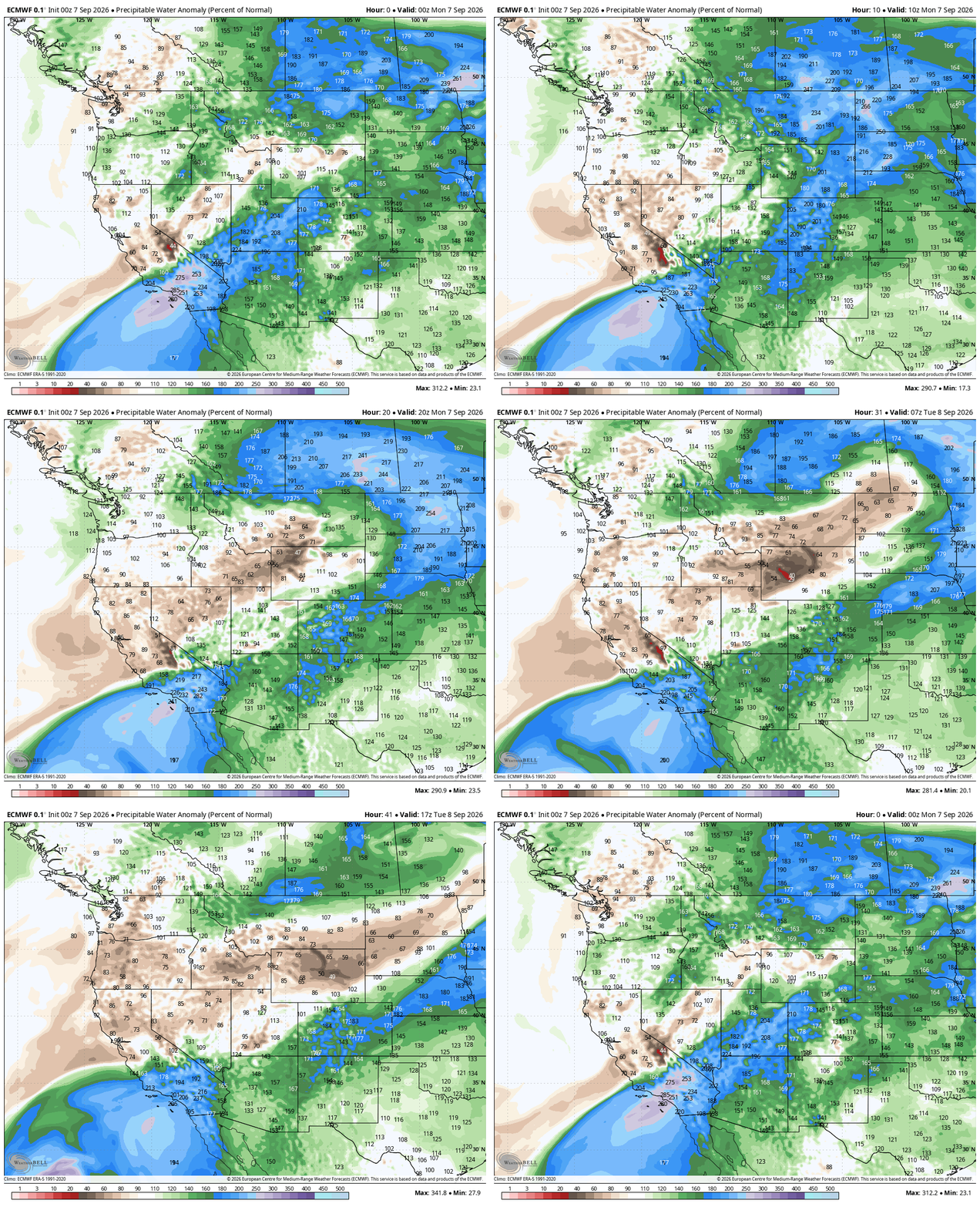
Statewide moisture content will peak near 180% of normal Monday, thanks to a concentrated pulse of Marie’s humidity overhead.
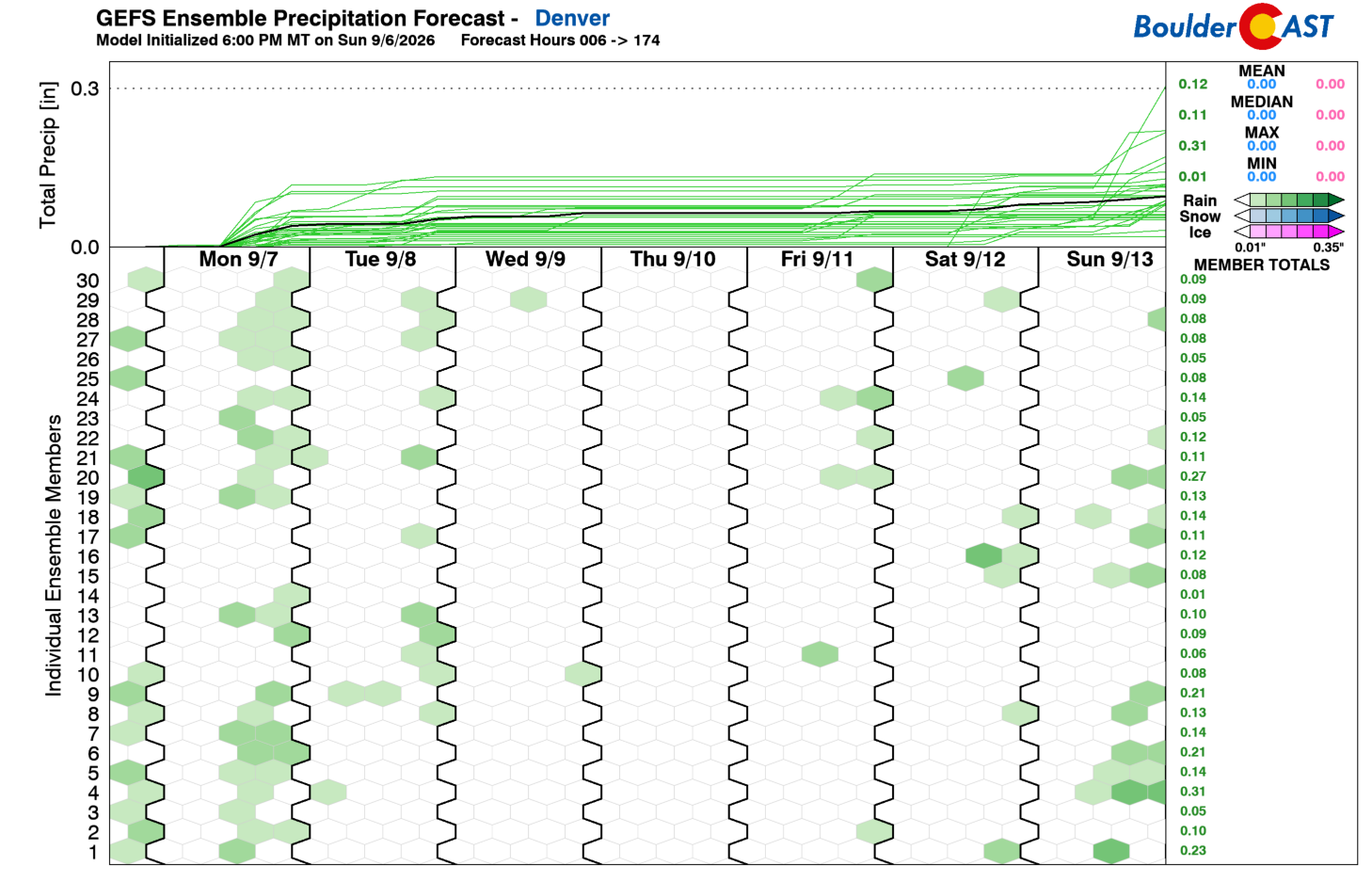
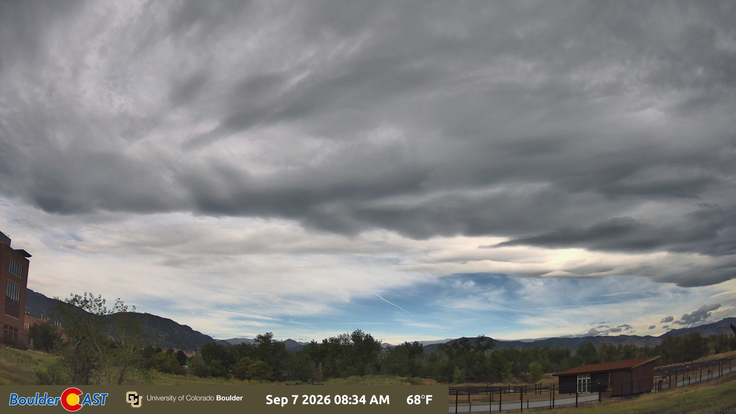
This will support 10 to 20% afternoon/evening storm chances both Monday and Tuesday, though thick wave cloud cover will undoubtedly have some impact on Monday’s storm potential.
The Storm Prediction Center highlights a Marginal Risk northeast of Denver, where a few stronger cells could produce isolated damaging winds, 1″ hail, and heavy downpours.
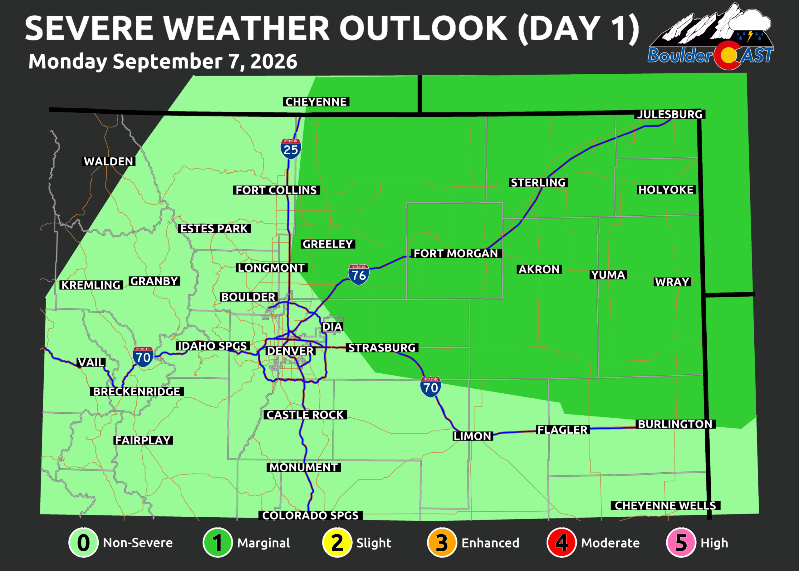
Most activity Monday will reside east of I‑25, but Denver and Boulder could still snag a storm — possibly even a stronger one.
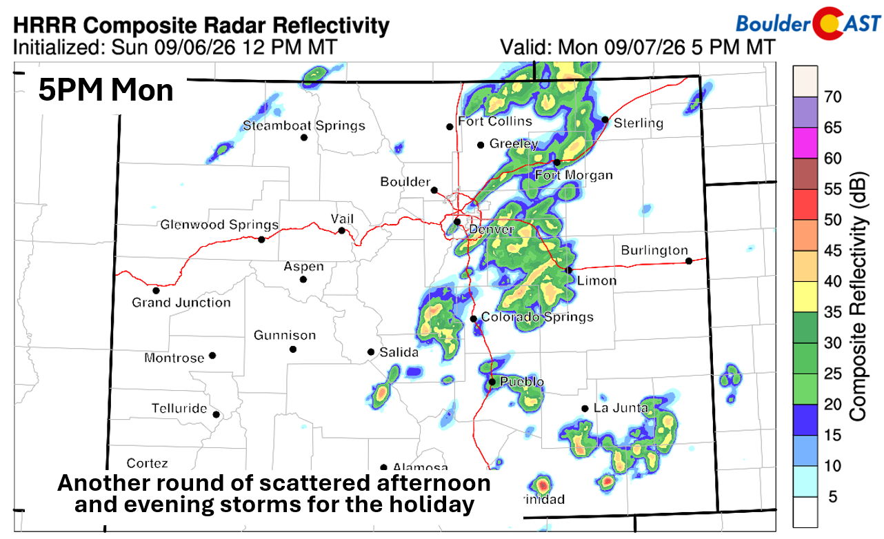
By Tuesday, the best moisture plume shifts further south and east which will take most of the storms with it. Temperatures both days will top out in the 85 to 90° range.
Dry Wednesday With Comfy Temps
The cold front’s southward push early Wednesday will bring a notably drier airmass to northern Colorado. Any lingering rain chances stay well south and east of Denver. Highs hover near 80°, and more than half of European ensemble members even show upper 70s for Denver — a refreshing change.
Heat Returns Late Week
Unfortunately, the cooldown is brief. Westerly zonal flow takes over Thursday and Friday, paired with ridging to the south.
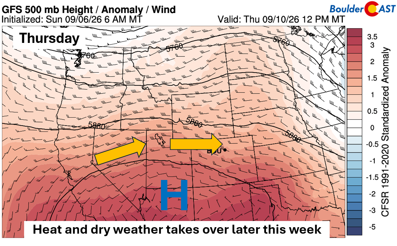
This classic late‑summer setup will drive temperatures back into the lower 90s and keep storm chances minimal. Thursday looks to remain totally dry, while Friday could see a couple isolated thunderstorms work back into the forecast, though they may end up holding off until the weekend.
Trending More Unsettled This Weekend
Ensemble guidance flags a meaningful shift for the upcoming weekend: renewed troughing in the Pacific Northwest and building ridging over New Mexico. This pattern will favor another push of subtropical moisture — again with ties to slow-moving Marie’s remnants — into the Four Corners.
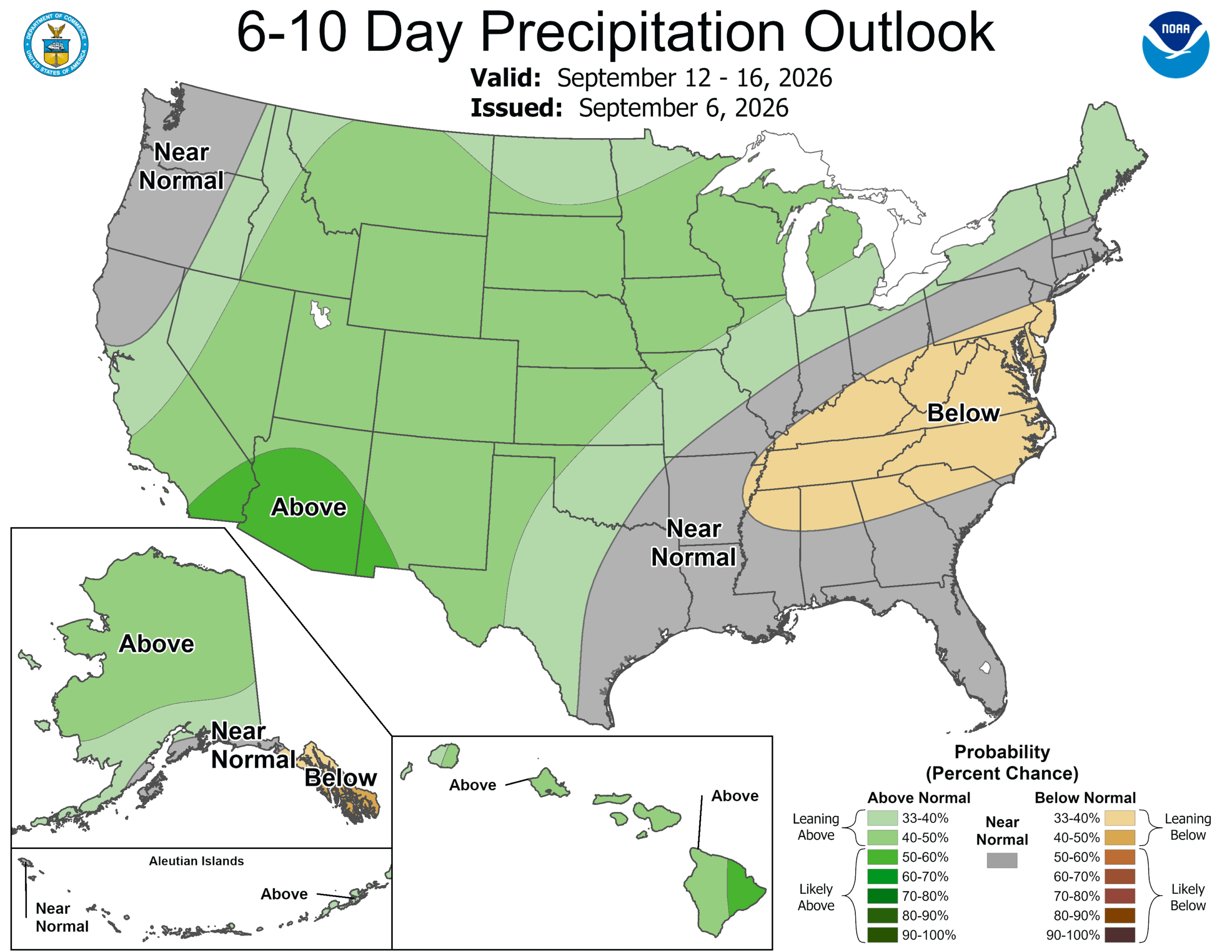
The Climate Prediction Center echoes this signal, leaning toward above‑normal precipitation for September 12–16 across all of Colorado. Whether this translates into meaningful rainfall for Boulder and Denver remains uncertain, but storm chances should increase again this weekend into early next week.
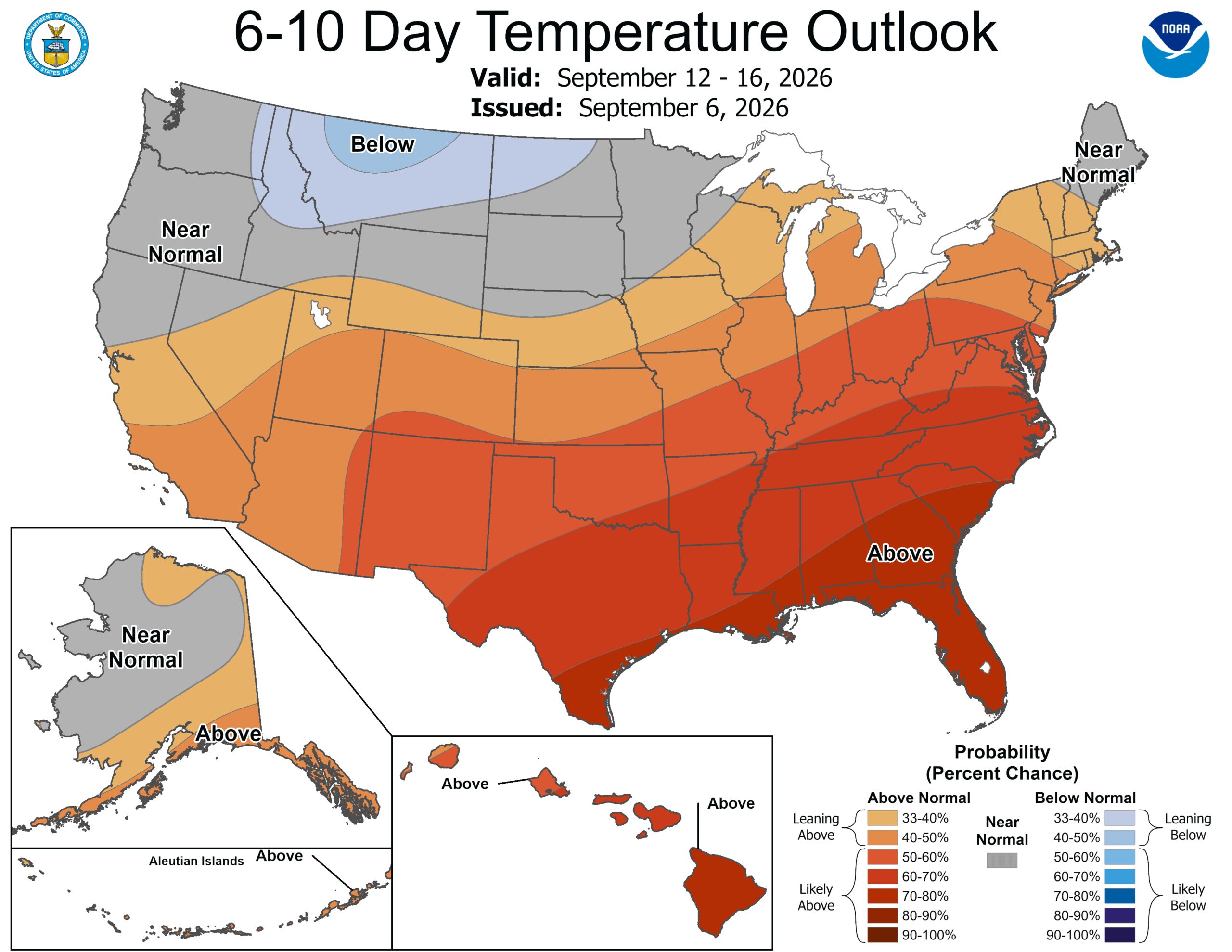
Temperatures also lean above normal, though only by 40–50% probabilities, with the strongest warmth focused over the Southern Plains and Southeast U.S.
Enjoy the short work week and this slow, painful slide into autumn. Thanks to the ongoing extreme drought, High Country colors are already starting to pop — weeks ahead of schedule. Don’t be caught off guard by the earlier peak this year!
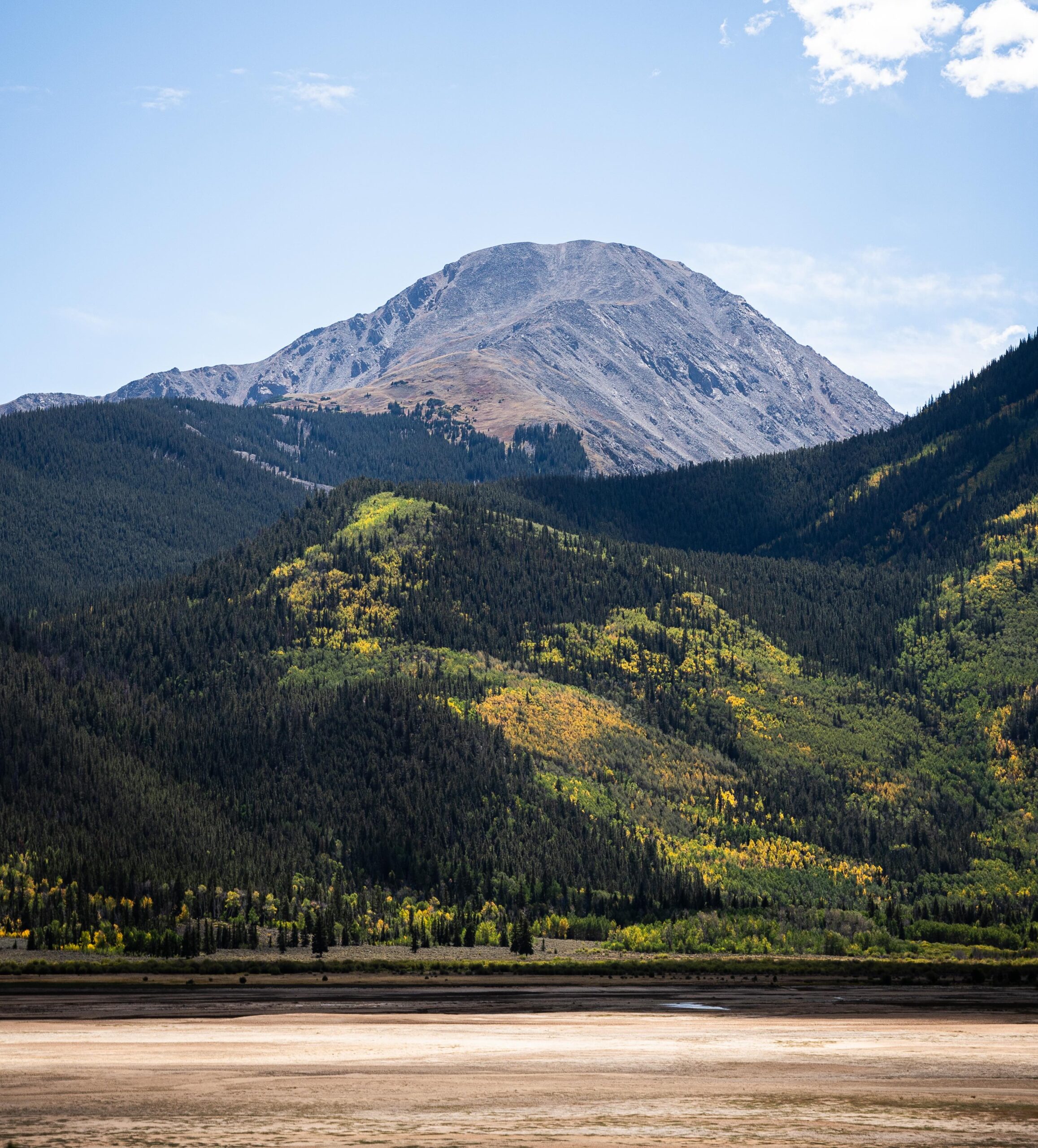
Mount Massive on Sunday 9/6/2026 via Threads user @coloradomountainadventures
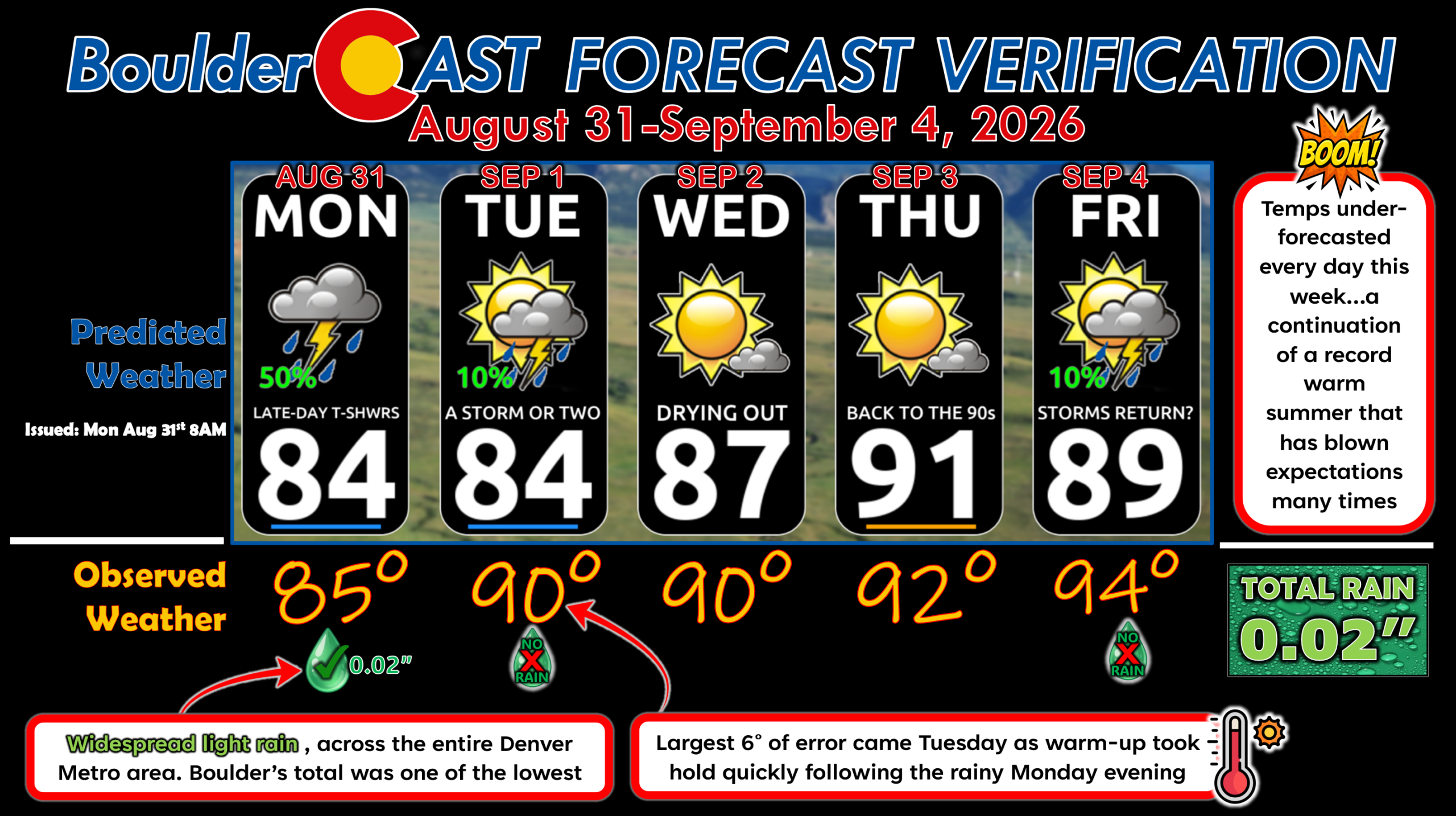
Forecast Verification: August 31 – September 4, 2026 (Last Week)
- 1 day of rain totaling 0.02″, low compared to the rest of the Metro area which picked up 5 to 10 times that much Monday evening.
- Largest temperature error of 6° on Tuesday. Expected clouds and some rain to limit highs again, but that didn’t really happen.
- All days were at or above normal temperatures, including four more days in the 90s to kick of September.
DISCLAIMER: This weekly outlook forecast is created Monday morning and covers the entire upcoming week. Accuracy will decrease as the week progresses as this post is NOT updated. To receive daily updated forecasts from our team, among many other perks, subscribe to BoulderCAST Premium.
Go Premium, get all the perks.
Daily Forecast Updates
Get our daily forecast discussion every morning delivered to your inbox.
All Our Model Data
Access to all our Colorado-centric high-resolution weather model graphics. Seriously — every one!
Ski & Hiking Forecasts
6-day forecasts for all the Colorado ski resorts, plus more than 120 hiking trails, including every 14er.
Smoke Forecasts
Wildfire smoke concentration predictions up to 72 hours into the future.
Exclusive Content
Weekend outlooks every Thursday, bonus storm updates, historical data and much more!
No Advertisements
Enjoy ad-free viewing on the entire site.
Enjoy our content? Give it a share!












You must be logged in to post a comment.