


Summer isn’t just knocking, it’s kicking the door wide open across the Front Range this week. An unusually stubborn ridge of high pressure is staying put overhead, sending temperatures soaring across the Denver Metro area for days to come with barely a cloud in the sky. Fire danger, air quality, and even the long‑awaited monsoon will all play a role eventually this week. We break down what this pattern means for heat records, fire concerns, and when rain chances might finally return to the area.
This week’s highlights include:
- Strong ridge 🏔️ — A powerful high‑pressure dome parked over the Northern Plains keeps Colorado hot and dry all week.
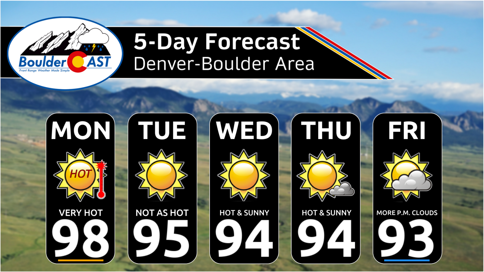
- Persistent heat 🌡️ — Daily highs land in the mid–upper 90s, with Monday likely the hottest. This 95°+ streak could challenge Boulder’s 1947 9-day-long record.
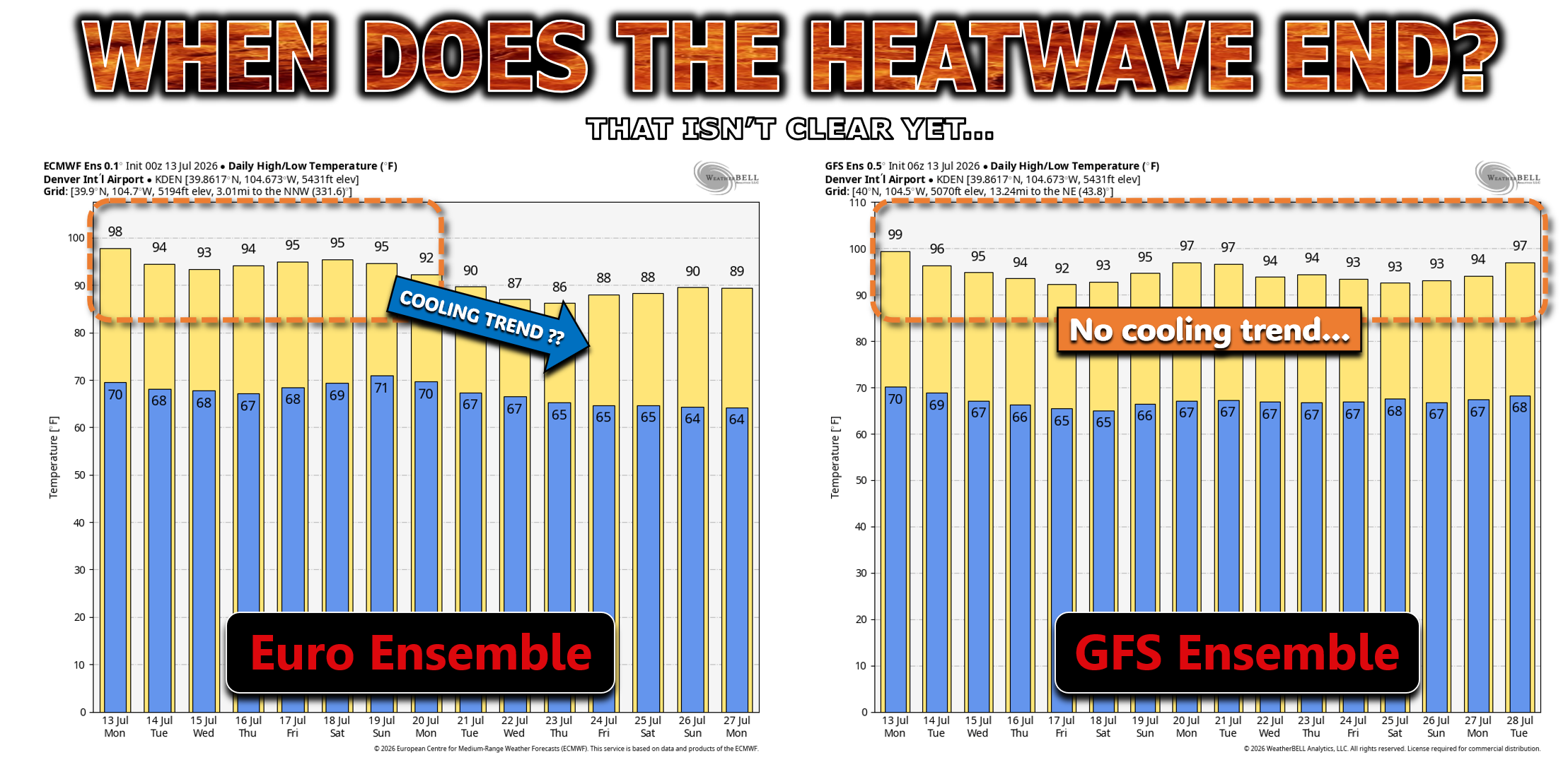
- Uncertain cooldown 🤷♂️ — Euro model hints at cooling next week, while the GFS keeps us roasting indefinitely.
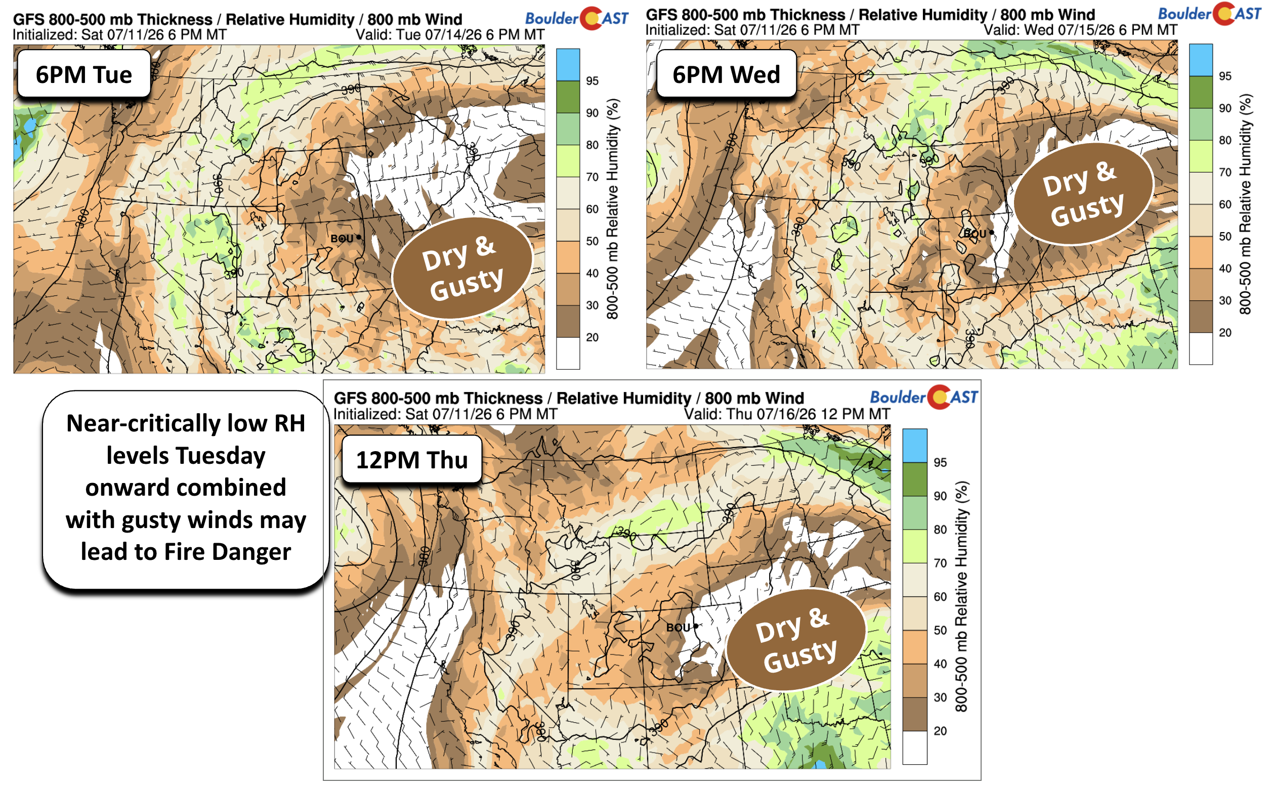
- Elevated fire danger 🔥 — Tuesday through Thursday brings near‑critical fire weather: Gusty winds, RH 15–20%, bone‑dry fuels, and erratic fire‑spread potential.
- Active fires 🚒 — Aspen Acres remains the largest and most destructive (98,600 acres burned, 800+ structures destroyed). The Snyder Fire is nearly fully contained.
- Poor air quality 😷 — Stagnant easterly flow will trap Denver area pollutants; Ozone Alerts are likely daily. Best outdoor activity windows: early morning or near sunset.
- Storm chances return ⛈️ — Monsoon moisture stays west this week, but weakening ridging may allow storms to creep back into the Front Range this weekend.
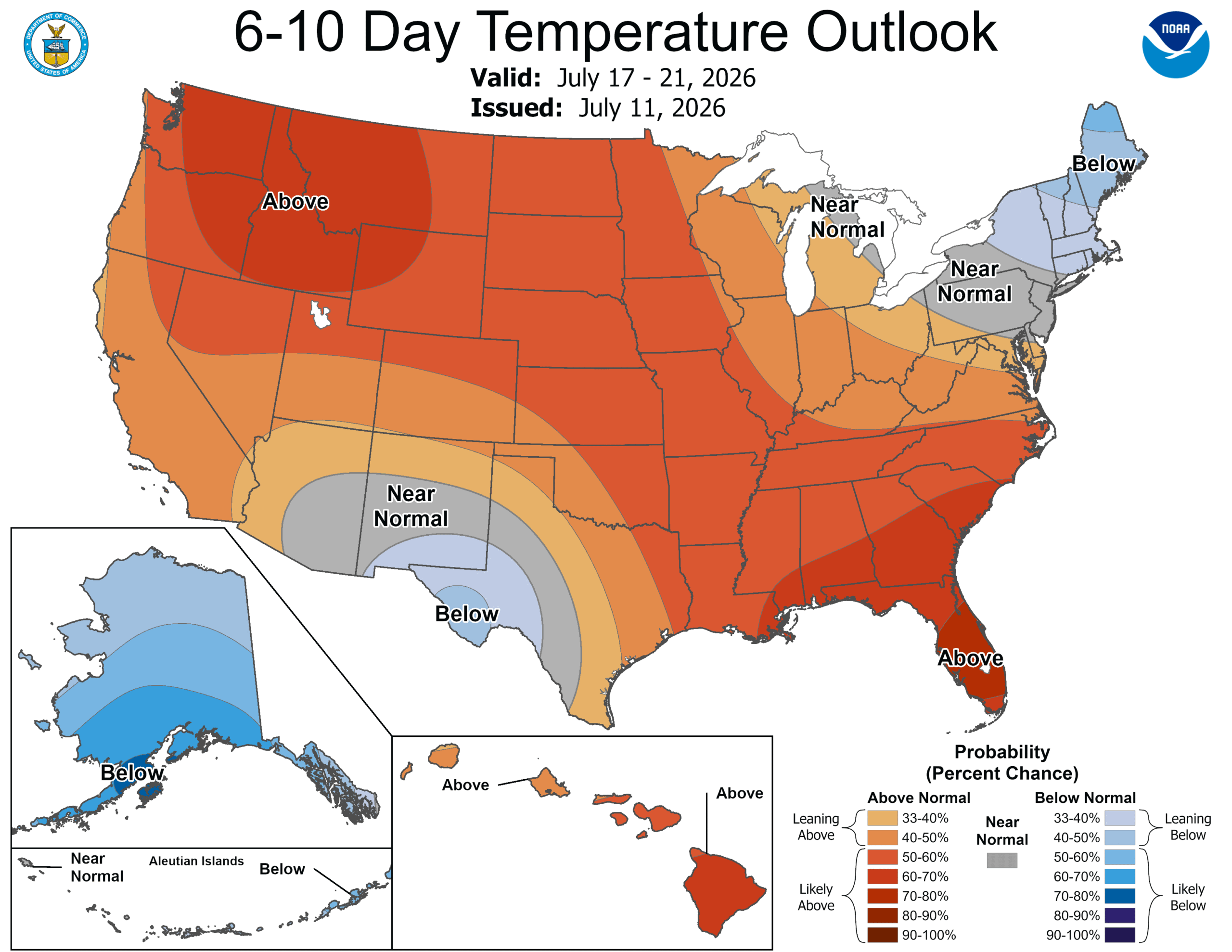
- Long‑term outlook 📈 — CPC favors continued heat and slightly above‑normal precipitation next week as monsoon signals slowly improve for Colorado.
DISCLAIMER: This weekly outlook forecast is created Monday morning and covers the entire upcoming week. Accuracy will decrease as the week progresses as this post is NOT updated. To receive daily updated forecasts from our team, among many other perks, subscribe to BoulderCAST Premium.

Go Premium, get all the perks.
Daily Forecast Updates
Get our daily forecast discussion every morning delivered to your inbox.
All Our Model Data
Access to all our Colorado-centric high-resolution weather model graphics. Seriously — every one!
Ski & Hiking Forecasts
6-day forecasts for all the Colorado ski resorts, plus more than 120 hiking trails, including every 14er.
Smoke Forecasts
Wildfire smoke concentration predictions up to 72 hours into the future.
Exclusive Content
Weekend outlooks every Thursday, bonus storm updates, historical data and much more!
No Advertisements
Enjoy ad-free viewing on the entire site.
Heat: A Daily Fixture Along the Front Range
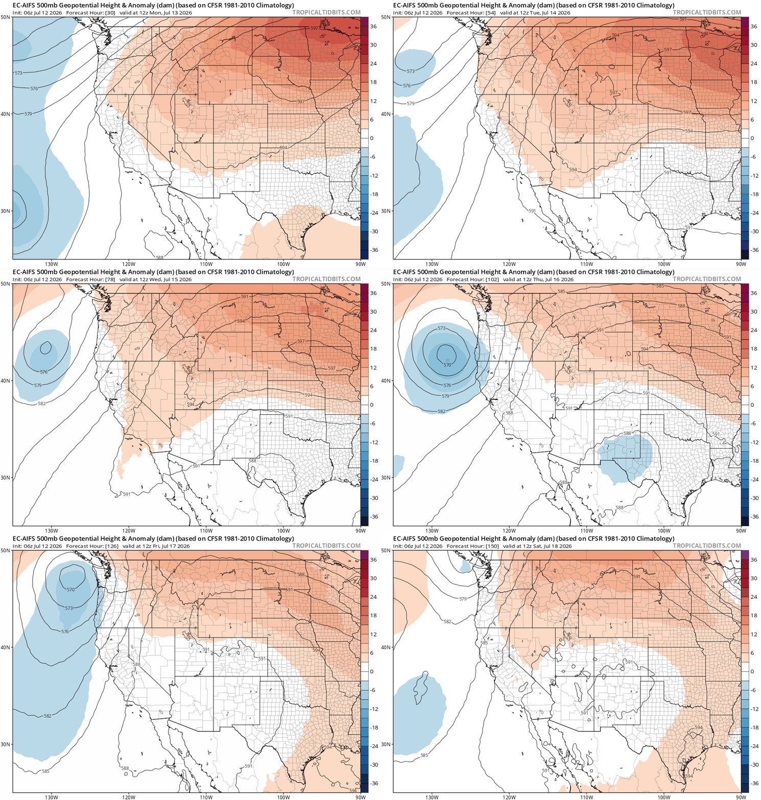
An anomalously strong ridge of high pressure over the Northern Great Plains into the Upper Mississippi Valley will continue to dominate our weather this week. Below shows an animation of the 500-mb heights through Saturday from the AI-Euro model. The high migrates to the east as the week wears on, but retains its grip, extending across Colorado through much of the week. There are some hints that a weak area of low pressure come Thursday and Friday out of Texas could reach the the southern Rockies late in the period, under-cutting the powerful ridge. This could increase rain chances, though guidance is mixed on if that features even gets into the area.
We are expecting each day this week to hover in the middle to upper 90s, highest on Monday. None of these temperatures will be close to breaking any daily record highs, aligning with our messaging that this heatwave isn’t historic in its magnitude, but the duration will be brutal.
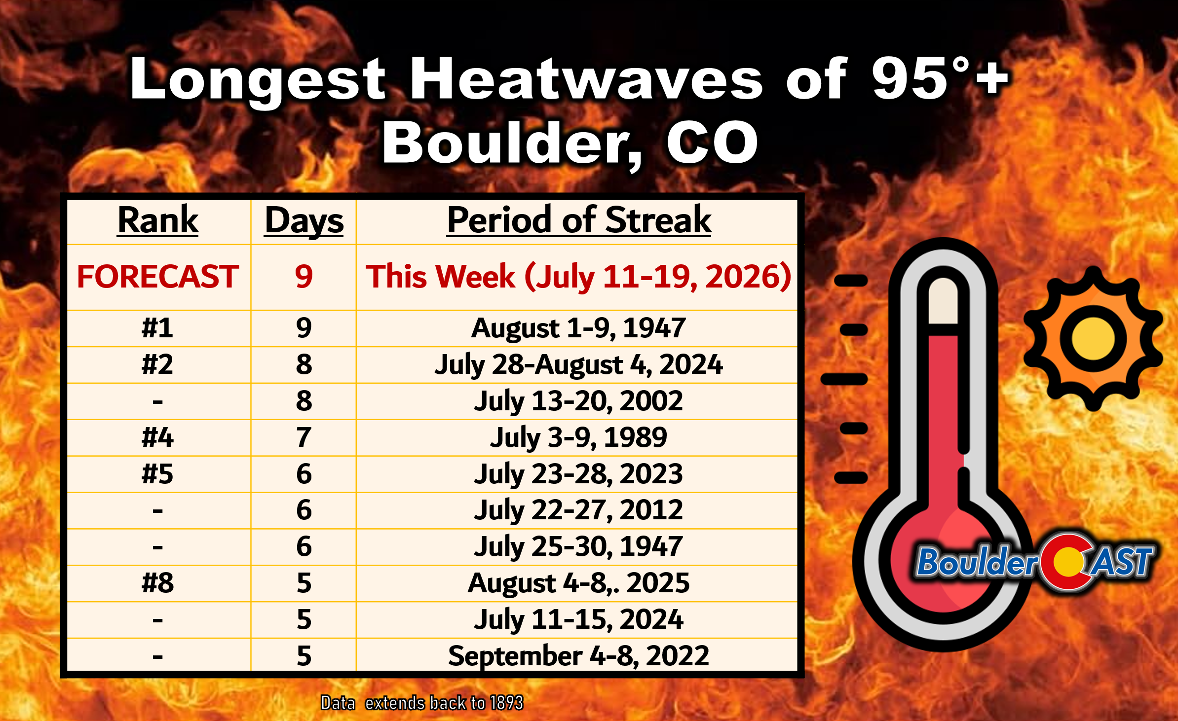
Our forecast indicates that a string of days reaching ~95°+ is possible through Friday. However, that could extend into the upcoming weekend as well, if not longer. If that were to happen, we could tie or exceed the longest stretch of 95°+ weather in Boulder which was set in August of 1947 with a total of 9 days. At this time, we’re expecting slightly cooler temperatures later in the week to drop us below the 95° threshold, but that may be too optimistic.
On a similar note, the exact conclusion of this heatwave unfortunately still remains uncertain at this time. The European model indicates a possible cooling trend heading into next week, while the GFS stubbornly keeps us in the 90s for eternity with no end in sight.
The longer-term NOAA Climate Prediction Center outlook indicates this stretch of warm to hot weather will persist from this weekend into next week. For now, it’s best just accept that summer has arrived and the heat is hear to stay for the foreseeable future.
Fire Danger Centered on Midweek
While fire danger will be elevated every day this week owing to an abundance of hot/dry air and completely parched fuels, we are most concerned with the middle part of the week. Specifically, Tuesday through Thursday is when the combination of hot temperatures, gusty east-southeast winds of 20-35 MPH at times, and RH in the 15-20% range will favor worsened fire danger. Near-critical conditions may occur and Red Flag Warnings may be needed in some portions of Colorado. As of right now, models land shy of meeting the criteria. Nevertheless, any fire starts would likely become erratic and difficult to contain under these conditions. Dewpoints will bottom out each afternoon in the 20s to low 30s, additionally making static electricity much easier to attain when opening and closing car or house doors.
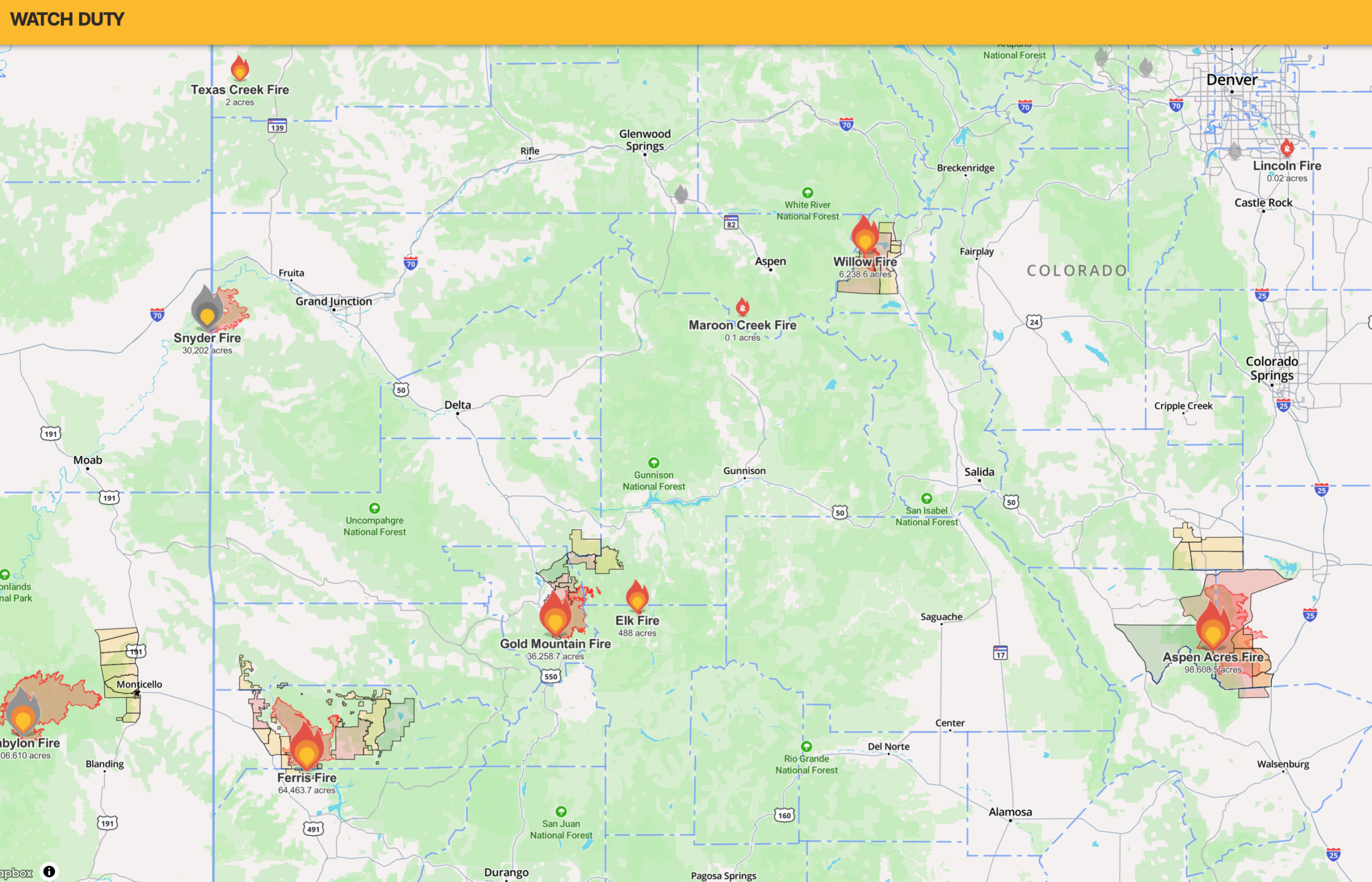
Below is the latest update from WatchDuty on the most active Colorado fires:
- Aspen Acres — 98,600 acres, 35% contained, 800+ structures destroyed
- Ferris Fire — 64,500 acres, 23% contained
- Gold Mountain Fire — 36,300 acres,13% contained
- Willow Fire — 6,200 acres, 33% contained
- Snyder Fire — 30,200 acres, 98% contained
The Aspen Acres Fire remains the largest and most destructive of the group, followed by the Ferris and Gold Mountain Fires.
Poor Air Quality Persists Due to Ozone
While wildfire smoke will largely be shunted to our west and southwest due to the persistent easterly flow at low and mid-levels (see our Colorado Smoke Forecast page), we still need to be concerned with other pollutants under this setup.
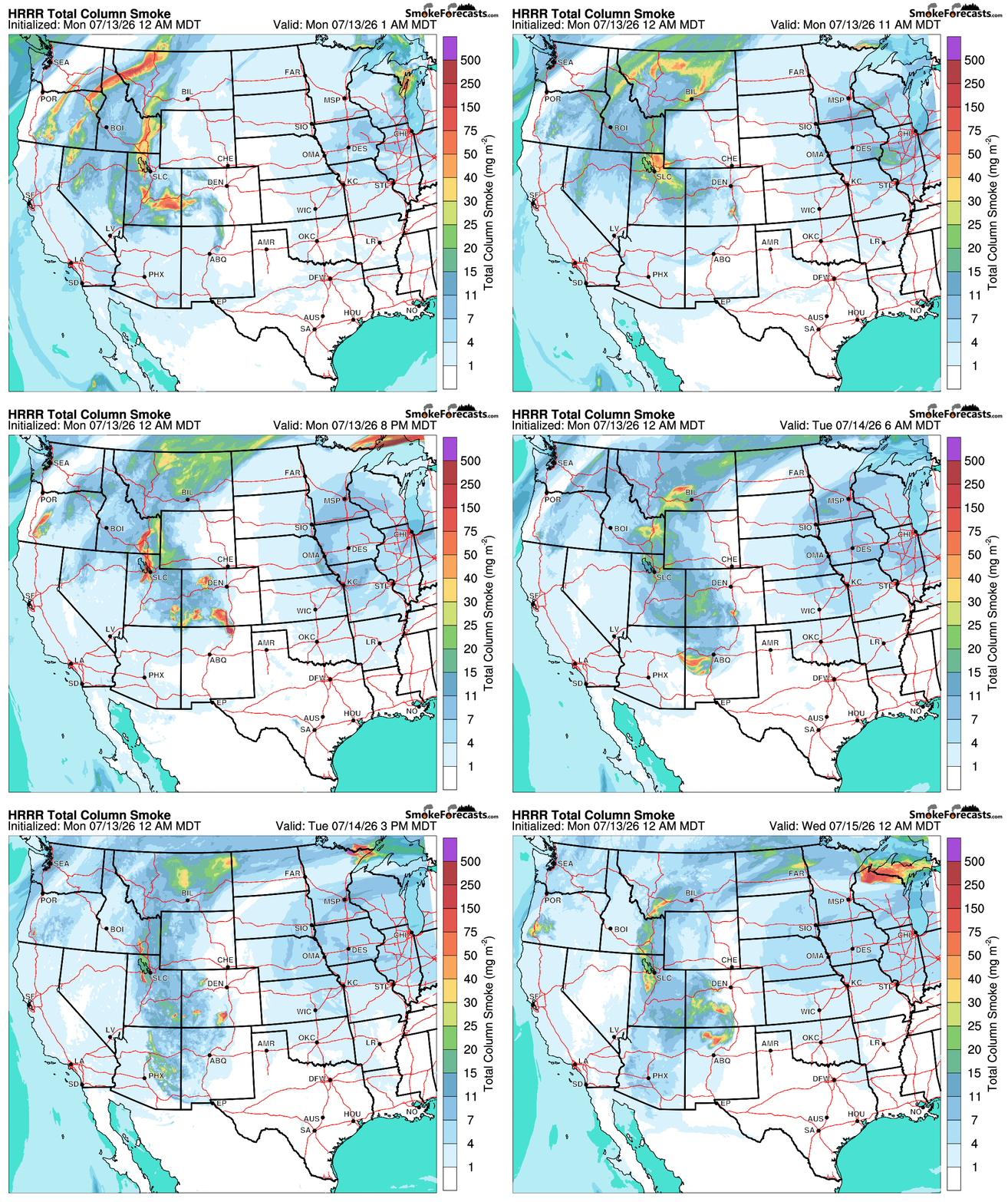
Wildfire smoke from western fires largely stays away from the Boulder-Denver area this week due to easterly flow.
The same stagnant easterly upslope flow will also prevent human and industry-sourced particulates from dispersing. Instead, they will accumulate over the Denver Metro thanks to the blocking higher terrain to our west. Combined with high heat values in the mid to upper 90s, air quality will be poor much of the week.
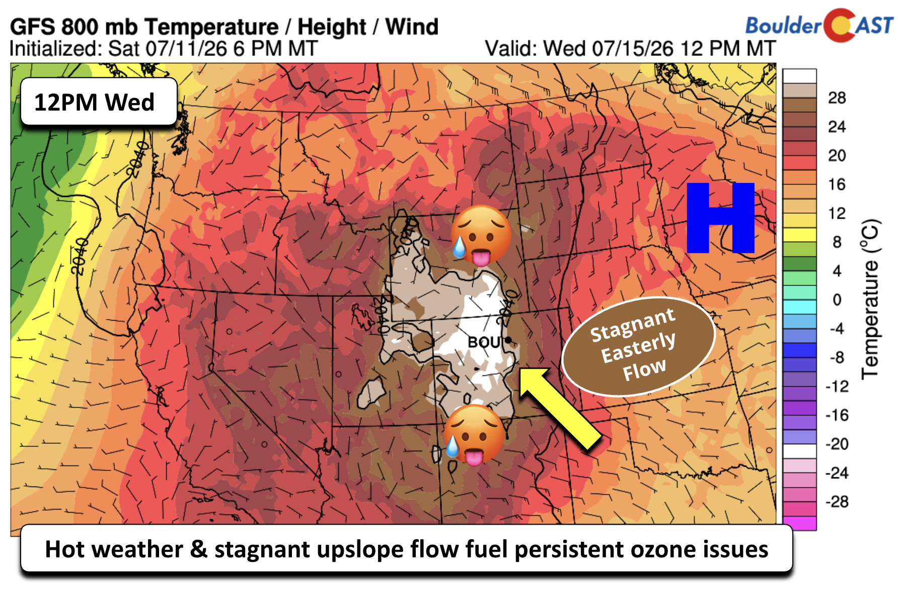
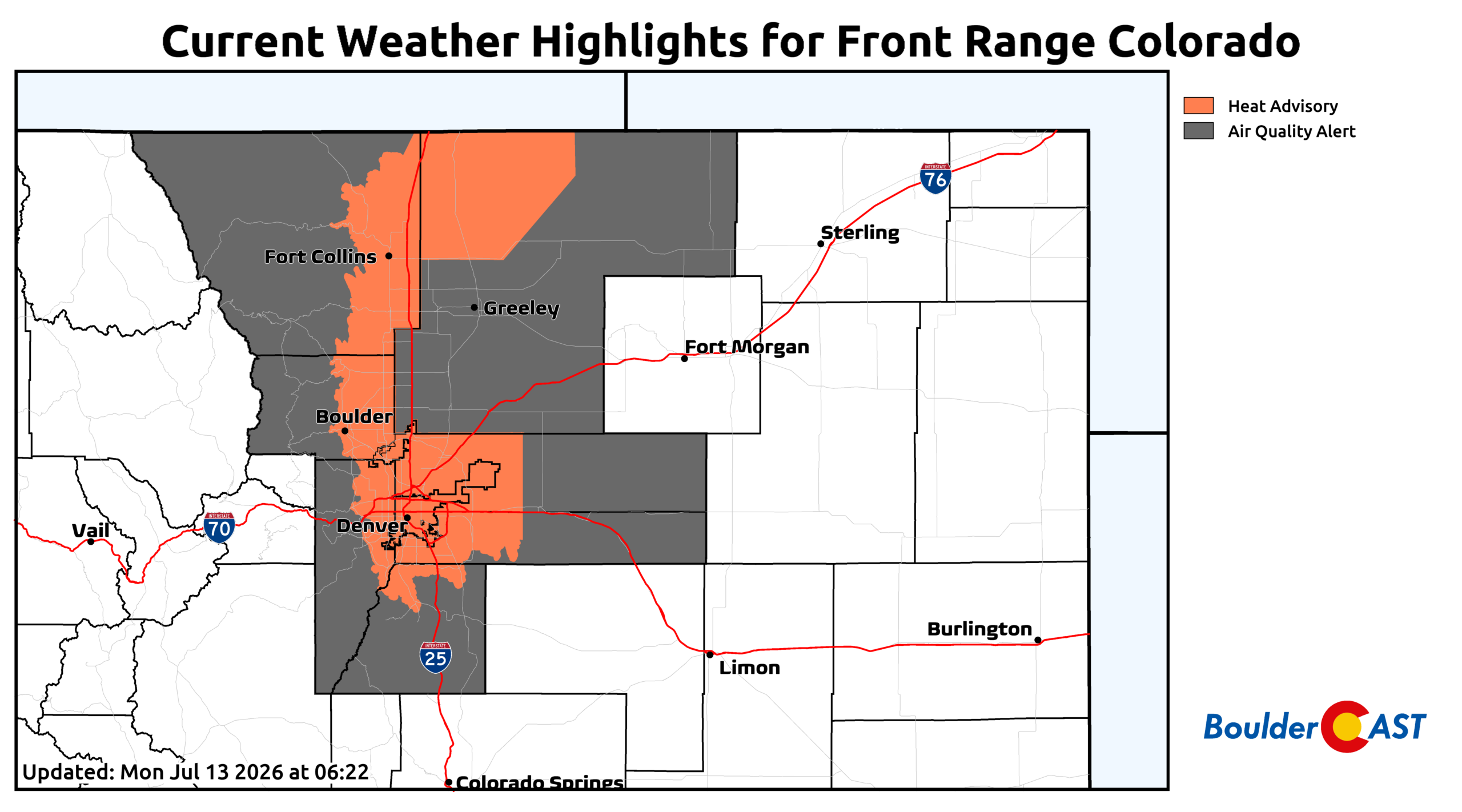
Air Quality Alerts will be around most or all days, with ozone being the primary pollutant. If you have to spend time outside, consider the early morning hours or closer to sunset when concentrations will be lower. Air Quality Alerts are indeed in effect Monday and are coincident with Heat Advisories in some spots.
Storm Chances *May* Return Next Weekend
The monsoon is not really taking shape yet in Colorado. With ridging extending into the area from the east most of this week, dry air and anomalously low precipitable water values will prevent storms from occurring over the Front Range. It’s quite the view from GOES-East Monday morning as incredibly dry, warm and subsident air rotates into eastern CO around a strong ~600dm ridge now centered over MN. This air is sourced from the upper troposphere and possibly the ozone-rich lower stratosphere.
Considering the extremely dry air over eastern Colorado, the main chance of storms will reside over western Colorado this week. The real moisture ring or horseshoe region will be well west and southwest of Denver, as indicated below. Dry and hot will be the name of the game here, while deeper moisture for storms stays shunted near the Great Basin and into Idaho/Montana.
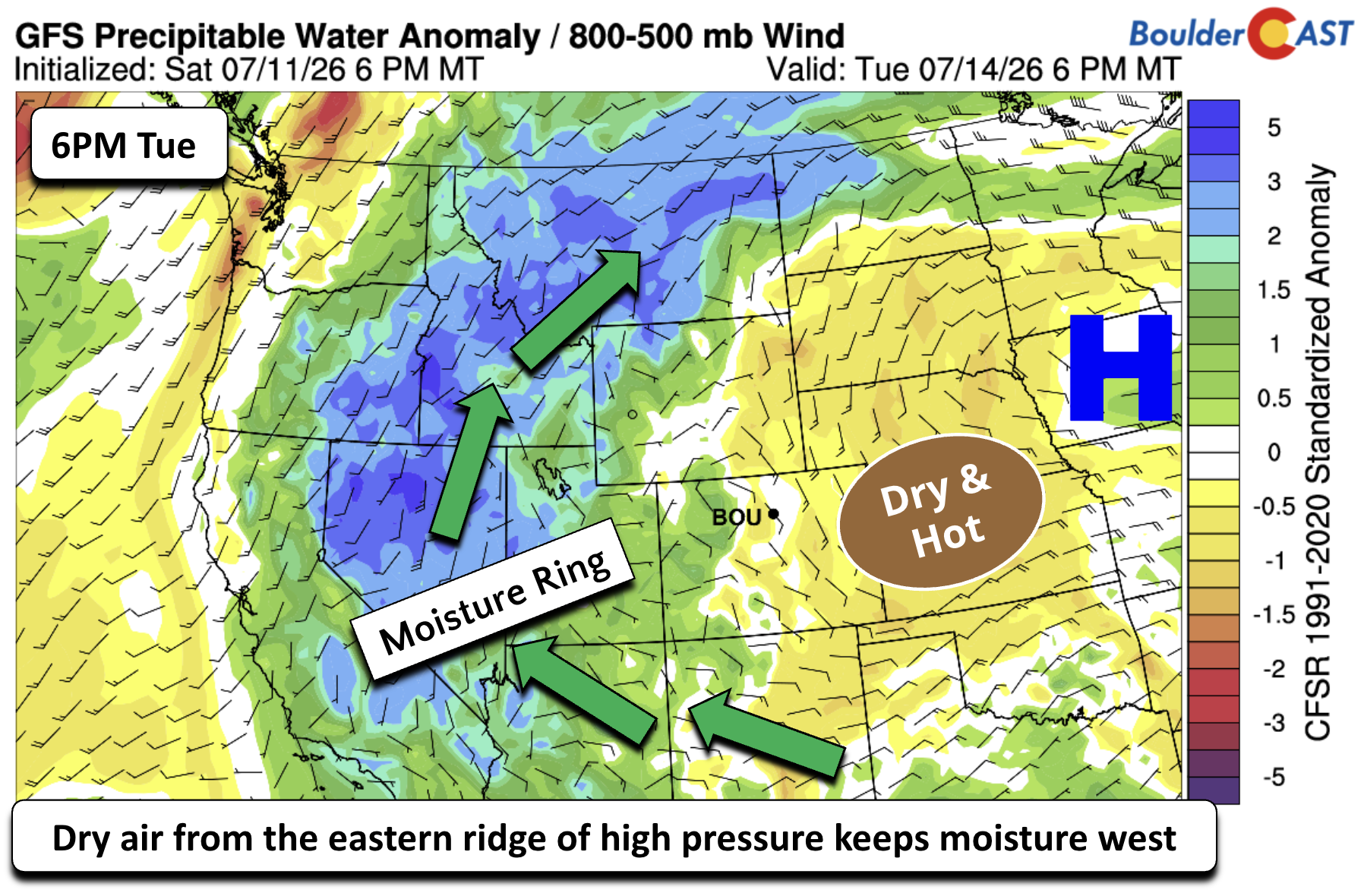
As a result, rain chances in the Front Range are essentially zero this week, with any rainfall staying in western Colorado into Utah and Nevada where pockets of dry lightning may spark new fires. Beneficial rains will occur in Arizona and New Mexico where the best monsoon moisture lies, with perhaps some of this spreading into the San Juans late in the week where flash flooding in any of the nascent burn scars will be a top concern.
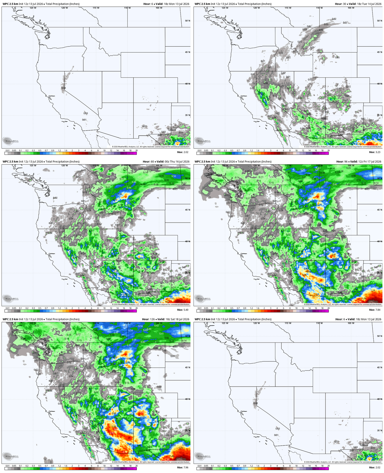
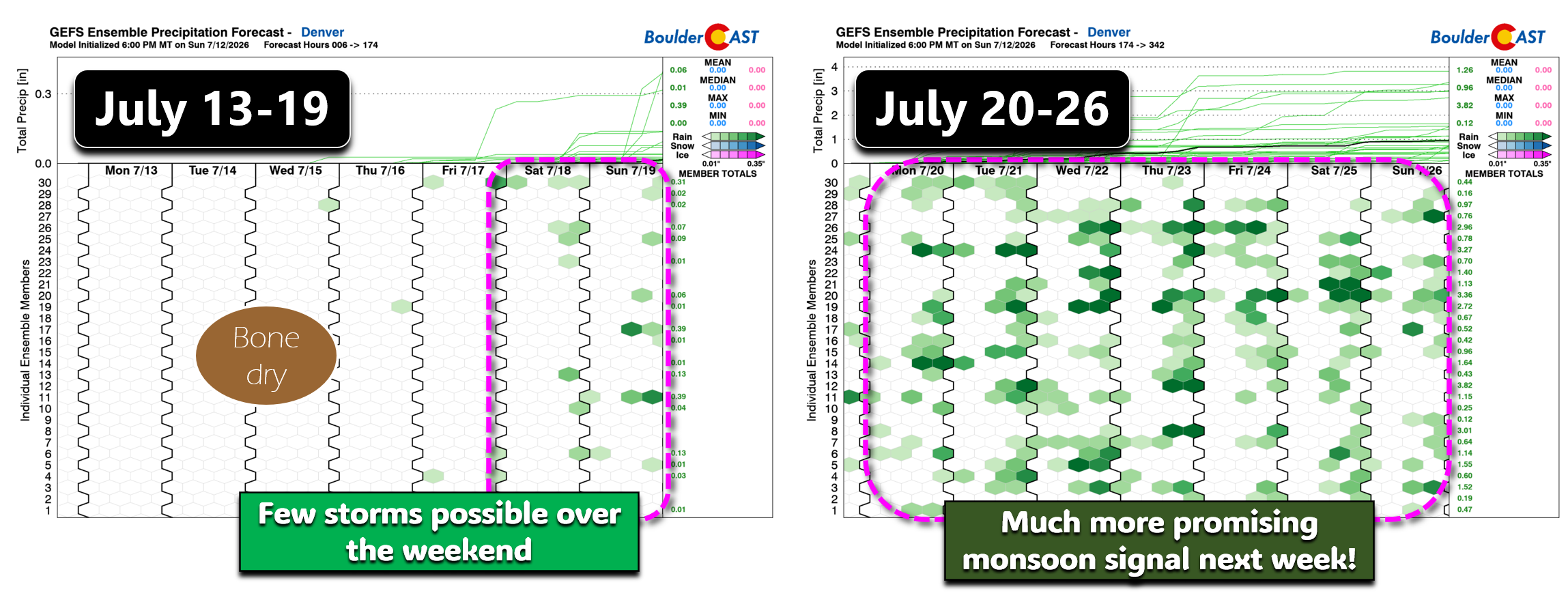
Here in the Denver Metro area, we may see an uptick in storm chances this weekend and especially heading into next next week. Saturday and Sunday will feature isolated, high-based storm chances (perhaps Friday as well). Next week, there are better signals in the guidance that ridging may weaken and allow for ripples of energy to rotate northward within an increasingly monsoon-infused airmass.
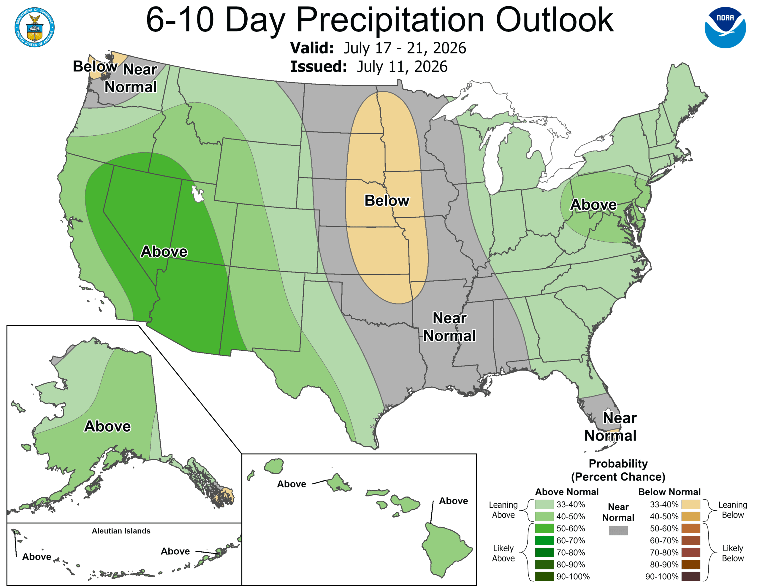
The Climate Prediction Center extended range precipitation outlook shows slight favoritism toward above normal rainfall during this timeframe in eastern Colorado. We love to see it, though having the bullseye a bit further east would be more comforting.
Bottom Line
A stubborn ridge will keep Front Range Colorado locked in a hot, dry pattern, with mid‑to‑upper 90s likely through at least Friday and potentially into the weekend, making a unlikely run at Boulder’s longest 95°+ streak on record. Fire danger peaks Tuesday through Thursday as heat, low humidity, and gusty ESE-erly winds combine to produce near‑critical fire conditions statewide. Persistent easterly flow will also trap pollutants along the Front Range, leading to daily poor air quality and frequent ozone alerts. Smoke should stay largely to the west, though. Storm chances remain essentially zero all week, but a weakening ridge and a plume of monsoon moisture may bring a modest uptick in weekend storms, with more convincing signals for above‑normal precipitation heading into next week.
Stay cool, stay hydrated, stay informed!
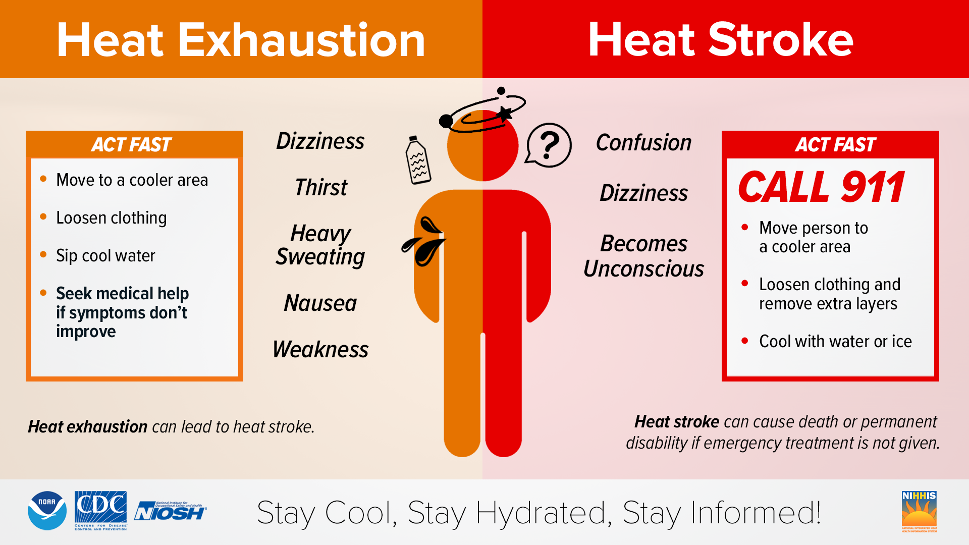
Forecast Specifics:
Monday through Friday: Hot, dry and sunny with poor air quality (ozone), gusty east-southeast winds, and elevated fire danger. Highs in the middle 90s over the Plains (upper 90s Monday) with middle 80s in the Foothills.
Weekend: Trending slightly wetter but still hot in the middle to upper 90s over the Front Range.
DISCLAIMER: This weekly outlook forecast is created Monday morning and covers the entire upcoming week. Accuracy will decrease as the week progresses as this post is NOT updated. To receive daily updated forecasts from our team, among many other perks, subscribe to BoulderCAST Premium.
Go Premium, get all the perks.
Daily Forecast Updates
Get our daily forecast discussion every morning delivered to your inbox.
All Our Model Data
Access to all our Colorado-centric high-resolution weather model graphics. Seriously — every one!
Ski & Hiking Forecasts
6-day forecasts for all the Colorado ski resorts, plus more than 120 hiking trails, including every 14er.
Smoke Forecasts
Wildfire smoke concentration predictions up to 72 hours into the future.
Exclusive Content
Weekend outlooks every Thursday, bonus storm updates, historical data and much more!
No Advertisements
Enjoy ad-free viewing on the entire site.
Enjoy our content? Give it a share!












You must be logged in to post a comment.