
Spring’s grip on our wet season is loosening, and the atmosphere is starting to hint at the drier pattern ahead — but not before we squeeze out a few more days of spotty storm potential. This week brings a mix of low‑end daily rain chances, early‑week severe storms, and a slow warm‑up that could push us toward our first 90° reading of the year by the weekend. Read on as we break down what to expect as we ride out this transitional stretch of early June.
This week’s highlights include:
⛈️ Daily storm chances continue, but driven by weak mesoscale forcing with no strong synoptic support.
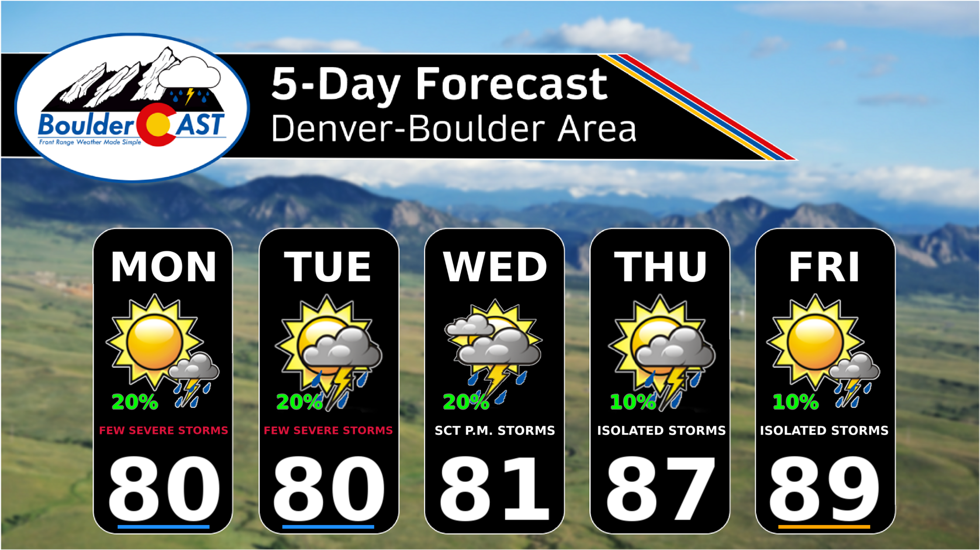
🌪️ Monday is the peak severe day, with 1–2″ hail possible in Boulder–Denver and stronger supercells east of DIA.
⚡ Tuesday keeps a marginal severe threat, though morning stratus may limit instability near Denver.
🌧️ Mid–late week brings isolated, slow‑moving storms, low shear, and minor burn‑scar flood concerns.
📉 Rain totals stay light, generally under 0.25″ for most of the Front Range by Friday night.
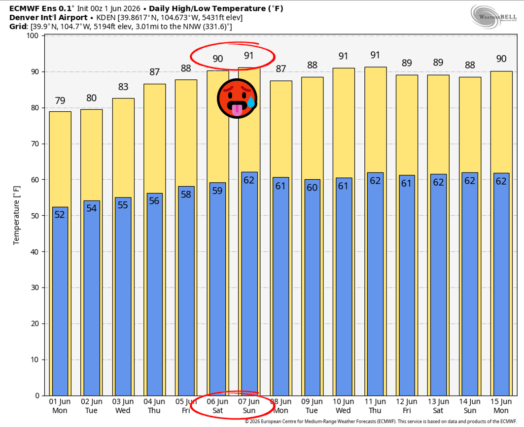
🌡️ Temperatures climb into the upper 80s, with the first 90°F of 2026 possible by the upcoming weekend.
DISCLAIMER: This weekly outlook forecast is created Monday morning and covers the entire upcoming week. Accuracy will decrease as the week progresses as this post is NOT updated. To receive daily updated forecasts from our team, among many other perks, subscribe to BoulderCAST Premium.

Go Premium, get all the perks.
Daily Forecast Updates
Get our daily forecast discussion every morning delivered to your inbox.
All Our Model Data
Access to all our Colorado-centric high-resolution weather model graphics. Seriously — every one!
Ski & Hiking Forecasts
6-day forecasts for all the Colorado ski resorts, plus more than 120 hiking trails, including every 14er.
Smoke Forecasts
Wildfire smoke concentration predictions up to 72 hours into the future.
Exclusive Content
Weekend outlooks every Thursday, bonus storm updates, historical data and much more!
No Advertisements
Enjoy ad-free viewing on the entire site.
Another week with low-end daily storm chances
Sad but true: our climatological spring wet season is already slipping away. We’re entering that familiar early June transition where Colorado gradually loses access to the mid‑latitude jet stream and the atmosphere dries out while we wait for the North American monsoon to ramp up later in the summer.
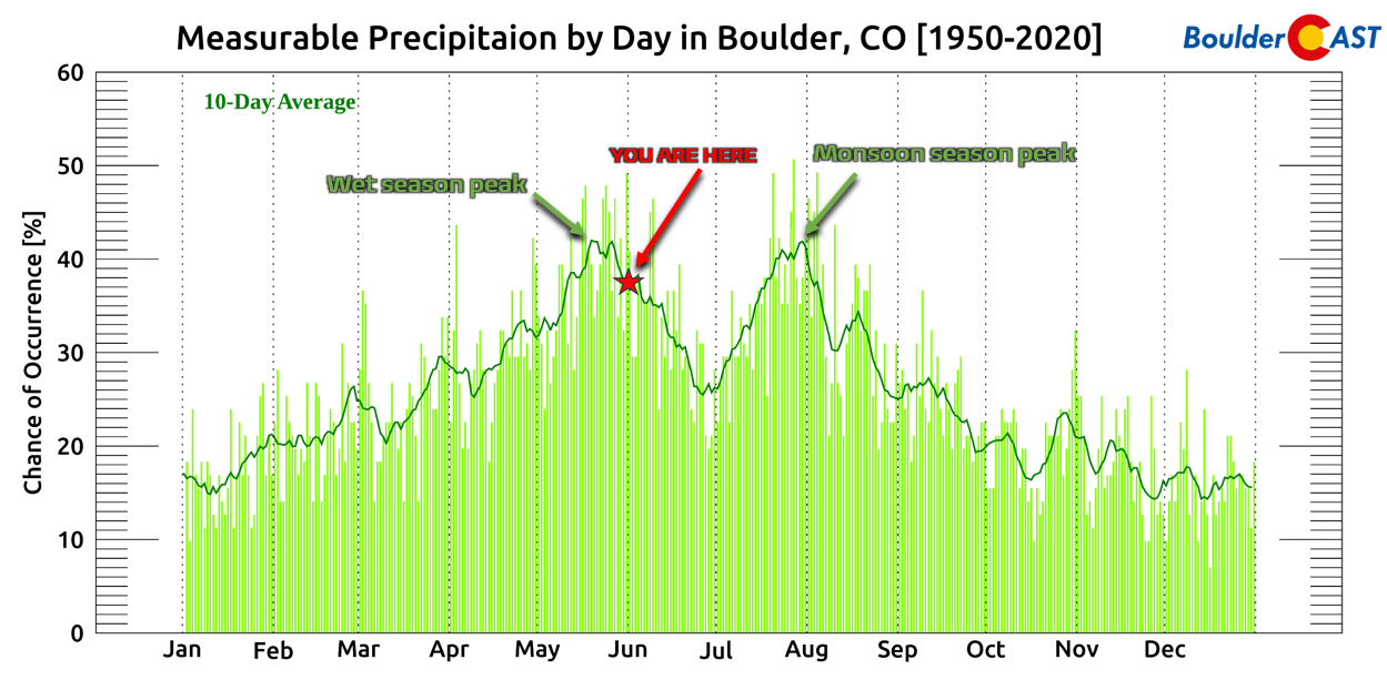
We still have a few weeks before that full pattern shift, but the window for one or two more meaningful soaking precipitation events is narrowing. And based on current guidance, this is not the week where we cash in.
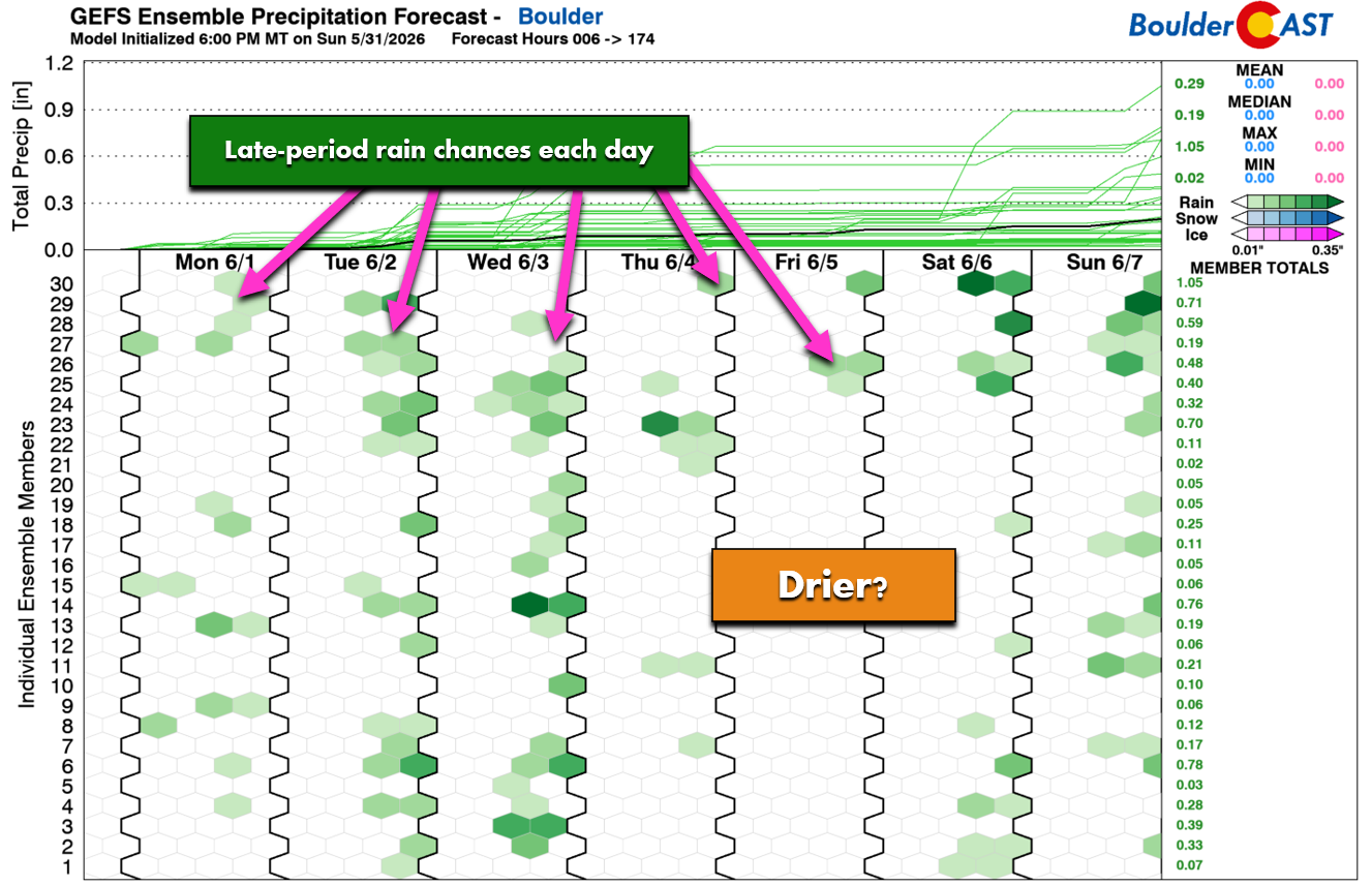
Instead, we continue the same theme we’ve lived for the past 10 days: daily storm chances, but driven by weak, mesoscale‑only forcings rather than any organized synoptic features. It’s the type of setup where many of us will stay dry — but at least there’s some action on the table each day.
Early week severe threat
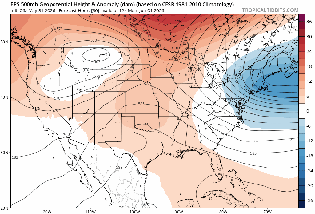
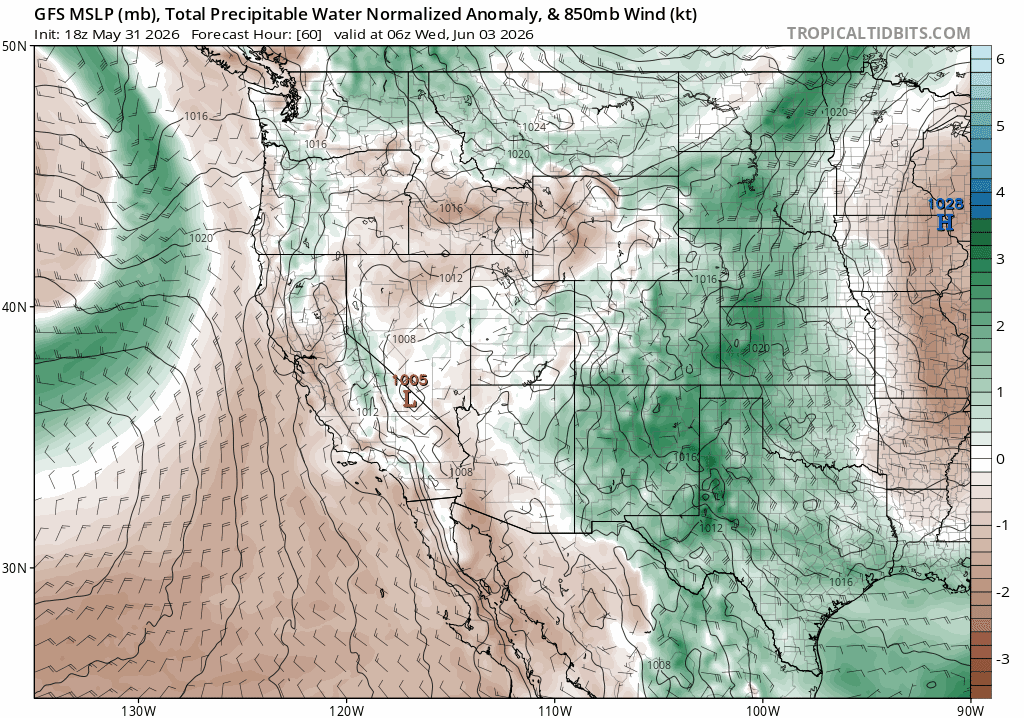
Flow across the central U.S. remains jammed up beneath a classic omega block over central Canada. A stubborn closed low over Montana is trapped until midweek, when the block finally breaks down and the system ejects east. Until then, Colorado will sit just south of the low with moderately strong southwest flow aloft, providing enough shear to support severe thunderstorms across northeast Colorado.
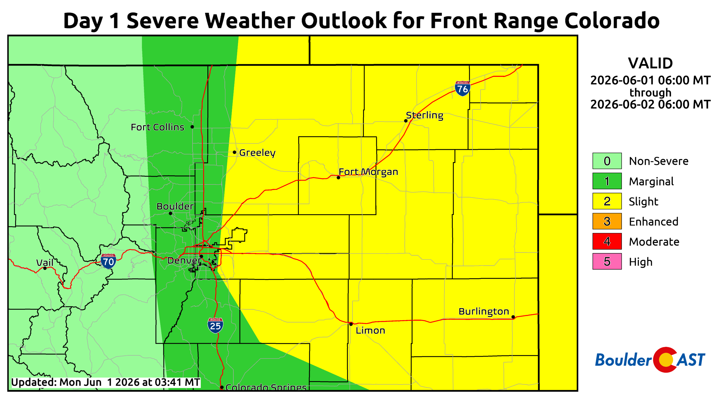
Monday: The Highest Risk
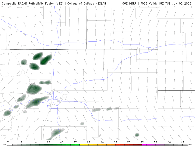
Monday is the day to watch along the Front Range. Shear profiles and instability will support 1–2″ hail in the Boulder–Denver corridor, with storms intensifying as they move east toward the Plains. Farther east — DIA to Limon and into Kansas/Nebraska — even larger hail and a couple tornadoes are possible.
The Storm Prediction Center (SPC) places Denver/Boulder under a Marginal Risk (Level 1 of 5), with a Slight Risk (Level 2 of 5) just east including DIA, Aurora, and Parker.
For the weather nerds, you may enjoy the SPC discussion for Monday afternoon:
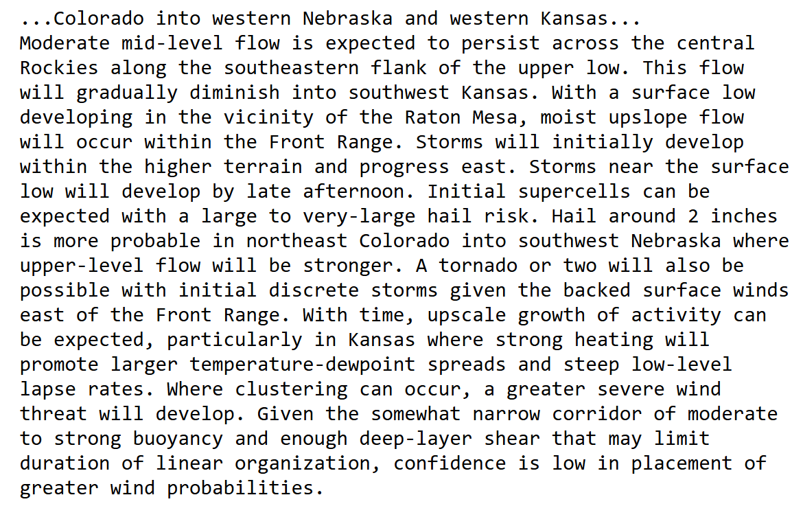
Short‑range guidance initiates the storms early afternoon along the Palmer Divide, Cheyenne Ridge, and the Foothills, before they track east and mature into supercells.
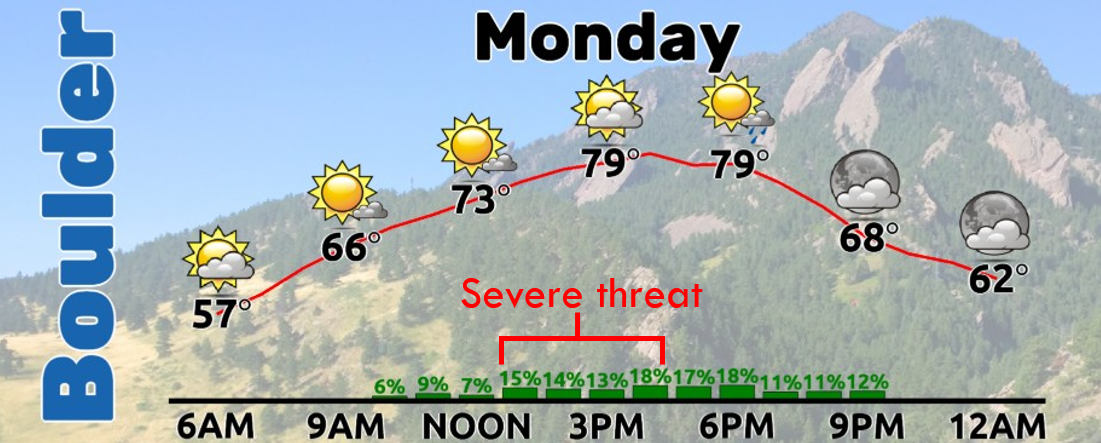
The primary window for severe weather in the Urban Corridor is 1–4 PM, followed by a few lingering weak thundershowers into the evening. Highs reach near 80°F.
Tuesday: still a threat, but more uncertain
The severe risk continues Tuesday, though morning stratus may limit instability near Denver. Areas east of the city remain under a Marginal Risk, and that zone could shift west if the cloud deck never materializes, is thinner or burns off earlier than expected.
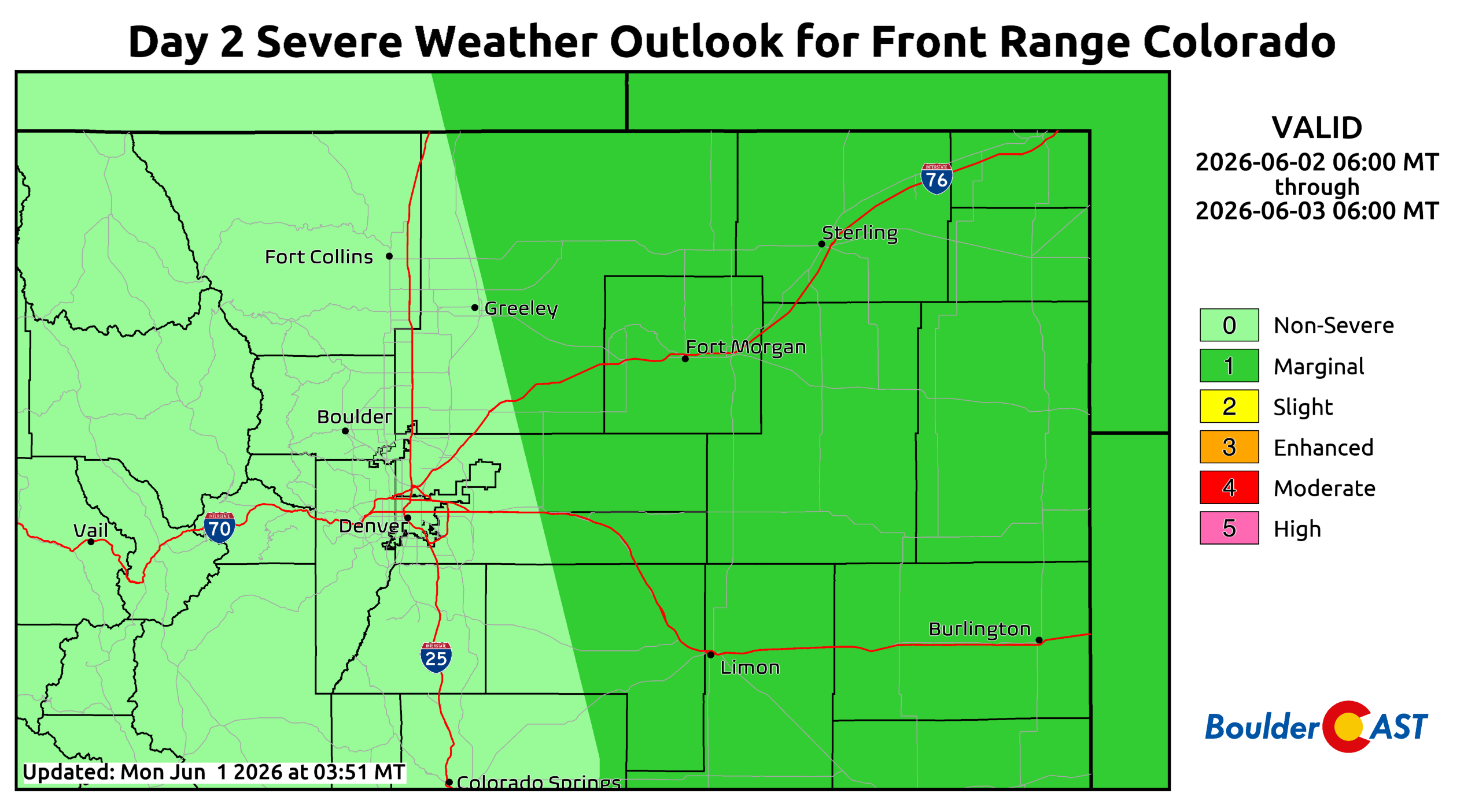
Highs climb into the low 80s with widely scattered late‑day storms. East of Denver, hail‑producing and tornado‑capable supercells remain the concern.
Late‑week: daily storms linger, but severe threat fades
By Wednesday, the Montana low finally ejects toward the Great Lakes, leaving Colorado under weak zonal flow aloft. At the surface, however, Gulf moisture transport remains active, keeping dewpoints elevated and allowing for daily storm chances despite the lack of meaningful forcing.
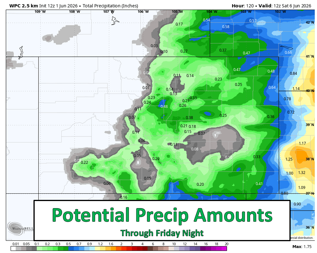
Wednesday through Friday brings isolated to scattered, slow‑moving thunderstorms. With weak upper‑level winds, shear is minimal — so severe weather is unlikely. Instead, the main hazard becomes efficient rainfall rates and localized flooding, primarily over burn scars or steep terrain. Even then, the risk appears low and conditional at this time.
Rain totals this week generally won’t impress. Monday and Tuesday offer the best chances, but much of the meaningful activity will be off to our south and east. Late‑week storms will be hit‑or‑miss. Most of the Front Range should end up with under 0.25″ by Friday night, with the usual winners and losers depending on where storms pulse.
As storm coverage decreases, temperatures will climb into the upper 80s by Thursday and Friday.
Eyeing the first 90°F of 2026
Neither Denver nor Boulder has officially hit 90°F yet this year. That could change late in the week, but the better shot comes this upcoming hot weekend, when ridging strengthens and moisture thins out.
Enjoy the week — and the daily storm roulette while it lasts. Summer’s heat isn’t far off…
Forecast Specifics:
Monday & Tuesday: Morning sun turning partly cloudy. Highs in the middle 80s on the Plains and near 70 in the Foothills with afternoon and evening widely scattered gusty storms. Minimal rainfall, but up to 40 MPH wind gusts. The chance is about 20-30 percent.
Wednesday through Friday: Highs warmer in the low to middle 80s for the Plains and upper 60s in the Foothills. Afternoon and evening isolated or widely scattered storms will again be possible, with that potential at about 20 percent each day, though these days are more uncertain in the extended.
DISCLAIMER: This weekly outlook forecast is created Monday morning and covers the entire upcoming week. Accuracy will decrease as the week progresses as this post is NOT updated. To receive daily updated forecasts from our team, among many other perks, subscribe to BoulderCAST Premium.
Go Premium, get all the perks.
Daily Forecast Updates
Get our daily forecast discussion every morning delivered to your inbox.
All Our Model Data
Access to all our Colorado-centric high-resolution weather model graphics. Seriously — every one!
Ski & Hiking Forecasts
6-day forecasts for all the Colorado ski resorts, plus more than 120 hiking trails, including every 14er.
Smoke Forecasts
Wildfire smoke concentration predictions up to 72 hours into the future.
Exclusive Content
Weekend outlooks every Thursday, bonus storm updates, historical data and much more!
No Advertisements
Enjoy ad-free viewing on the entire site.
Enjoy our content? Give it a share!


Leave a Reply
You must be logged in to post a comment.