A fleeting brush with winter may have swept across the Front Range this past weekend, but the atmosphere isn’t planning to stick with the theme for long. That sharp Arctic plunge—while refreshing for snow lovers—was more of a brief interruption than a true turning point. A closer look at the pattern ahead shows Colorado snapping right back into its now‑familiar routine of warm afternoons, bone‑dry air, and a statewide snowpack sitting at record‑low levels. Winter may have knocked on the door, but it certainly isn’t moving in.
This week’s highlights include:
- ❄️ Weekend taste of winter: Two light snow events brought a dusting–2″ each, paired with a sharp Arctic chill.
- 🥶 Sub-zero temperature crash: Clear skies + fresh snow sent many spots below zero Sunday night; Boulder briefly dipped negative before downslope winds warmed things up quickly Monday morning.
- 🔥 Drying out fast: Downslope winds return temps to the 40s Monday with humidity dropping to 6–12%, though recent snow keeps fire danger low.
- 🌤️ Quiet, dry week ahead: Persistent northwest flow brings mild 40s–50s, weak fronts, and only a small chance of an Arctic push late week.
- 📉 No real winter in sight: Ensembles keep Colorado warm, dry, and at times breezy into early February, worsening fire danger and leaving statewide snowpack at record lows.
DISCLAIMER: This weekly outlook forecast is created Monday morning and covers the entire upcoming week. Accuracy will decrease as the week progresses as this post is NOT updated. To receive daily updated forecasts from our team, among many other perks, subscribe to BoulderCAST Premium.

Go Premium, get all the perks.
Daily Forecast Updates
Get our daily forecast discussion every morning delivered to your inbox.
All Our Model Data
Access to all our Colorado-centric high-resolution weather model graphics. Seriously — every one!
Ski & Hiking Forecasts
6-day forecasts for all the Colorado ski resorts, plus more than 120 hiking trails, including every 14er.
Smoke Forecasts
Wildfire smoke concentration predictions up to 72 hours into the future.
Exclusive Content
Weekend outlooks every Thursday, bonus storm updates, historical data and much more!
No Advertisements
Enjoy ad-free viewing on the entire site.
Arctic air is almost in the rearview mirror
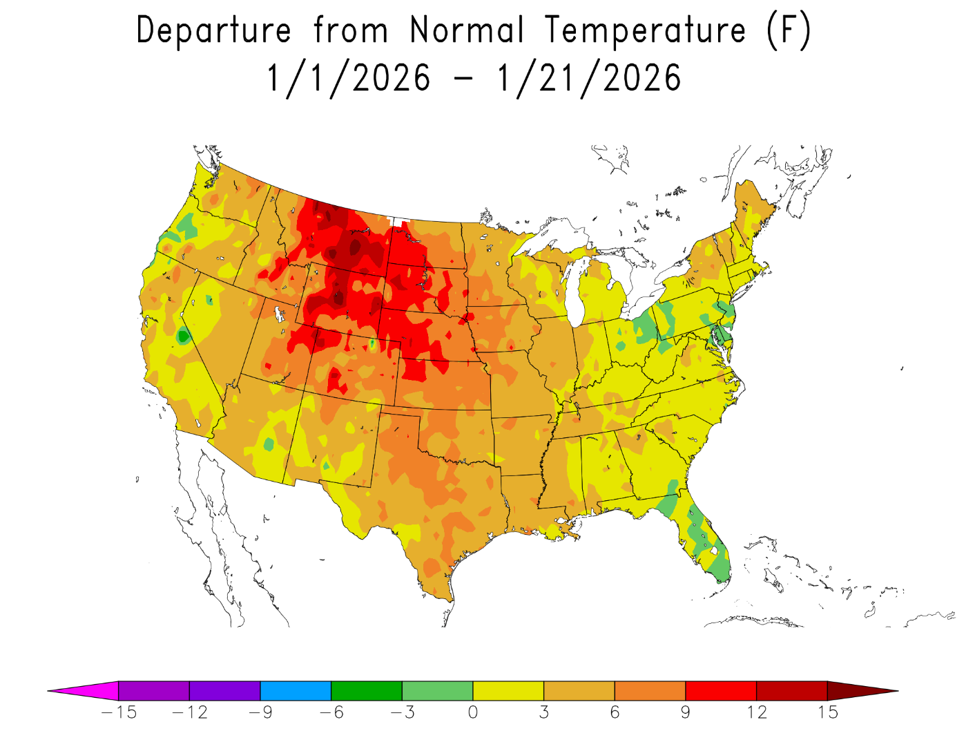
It was nice to finally have a taste of winter over the weekend, with occasional light snow and bitter cold temperatures engulfing the Front Range for three straight days. The cold definitely bit harder than it should in January, owing to our wildly above normal temperatures of late.
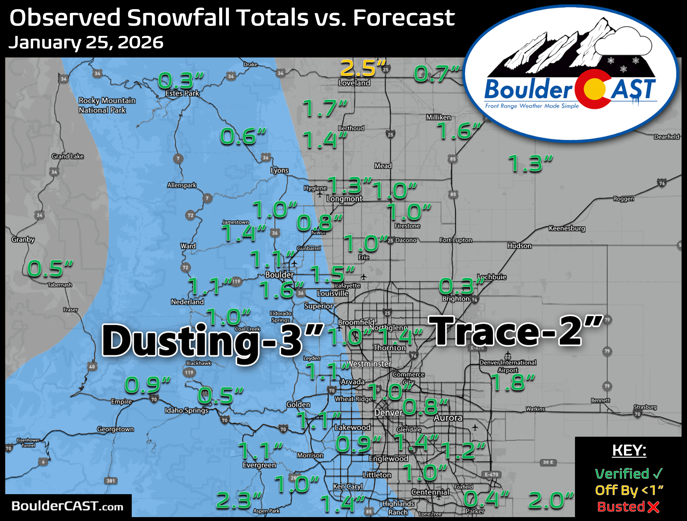
The first wintry system, arriving Friday into early Saturday, produced a modest dusting to 2 inches of snow across the Metro area and Foothills.
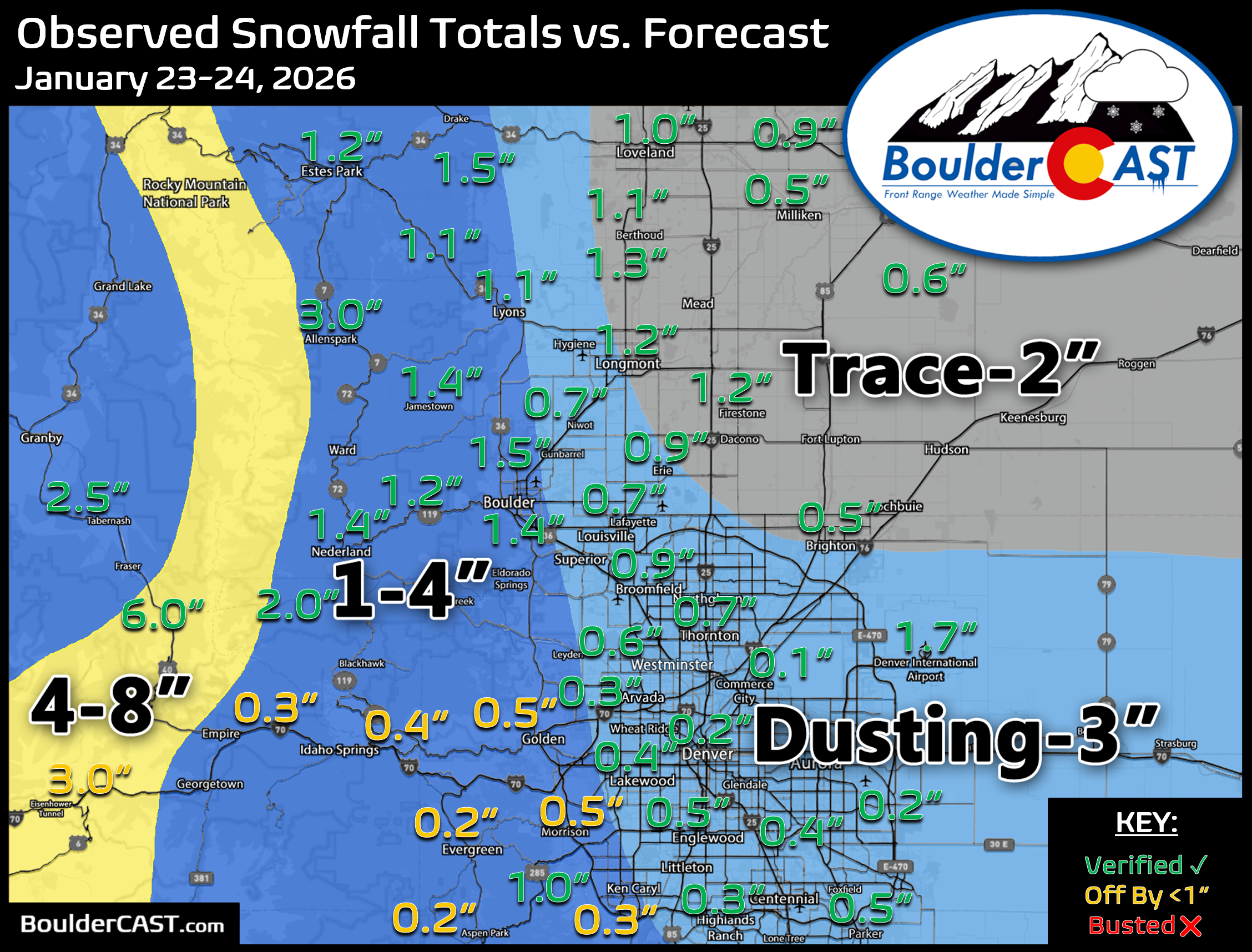
Sunday’s wave—yes, the same one that may haunt Broncos fans for a while—brought nearly identical totals, another dusting to 2 inches spread along the I-25 Corridor.
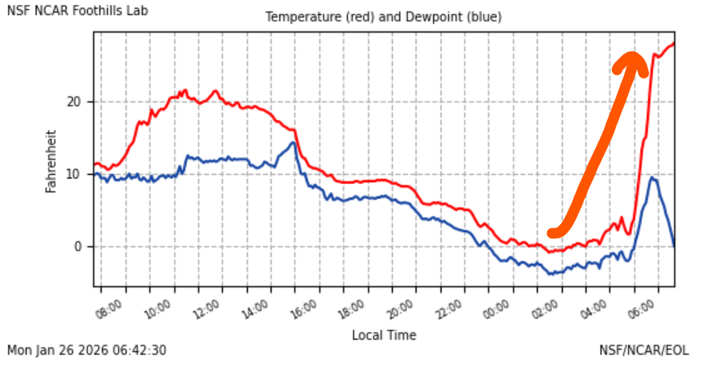
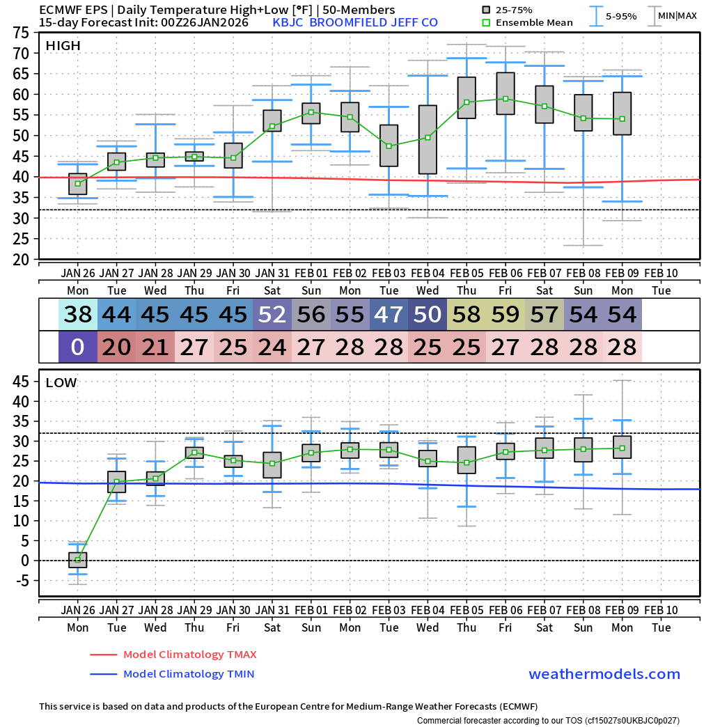
By Monday morning, though, the Arctic air mass is already losing its grip. Downslope winds began scouring it out from the west, but not before clear skies and fresh snow cover allowed temperatures to tank overnight. Many locations dipped below zero, including Boulder, which briefly slipped into the negatives after midnight. Once the downslope strengthened, temperatures rebounded quickly, jumping into the upper 20s before sunrise.
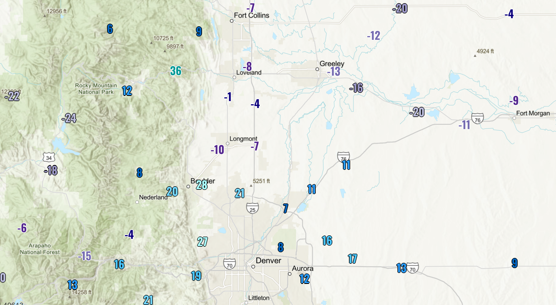
The warm‑up has been highly localized. Areas exposed to even a hint of downslope—Boulder in the 20s, Denver in the teens—have warmed a lot. But sheltered basins and valleys remain locked in the deep Arctic freezer. Mountain communities west of the Divide and the low‑lying South Platte River valley are still well below zero.
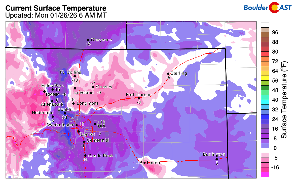
As of writing early Monday, the temperature spread is remarkable: roughly 35 degrees between Boulder and Longmont, and nearly 50 degrees between Boulder and Greeley, where readings plunged to around –20°F.
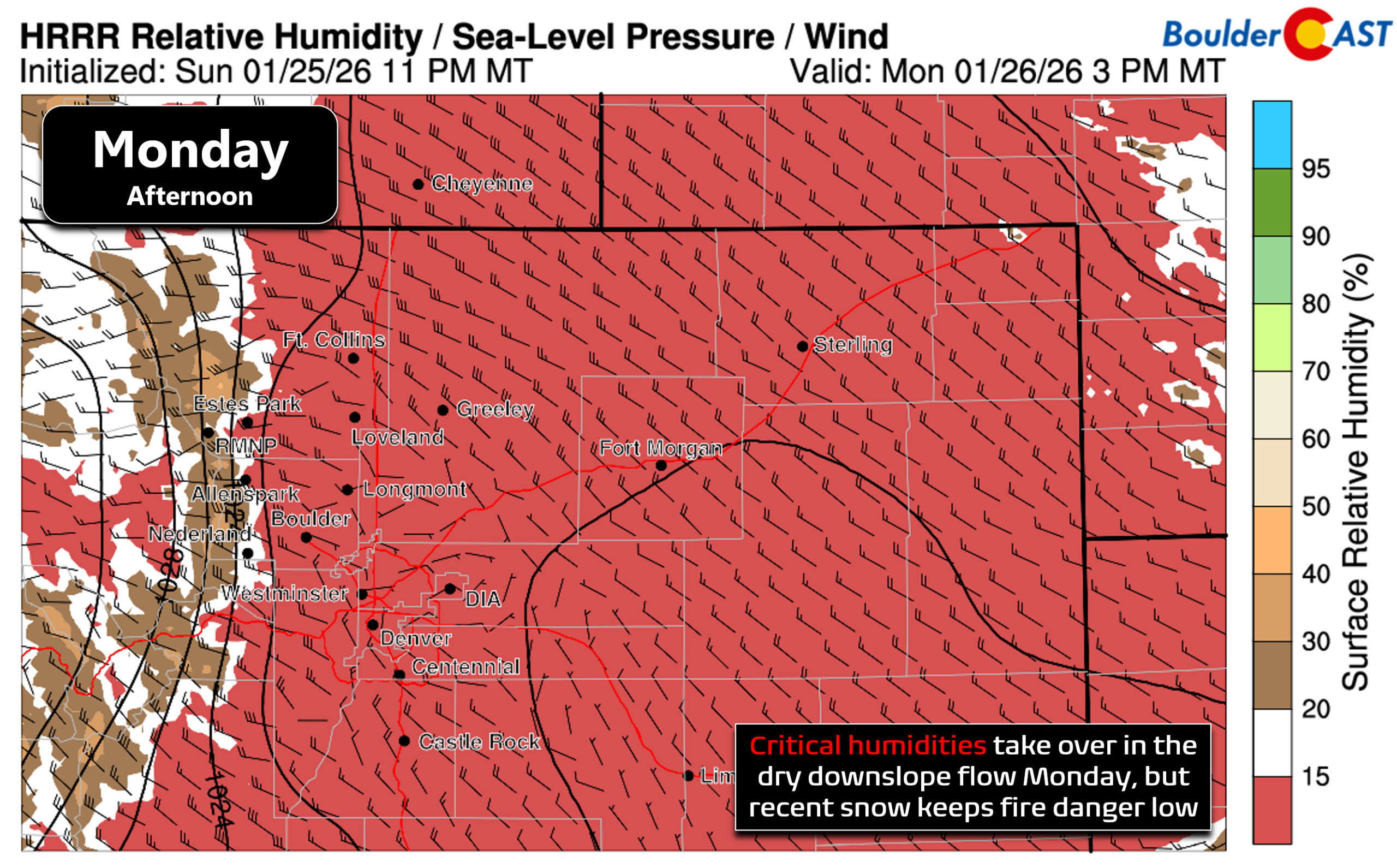
As the day progresses, downslope flow will dominate most of the Front Range, pushing temperatures back toward seasonal norms in the mid‑40s. Models continue to insist that the entrenched Arctic air in the South Platte valley will erode as well, though that may be overly optimistic given how dense and stubborn the cold pools can be. The dry westerly winds will also drive afternoon humidity into the 6 to 12% range—critical territory—but the recent snowfall is doing us a favor by suppressing what would otherwise be a concerning fire‑weather setup in parts of the Foothills.
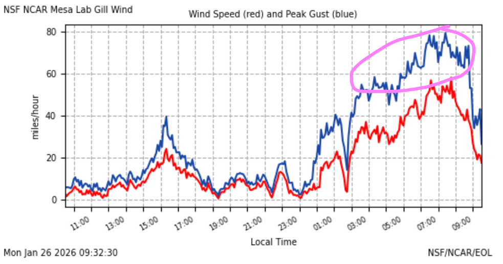
There may be some areas of blowing snow Monday morning in and near the Foothills where winds are gusting over 40 MPH (even over 80 MPH as recorded at NCAR Mesa Lab!).
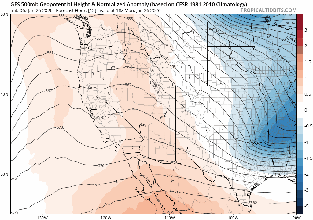
The rest of the week settles into a familiar pattern: dry, quiet northwest flow, the same regime that has dominated much of fall and winter here. A strong ridge will build along the West Coast while a deep trough anchors over the Great Lakes, leaving Colorado wedged between the two. Weak, moisture‑starved shortwaves will ripple overhead at times, but none appear capable of producing precipitation east of the Divide. Instead, they’ll drag occasional weak cold fronts across the lower elevations.
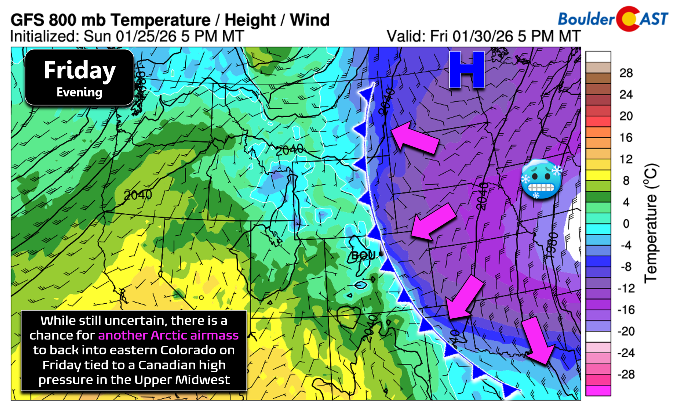
One such front may slip through around Wednesday, offering only a minor temperature dip into Thursday. A more interesting possibility emerges late in the week, when an Arctic high over the northern Plains could shove a stronger front westward into eastern Colorado—potentially Friday. Model agreement is shaky, but the setup is plausible, and a brief return to bitter cold can’t be ruled out.
Highs through the week will generally land in the mid‑40s to lower 50s with at least partial sunshine each day.
Even if the late‑week Arctic push materializes, it likely won’t linger. The West Coast ridge looks poised to take over again, steering warmer, drier air back into Colorado for the weekend and early next week while the eastern U.S. braces for another Arctic blast.
For anyone hoping this recent cold snap signaled a broader pattern shift toward a more traditional winter in Colorado, the outlook isn’t encouraging.
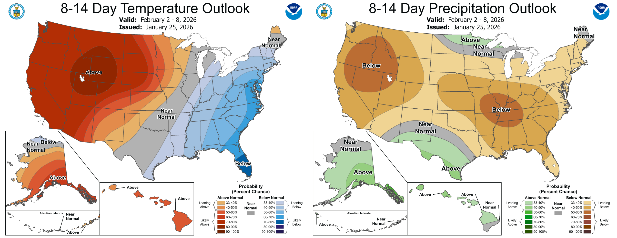
Ensemble guidance continues to favor a prolonged stretch of warm, dry, occasionally breezy weather into early February across the Intermountain West. No major cold outbreaks or significant snowstorms appear likely until at least the second week of the month—if not later.
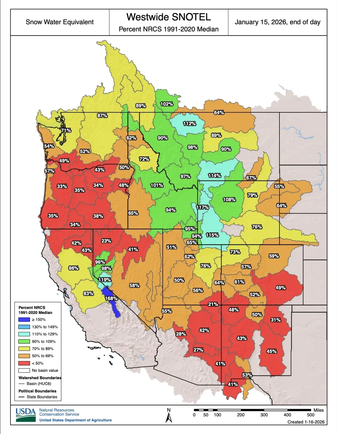
The longer this pattern holds, the more it compounds our ongoing issues: elevated fire danger, parched soils, and a statewide snowpack sitting at record‑low levels for late January. Winter may have brushed past us this weekend, but for now, it seems content to keep its distance.
Forecast Specifics:
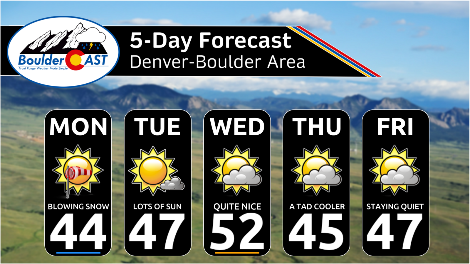
Monday: Gusty winds may create areas of blowing snow during the day, mainly in the Foothills. Otherwise, sunny skies and much warmer temperatures than recent days. Highs top out in the middle 40s on the Plains with lower 30s in the Foothills.
Tuesday: Mostly sunny and pleasant with highs in the upper 40s on the Plains and middle 30s in the Foothills.
Wednesday: The warmest day of the week with highs in the low to middle 50s on the Plains and lower 40s in the Foothills. Skies will be partly cloudy.
Thursday: Partly cloudy and a tad cooler with highs in the middle 40s on the Plains with middle 30s in the Foothills.
Friday: A quiet day with highs in the 40s, though there is some chance that an Arctic front backs into the area during the day from the east which would drastically reduce temperatures. This remains uncertain.
Weekend: Dry and quiet weather is expected over the weekend with moderating temperatures back into the 50s.
DISCLAIMER: This weekly outlook forecast is created Monday morning and covers the entire upcoming week. Accuracy will decrease as the week progresses as this post is NOT updated. To receive daily updated forecasts from our team, among many other perks, subscribe to BoulderCAST Premium.
Go Premium, get all the perks.
Daily Forecast Updates
Get our daily forecast discussion every morning delivered to your inbox.
All Our Model Data
Access to all our Colorado-centric high-resolution weather model graphics. Seriously — every one!
Ski & Hiking Forecasts
6-day forecasts for all the Colorado ski resorts, plus more than 120 hiking trails, including every 14er.
Smoke Forecasts
Wildfire smoke concentration predictions up to 72 hours into the future.
Exclusive Content
Weekend outlooks every Thursday, bonus storm updates, historical data and much more!
No Advertisements
Enjoy ad-free viewing on the entire site.
Enjoy our content? Give it a share!


your 5-day has the wrong days (THU-MON) for this week (MON-FRI)
Thanks, fixed. Monday morning brain fog 🙂