As we head into what’s normally the coldest stretch of the year along the Front Range, the atmosphere has other plans. Instead of Arctic air and snow globe conditions, we’re staring down a week of springlike warmth, fire weather concerns, and multiple shots at breaking long‑standing temperature records—including on Christmas Day. We’ll walk you through why this pattern is so unusual, what it means for Boulder and the Foothills, and where you can still find real winter this week if you’re craving it.
This week’s highlights include:
- ❄️ The coldest week of the year: Boulder’s coldest days typically fall just before Christmas, unlike most of the U.S.
- 🔥 Not this year: Temps run 15–25°F above normal all week thanks to a powerful ridge over the southern Plains.
- 🌡️ Record warmth: Highs in the 60s–70s may challenge multiple daily records this week, including what could be our warmest Christmas Day on record.
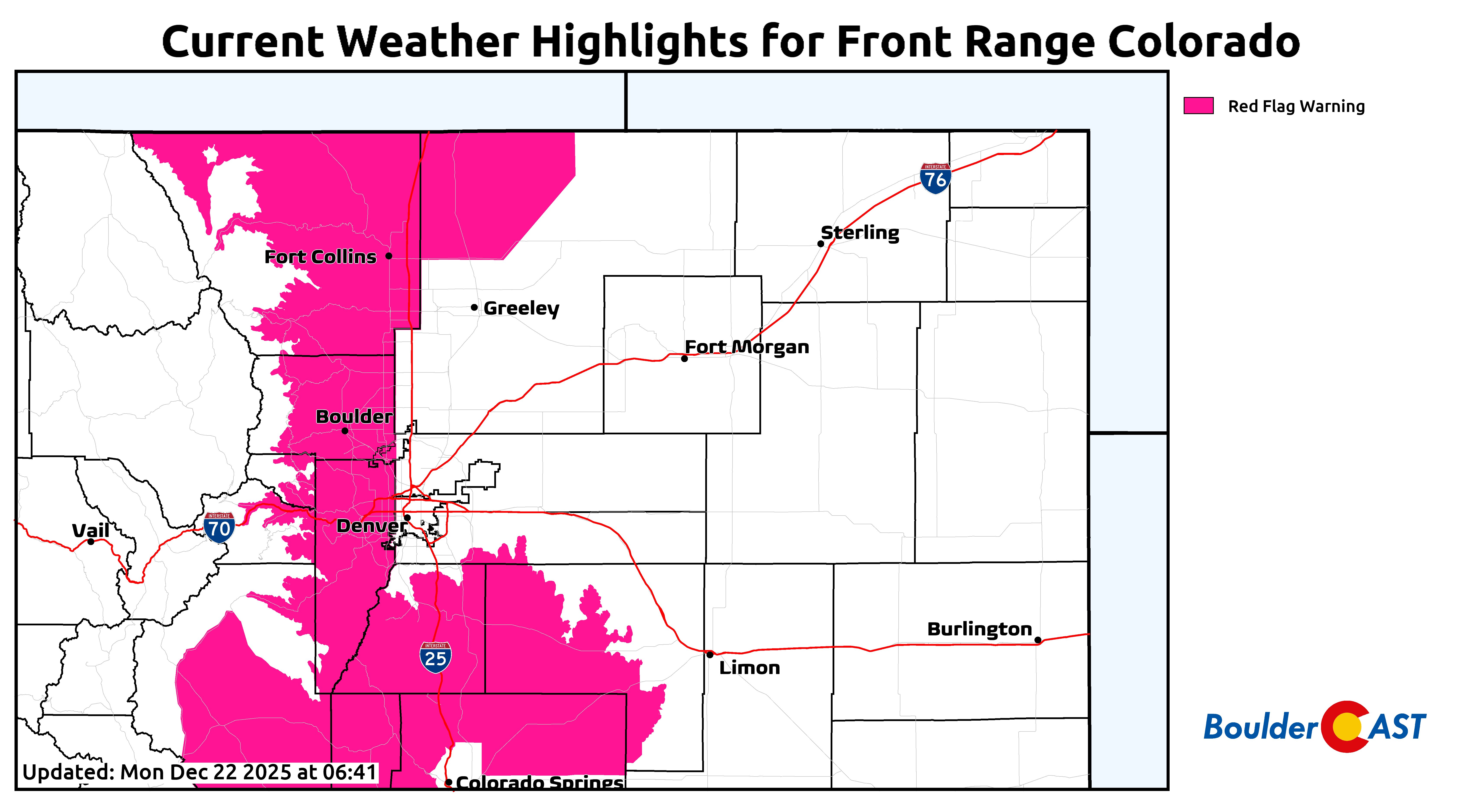
- 💨 Fire weather: Red Flag Warnings cover the western Metro and Foothills Monday where fire could spread rapidly.
- 🏔️ Mountain snow only: A late‑week trough brings healthy snowfall to parts of the High Country, but none for Boulder or Denver.
- 🎄 Warm, brown Christmas: Zero chance of snow and no freezing nights this week; next week looks mild and dry as well.
DISCLAIMER: This weekly outlook forecast is created Monday morning and covers the entire upcoming week. Accuracy will decrease as the week progresses as this post is NOT updated. To receive daily updated forecasts from our team, among many other perks, subscribe to BoulderCAST Premium.

Go Premium, get all the perks.
Daily Forecast Updates
Get our daily forecast discussion every morning delivered to your inbox.
All Our Model Data
Access to all our Colorado-centric high-resolution weather model graphics. Seriously — every one!
Ski & Hiking Forecasts
6-day forecasts for all the Colorado ski resorts, plus more than 120 hiking trails, including every 14er.
Smoke Forecasts
Wildfire smoke concentration predictions up to 72 hours into the future.
Exclusive Content
Weekend outlooks every Thursday, bonus storm updates, historical data and much more!
No Advertisements
Enjoy ad-free viewing on the entire site.
A brown Christmas this year
If you look at the Front Range climate record, the coldest stretch of the entire year usually lands right around the end of December. However, most of the country hits its coldest temperatures in mid‑January or even early February, after the atmosphere has had time to fully cool.
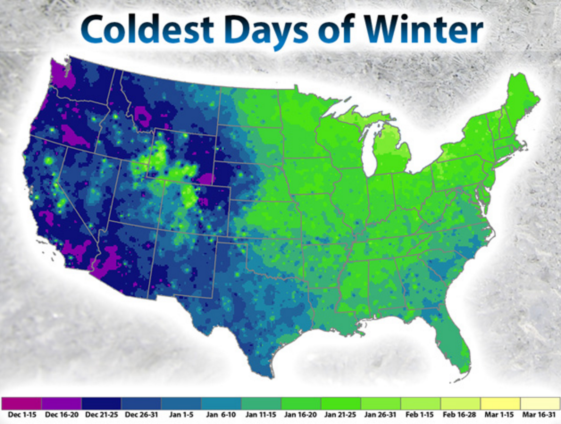
Here in the lee of the Rockies, Boulder’s coldest highs and lows tend to cluster in the days leading up to Christmas. Chalk it up to our dry air, long nights, and the way Arctic air masses can spill southward and bank up against the terrain this time of year.
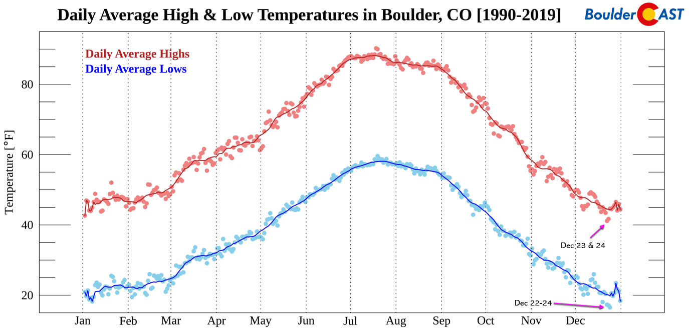
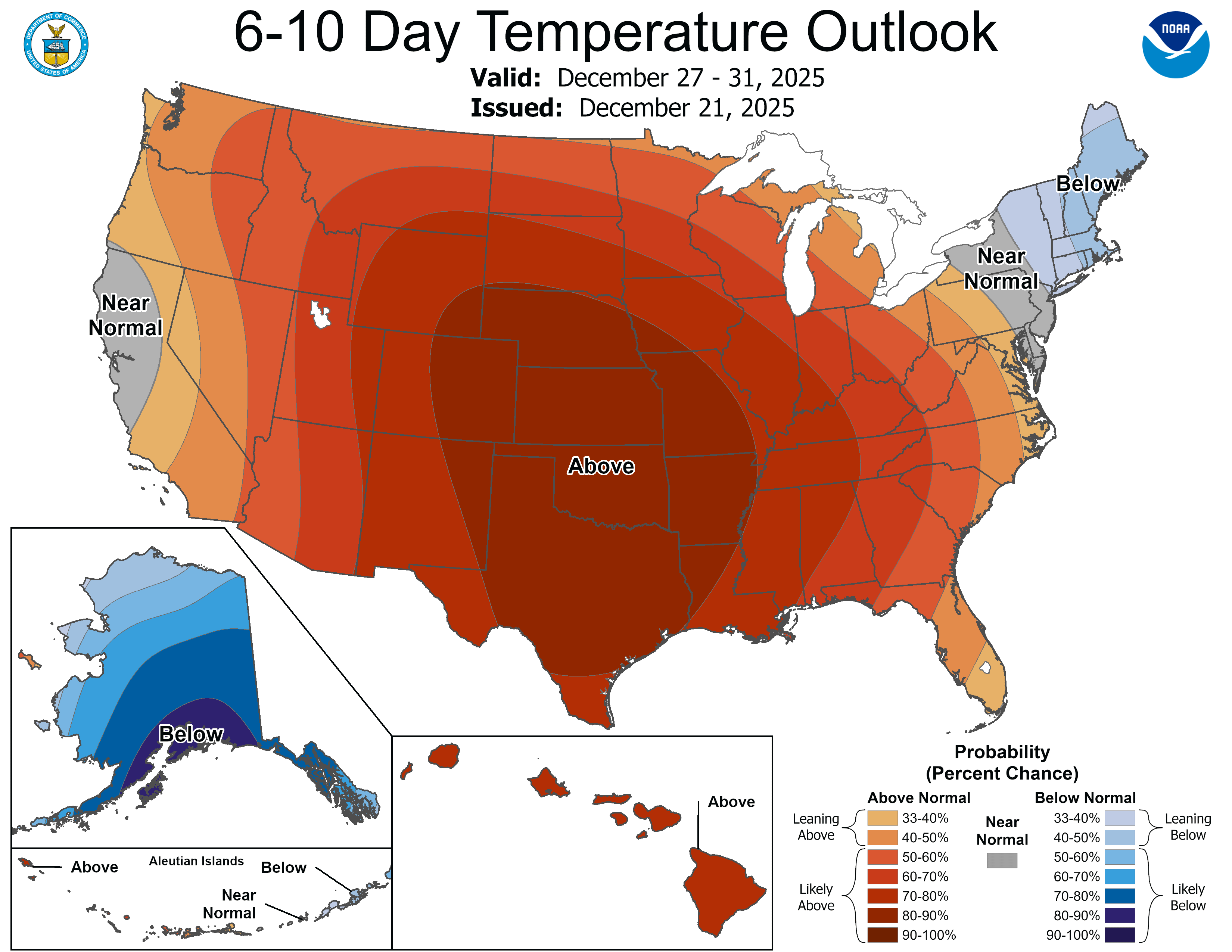
That said… none of that climatology will do us any favors this week. We’ll be running a solid 15–25°F above normal every single day through Friday, with nothing even remotely “cold” on the horizon.
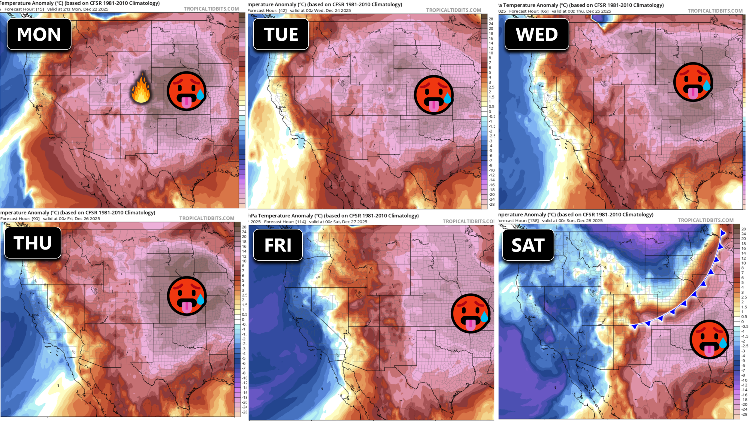
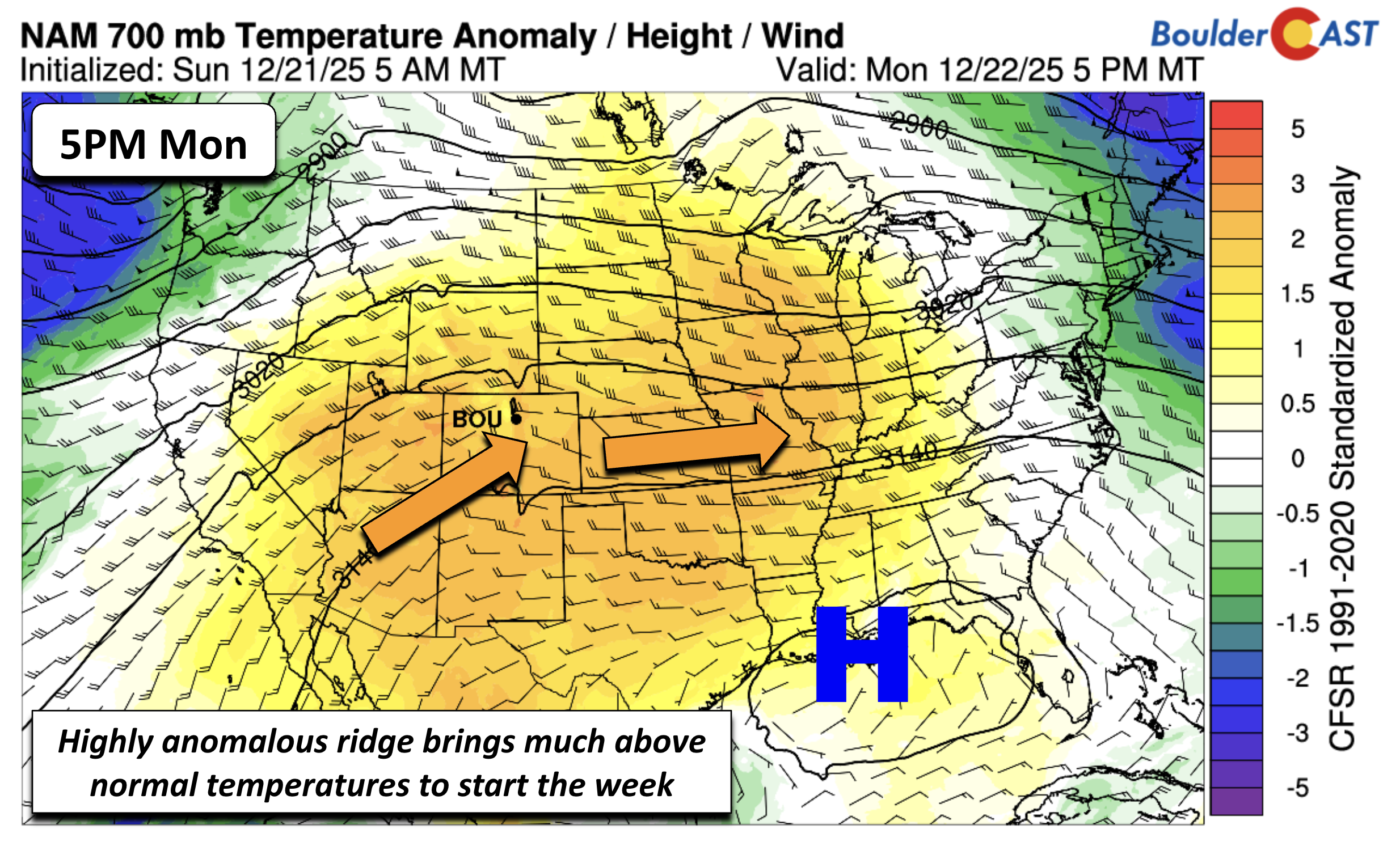
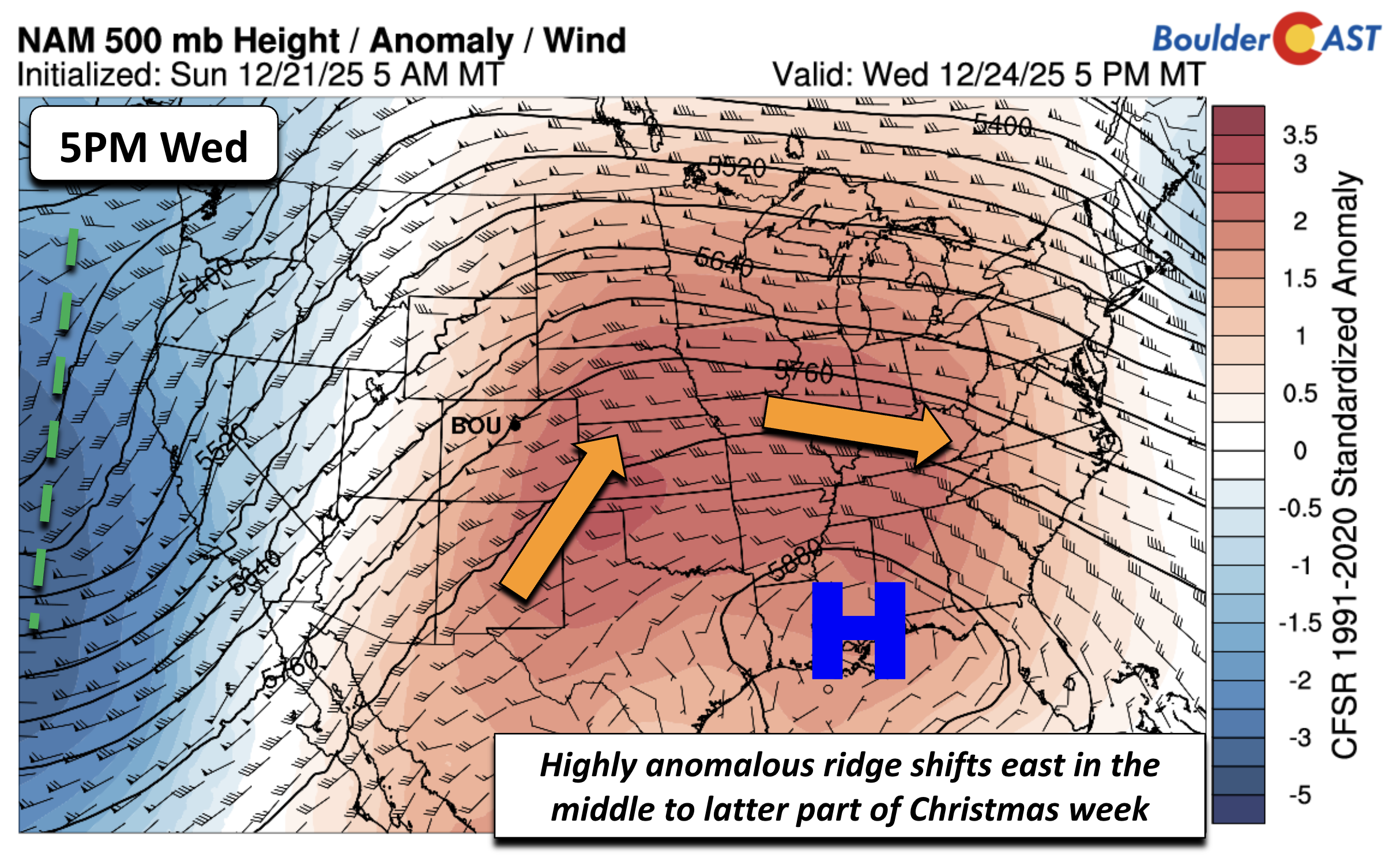
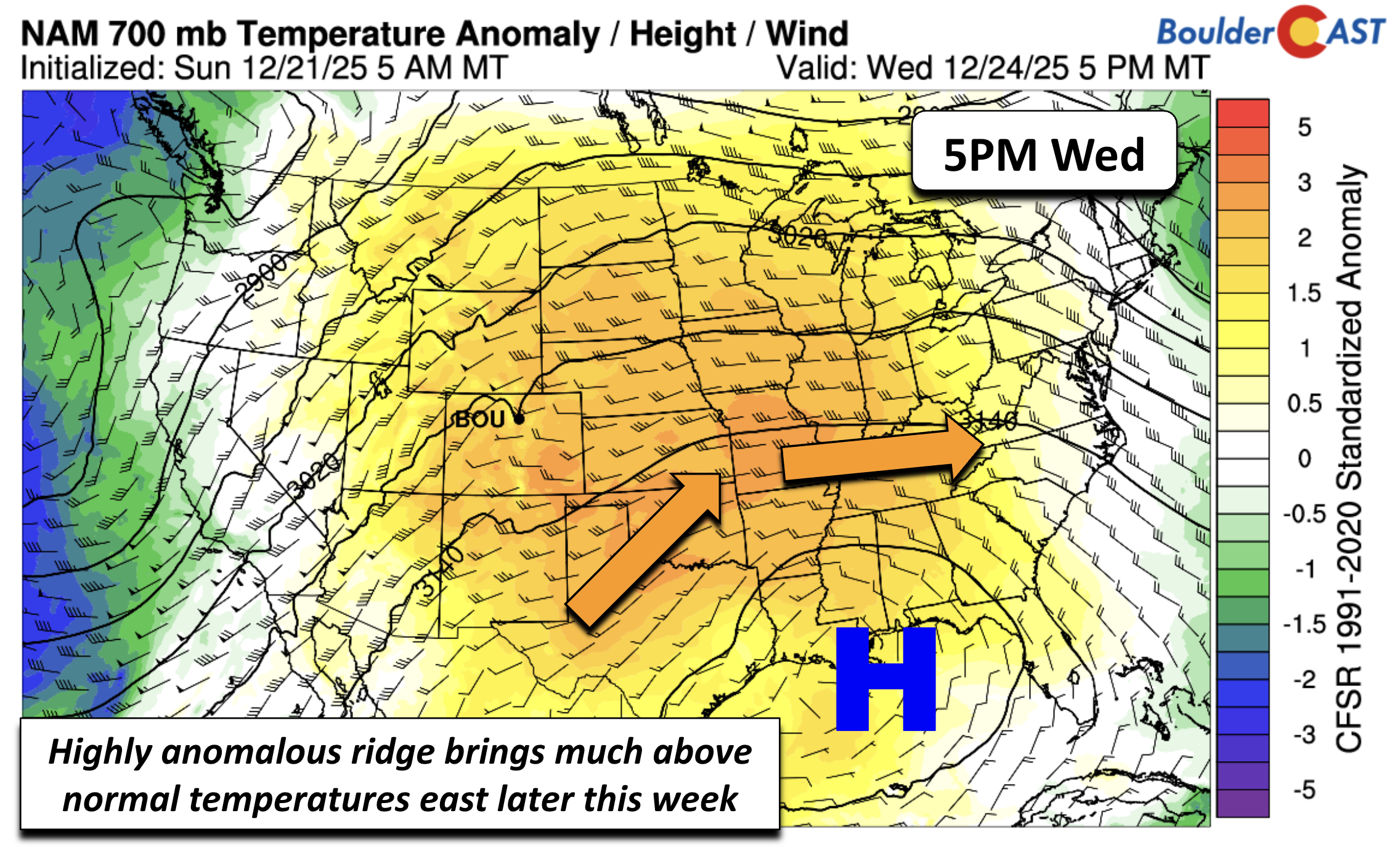
The culprit is a highly anomalous ridge of high pressure parked over the southern Plains into the lower Mississippi Valley and it’s a big one indeed! This ridge is spreading helps of mild air across most of the country heading into the holidays, and here at home it’s strong enough to put some of our December temperature records at risk.
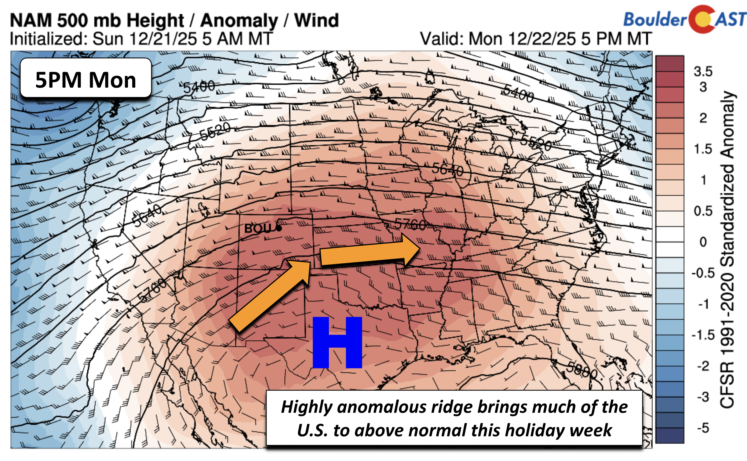
Low‑level temperature anomaly map tells the story clearly: a broad swath of above‑normal warmth stretches from Mexico all the way into the northern Plains and upper Midwest. For Monday in Boulder and Denver, highs will easily push into the lower 70s.
Fire Weather Concerns Monday
We’re keeping an eye on the wind Monday, but for now it looks like the strongest gusts will stay west of the Boulder‑Denver corridor. The Foothills well west of town could see 45–70 MPH gusts, while Boulder itself may see 20–35 MPH breezes. Denver should stay closer to 25 MPH or less.
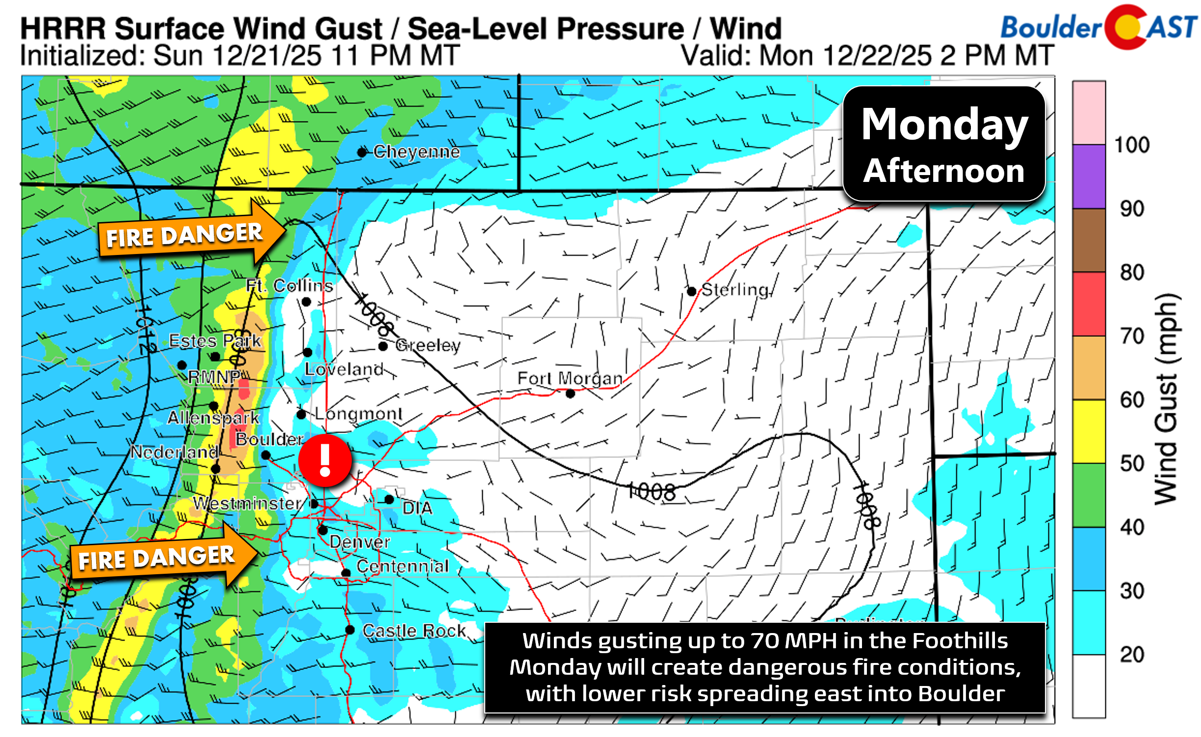
Red Flag Warnings are active from 8 AM to 5 PM Monday for the western Metro and Foothills where gusty winds—sporadic in the lowlands, persistent in the higher terrain—will overlap with critically low humidity. Monday’s setup is nowhere near the “Particularly Dangerous” conditions we dealt with on Friday, but it still warrants caution. Any spark in the Foothills could spread quickly.
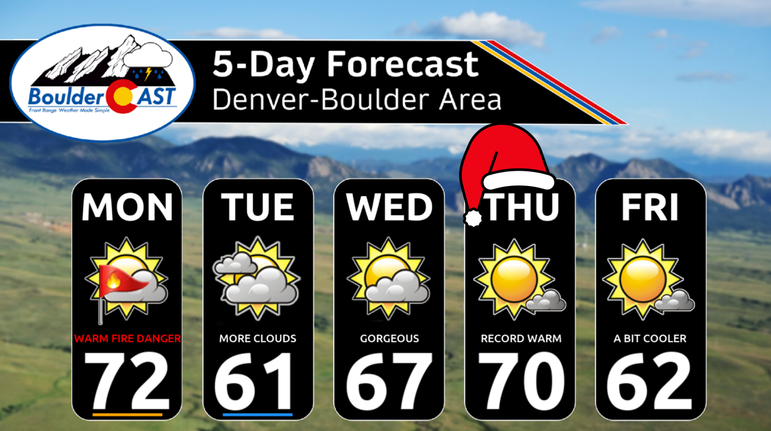
Warmth and Records Abound
Highs this week will live in the 60s and even low 70s at times. Boulder’s record high for Monday is 71° (set in 1933), and that’s within reach. Christmas Day’s record of 68° (2005) is also in jeopardy.
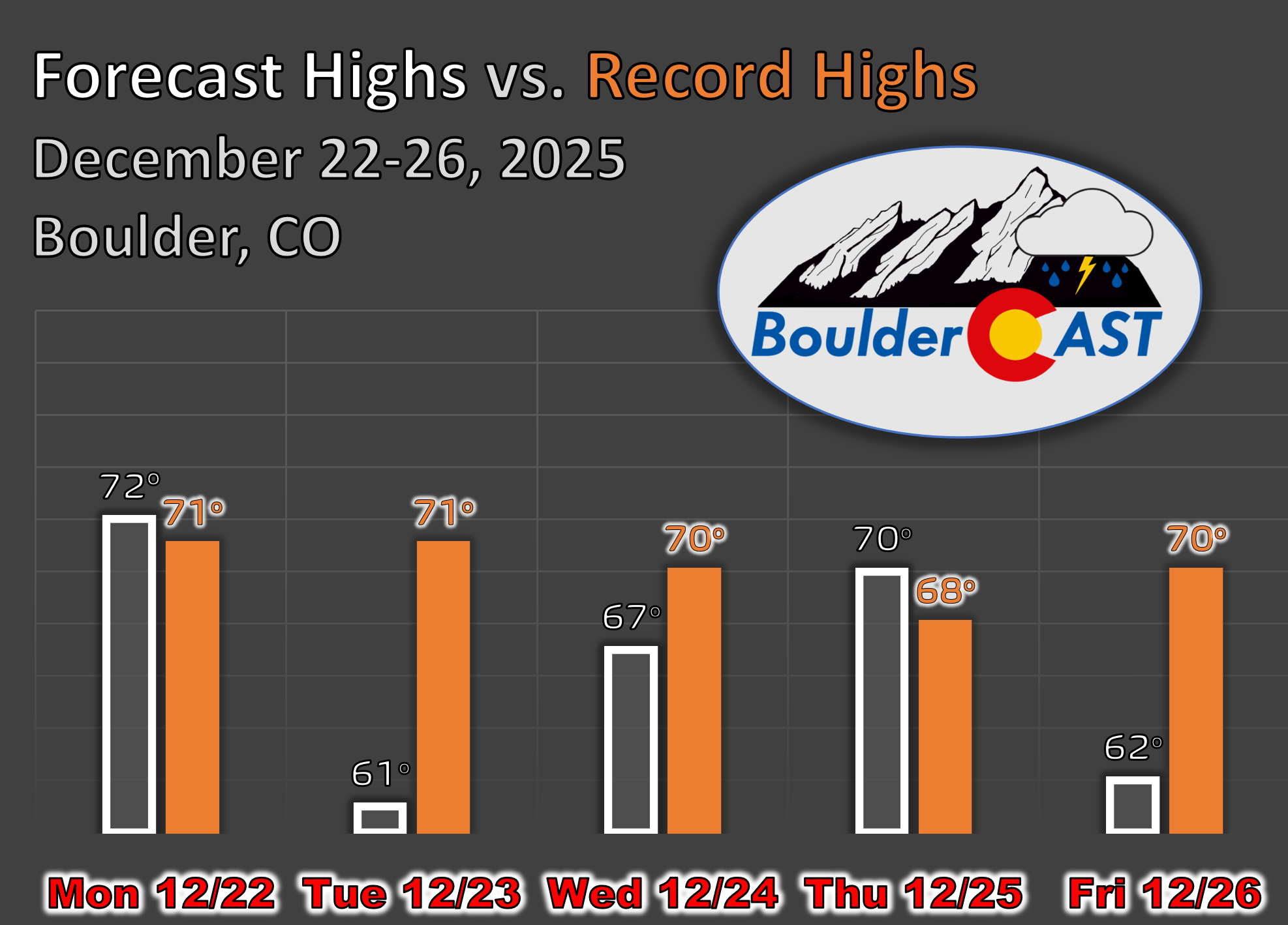
Tuesday brings a wind shift—not a true cold front—from a passing surface trough. That will knock temperatures back slightly into the low and mid‑60s, but still well above average. A more meaningful cooldown doesn’t arrive until Friday or the weekend as the ridge finally slides east toward the northern Gulf of Mexico.
By midweek, the warmth expands from the Four Corners all the way to the Mid‑Atlantic and Deep South.
And yes, it’s looking like a warm, brown Christmas with zero percent chance of snow—both on the ground and falling during the day. Highs should top out in the upper 60s to maybe 70 once again—right in the ballpark of the record highs for the date.
Late‑Week Pattern Change and Mountain Snow
A deeper trough digs into the Four Corners late Friday into the weekend. Details are still fuzzy, but it could bring a more unsettled stretch with at least a chance of rain or snow in the Metro area. At minimum, it should knock temperatures back toward seasonal norms.
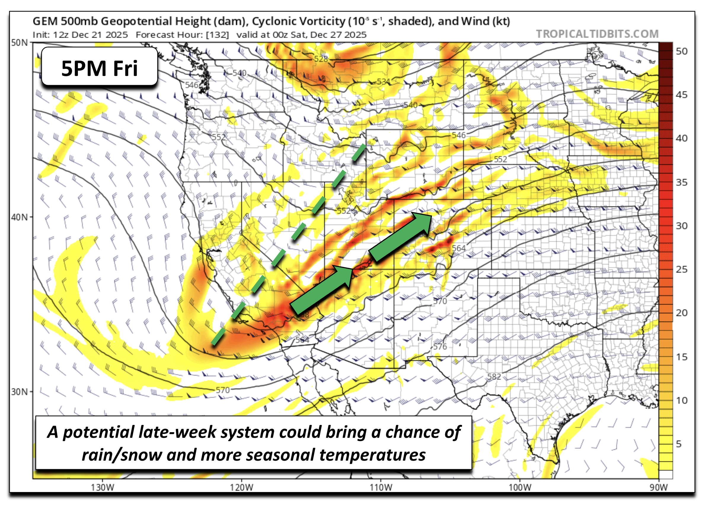
If you’re hoping for a white Christmas, you’ll need to head into the high country. A strong Pacific system bringing flooding rains and heavy Sierra snow midweek will shift east Wednesday and Christmas Day. That moisture slams into Colorado’s western and southwestern slopes Thursday and Friday, delivering healthy snowfall to the higher peaks.
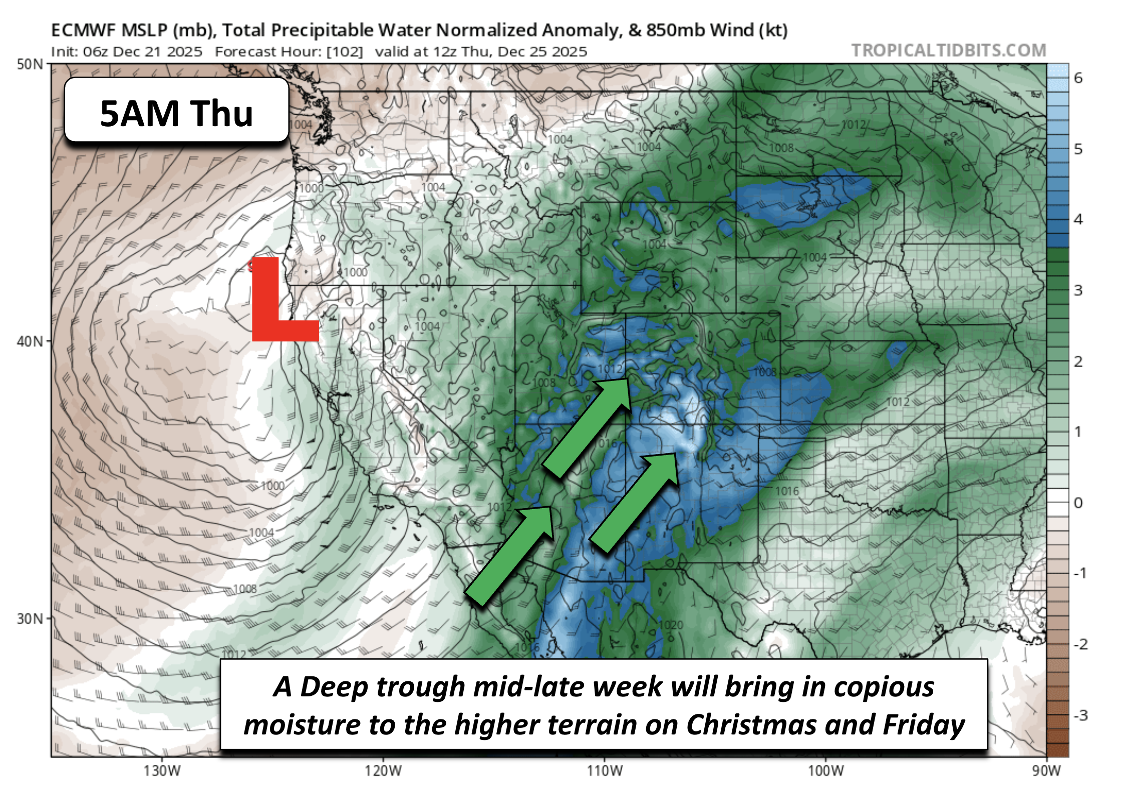
The GFS paints a swath of accumulating snow along and west of the Divide through Friday night.
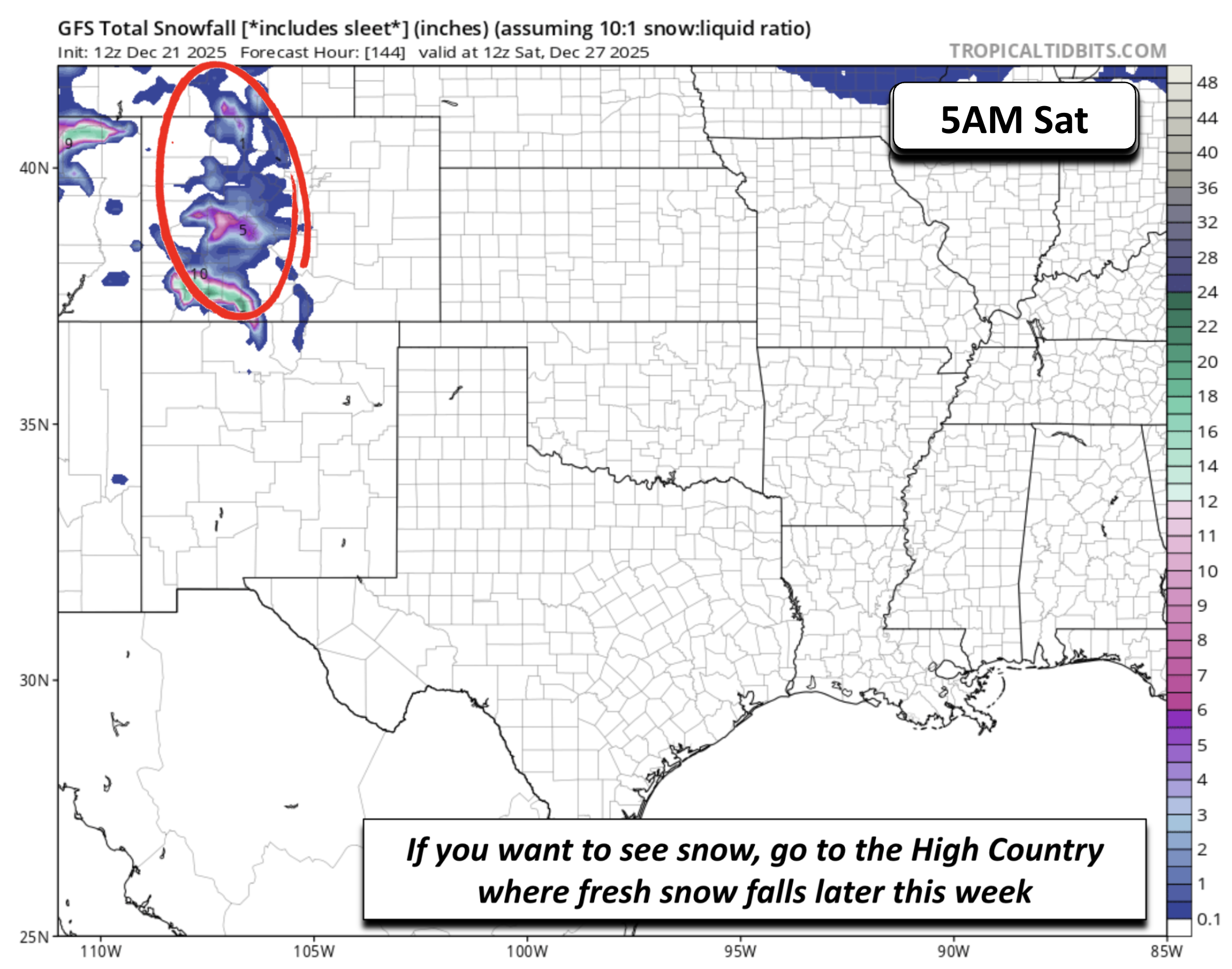
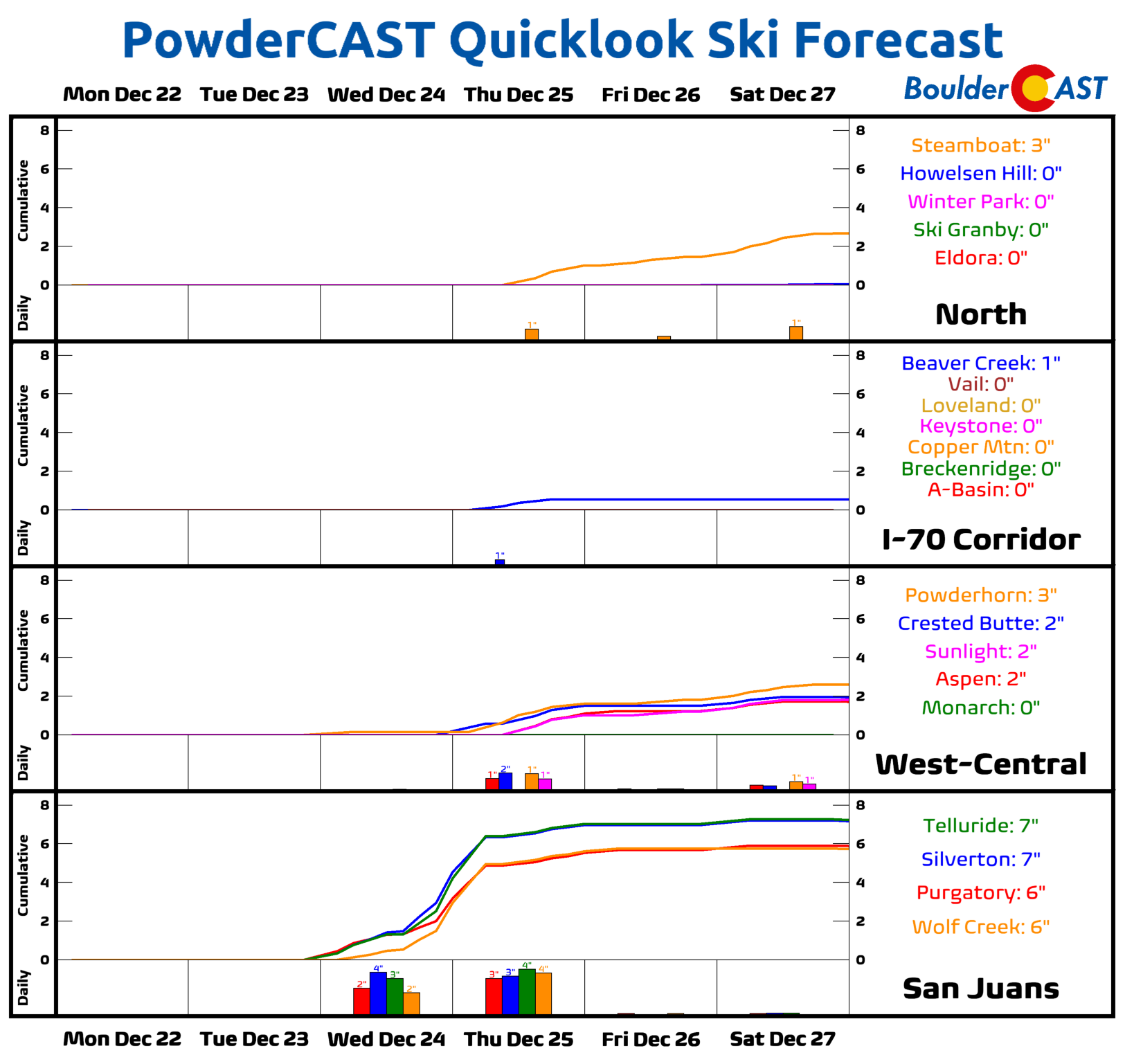
PowderCAST is also highlighting several inches for the San Juans and west‑central mountains—welcome news for skiers after a rough start to the season.
You certainly won’t have the chance to see any snowflakes in the Boulder-Denver area this week. You’ll need to head west and up in elevation for any hopes of that. In fact, we won’t even have below freezing temperatures, even during the overnight periods.
There’s no real change in sight either. Even next week looks like a repeat of this one, albeit likely not as warm. We’ll continue to see limited chances for precipitation and elevated fire danger anytime those La Niña-infused downslope winds return. We’re stuck in a troubling pattern right now in the Front Range, with no hope for any real changes until sometime in January at best.
From all of us at BoulderCAST,
we wish you a Happy Holidays!
![]()
Forecast Specifics:
Monday: Partly to mostly sunny and warm with highs in the lower 70s for the Plains and upper 50s in the Foothills. Gusts up to 30 MPH in Boulder and 60 MPH in the Foothills creating dangerous fire weather conditions during the day.
Tuesday: Partly to mostly cloudy a touch cooler but still mild in the lower 60s on the Plains and lower 50s in the Foothills.
Wednesday and Christmas Day: Partly sunny and warm with upper 60s to lower 70s on the Plains and upper 50s in the Foothills.
Friday: Increasing clouds with highs in the upper 50s to low 60s on the Plains and upper 40s in the Foothills.
Weekend: The pattern favors a trend to more seasonal temperatures (40s), along with a very low-end rain/snow chance sometime over the weekend.
DISCLAIMER: This weekly outlook forecast is created Monday morning and covers the entire upcoming week. Accuracy will decrease as the week progresses as this post is NOT updated. To receive daily updated forecasts from our team, among many other perks, subscribe to BoulderCAST Premium.

Help support our team of Front Range meteorologists by joining BoulderCAST Premium. Get the most accurate Boulder and Denver weather forecasts delivered to your inbox every single day plus much much more…

Enjoy our content? Give it a share!


You must be logged in to post a comment.