This week brings a stretch of unseasonably warm and quiet mid-November weather across the Front Range, with highs holding in the upper 60s to low 70s through Friday. However, a stronger cold front arrives in time for the weekend and it could finally deliver a shot of snow. Models remain split on the system’s track, leaving the Metro area with only modest odds to see accumulating snow, while the Mountains look primed for several inches. With records for Boulder’s latest first snowfall and longest snow‑free streak hanging in the balance, this is a setup worth watching as the week unfolds.
This week’s highlights include:
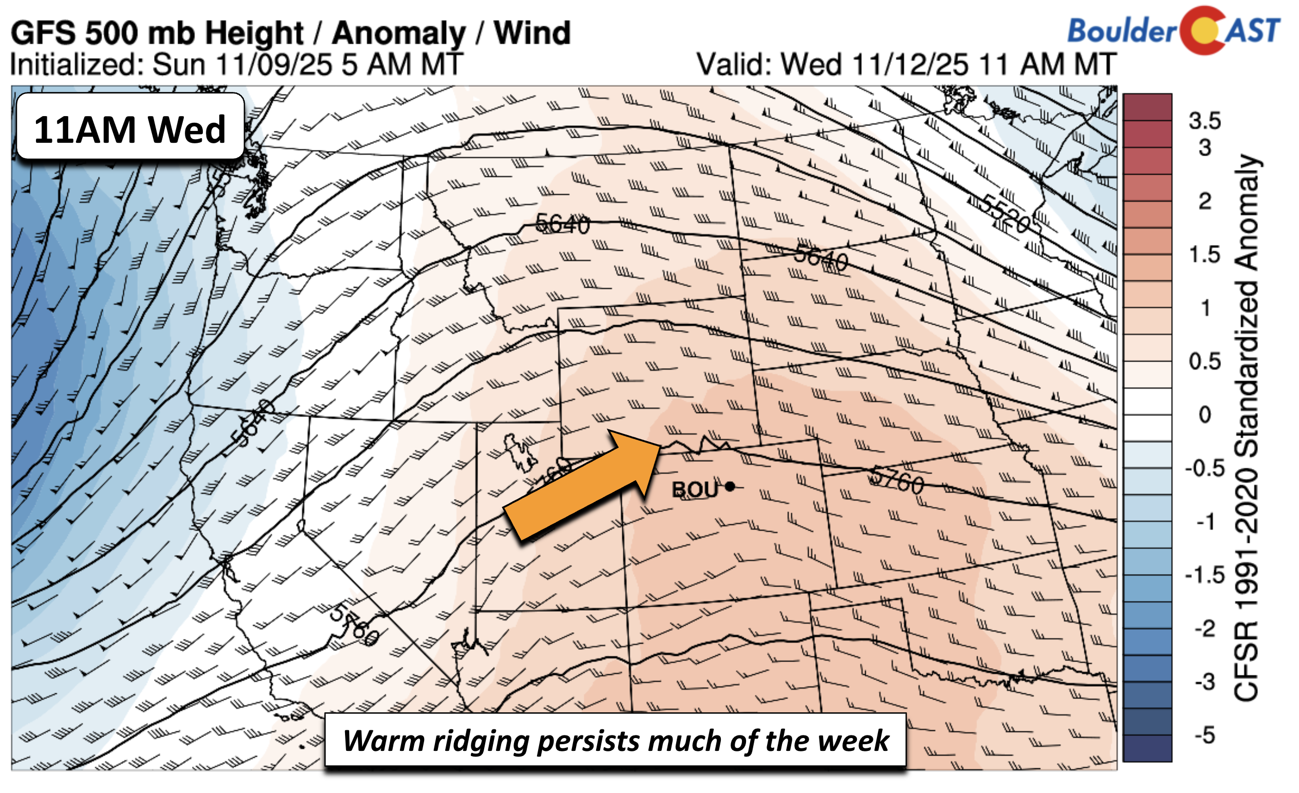
- Eastern Trough, Western Ridge: Freezing temps and snow in the Appalachians, while Colorado stays under warm high pressure ridging.
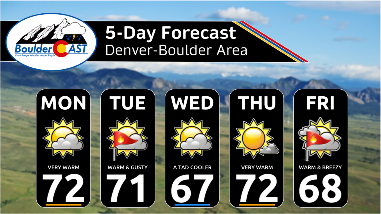
- Warm All Week Long Quiet, unseasonably warm conditions with highs 15° above average, reaching the upper 60s to low 70s every day through Friday.
- Tuesday Fire Danger: Gusty west-northwest winds up to 25 MPH possible across the Plains. Fire danger will be elevated with near-record highs.
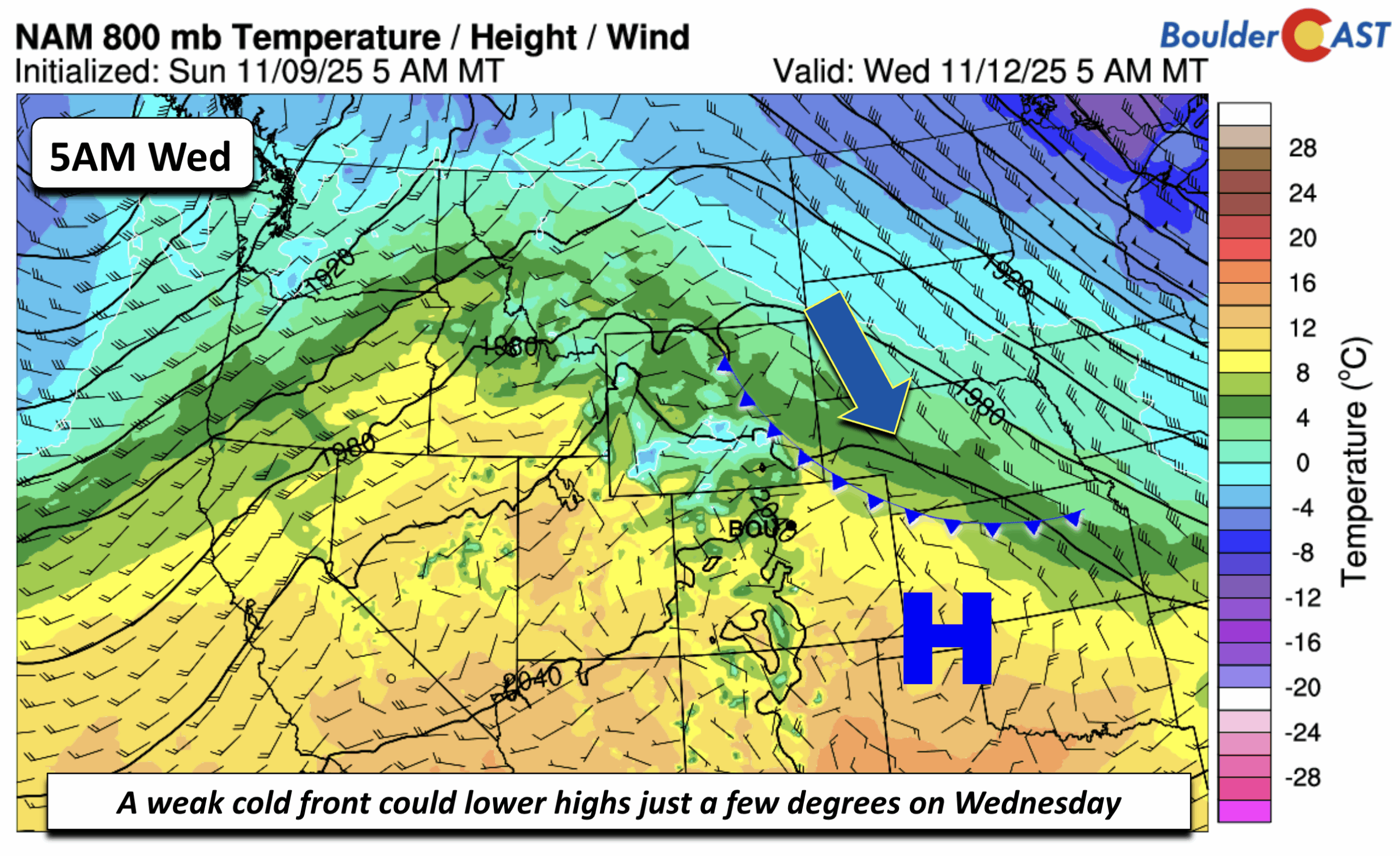
- Midweek Front: Weak cold front early Wednesday may lower highs slightly, but temperatures remain well above normal.
- Late-Week Cool Down: Stronger cold front Friday–Saturday drops highs to seasonal norms in the 40s–50s, tied to an upper trough.
- Snow Chances Uncertain for the Weekend: A vigorous trough will impact Colorado during the upcoming weekend, but any snow chances east of the Mountain are still uncertain.
DISCLAIMER: This weekly outlook forecast is created Monday morning and covers the entire upcoming week. Accuracy will decrease as the week progresses as this post is NOT updated. To receive daily updated forecasts from our team, among many other perks, subscribe to BoulderCAST Premium.

Go Premium, get all the perks.
Daily Forecast Updates
Get our daily forecast discussion every morning delivered to your inbox.
All Our Model Data
Access to all our Colorado-centric high-resolution weather model graphics. Seriously — every one!
Ski & Hiking Forecasts
6-day forecasts for all the Colorado ski resorts, plus more than 120 hiking trails, including every 14er.
Smoke Forecasts
Wildfire smoke concentration predictions up to 72 hours into the future.
Exclusive Content
Weekend outlooks every Thursday, bonus storm updates, historical data and much more!
No Advertisements
Enjoy ad-free viewing on the entire site.
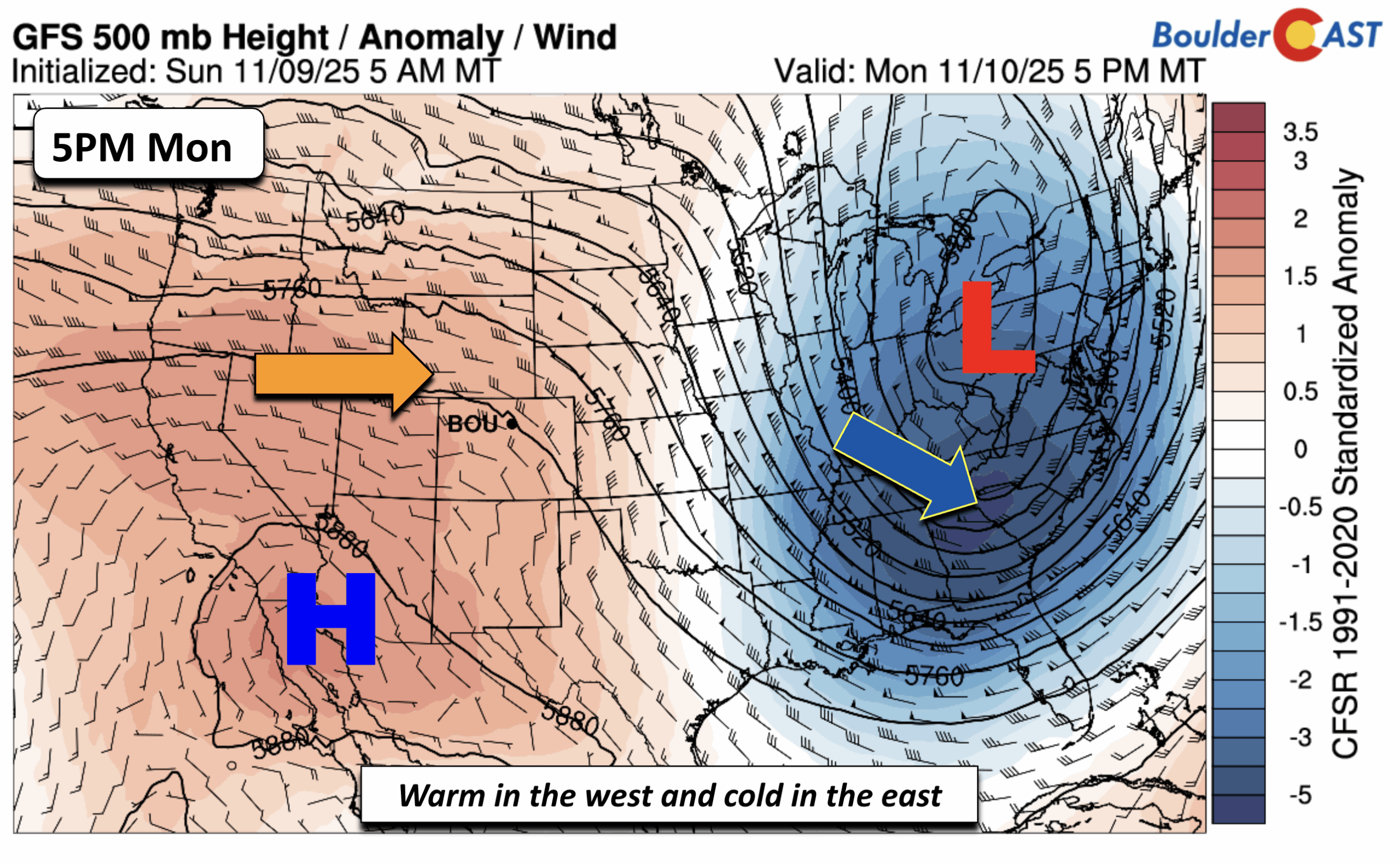
Warmth galore for much of the week
To start the week, the big-picture pattern features a deep trough over the eastern U.S. That setup will bring freezing temperatures and even some snow to the higher terrain of the Appalachians. Out west, including Colorado and the West Coast, high pressure ridging dominates—meaning warm, stable conditions. Here along the Front Range, highs will run about 15° above average. Normally we’d expect mid-50s this time of year, but instead we’ll be enjoying upper 60s to low 70s. Perfect weather for getting outside before or after work.
Tuesday could bring some gusty winds as a west-northwest flow brushes the Plains. Gusts up to 25 MPH are possible leading to elevated fire danger.
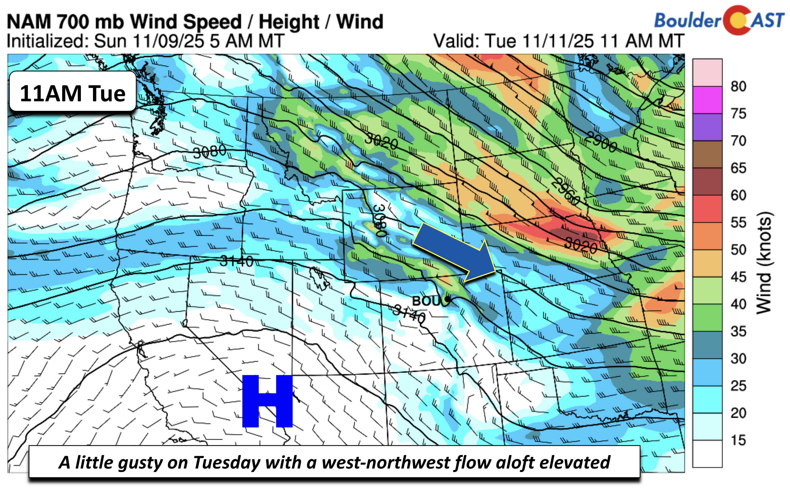
Those winds are tied to a weak cold front sliding south early Wednesday. That front may knock highs down slightly, but guidance suggests it will lift north and east during the day, so we’ll stay well above normal regardless. This may end up being a Denver Cyclone day with cooler readings towards Boulder (low 60s) and warmer ones south/east of Denver (low 70s).
From Wednesday through Friday, high pressure takes back control. Expect continued warmth, occasional mid- and high-level clouds, and no threat of rain or snow.
You can see from the GEFS temperature forecast that there will be only subtle shifts in the highs this week over the Denver Metro, largely hovering in the upper 60s to low 70s. By late Friday into Saturday, a stronger cold front arrives. That will drop highs back closer to seasonal norms—think 40s and 50s. More importantly, this front is tied to a vigorous upper-level trough, one which could finally bring us a shot at snowflakes.
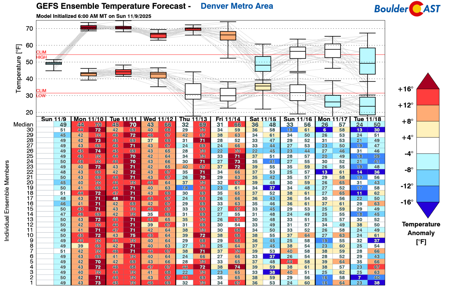
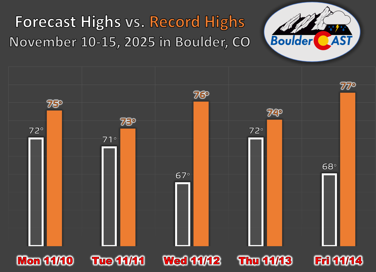
While this week will be unseasonably warm, record highs aren’t currently in the forecast. Still, Boulder will be within a few degrees of records Monday, Tuesday, and Thursday.
Weekend Snow Watch
That late-week cold front will be connected to what guidance is showing as a rather vigorous upper-level trough. Models are split on how this system evolves which will have big implications on whether we will see snow across the Boulder-Denver area:
- A west-to-east track would favor downslope winds, limiting snow chances for the Boulder-Denver area.
- A more southerly track could set up upslope flow, which is much more favorable for snow all along the Front Range.
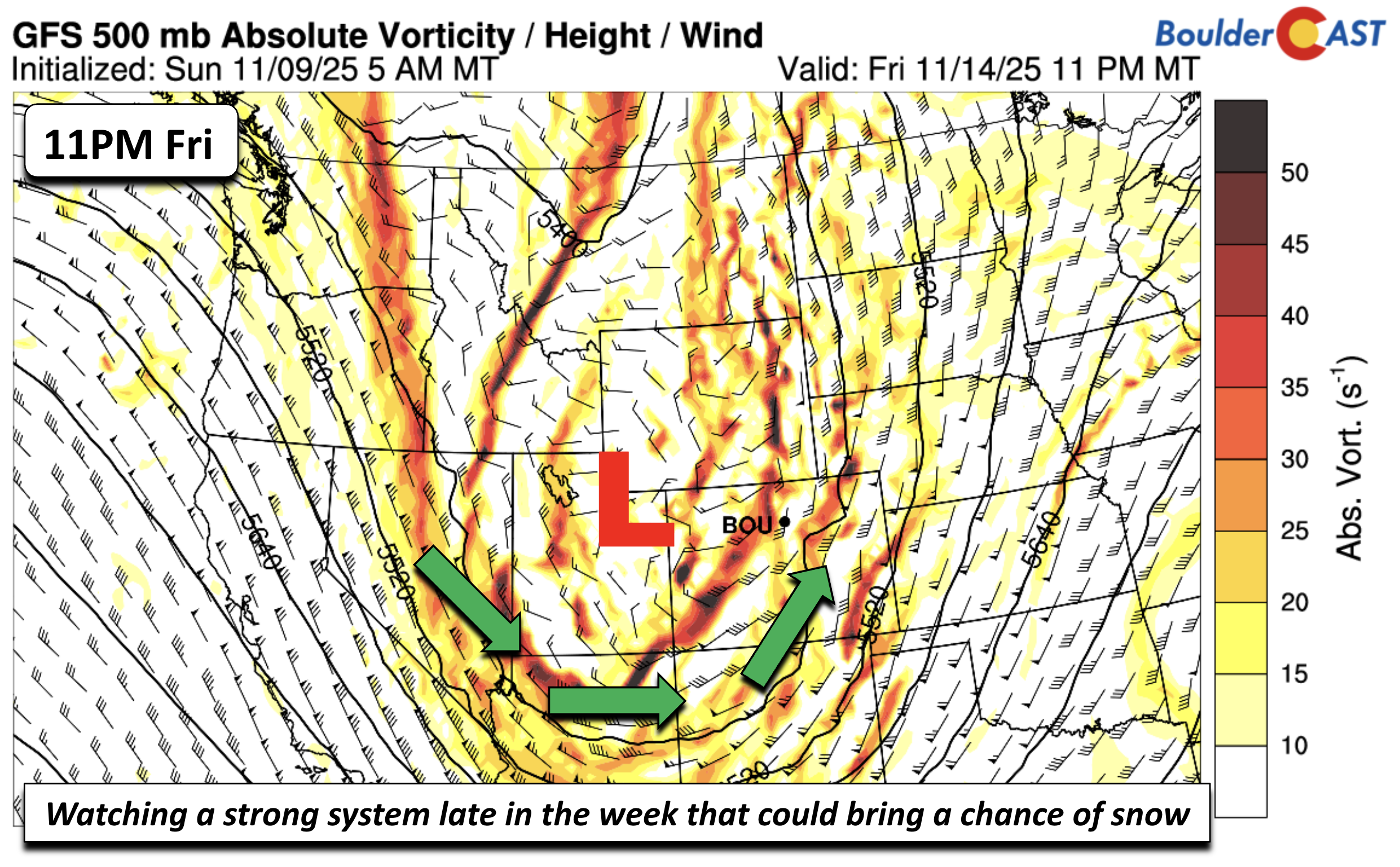
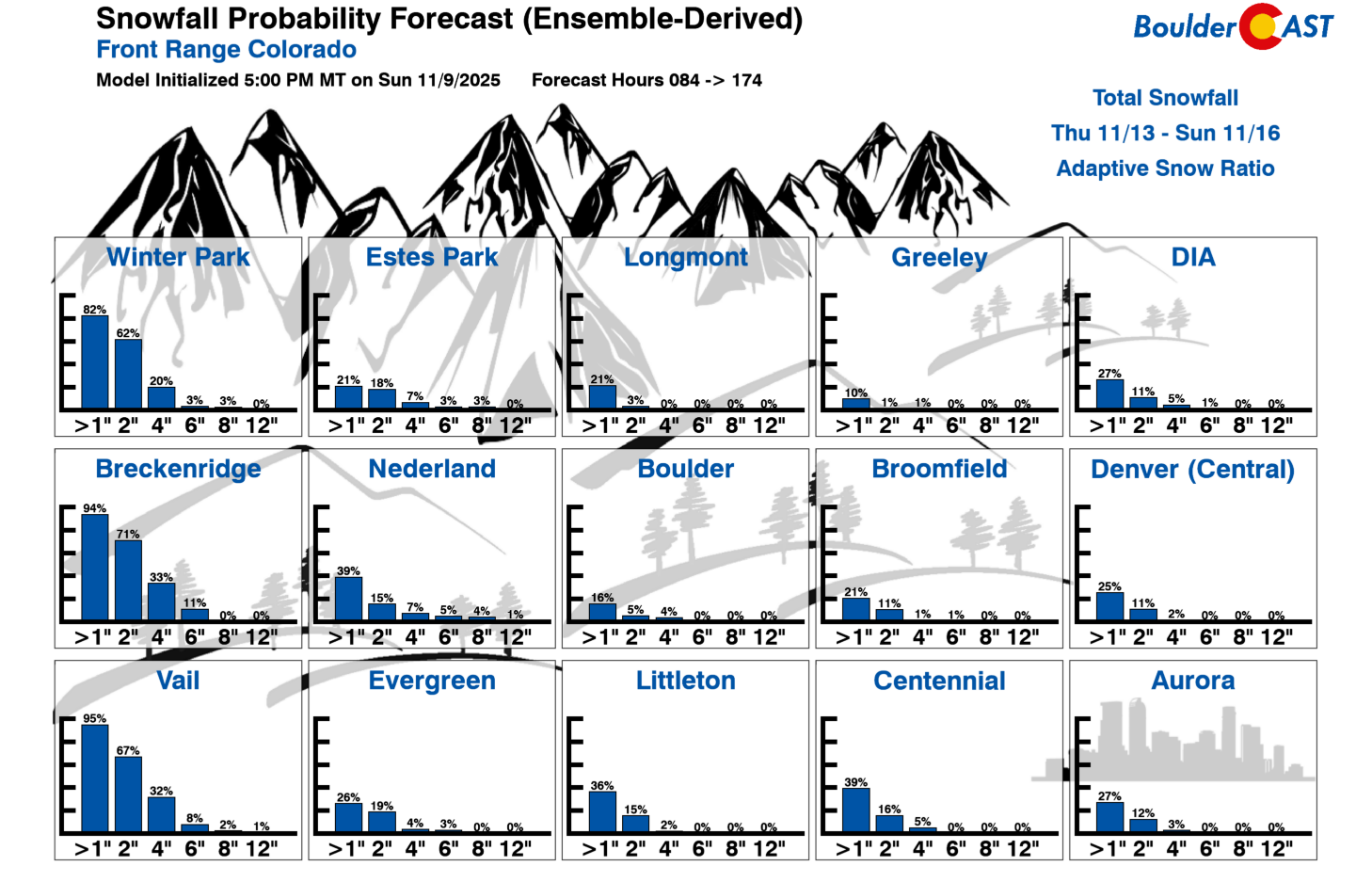
At this point, the GFS and European ensembles both suggests widespread accumulating snow in the Mountains over the weekend (roughly 3-7″ up there) — the occurrence of snow up there is an easy forecast. However, the situation across the lower elevations east of the Continental Divide is less clear, with our eventual outcome more closely tied to how the uncertain trough will evolve.
More than a third of ensemble members have light snow in Boulder and Denver this upcoming weekend, sometime between Friday night and Sunday, but generally less than 1″ of potential accumulation is indicated in most of those cases. That leaves a 60%+ chance of not seeing any snow down in the Metro area.
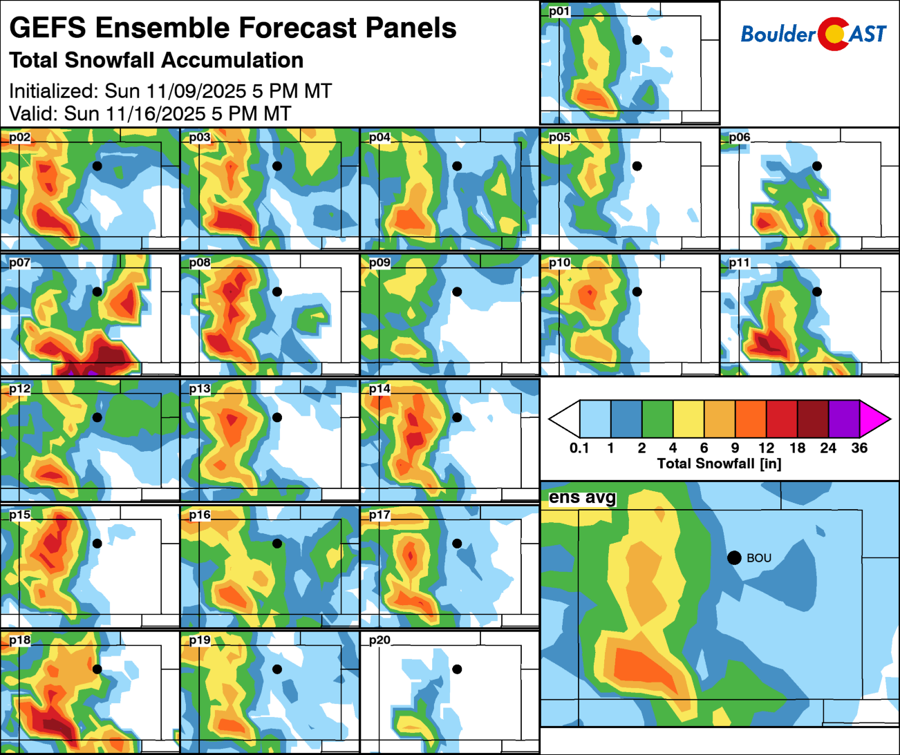
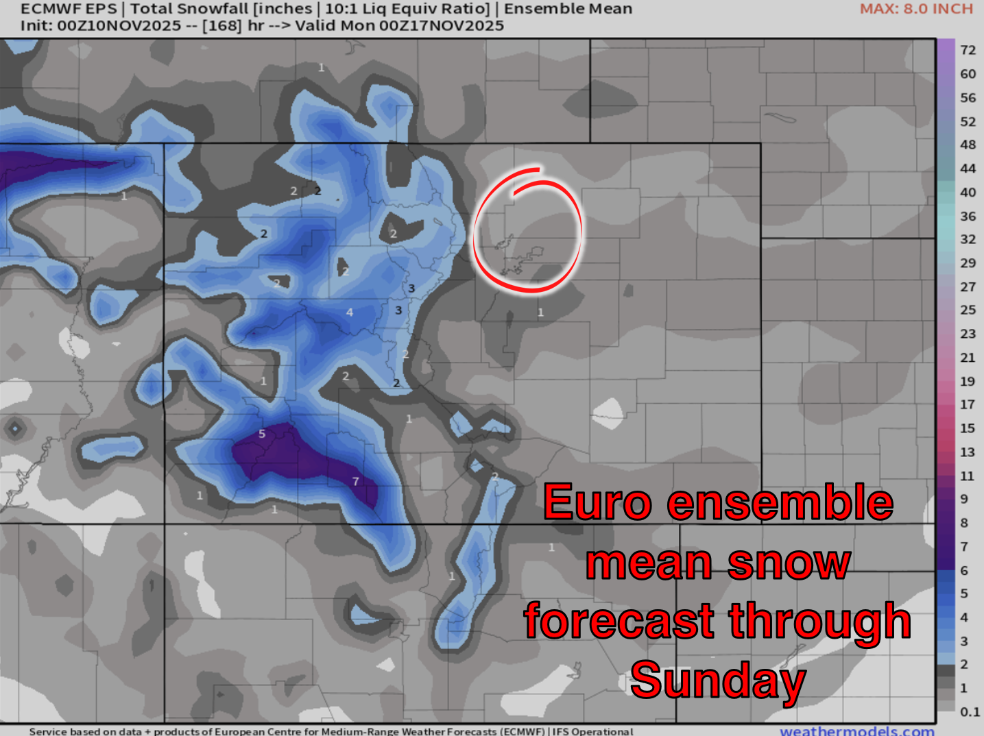
Our Snowfall Probability Charts currently show about a 10–30% chance for an inch or so in the Metro area. Not a strong signal for ending our snow drought, but worth watching as the week unfolds.
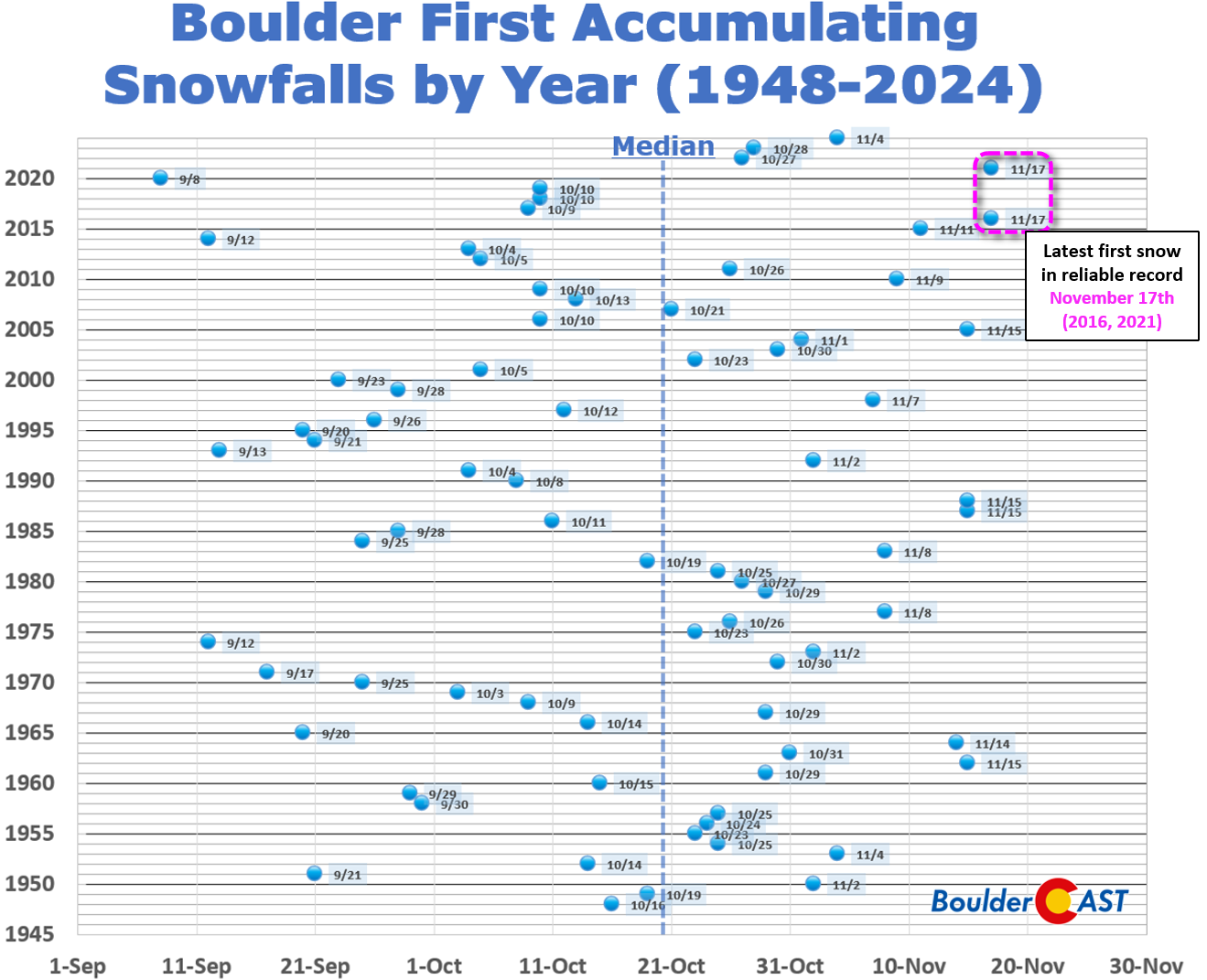
This is especially true considering that Boulder is closing in on a few records, including our latest first snowfall (November 17th using reliable data):
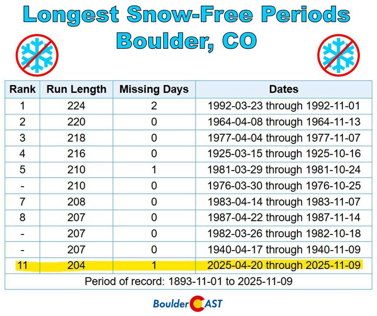
And our longest stretch of days without any snow (currently at 204, record is 224):
Bottom Line
Enjoy the lingering warmth this week—it’s rare to have this kind of stretch in mid-November. And stay tuned for updates as we track the slim but intriguing chance for snowflakes by the weekend.
Forecast Specifics:
Monday through Thursday: A mixture of clouds and sunshine with highs generally in the upper 60s to low 70s on the Plains and upper 50s to near 60 in the Foothills. Gusty winds are possible Tuesday around 25 MPH which will lead to elevated fire danger.
Friday: Increasing clouds with a chance of rain/snow showers developing Friday night. Highs in the mid to upper 60s on the Plains and low 50s in the Foothills. Friday may also have increased fire risk alongside some breezes.
Weekend: Likely trending closer to average or below normal for highs, along with a slight chance of rain/snow showers at some point over the weekend.
DISCLAIMER: This weekly outlook forecast is created Monday morning and covers the entire upcoming week. Accuracy will decrease as the week progresses as this post is NOT updated. To receive daily updated forecasts from our team, among many other perks, subscribe to BoulderCAST Premium.
Go Premium, get all the perks.
Daily Forecast Updates
Get our daily forecast discussion every morning delivered to your inbox.
All Our Model Data
Access to all our Colorado-centric high-resolution weather model graphics. Seriously — every one!
Ski & Hiking Forecasts
6-day forecasts for all the Colorado ski resorts, plus more than 120 hiking trails, including every 14er.
Smoke Forecasts
Wildfire smoke concentration predictions up to 72 hours into the future.
Exclusive Content
Weekend outlooks every Thursday, bonus storm updates, historical data and much more!
No Advertisements
Enjoy ad-free viewing on the entire site.
Enjoy our content? Give it a share!


You must be logged in to post a comment.