
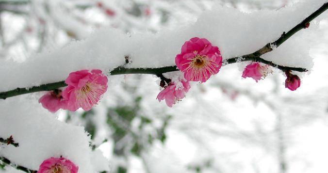
The sun is out Saturday morning and already working quickly to melt our most recent round of late-season snow in the Front Range. We briefly review the snowfall totals which greatly favored the western side of the Metro area including Boulder. We also tackle the question of whether this will be our final snowfall of the season or not.
As usual, west is best!
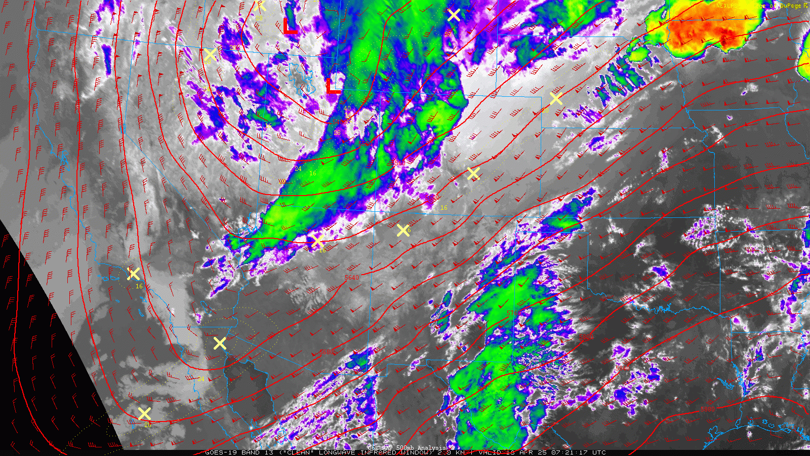
The storm system responsible for approximately 24 consecutive hours of snowflakes here in the Front Range dove straight southward across Utah on Friday, and now resides in eastern-central Arizona as of Saturday morning. The mid-level disturbance has been fighting the good fight to become a cut-off low the entire time, but still has not completed this transition and remains somewhat weakly organized right now to our southwest.
It’s no longer our concern at this point, though. The storm is too small and too far away to bring any additional impacts here, beyond the hefty helping of wet snow we’ve already received. As of Saturday morning, the sun is coming out and the melt is on!
In general, the forecast played out about as expected, with rain showers and thunderstorms Thursday evening quickly transitioning to snow before midnight. Snow then continued almost non-stop all the way into late Friday evening, totally up to 24 hours or more in some areas. High temperatures on Friday only reached the lower 30s, about as cold as it gets this time of year, but the April sun scattering through the thick clouds still worked to melt and compact much of the snow during the day. The fact that this snowstorm extended across an entire spring day allowed for some of the snow to melt off the vegetation in the middle of the event, surely saving some trees from a more disastrous outcome.
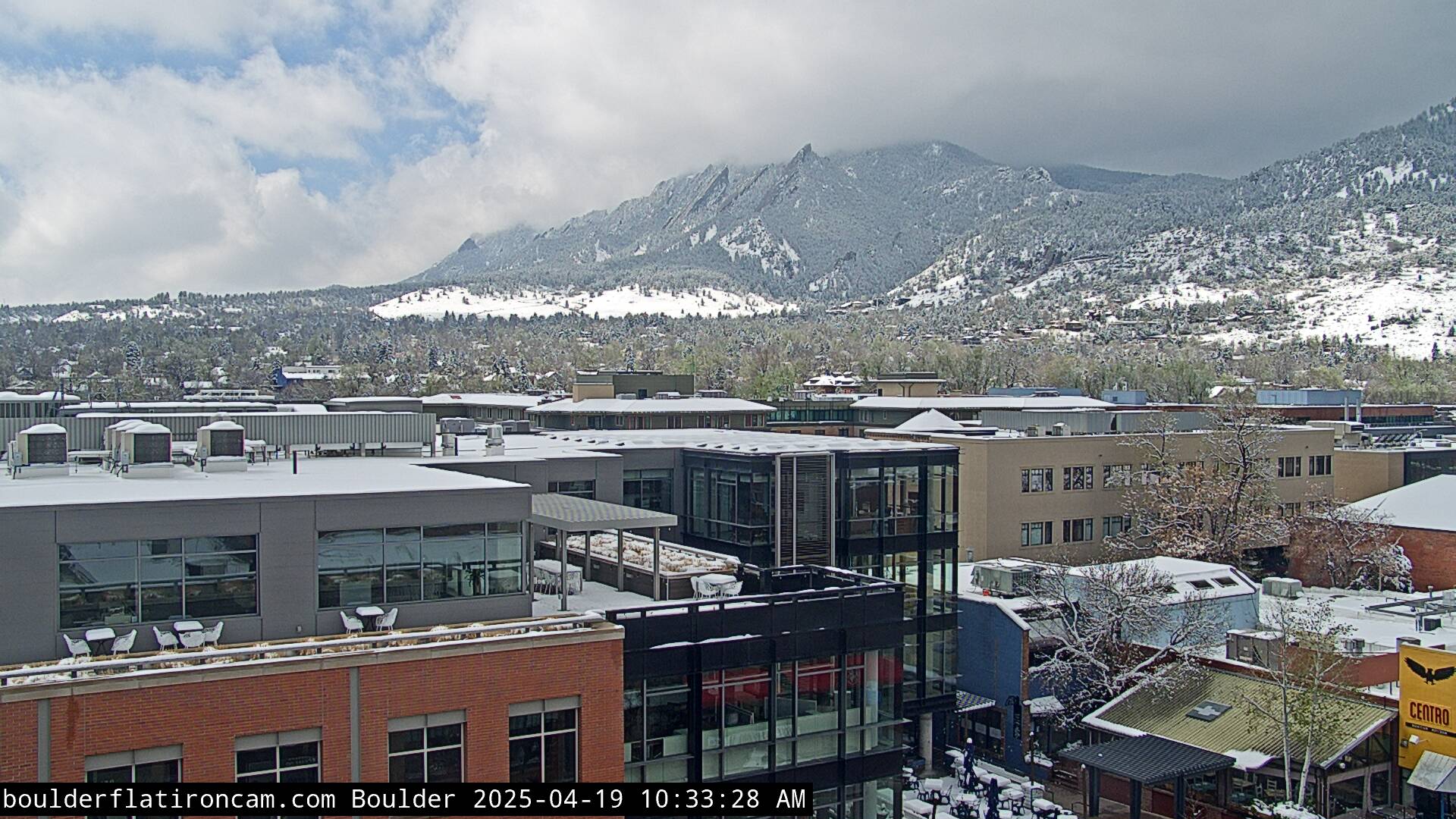
The view from CU Boulder Friday morning, only about half way into the storm.
Despite the many challenges with predicting snow this time of year, our prognostication turned out pretty good. The BoulderCAST snowfall forecast map issued Thursday morning is shown below with storm totals overlaid. Green values indicate our forecast verified, Yellow values mean the observed total was just outside our forecast, while Red was a busted forecast (more than 1″ off). The western suburbs piled up the most snow — anywhere from 3 to 8 inches. However, the eastern suburbs received much less, just a dusting to 2 inches fell east of Interstate 25. The Foothills received anywhere from 6 to 11 inches. The highest report we found was from Loveland Ski Resort at 15 inches!
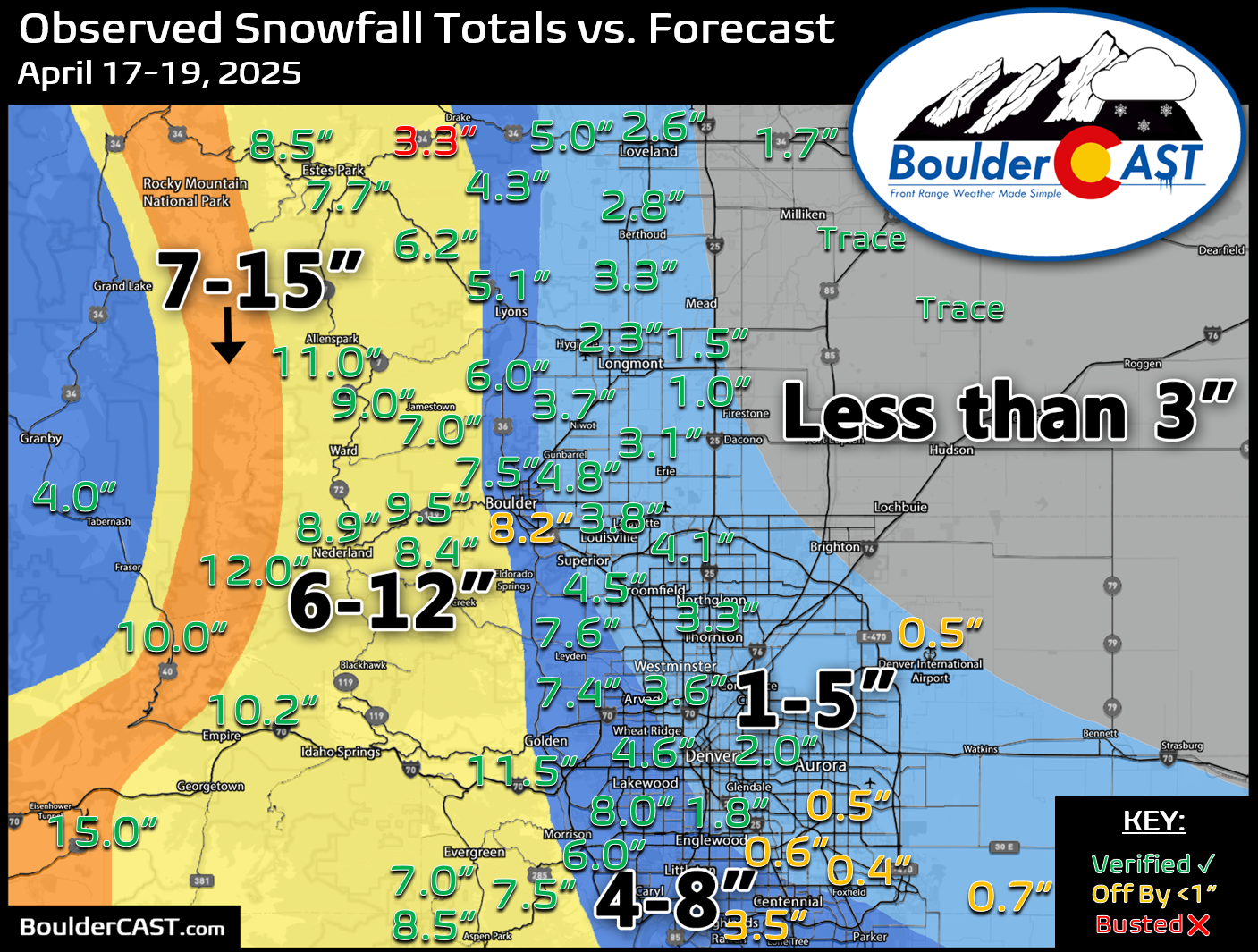
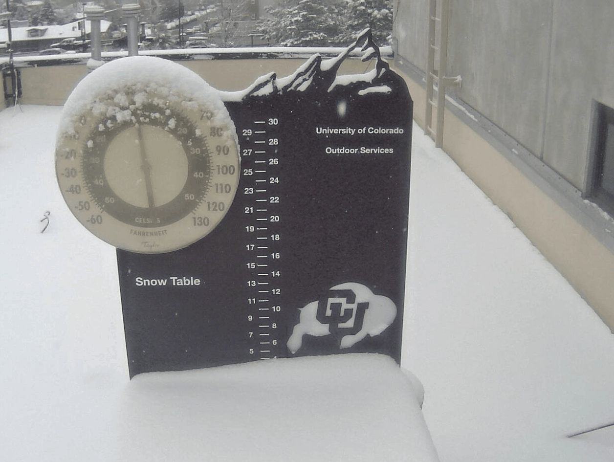
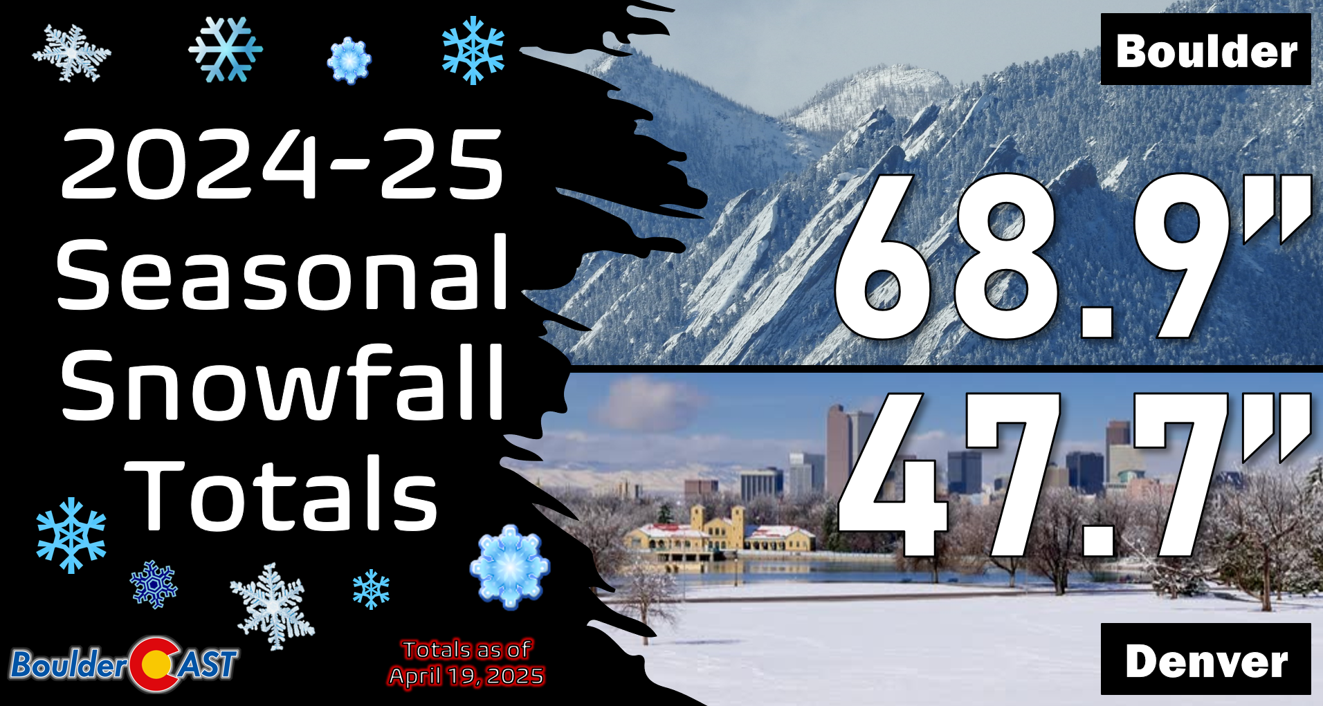
Officially, Boulder received 8.2″ of wet snow from the late-season storm, while Denver (DIA) recorded 0.5″. Seasonally Boulder has opened up a nearly two-foot lead over Denver, but both cities remain below normal season-to-date.
You can find a recap of all the winter storms so far in the 2024-2025 snow season HERE.
Will there be any more snow?
This is the million dollar question that we’ve been asked numerous times the last few days — will there be any more snow this spring? Let’s first tackle this ponderance with historical data. The chart below shows the date of Boulder’s last measurable snowfall for each year dating back to 1950 (blue snowflake icons). By measurable, we mean that officially 0.1″ or more of snow was recorded. As is often the case late in the snow season, a few flakes mix in with rain, or flurries briefly fly, but never stick on the ground. These are instances where a trace of snow has occurred, but wasn’t measurable. Trace snow amounts are not included in this graph.
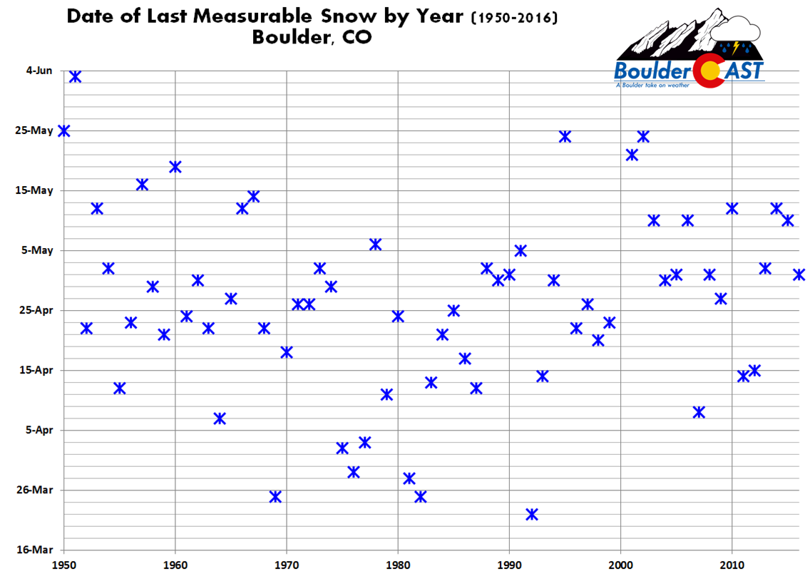
The date of Boulder’s last accumulating snowfall varies from mid-March to early June (yes, it has snowed in June before!). The median date is still about a week away on April 26th. The latest date ever, June 3rd, confirms for us that snow is still possible in Boulder for SEVEN more weeks!
The odds of our last measurable snowfall occurring on or before various dates are given below:
- April 3: 10%
- April 17th: 25%
- April 26th: 50%
- May 5th: 75%
- May 16th: 90%
Surely you are familiar with the basic “rule of thumb” that you shouldn’t plant a garden before Mother’s Day in Denver? This rule is mostly targeting towards our last frost or freeze of the season, but it roughly applies well to our last snowfall too. However, there’s historically still about a 15% chance of snow AFTER Mother’s Day. A more perfect rule would be Memorial Day, which assures greater than 95% odds that snow is over and done with here!
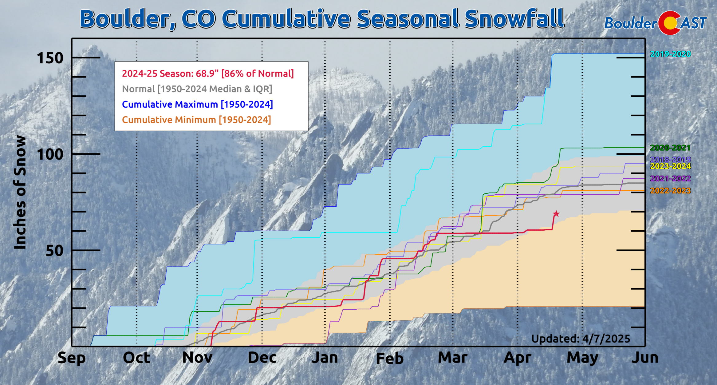
As you can see, there’s still a fairly high chance, at least according to climatology, that our final snowfall is still ahead of us…somewhere around 70% probability as of today (April 19th). This is promising news! Even considering the 8″ of slop that fell in Boulder with this most recent storm, we’re sitting at just 69″ of snow this season, about 10″ below normal.
As far as the actual snow outlook right now, we’re not seeing anything in the extended that would suggest snow is heading towards the Denver Metro area. There will be another storm moving in later in the upcoming week, but it won’t have nearly cold enough air to produce any snowflakes for us. It may end up being too warm for any snow in the Foothills even.
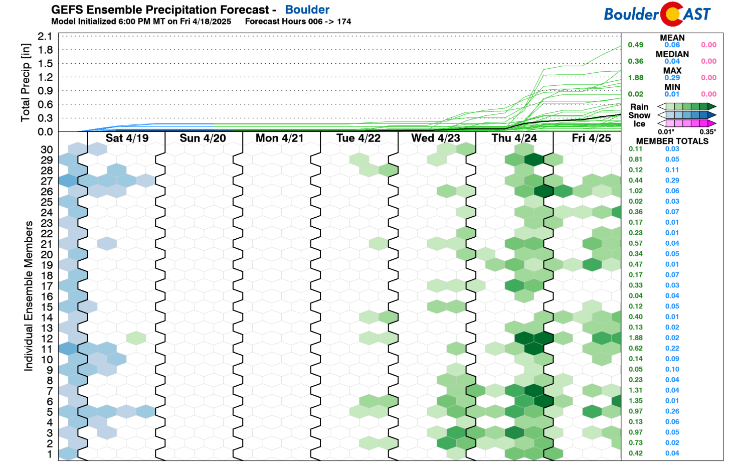
Beyond the next seven days, a warming pattern is expected to take us through the transition into early May, with a high probability for warmer than normal temperatures next week.
While this doesn’t fully rule out additional snow coming in the weeks ahead, this doesn’t make it very likely. Once we get into May the window for accumulating snow closes rapidly in the Boulder-Denver area, requiring a very strong storm system to pull down cold enough air from Canada for turn rain to snow here. We don’t see any signs of that happening in any ensembles or climate model offerings at this point. That said, we’d say the odds of receiving additional snowfall this season are lower than the 70% chance suggested by climatology, but we won’t fully rule out more snow for another few weeks.
We’ll be back on Monday with our usual weekly outlook. Enjoy the sunshine and warming temperatures the next few days — the blanket of white slop will be gone in no time at all!
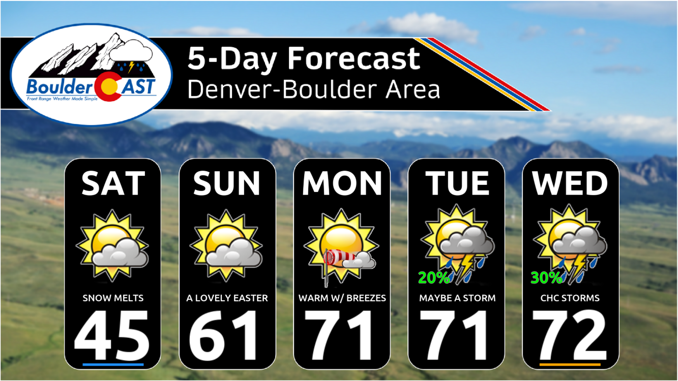
Happy Easter from the BoulderCAST team!
![]()
Get BoulderCAST updates delivered to your inbox:

Go Premium, get all the perks.
Daily Forecast Updates
Get our daily forecast discussion every morning delivered to your inbox.
All Our Model Data
Access to all our Colorado-centric high-resolution weather model graphics. Seriously — every one!
Ski & Hiking Forecasts
6-day forecasts for all the Colorado ski resorts, plus more than 120 hiking trails, including every 14er.
Smoke Forecasts
Wildfire smoke concentration predictions up to 72 hours into the future.
Exclusive Content
Weekend outlooks every Thursday, bonus storm updates, historical data and much more!
No Advertisements
Enjoy ad-free viewing on the entire site.
Enjoy our content? Help us out and give it a share:


You must be logged in to post a comment.