As we step into the first week of meteorological winter, the Front Range will feel like anything but. This week will feature pleasant weather thanks to a persistent and strong ridge along the West Coast. While the primary storm track remains off to the east, Colorado will enjoy above normal temperatures and dry conditions, day in and day out. Read on for all the details.
This week’s highlights include:
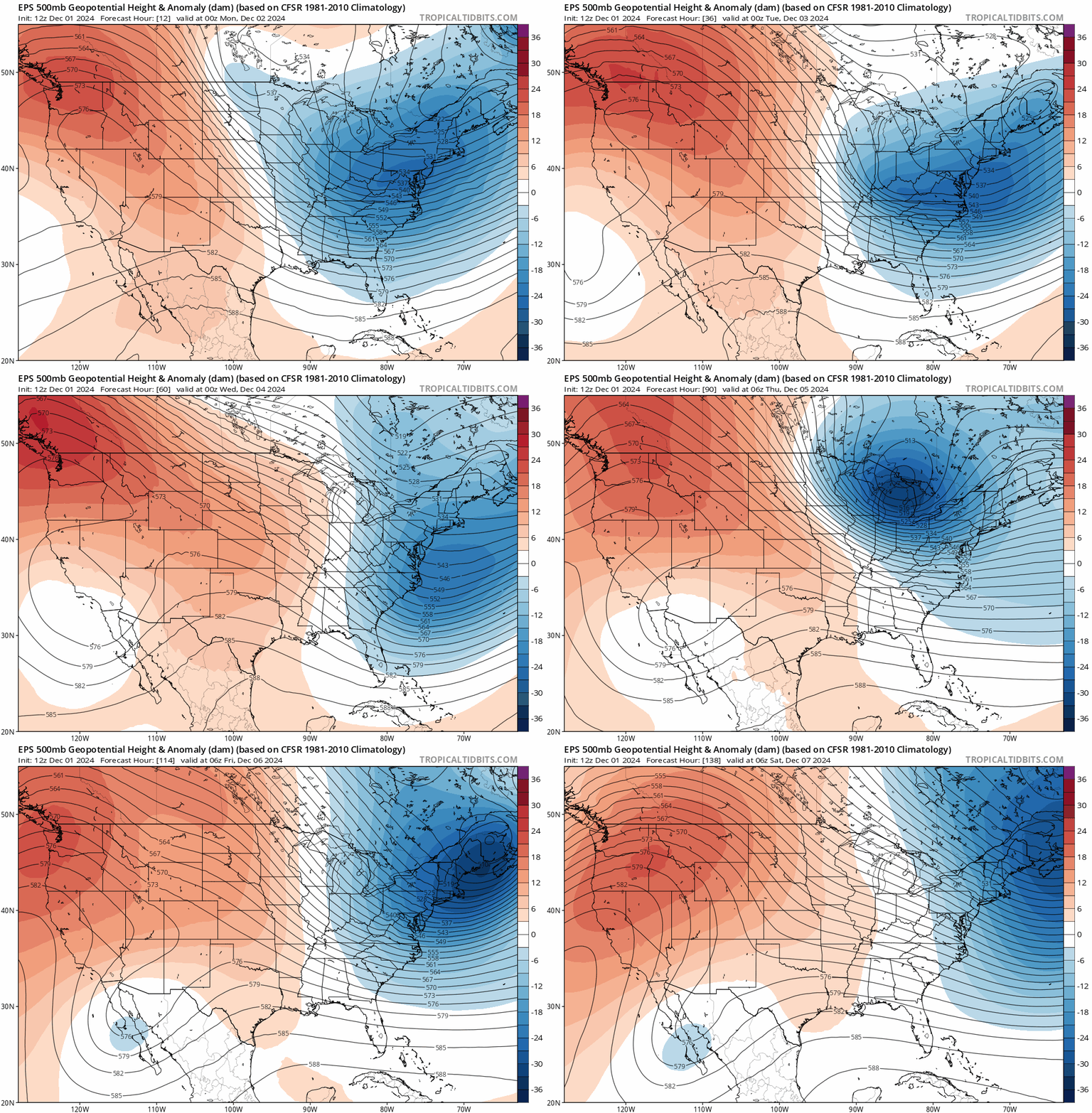
- Large Scale Pattern: A deep trough in the Great Lakes/Northeast and a strong ridge along the West Coast will dominate the national weather pattern, with Colorado being more influenced by the ridge.
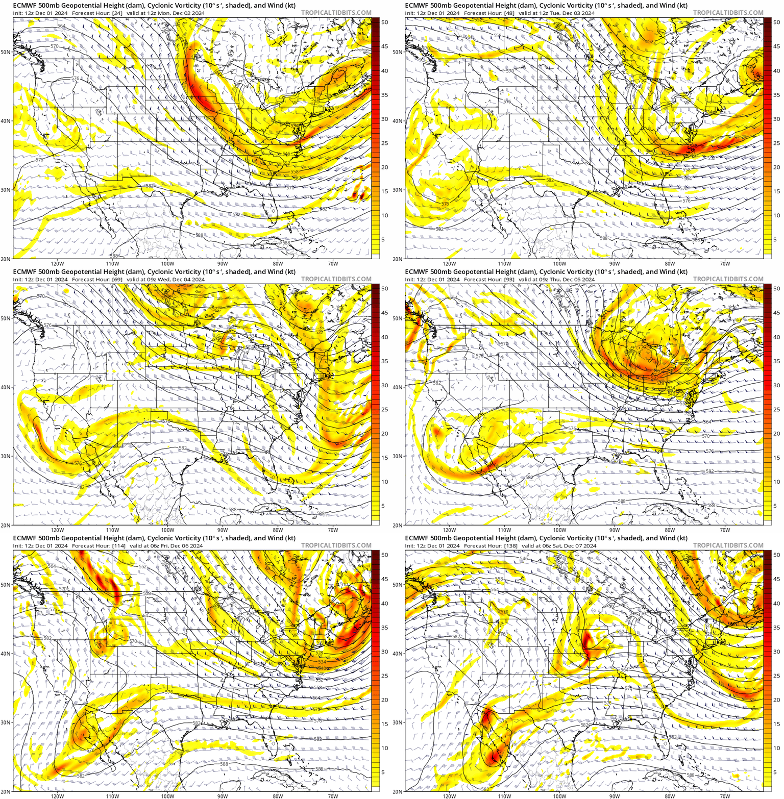
- Storm Track: The primary storm track will remain east of Colorado, with disturbances moving from the Canadian Yukon into the Great Lakes, leading to dry conditions in Colorado under northwest flow.
- Tranquil Weather: The Front Range will experience a stretch of mild, sunny conditions with generally light winds throughout the week.
- Late-Week System: A system in the northwest flow may approach late in the week, potentially bringing light snow to the Mountains, but little more.
DISCLAIMER: This weekly outlook forecast is created Monday morning and covers the entire upcoming week. Accuracy will decrease as the week progresses as this post is NOT updated. To receive daily updated forecasts from our team, among many other perks, subscribe to BoulderCAST Premium.
Daily Forecast Updates
Get our daily forecast discussion every morning delivered to your inbox.
All Our Model Data
Access to all our Colorado-centric high-resolution weather model graphics. Seriously — every one!
Ski & Hiking Forecasts
6-day forecasts for all the Colorado ski resorts, plus more than 120 hiking trails, including every 14er.
Smoke Forecasts
Wildfire smoke concentration predictions up to 72 hours into the future.
Exclusive Content
Weekend outlooks every Thursday, bonus storm updates, historical data and much more!
No Advertisements
Enjoy ad-free viewing on the entire site.
All clear for early December
The large scale pattern across the nation this week will consist of a deep trough in the Great Lakes/Northeast while a strong ridge holds along the West Coast, even pushing all the way northward into the Arctic at times. While Colorado will remain in between these two broader features, we’ll be closer to the ridge and more so under its influence than the trough.
The primary storm track will remain off to the east of our area for most of the week, with passing disturbances trekking from the Canadian Yukon into the Great Lakes. Some of these distant systems could send a weak boundary or two into Colorado, but nothing noteworthy and temperatures would only fluctuate a few degrees up and down, if at all. It’s not until very late in the week when a system in this northwest flow may get closer to our area (see tail-end of the animation below), but models remain torn on this facet of the extended forecast.
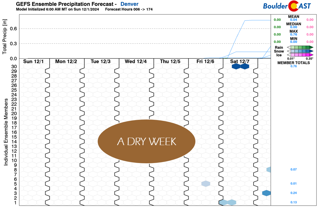
The result of this pattern will be a long stretch of tranquil weather in the Front Range under tame northwest flow, with mild, sunny conditions and generally light winds through at least Friday, but likely longer. Not surprisingly, the ensembles are completely dry throughout the week, only showing a non-zero but still extremely slim chance of a few snow showers late Friday or Saturday. The late-week system will likely only bring light snow to the Mountains, with dry conditions strongly favored in the Denver Metro area and perhaps a minor cooldown.
Enjoy the week and here’s hoping the second week of December is a bit more exciting weather-wise — some ensemble members do seem to hint at somewhat more active conditions, but time will tell….
Forecast Specifics:
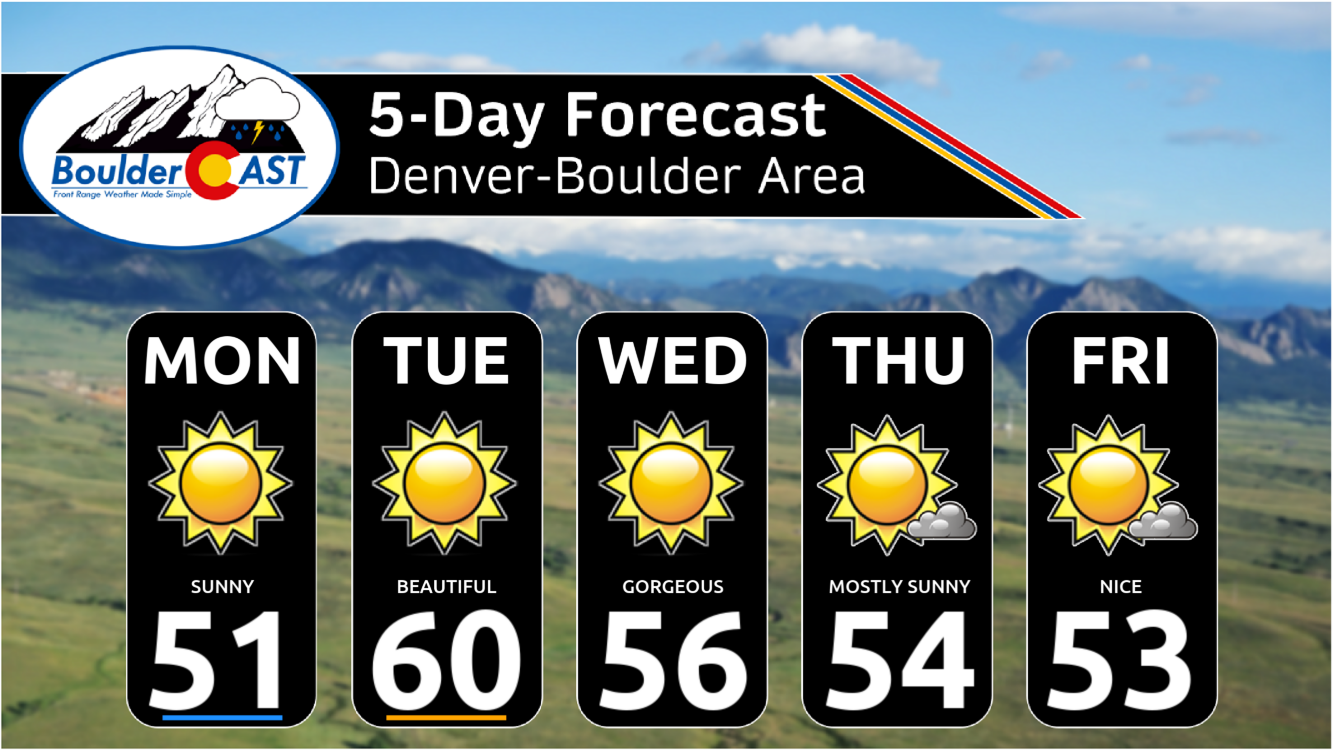
Monday: Sunny and mild with temperatures in the lower 50s on the Plains with lower 40s in the Foothills.
Tuesday: Sunny and warm with highs soaring to close to 60 degrees on the Plains with upper 40s in the Foothills.
Wednesday: Staying sunny and mild with highs in the middle 50s on the Plains with lower 40s in the Foothills.
Thursday & Friday: Mostly sunny and mild with highs staying above normal in the lower to middle 50s.
Weekend: Likely staying mild, dry and sunny with temperatures in the 50s. Light Mountain snow may occur north of I-70 Friday night or Saturday with minor accumulations.
Get BoulderCAST updates delivered to your inbox:
DISCLAIMER: This weekly outlook forecast is created Monday morning and covers the entire upcoming week. Accuracy will decrease as the week progresses as this post is NOT updated. To receive daily updated forecasts from our team, among many other perks, subscribe to BoulderCAST Premium.
Daily Forecast Updates
Get our daily forecast discussion every morning delivered to your inbox.
All Our Model Data
Access to all our Colorado-centric high-resolution weather model graphics. Seriously — every one!
Ski & Hiking Forecasts
6-day forecasts for all the Colorado ski resorts, plus more than 120 hiking trails, including every 14er.
Smoke Forecasts
Wildfire smoke concentration predictions up to 72 hours into the future.
Exclusive Content
Weekend outlooks every Thursday, bonus storm updates, historical data and much more!
No Advertisements
Enjoy ad-free viewing on the entire site.
Enjoy our content? Give it a share!




You must be logged in to post a comment.