Over the course of the last week, we’ve seen the beneficial summer rains spread across much of the Denver Metro area. The week ahead will see the plume of monsoon moisture shift westward, bringing a period of temporary drying to our region. Read on for all the details, including the extent of the heat and when we think the monsoon rains will ramp back up.
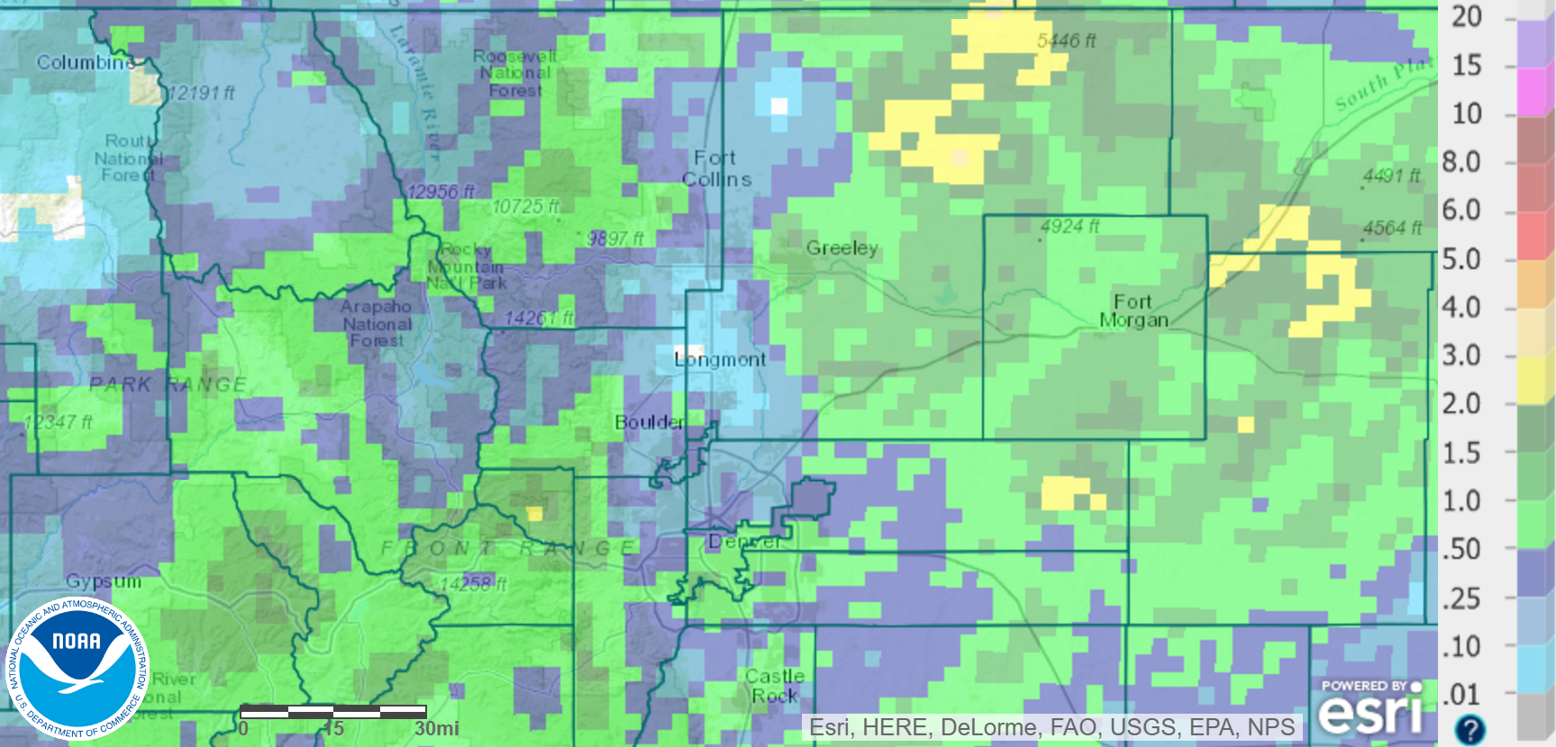
Boulder has officially recorded precipitation on nine of the last ten days. NINE of the last TEN! Unfortunately, things never came together to provide more than a few short spits of rain on each occasion. As such, the total rainfall over the last tens days in the city of Boulder was just 0.38″. Well below normal for the time-span.
The precipitation map below shows that most other locales did a little better, including the Plains northeast of Denver and even our Foothills. The only place that saw less rain than Boulder was Longmont!
The rains over the past week are a start. But that’s about it. We need more. Unfortunately, the week ahead doesn’t look as promising as the last…
Monsoon moisture begins to shift west
As quickly as the plume of monsoon moisture arrived, it will depart as the large-scale pattern responsible shifts westward. In the 500 mb vorticity map below for this evening, notice the high-pressure ridge centered over southwest Colorado. The clockwise flow around this high brings the subtropical air northward into California and Nevada.
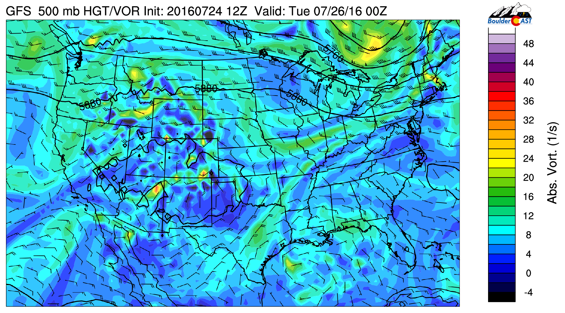
GFS 500 mb vorticity map for Monday evening, showing the ridge of high pressure located over southern Colorado
For potent monsoon flow into Colorado, we really want to see that high centered in Kansas and Oklahoma (where it was parked all of last week).
Today will be a day of transition, so there will still be a little residual moisture in place to allow for widely scattered storms this afternoon. However, they won’t be nearly as widespread or ferocious as yesterday.
Progressing into Tuesday, we see the ridge shift even more westward, now centered across southern Nevada. You can imagine this will dry things out even further for us in northeast Colorado.
With that said, storm chances decrease. However, we can’t rule out an isolated afternoon thunderstorm, especially in and near the Foothills.
Highs on both Monday and Tuesday will remain warm in the low 90’s.
Dry northwest flow by midweek
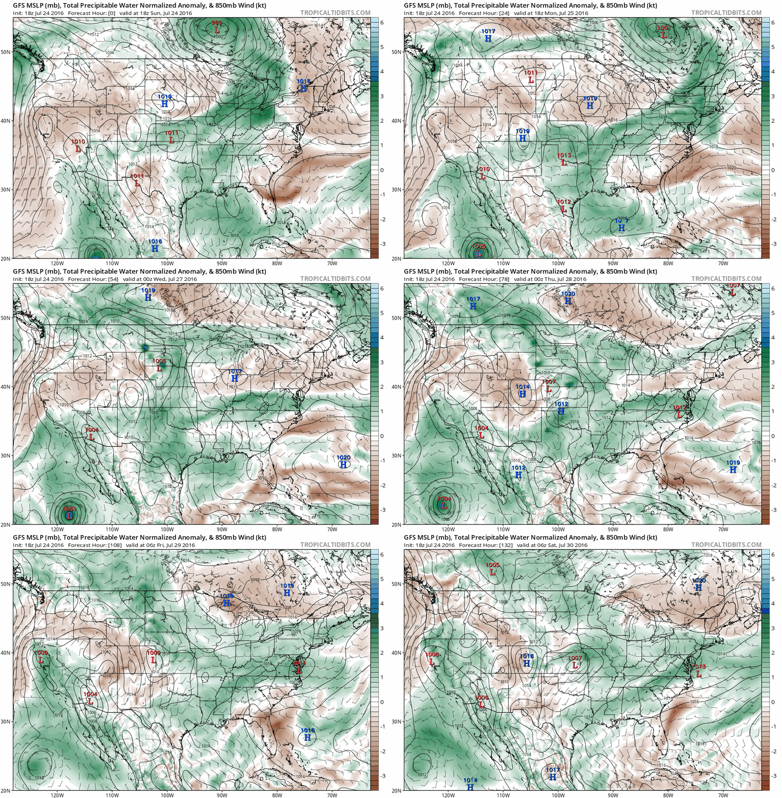
Sorry monsoon enthusiasts…. The weather story by Wednesday will be the presence of dry, northwest flow across our neck of the woods. The moisture anomaly loop below shows how this dry airmass works its way into the state for the second half of the week. Lots of brown streaming into Colorado(dry air).
You should also note the monsoon moisture plume being pushed westward into California and even Oregon.
As a result, both Wednesday and Thursday should be mostly dry across the Denver Metro area, with plenty of sunshine and highs climbing into the low 90’s.
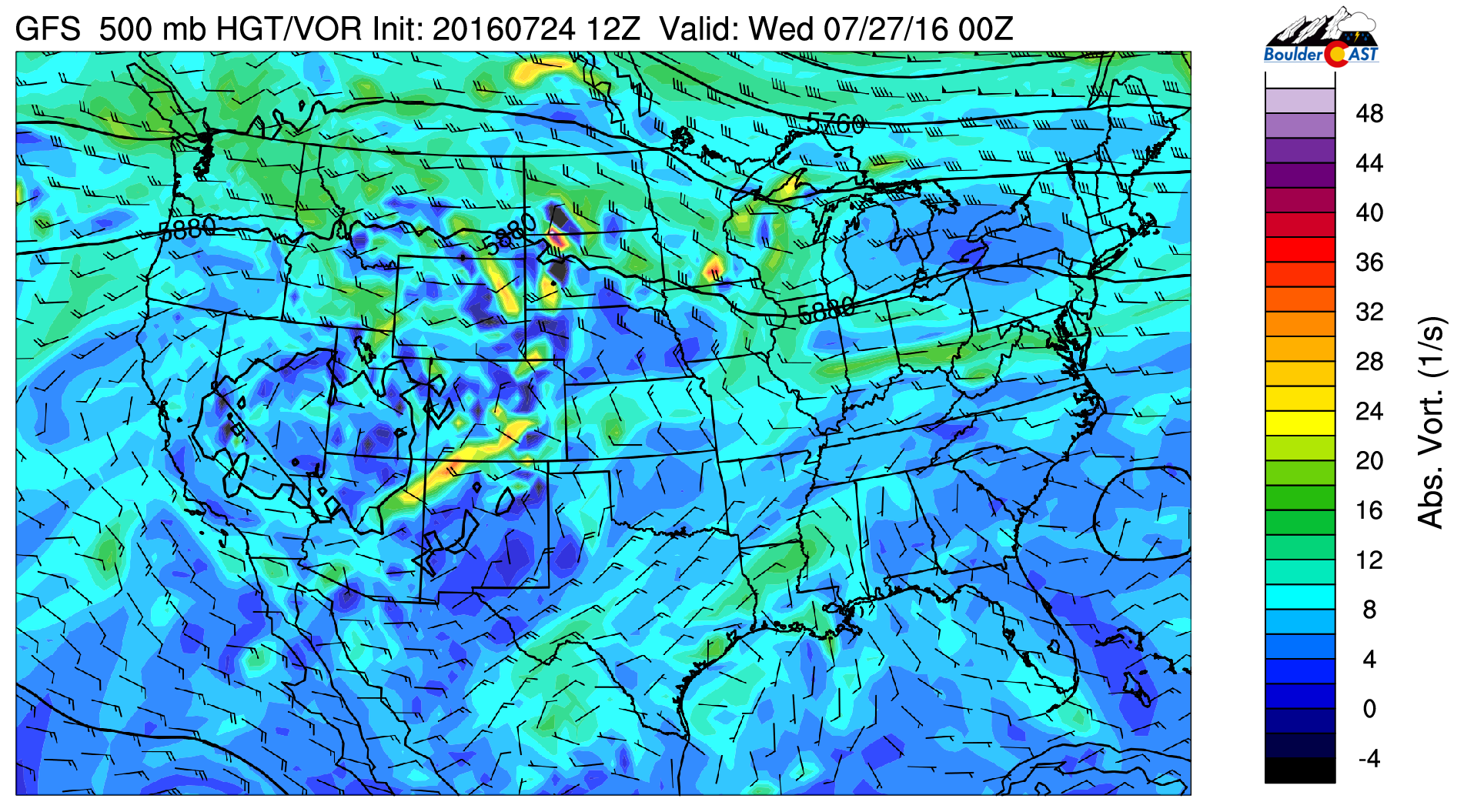
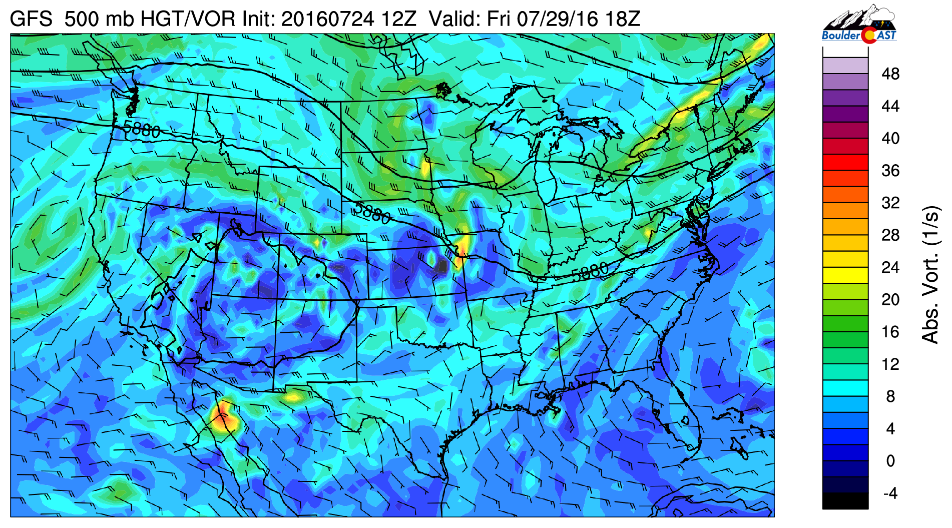
By Friday, the ridge begins to slowly migrate back eastward. In the 500 mb vorticity map below, notice that the center has moved into southern Utah. This is a sign of things to come. With the ridge moving east, the moisture will slowly return to Colorado. Early indication is that this will occur late in the weekend or early next week!
Also on Friday, at least two models are showing the potential for a weak cold front to work its way into northeast Colorado. The cooler push of air can be seen in the 800 mb temperature map below for noon Friday.
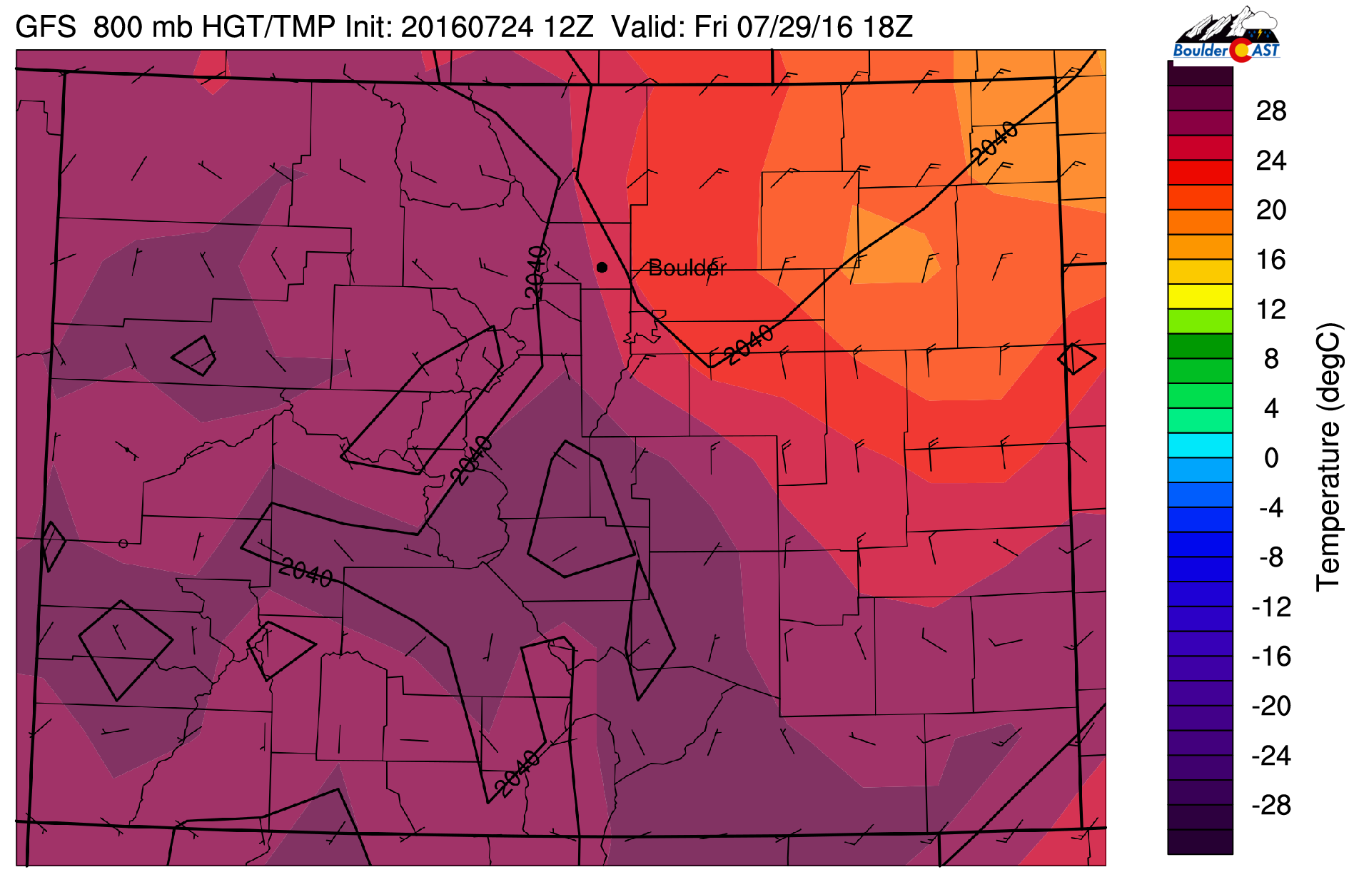
GFS forecast 800 mb temperature map for Friday at noon, showing a “cooler” push of air behind a cold front
It looks like the front will arrive in the morning, but doesn’t appear to be all that significant. With day time heating, highs should still be able to slowly climb back into the upper 80’s to near 90 degrees to close out the work week.
The more interesting facet of the front is the influx of moisture on its backside. This moisture bump can be seen below in the precipitable water maps for Thursday (left) and Friday (right).

GFS precipitable water forecast for Thursday (left) and Friday (right), showing increasing moisture Friday behind the cold front
This moisture should allow for thunderstorm activity to return to the region. If not the Plains, at the very least, in the higher elevations east of the Divide. Nothing major, but a few isolated storms will be possible.
When will the summer heat let up? You’re guess is as good as ours. We’re not seeing any indication of this yet. Stay tuned!
Forecast Specifics:
Monday: Mostly sunny early with increasing afternoon clouds and widely scattered thunderstorms developing in the High Country and moving eastward toward the Plains. Highs in the low 90’s over the Plains and near 80 in the Foothills.
Tuesday: Mostly sunny with isolated afternoon showers and thunderstorms. Highs in the low 90’s across the Plains, with near 80 in the Foothills.
Wednesday: Mostly sunny skies and dry. Highs in the mid 90’s on the Plains with low 80’s in the Foothills.
Thursday: Mostly sunny, except maybe a few isolated storms, particularly northeast of Denver. Highs temperatures in the low 90’s for the Plains, with mid 80’s in the Foothills.
Friday: Mostly sunny skies with isolated storms in the afternoon and evening, especially across the higher elevations. Highs near 90 on the Plains with upper 70’s in the Foothills.
High Country: Storm chances are highest on Monday with some moisture in place, say about 50%. Isolated storms linger on Tuesday, with very limited, if any, storms for Wednesday and Thursday. By Friday, isolated storms return to the forecast as moisture begins to creep back up.
Extended: After a stretch of drier weather this week, models bring the monsoon moisture plume back into Colorado by early next week. With this, we should have much more rain to discuss this time next week. To get there, this weekend will be mostly dry with just a few isolated storms. Temperatures look to remain in the 90’s for both Saturday and Sunday.
Mon
Tue
Wed
Thu
Fri


Temperature
92
93
93
92
89


Precip Chc (Plains)
20%
10%
0%
10%
20%




You must be logged in to post a comment.