The week ahead will usher in persistent unseasonable warmth and sunshine to Front Range Colorado. There’s a better chance of setting record high temperatures this week than there will be to see any kind of precipitation. We are watching a couple of cold fronts, but they will be the dry variety with temperatures not even dropping below normal on their backside. Upper-level ridging will continue to push in from the West Coast for the weekend keeping things pleasant and dry through at least Sunday for our area. As you might imagine, there’s no chance of snow or additional sub-freezing temperatures in the pipeline.
This week’s highlights include:
- Quiet weather is the main story with a ridge of high pressure in place much of the week
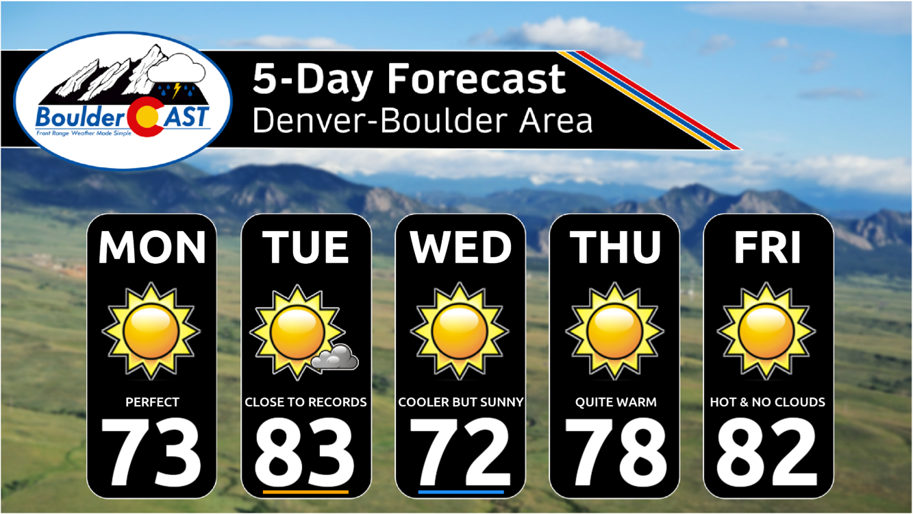
- Temperatures will be above normal in the 70s to lower 80s each and every day
- Tuesday and Friday will push into the 80s, while Wednesday will be our “coldest” day behind a “cold” front
- The storm track likely won’t get active again until early next week, but even then we may not see much precipitation from it right away
- There’s no chance of any snow or hard-freezes in the pipeline
DISCLAIMER: This weekly outlook forecast is created Monday morning and covers the entire upcoming week. Accuracy will decrease as the week progresses as this post is NOT updated. To receive daily updated forecasts from our team, among many other perks, subscribe to BoulderCAST Premium.
Daily Forecast Updates
Get our daily forecast discussion every morning delivered to your inbox.
All Our Model Data
Access to all our Colorado-centric high-resolution weather model graphics. Seriously — every one!
Ski & Hiking Forecasts
6-day forecasts for all the Colorado ski resorts, plus more than 120 hiking trails, including every 14er.
Smoke Forecasts
Wildfire smoke concentration predictions up to 72 hours into the future.
Exclusive Content
Weekend outlooks every Thursday, bonus storm updates, historical data and much more!
No Advertisements
Enjoy ad-free viewing on the entire site.
Quiet & mild for most of the week
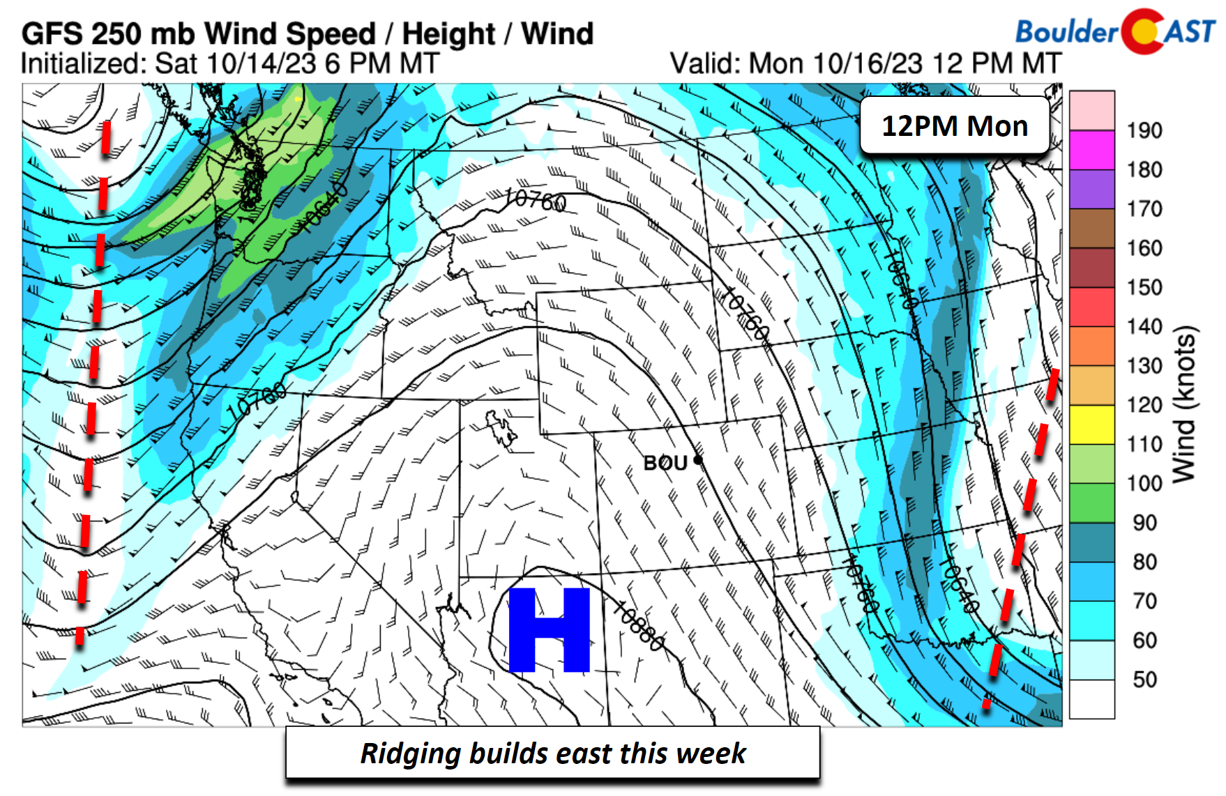
Avery quiet week is in store for us on the Front Range for this third full week of October. It’s hard to believe that we are more than half way through the month and we’re just ten weeks from the end of the year! On Monday, ridging will build eastward replacing the trough which was over us this past week and the early part of the weekend which brought the coldest weather of the season including the first sub-freezing temperatures in some areas. As you will soon find out, this ridge will be the story through the majority of the week ahead. For Monday, some patchy high clouds will be around, but temperatures will trend above normal with lower 70s expected on the Plains — just the tip of the “iceberg” for what’s to come this week.
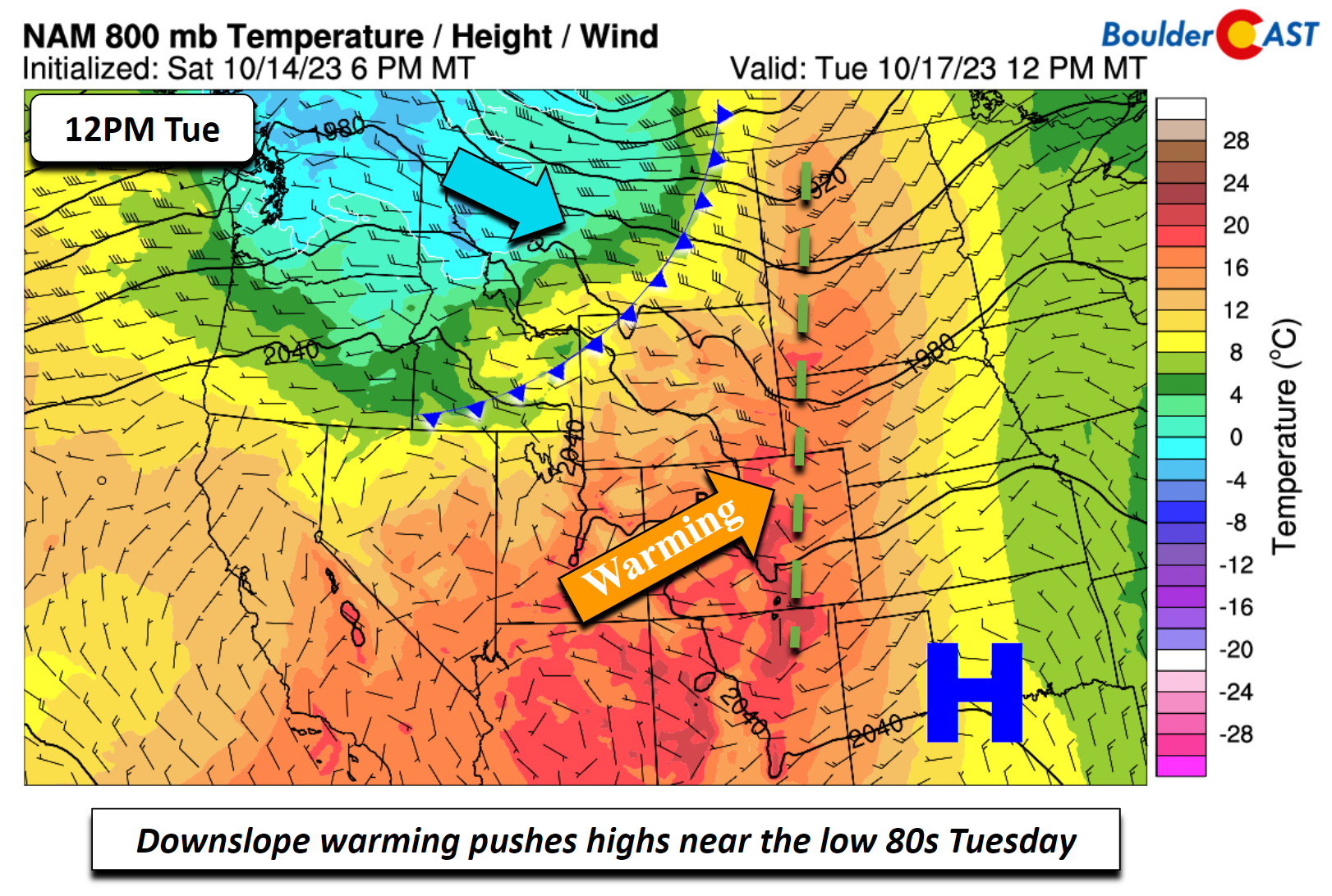
The warmest day of the week will be Tuesday when downslope flow will take place ahead of a cold front slated to move through late Tuesday night. These westerly surface winds will aid a much warmer airmass with near 18°C forecast for just above the surface:
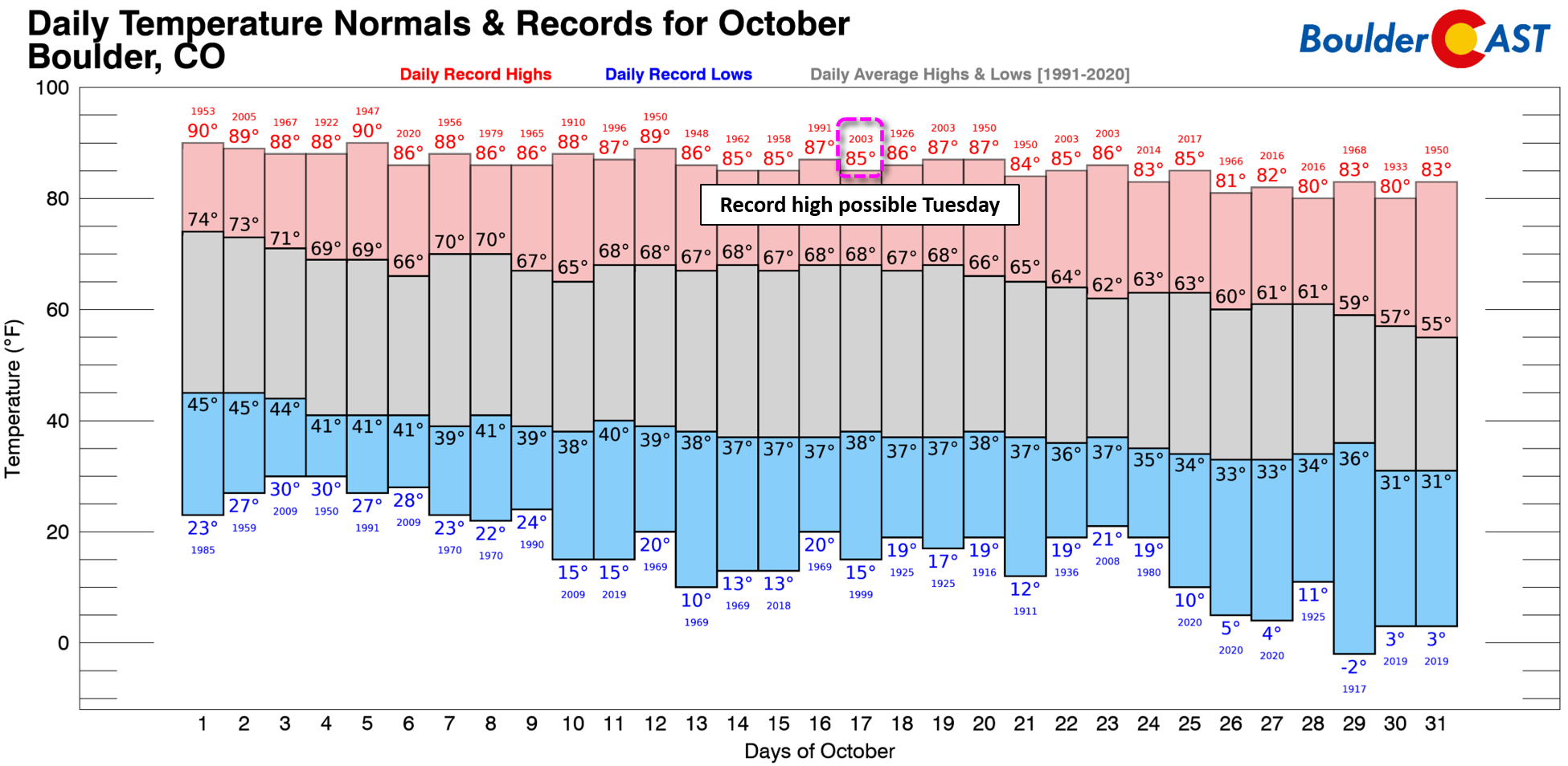
This unseasonable warmth will translate into highs on Tuesday in the lower 80s for most of us, pushing towards the existing record highs for the date which are 85°F in Boulder and 86°F in Denver.
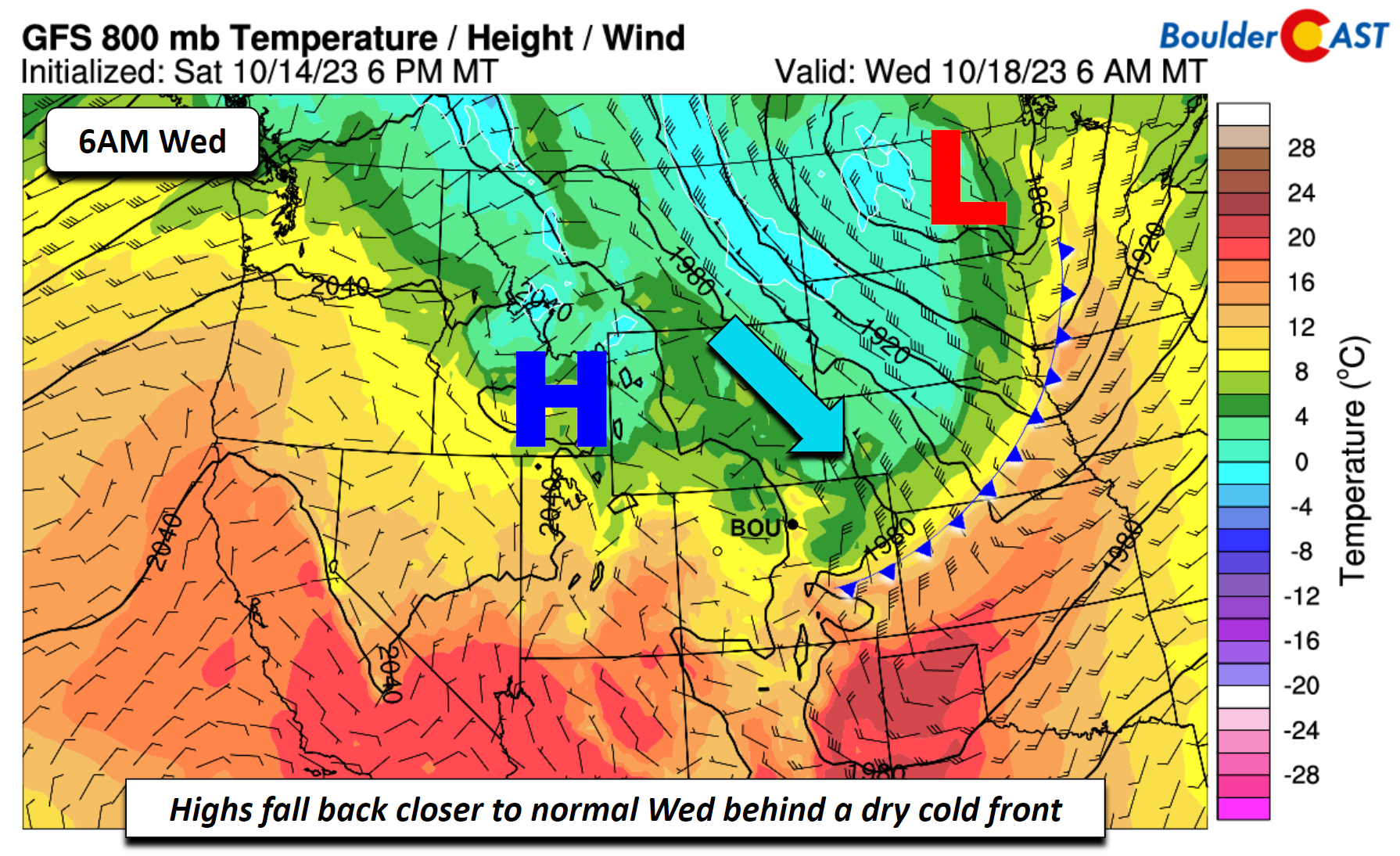
An area of low pressure tracking into the upper Midwest Wednesday will briefly shunt the mid-level ridge to our south and southwest. That will allow a cold front to move through the Front Range early Wednesday morning before sunrise. Highs as a result will be somewhat cooler, but no precipitation is expected as there isn’t nearly enough moisture for that. If Tuesday is our warmest day — Wednesday will be our coolest with highs ranging from the upper 60s to lower 70s under an upslope flow — still slightly above seasonal normals, even behind a cold front. Ugh!
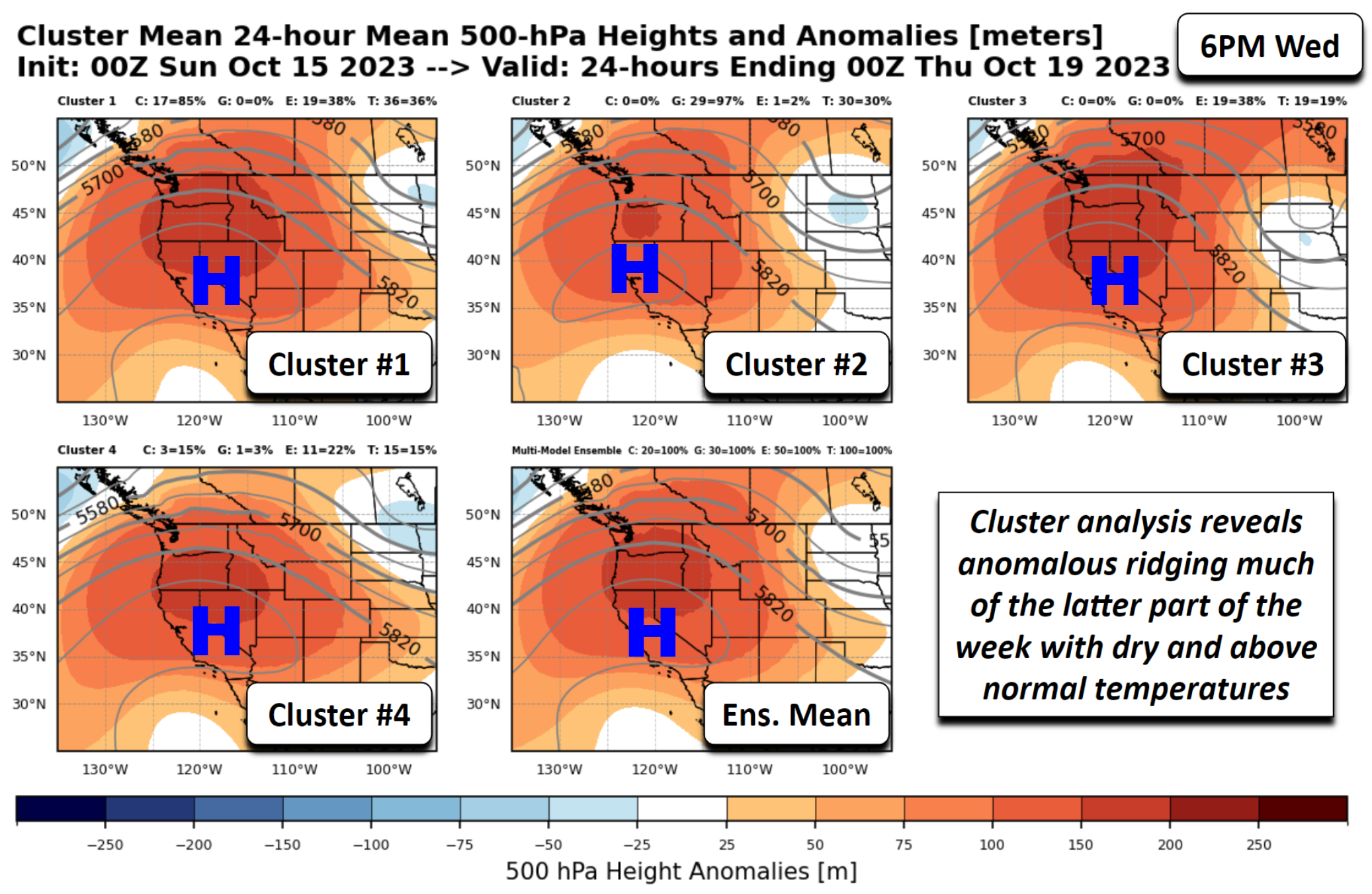
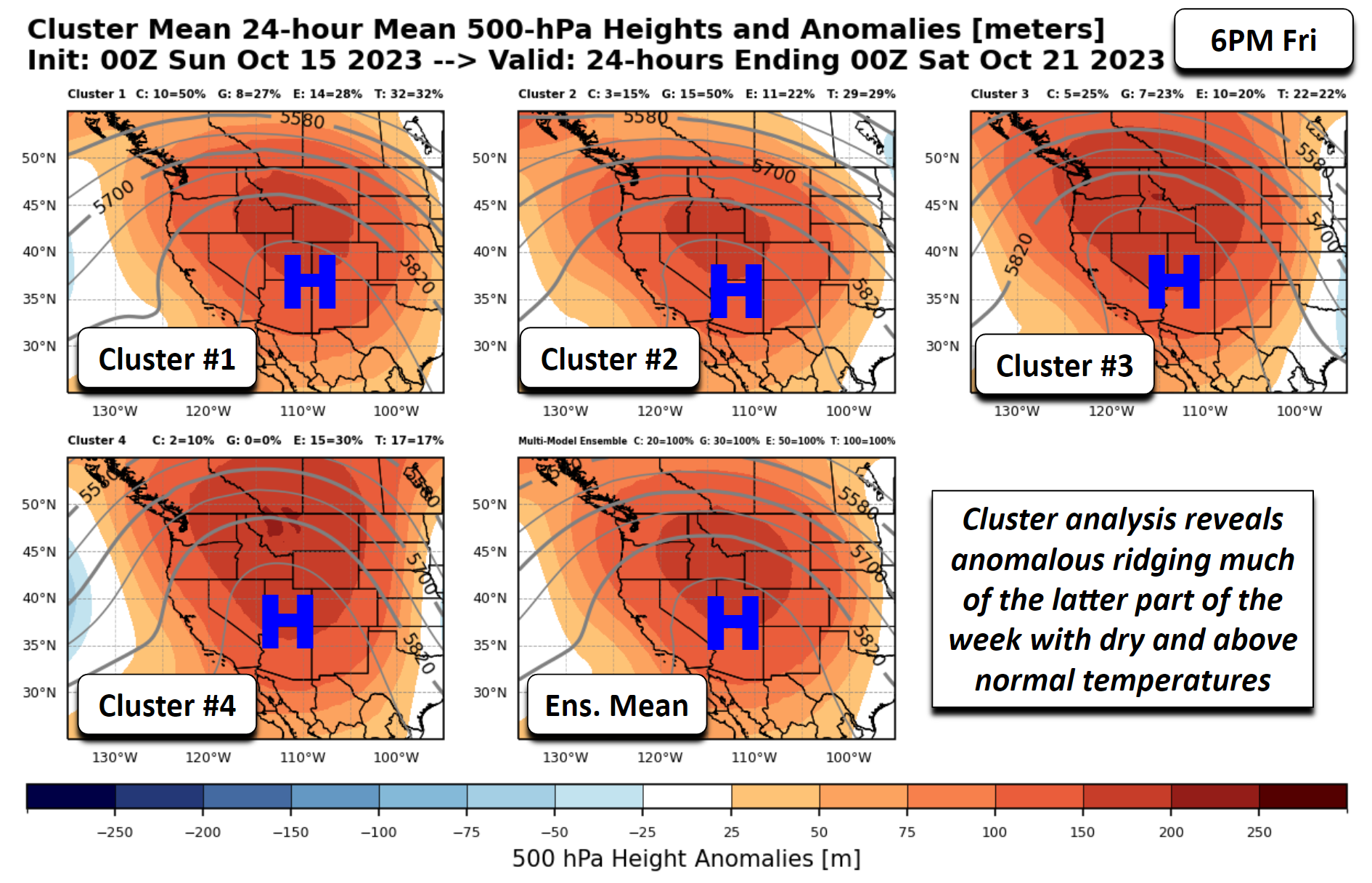
As we get into the latter part of the week, the main weather players will be upper-level ridging and high pressure over the west coast sliding east to near the Four Corners by late Friday and into Saturday. On Wednesday, most ensemble cluster solutions (below) show the trough over the northern Great Plains tied to the cold front moving through our area.
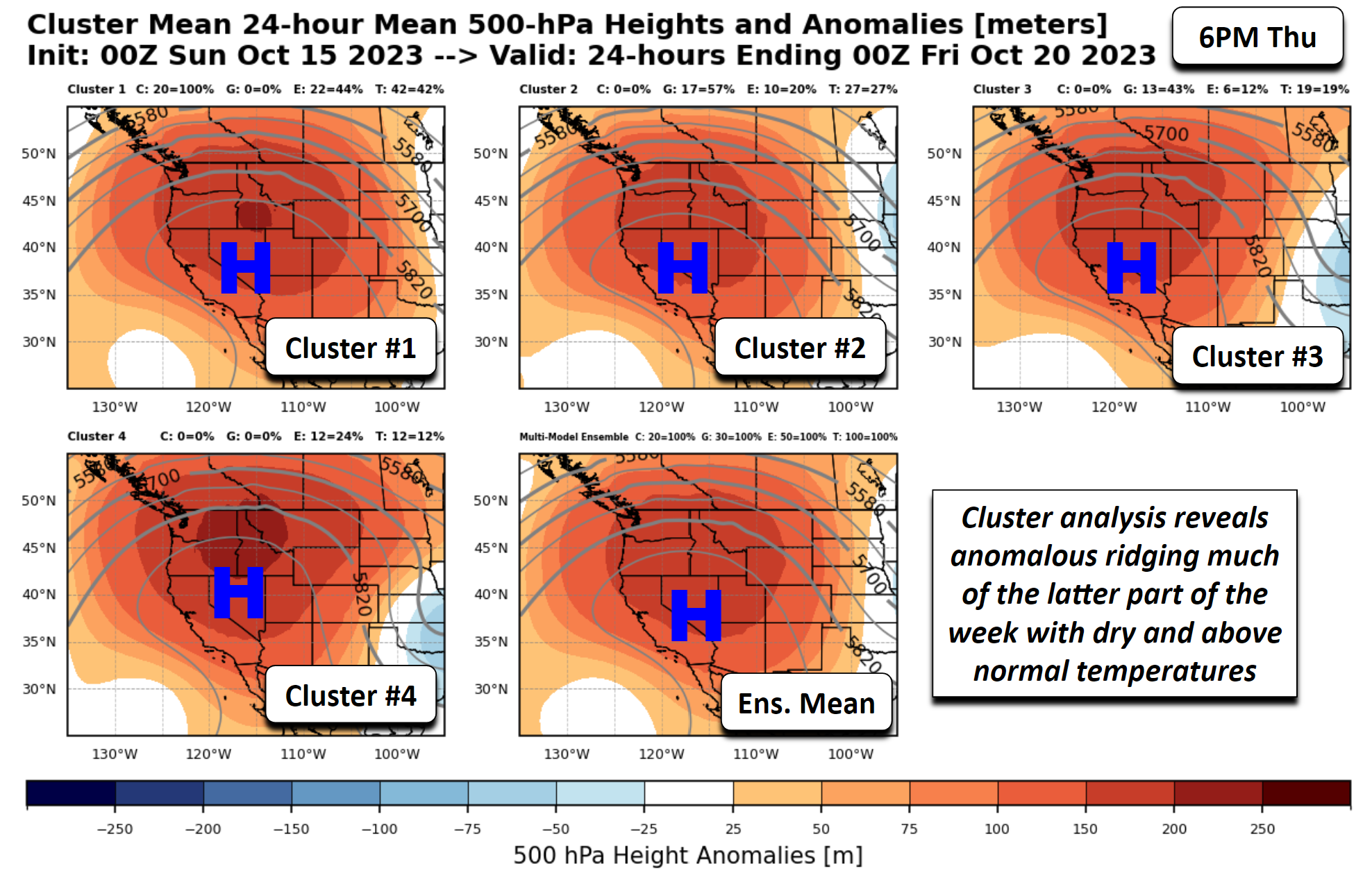
Come Thursday, the trough to our east will shift into the Mid-Mississippi Valley and the ridge to our west will move into southern Nevada. This will spell out highs rebounding from Wednesday, likely into the mid to upper 70s.
As we close out the week on Friday, the ridge of high pressure will move near the Four Corners region, with well above normal height anomalies extending far north into Montana.
This should support temperatures pushing back into the lower 80s on Friday across the Boulder-Denver Metro area. Whether you like it or not, the extended forecast is bursting from the seams with warmth and sunshine:
The pesky ridge is forecast to remain in place into the upcoming weekend. We are watching another cold front projected to move through sometime Saturday, but once again it will be another dry frontal passage for us. A more active storm track will not build back into our area until next week. Until that time, we’ll continue to see dry weather with no chance of precipitation at all for the next seven days or more. Our weather discussion next week may be a tad more interesting, but don’t count on it just yet…
What a beautiful day in western #Boulder County. The weather is just perfect! ☀️ #cowx pic.twitter.com/pE6aBuML5V
— BoulderCAST Weather (@BoulderCAST) October 15, 2023
Forecast Specifics:
Monday: Patchy high clouds at times, otherwise sunny and mild with lower 70s on the Plains and low 60s in the Foothills.
Tuesday: Our likely warmest day of the week with an increase in clouds late in the day. High temperatures soar into the lower 80s on the Plains and lower 70s in the Foothills. This will be within a couple degrees of record highs for October 17th.
Wednesday: Cooler but staying sunny following the passage of a dry cold front. Highs in the upper 60s to lower 70s for the Plains and low 60s in the Foothills.
Thursday: Warmer under continued sunny skies. Highs in the mid to upper 70s for the Plains and middle 60s for the Foothills.
Friday: Sunny with temperatures warming further into the lower 80’s on the Plains and near 70 for the Foothills.
The Weekend: Saturday will stay warm and sunny with temperatures close to 80 degrees. Sunday should be cooler but still seasonally mild following yet another dry cold front.
DISCLAIMER: This weekly outlook forecast is created Monday morning and covers the entire upcoming week. Accuracy will decrease as the week progresses as this post is NOT updated. To receive daily updated forecasts from our team, among many other perks, subscribe to BoulderCAST Premium.
Daily Forecast Updates
Get our daily forecast discussion every morning delivered to your inbox.
All Our Model Data
Access to all our Colorado-centric high-resolution weather model graphics. Seriously — every one!
Ski & Hiking Forecasts
6-day forecasts for all the Colorado ski resorts, plus more than 120 hiking trails, including every 14er.
Smoke Forecasts
Wildfire smoke concentration predictions up to 72 hours into the future.
Exclusive Content
Weekend outlooks every Thursday, bonus storm updates, historical data and much more!
No Advertisements
Enjoy ad-free viewing on the entire site.
Get BoulderCAST updates delivered to your inbox:
Enjoy our content? Give it a share!




You must be logged in to post a comment.