A strong cut-off low pressure system will slowly pass by south of Colorado early in the week leading to below normal temperatures, gusty winds and at times light snow for the area. Little to no accumulation is expected across the lower elevations though. Things turn sunny and warmer Wednesday and beyond, with the upcoming weekend looking particularly stunning. Read on for our complete outlook of the week ahead.
This week’s highlights include:
- The mildly-hyped big storm system developed too far south across New Mexico on Monday offering minimal impacts to our area
- Dreary, cold and gusty Monday with light snow possible during the morning and early afternoon — less than 2″ of accumulation expected on grassy surfaces
- Staying cool on Tuesday with widely scattered late-day rain/snow showers — no accumulation
- Drying out Wednesday and beyond with plenty of sun and temperatures returning closer to seasonal values
- A beautiful weekend is shaping up with 70s expected
DISCLAIMER: This weekly outlook forecast is created Monday morning and covers the entire upcoming week. Accuracy will decrease as the week progresses as this post is NOT updated. To receive daily updated forecasts from our team, among many other perks, subscribe to BoulderCAST Premium.
Swing and a miss
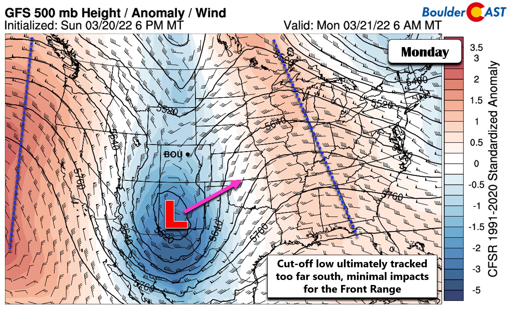
The strong low pressure system, which showed glowing potential for snow across our area a handful of days ago, ultimately has tracked too far south into New Mexico to have any significant impacts for the Front Range to kick off the week. We first alerted you to this interesting atmospheric set-up around the middle of last week, with a simple warning to keep an eye on this developing storm and where it may end up as somewhere in eastern Colorado was likely to see substantial snow from it. By Saturday, we were confident that it would be a “swing and a miss” for the Denver area with the system taking a dive too far south. That’s where we stand now. As of Monday morning, the center of the intensifying mid-level low pressure is way down across southwestern New Mexico. The Front Range is just barely catching a little southeasterly flow aloft as noted by the wind barbs below.
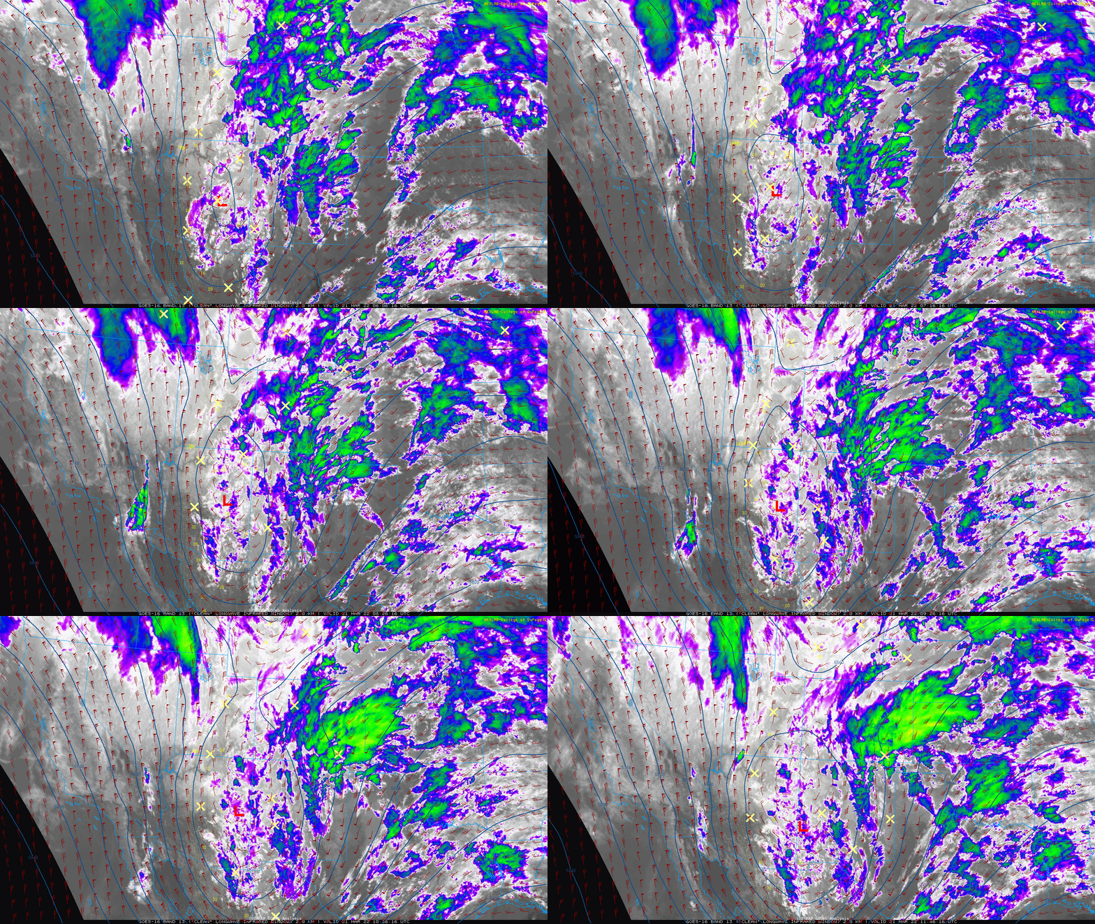
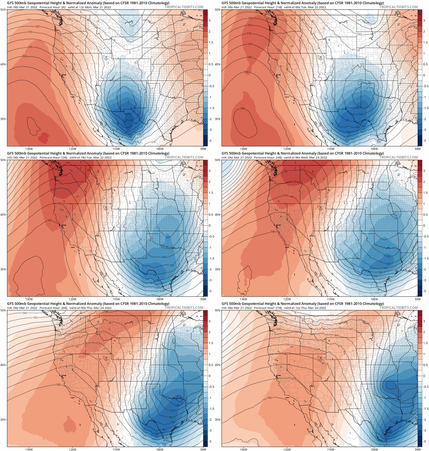
GOES-East infrared satellite imagery confirms this positioning over southwest New Mexico. The low is expected to track slowly east and northeast over the coming days into Kansas.
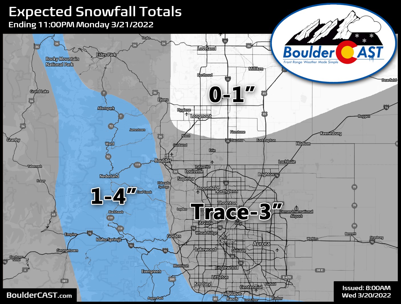
The Denver Metro area will still see some light precipitation on Monday as weak lift and upslope come together with temperatures turning just cold enough for snow. Two short-range model snowfall forecasts are shown below. This is clearly not going to be a major snow-maker for our area.
With the meager snowfall rates and “warm” temperatures above the freezing mark on Monday, little to no accumulation is expected across the lower elevations, though some spots may see an inch or two — that’s most likely south or southwest of Denver. Several inches are possible across the Foothills and Palmer Divide. Our snowfall map issued over the weekend still looks good, though anything more than 1-2″ on the Plains seems rather unlikely. The primary window for snowflakes on Monday will be through the morning and early afternoon. Roads will remain just wet with any accumulation confined to grassy and elevated surfaces.
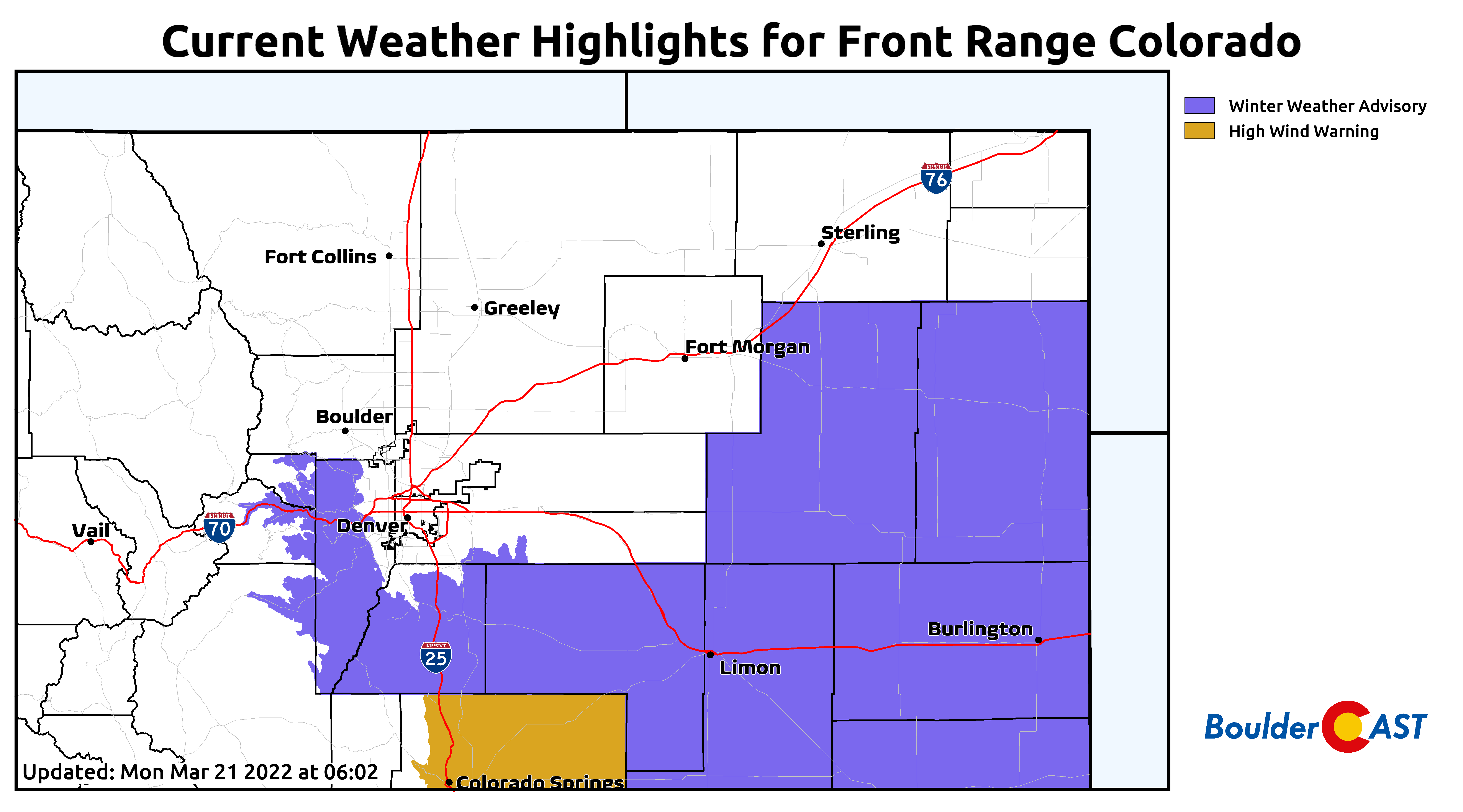
Winter Weather Advisories have been posted for the Jefferson County Foothills and Palmer Divide which will both benefit from the predominantly northerly flow today.
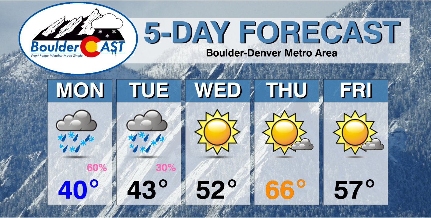
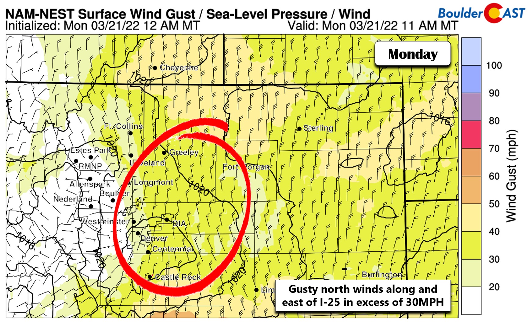
Despite the lack of snow, temperatures will be much colder on Monday compared to this past weekend. Highs are forecast to stay in the lower 40s instead of the 50s and 60s. Winds will be blustery out of the north as well, so it will feel even more raw out there. Watch for gusts in excess of 30 MPH along and east of Interstate 25 through the day with lighter north winds around Boulder.
Staying cool & breezy through midweek
Even with the core of the storm entirely missing the Denver Metro area, the broader influence, strong and cool northerly flow, will stick with us into midweek as the deep low tracks slowly into the southern Great Plains and an approaching high pressure moving in from the west help intensify the pressure gradient. Temperatures will remain below normal through midweek for us, with highs Tuesday into the 40s and in the 50s on Wednesday. A very weak disturbance on Tuesday will kick off a few rain/snow showers in the afternoon and evening hours with no accumulation expected outside of the higher terrain.
Quieter & sunny Thursday and beyond
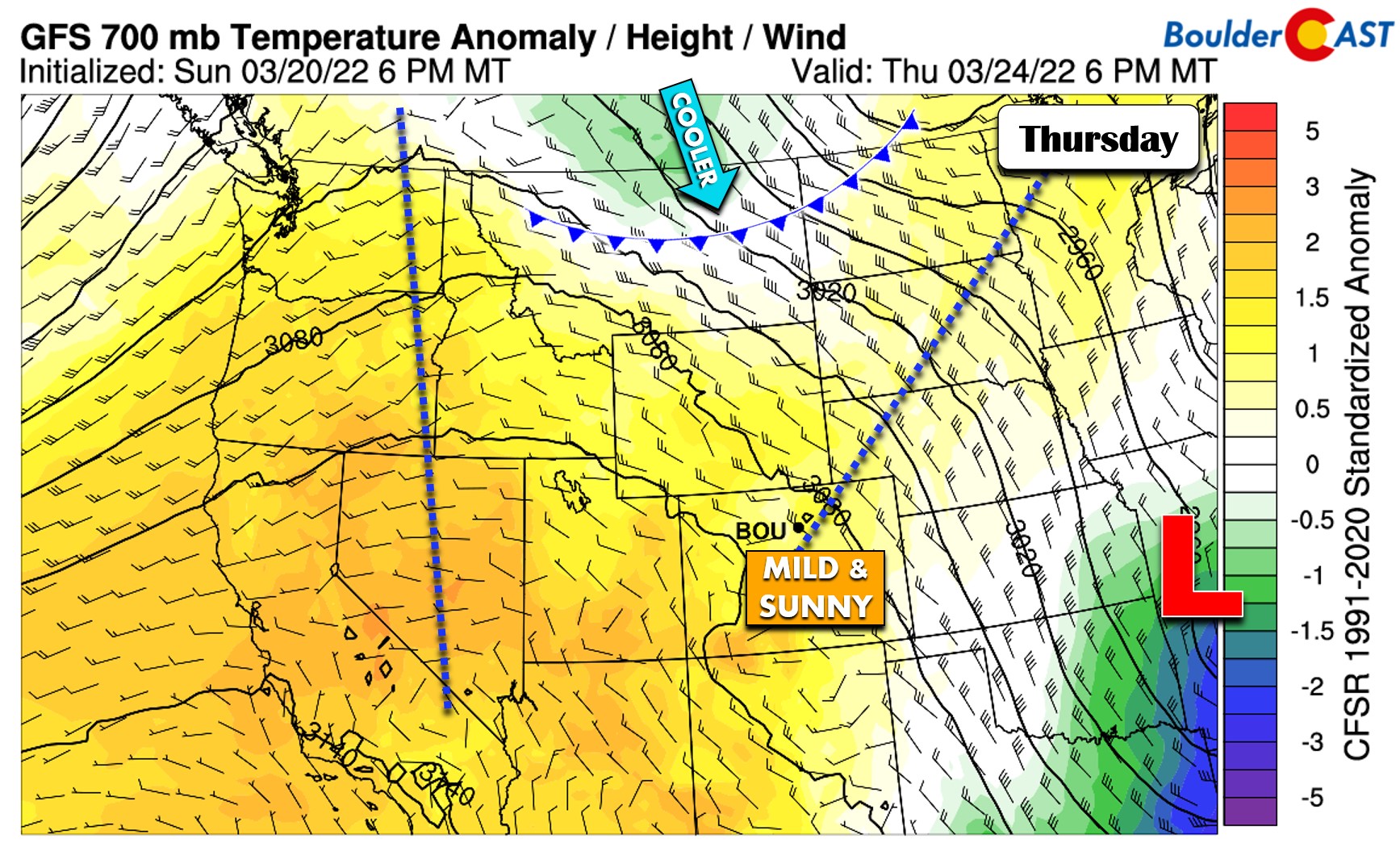
Thursday will be the first really nice day of the week owing to an encroaching ridge of high pressure from the west. Mild and dry northwest flow will take hold of Colorado bringing sunny skies and decently warm temperatures. Look for highs to reach into the middle to upper 60s.
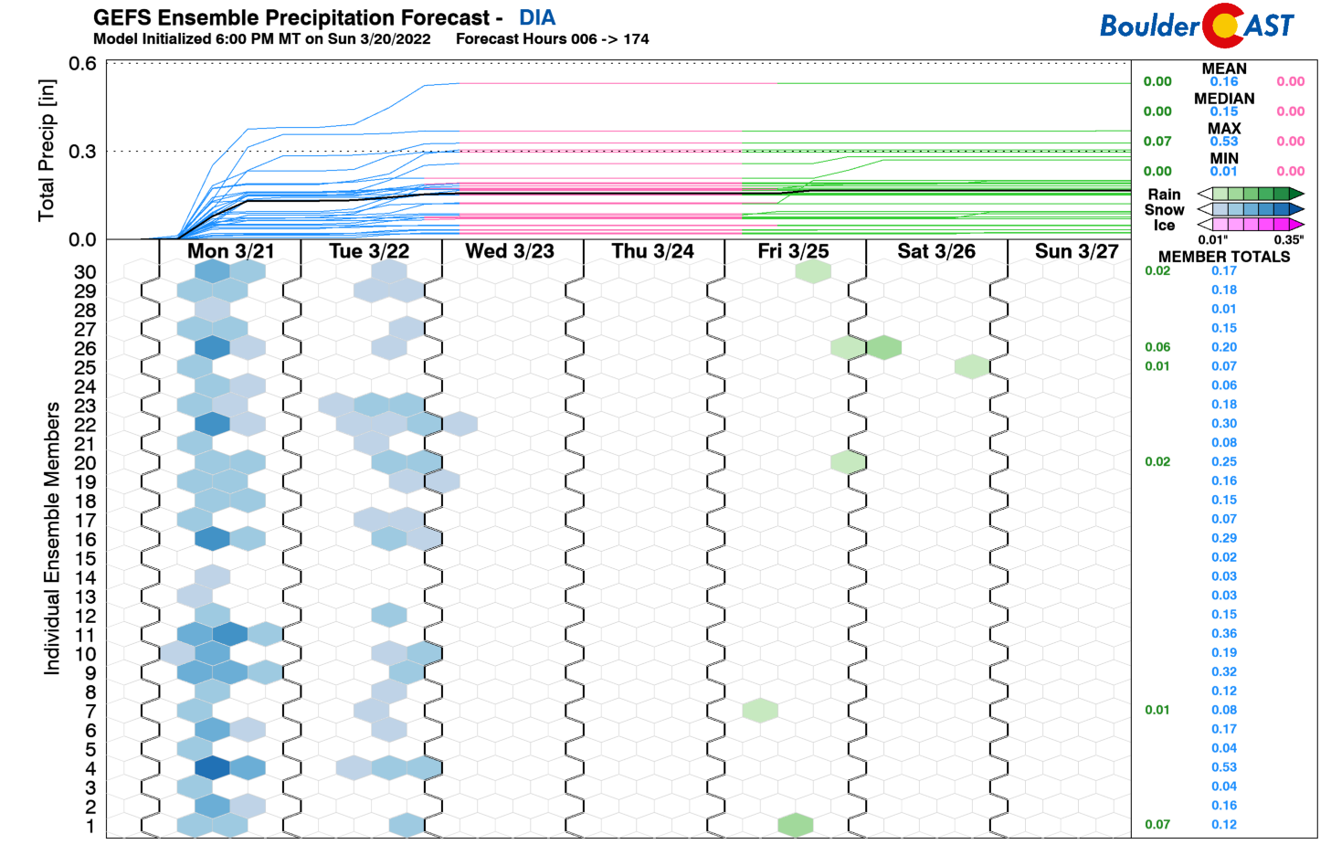
However, as you can see above, there will be a weak disturbance and cold front dropping southward out of central Canada into the Great Plains. Models currently advertise a dry cold front with this system clipping northeast Colorado. A couple ensemble members are showing hints of measurable rain behind this front (see below), but that seems unlikely. For now, plan for continued sunshine on Friday with slightly cooler temperatures dropping back into the upper 50s.
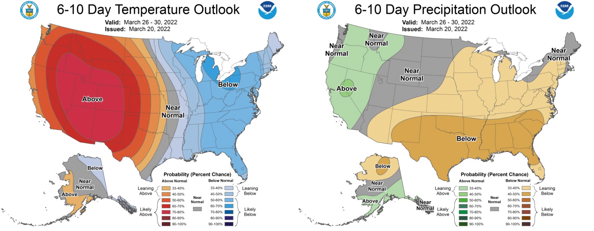
The upcoming weekend should be gorgeous across the entire state as the ridge of high pressure that has been hanging out over the Pacific Ocean makes a more substantial push towards Colorado. As a result of this broad pattern shift, the Climate Prediction Center paints the entire West with above normal temperatures for the weekend into early next week. Expect dry weather alongside temperatures warming near or above 70 degrees Saturday and beyond.
Stay up to date with Colorado weather and get notified of our latest forecasts and storm updates:
Forecast Specifics:
Monday: Dreary with light snow or mixed precipitation likely in the morning into early afternoon. Gusty north winds up to 35 MPH mainly east of Interstate 25. Less than 1″ of snow accumulation expected for the lower elevations, with up to 4″ in the Foothills. Highs in the upper 30s on the Plains with lower 30s in the Foothills.
Tuesday: Mostly cloudy, chilly and breezy with widely scattered afternoon and evening rain/snow showers. Little to no accumulation expected, except in the Foothills which could see an inch or so. Highs in the lower 40s on the Plains with lower 30s in the Foothills.
Wednesday: Staying cool but sunny with breezy north winds. Highs in the lower 50s on the Plains with upper 30s in the Foothills.
Thursday: Mostly sunny and warmer — the nicest day of the week. Look for temperatures in the middle 60s for the Plains with lower 50s in the Foothills.
Friday: Mostly sunny and pleasant. A little cooler behind a dry cold front. Expect highs to reach the upper 50s across the Plains with lower 50s in the Foothills.
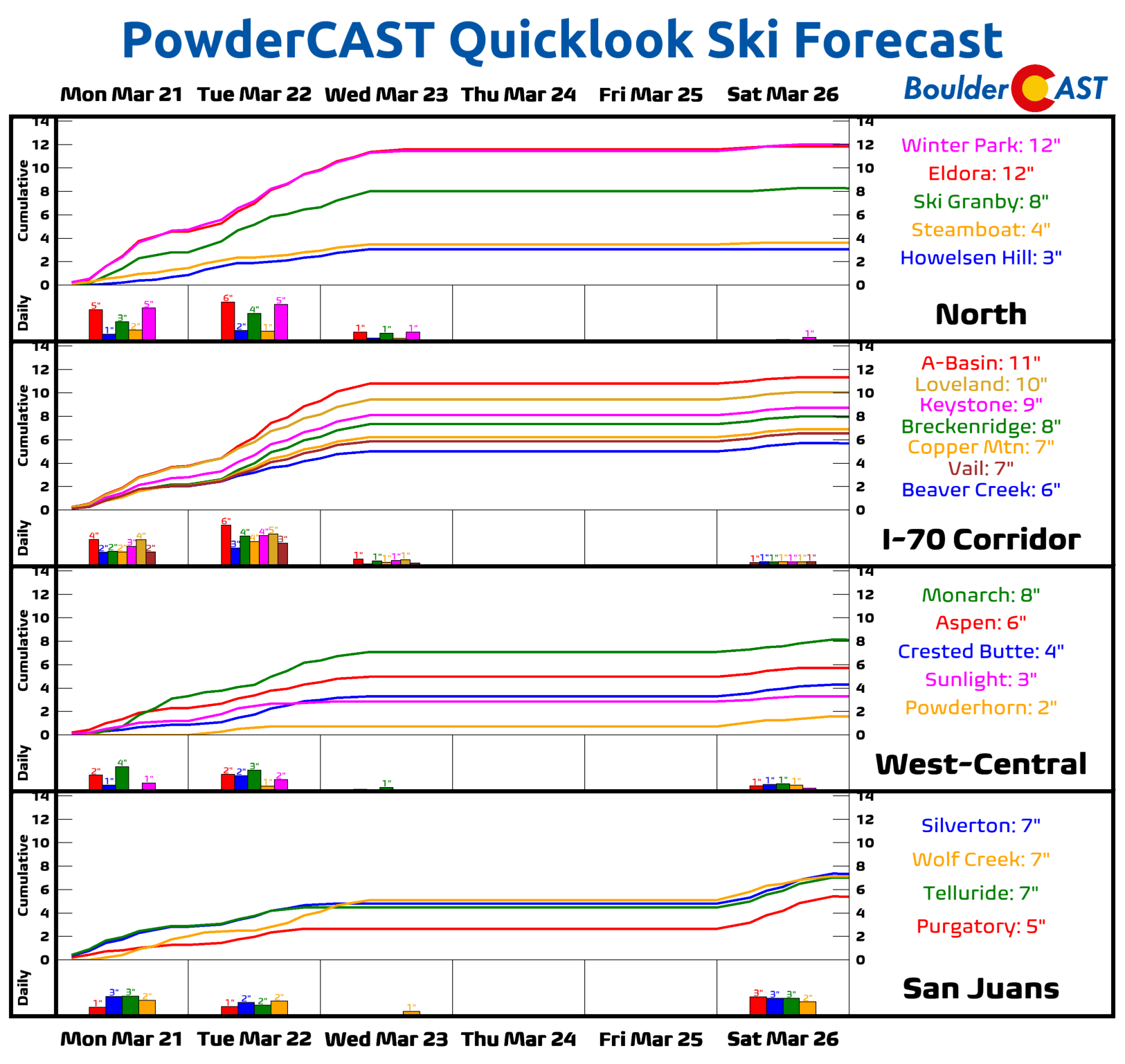
Mountains: Scattered snow showers will be possible across most of the state’s Mountains Monday through Tuesday night. Most ski resorts will see less than 6″, but a few resorts could end up in the 6 to 12″ range. Wednesday and beyond things dry out considerably with sunshine and warmer temperatures expected heading through the late week and weekend ahead.
Help support our team of Front Range weather bloggers by joining BoulderCAST Premium. We talk Boulder and Denver weather every single day. Sign up now to get access to our daily forecast discussions each morning, complete six-day skiing and hiking forecasts powered by machine learning, first-class access to all our Colorado-centric high-resolution weather graphics, bonus storm updates and much more! Or not, we just appreciate your readership!
Spread the word, share the BoulderCAST forecast!





You must be logged in to post a comment.