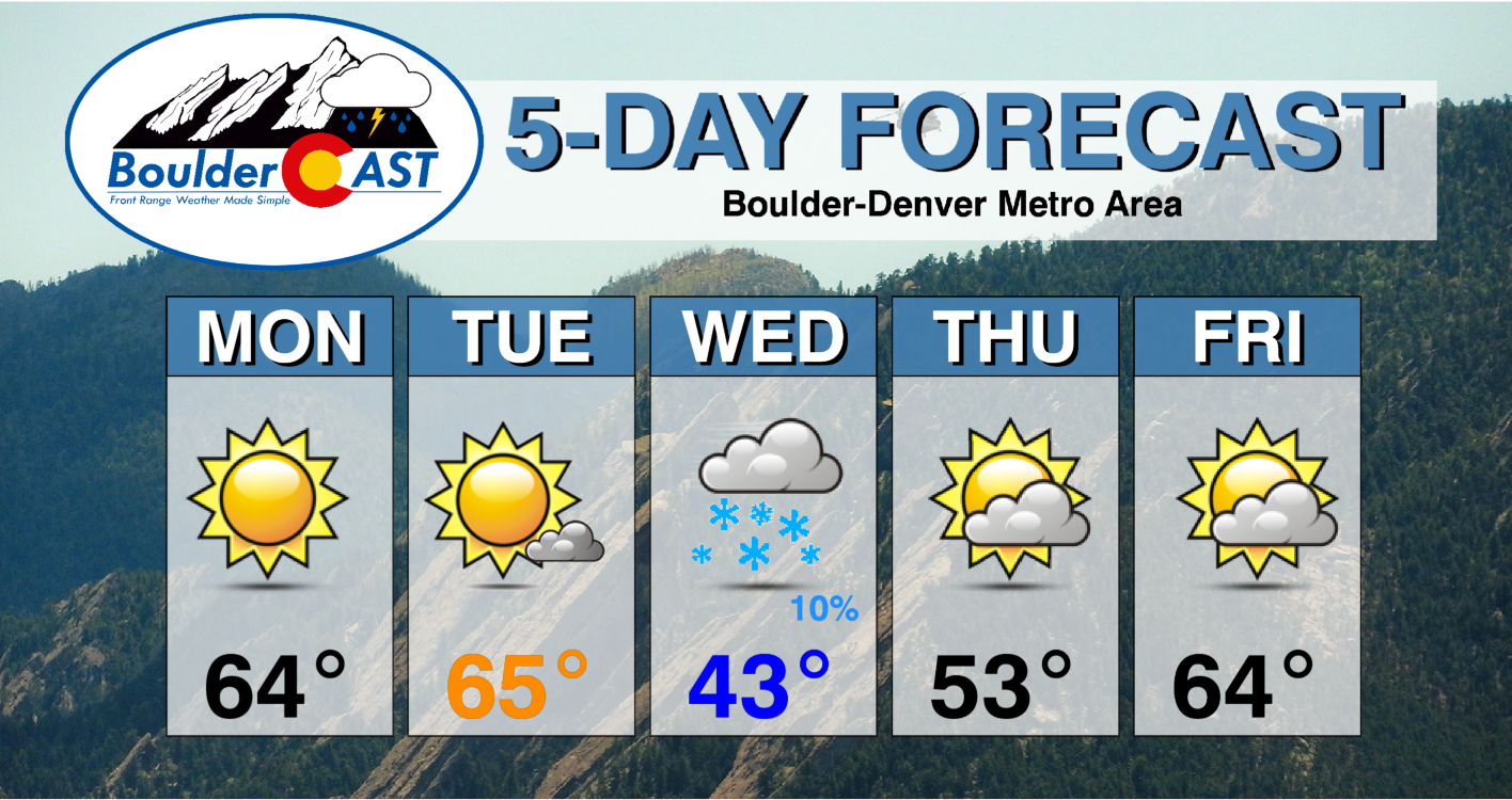
Warm weather and sunshine will start out our holiday week as temperatures reach comfortably into the 60’s. A strong cold front will usher in much colder temperatures around midweek, along with a slight chance of snow. Early indications are that Thanksgiving will be seasonal and dry. A gradual warming trend is in-store for the latter half of the week and into the weekend with no major storm systems anywhere to be found in the pipeline.
This week’s highlights include:
- Monday & Tuesday will be warm with highs in the 60’s
- A strong cold front moves in early Wednesday, with the small potential for light snow
- Cool and dry for Thanksgiving day
- Drier and moderating temperatures to end the holiday week into the upcoming weekend
- Slight potential for strong downslope winds later in the week
DISCLAIMER: This weekly outlook forecast is created Monday morning and covers the entire upcoming week. Accuracy will decrease as the week progresses as this post is NOT updated. To receive daily updated forecasts from our team, subscribe to BoulderCAST Premium.
Very warm to start the holiday week…record warmth?
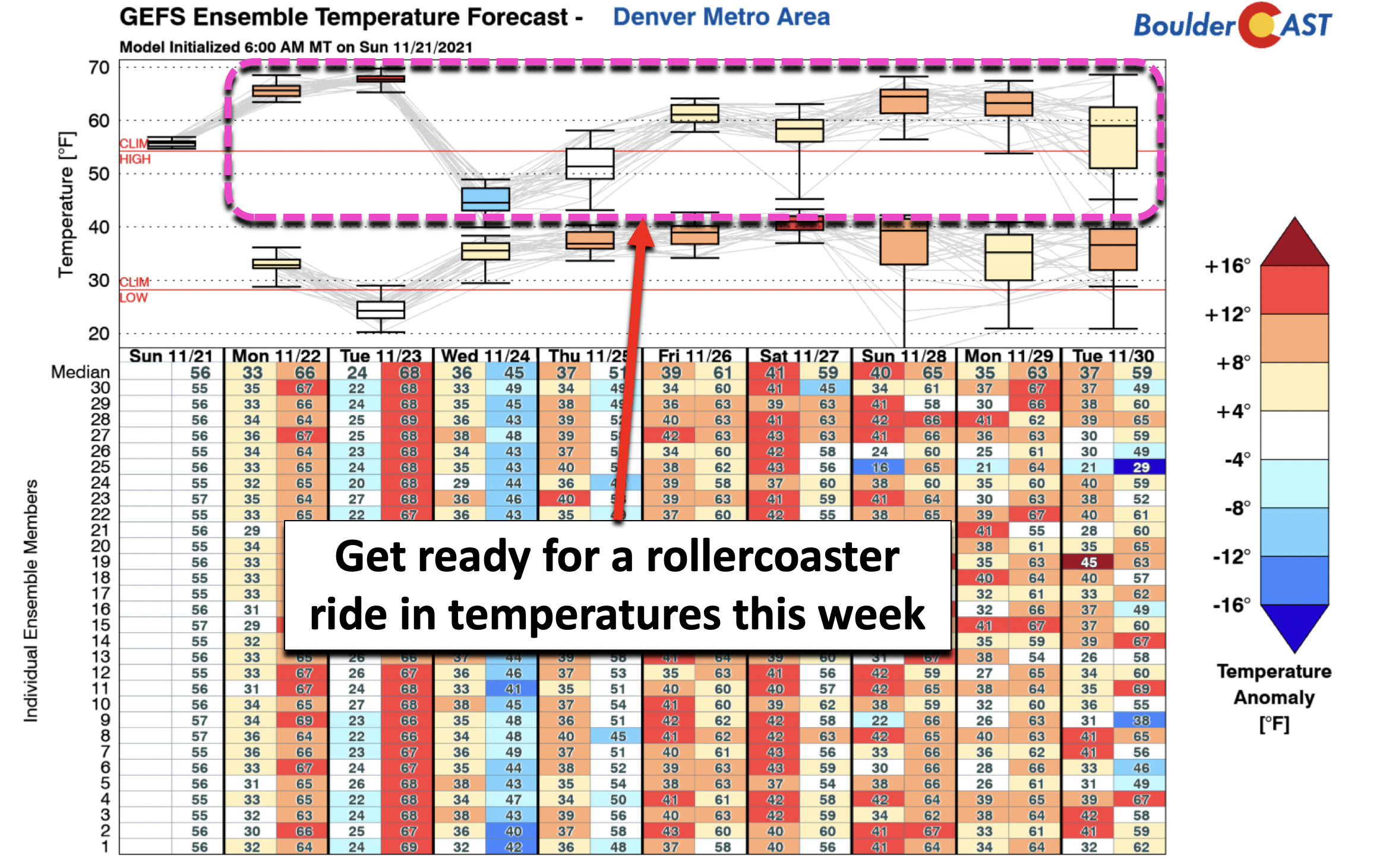
The figure below shows the overall trend in maximum and minimum temperatures for the week ahead as predicted by the GFS model ensembles. Focus on the area highlighted in pink. Get ready for quite the rollercoaster ride! We will start out the week well above average, in the middle to upper 60s Monday and Tuesday. Could we see a record high set one of these days? Probably not, as the existing record high both days is 73°F, but we’ll still be warm nonetheless. The bottom falls out on Wednesday and Thursday behind a strong cold front, meaning a chilly Thanksgiving day. Temperatures will moderate again by the end of the week.
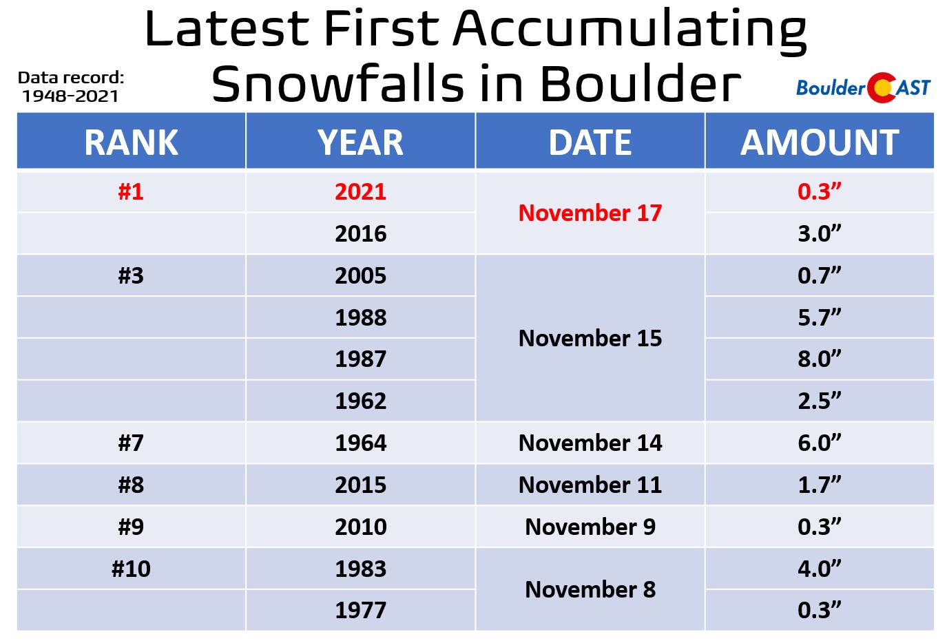
Accompanying the cold front Wednesday will be a tiny chance of snow for Denver and Boulder alike. Last week Boulder picked up its first official snow of the season… a measly 0.3″ on November 17th. This tied the city’s latest ever first snowfall record. Denver has yet to see any snow stick this season and has already locked up the latest snowfall record.
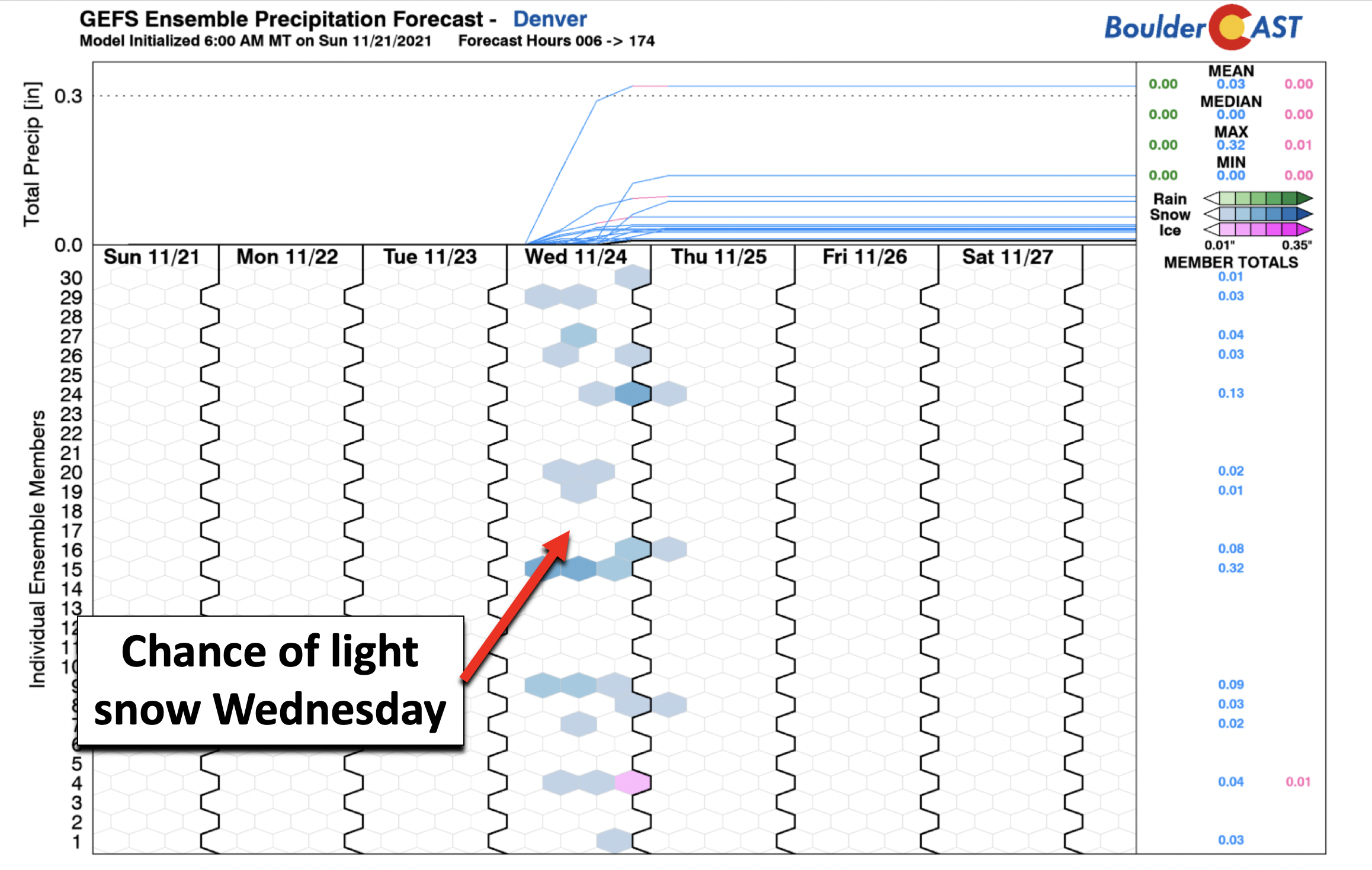
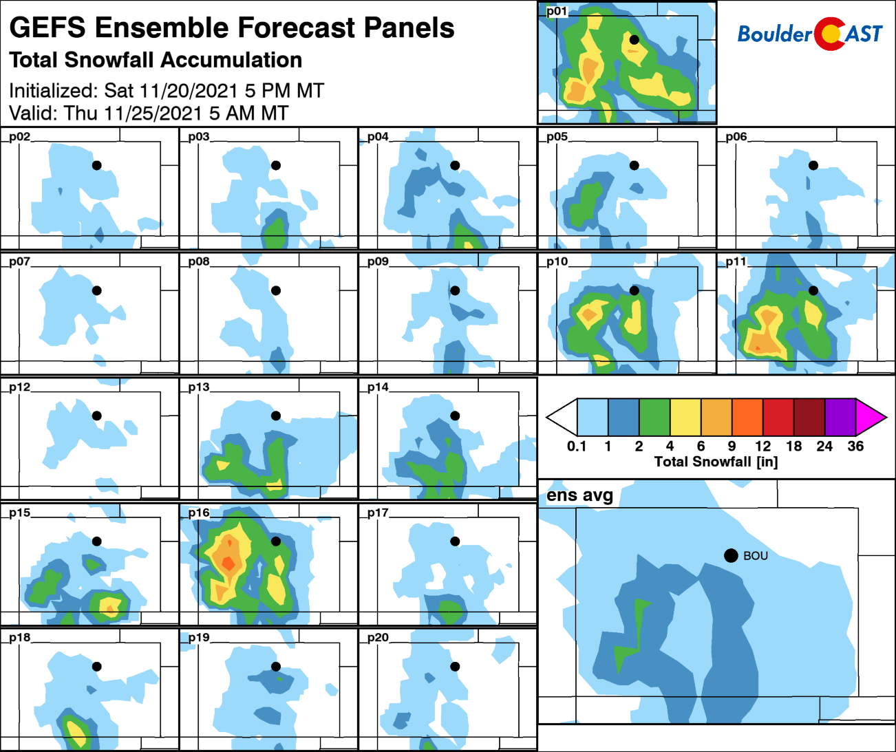
Although overall confidence is low with the GEFS ensembles (below) not overly excited, we will look at the potential for a little white stuff Wednesday into Wednesday night this week across the area.
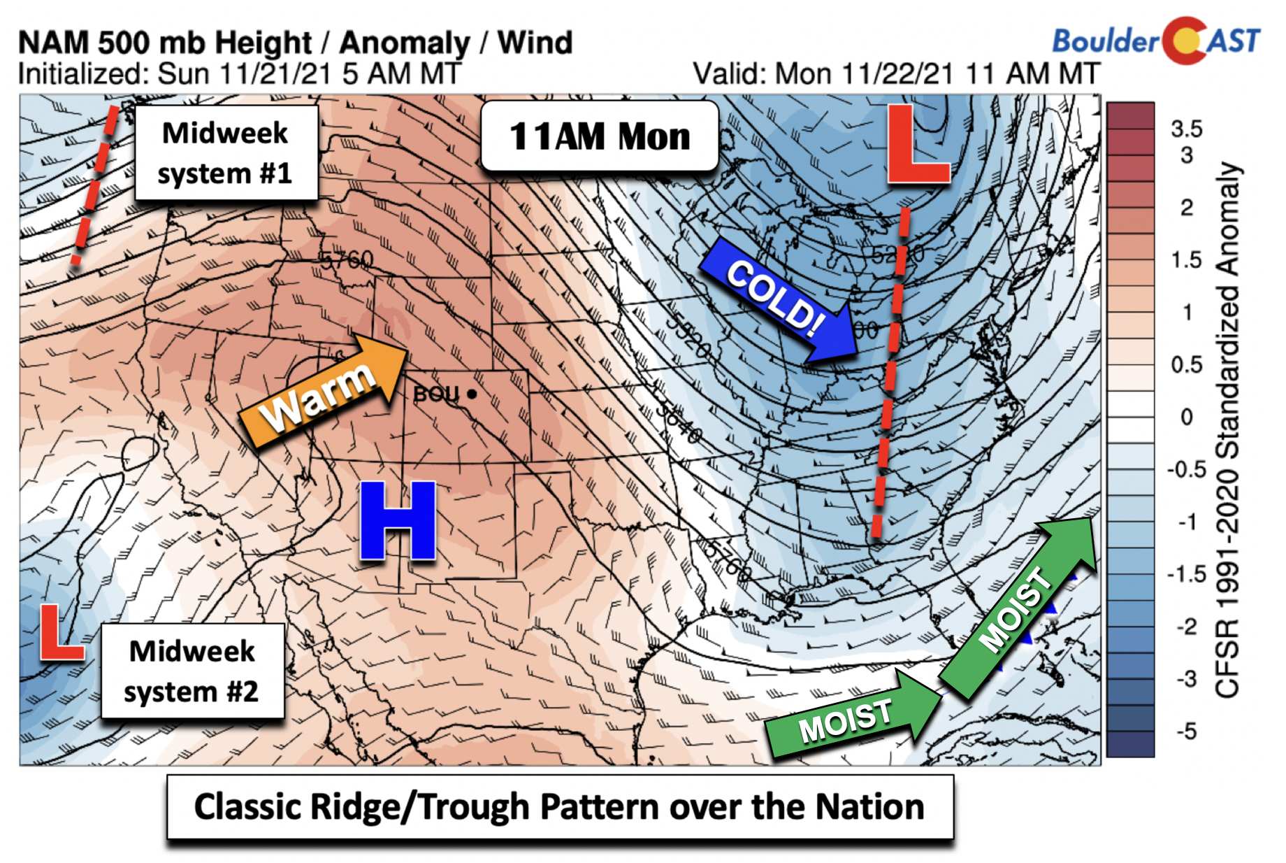
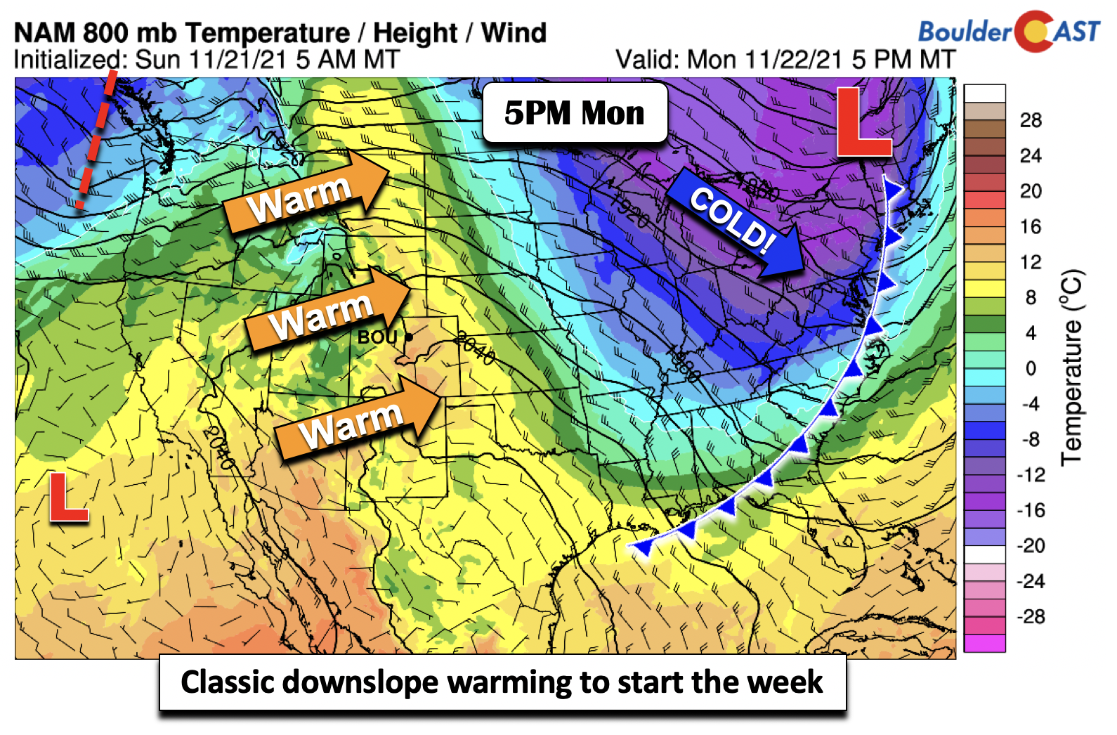
Now let’s discuss the specifics to start our week. At the mid-levels of the atmosphere (below), the nation is under a classic trough/ridge pattern, with ridging out West and a deep trough in the East. As a result, it is warm for us in Colorado yet chilly on the East Coast. Worth noting are two weak systems, one over the Pacific Northwest coast, and a second southwest of California. These two systems will be a player in our sensible weather Wednesday and early Thursday with a cold front and light snowfall chances.
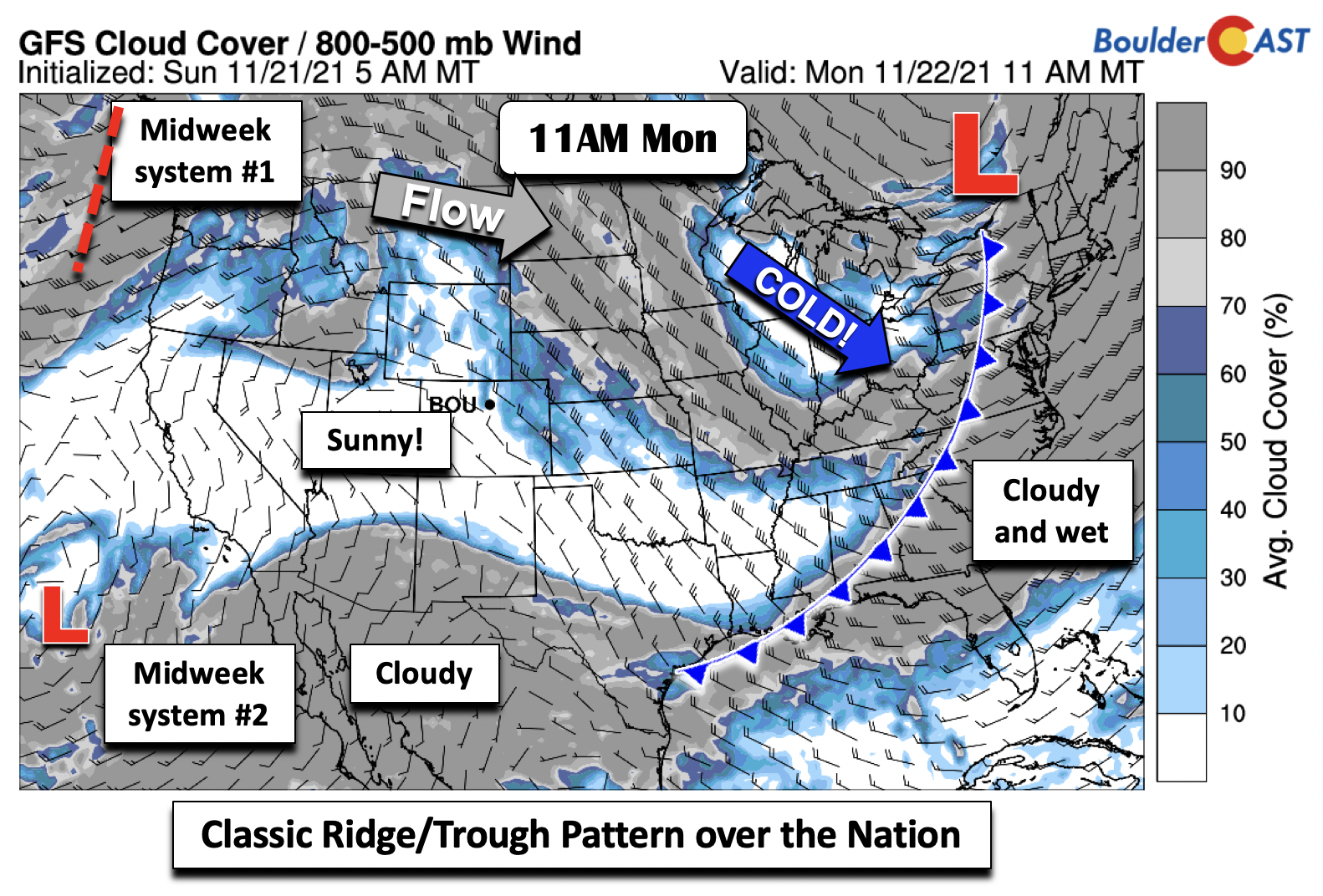
Cloud cover today follows closely the mid-level pattern, with deep cloudiness and rainfall over the southeast and northeast US. The clouds tied to the eastern US cold front extend into Mexico and southern Arizona and New Mexico. Clouds are are present in the Midwest, but sunshine is prevalent across the great state of Colorado!
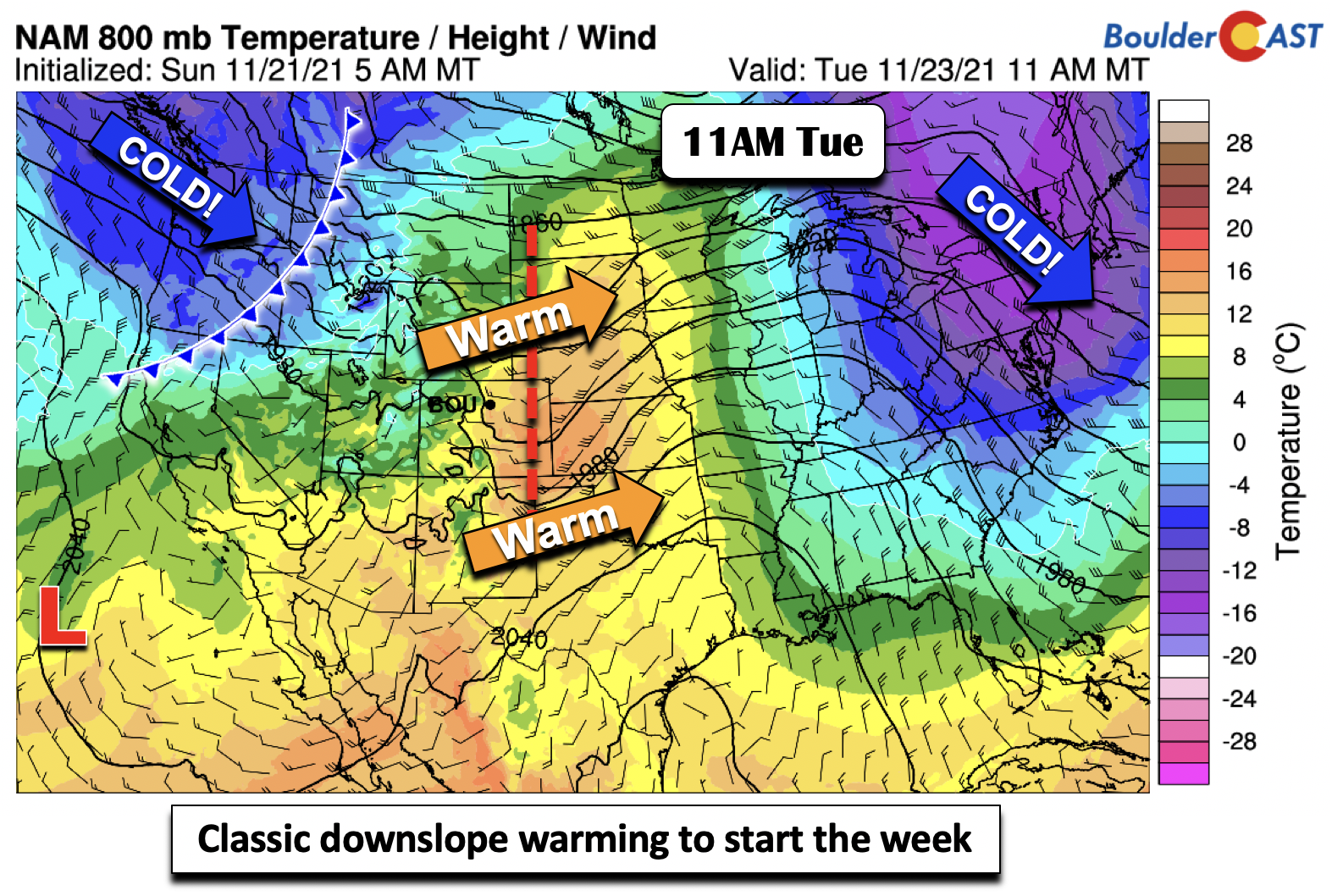
At the low-levels, both Monday and Tuesday, warmth is well in-place over our area, extending from New Mexico into Montana. This is a classic downslope warming signature.
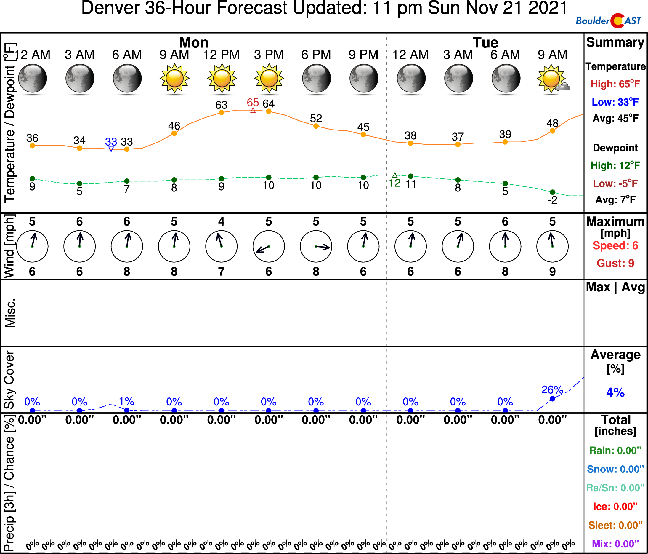
Highs this afternoon should be some 10 to 14°F warmer than Sunday in the middle 60’s. Just a great day to be outside and skip work for the holiday week!
On Tuesday, the pattern does not change a whole lot, but the downslope warming further pushes east into Kansas. With the airmass warmer a bit on Tuesday relative to Monday, high temperatures will climb perhaps a degree to two into the middle or even upper 60’s. The cold front that will reach us Wednesday is out over the Pacific Northwest at this point in time (below).
Much colder Wednesday and Thanksgiving…will it snow Wednesday night?
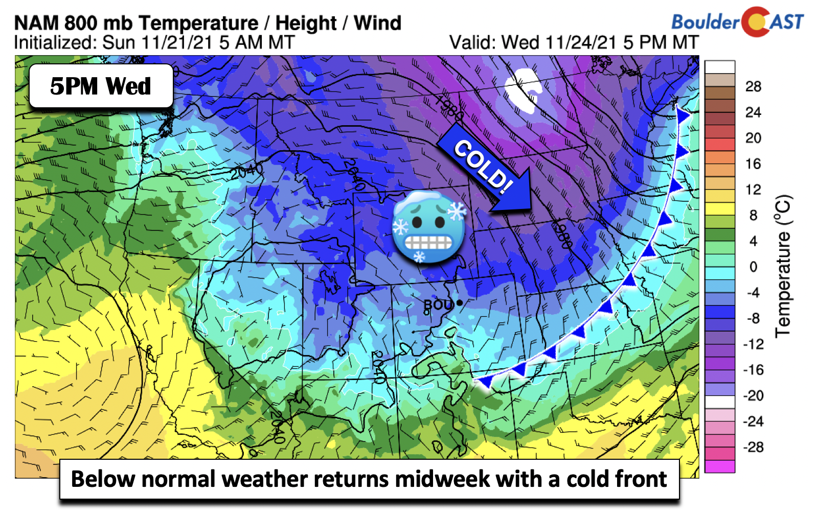
The cold front we mentioned earlier will plow through the area sometime Wednesday morning. Cold air then continues to filter in through the day, with low-level upslope forming for the late afternoon and evening hours. Note the deepest cold air with the front is over North Dakota. After two pleasantly warm days, Wednesday will be 25 or more degrees colder so be prepared for that change. Highs Wednesday currently look to be in the lower to middle 40s.
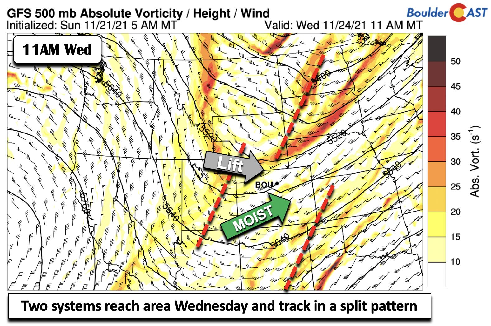
Clouds will be on the increase as well Wednesday as the two systems discussed in the beginning of this post reach the state (below). While the overall details are still being ironed out, the latest model guidance shows that the northern stream system will track east-southeast, while the southern stream system tracks east-northeast into Kansas. This sets up a more or less split flow pattern at the mid-levels. If the northern stream system takes a more southern track, it would increase our chances of snow. But it if trends north and east into Nebraska, it would keep our forecast largely dry. Nevertheless, moisture is good enough for some light precipitation Wednesday night across the state. As is the case with any of these systems, models tend to trend slower, so our best guess is Wednesday night to early Thursday for any snow chances.
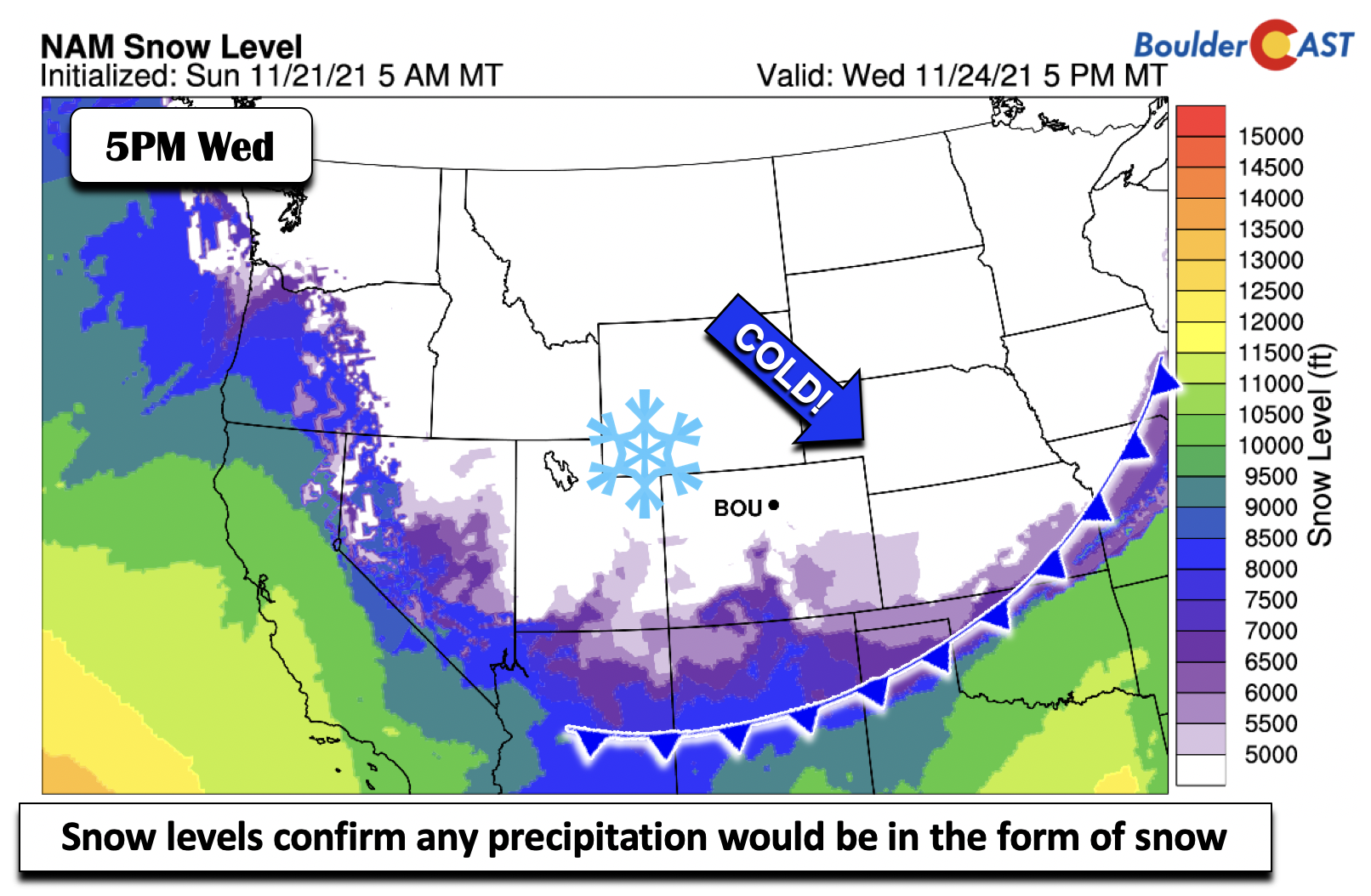
We could have guessed it by the temperature pattern behind the front, but our snow level calculations confirm the hypothesis that any precipitation that manages to materialize Wednesday would be in the form of snow, with snow levels well below the Boulder and Denver elevation.
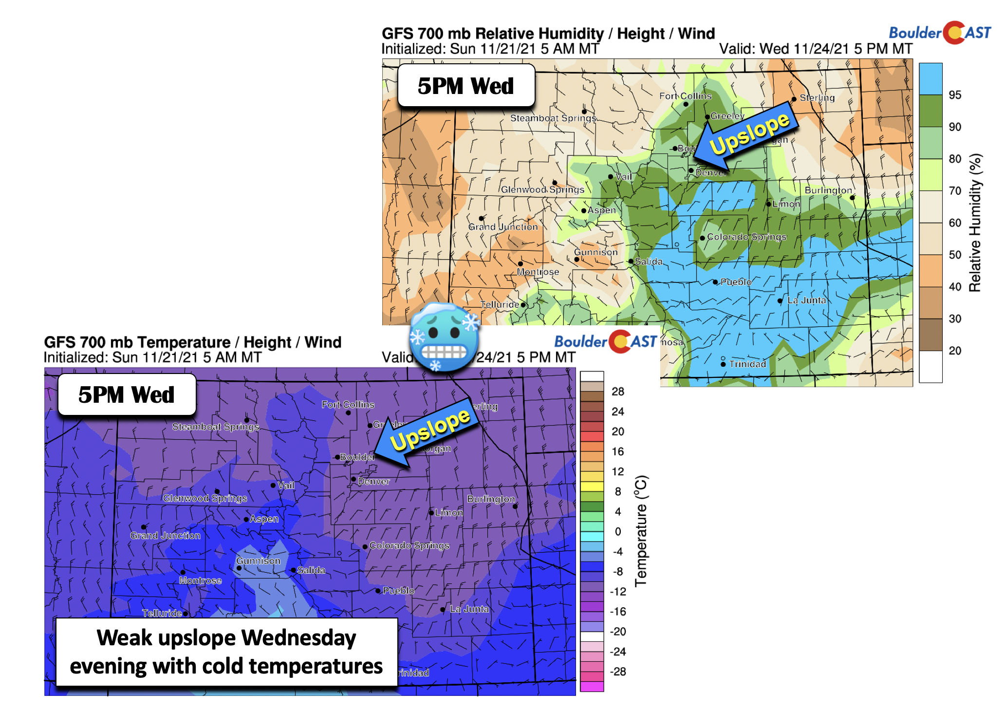
As it currently stands, the GFS is the most bullish on snow potential Wednesday evening. Along with the cold air, it has light upslope winds aloft and near the surface, along with high relative humidity conducive for clouds/precipitation. The NAM and Euro, on the other hand, are less aggressive and drier, favoring a more downslope pattern as the trough tracks a tad north of the state. We are too far out to look at the high-resolution models as of yet, but they will be very telling as we get closer.
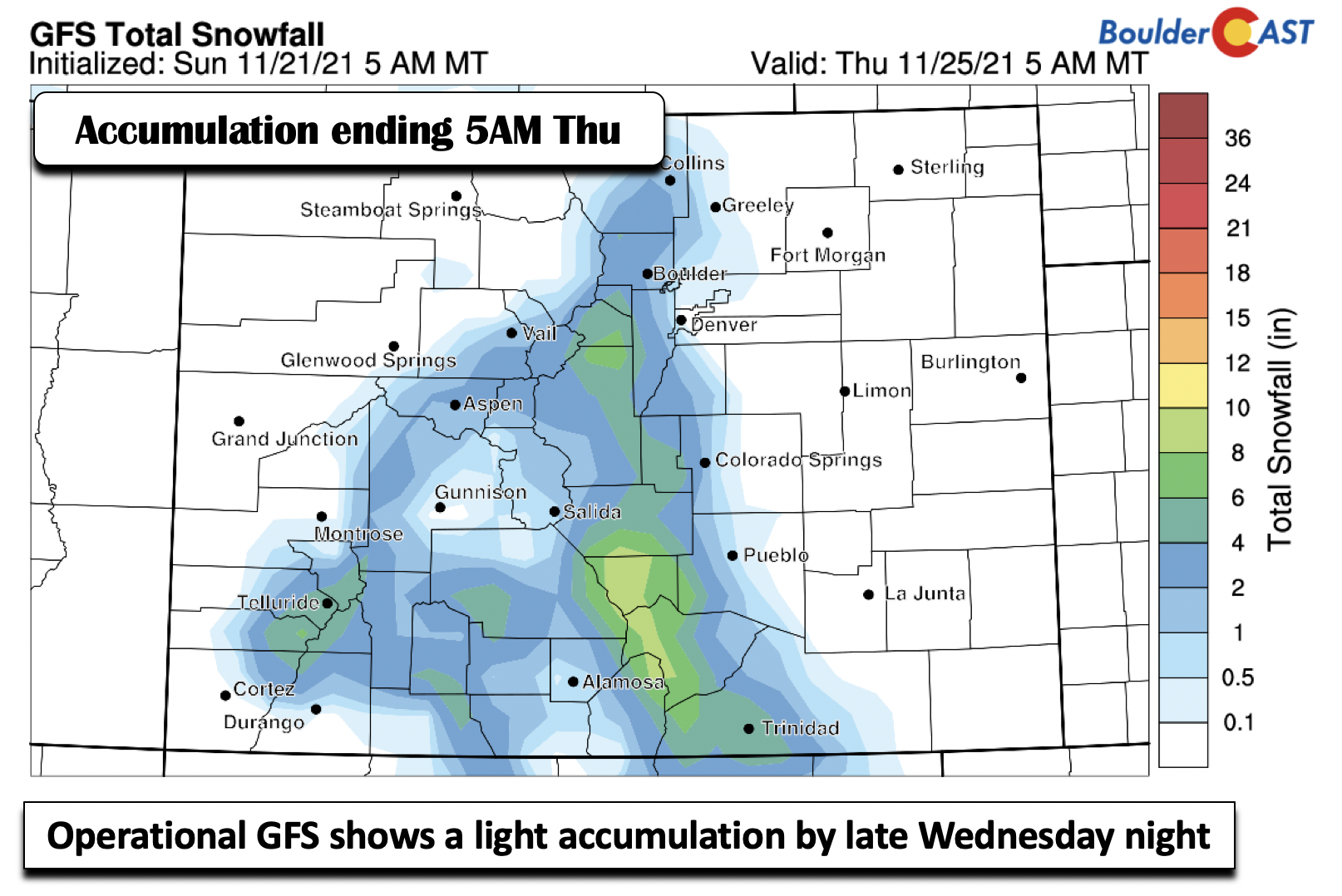
The operational GFS shows some light snow accumulations (trace to 2″) over the Front Range by 5AM Thanksgiving morning, mainly in the higher terrain though
While there is plenty of uncertainty, a number of the GEFS ensembles (below) paint at least some snowfall for the Denver Metro area, although amounts vary widely from nothing at all up to 4 inches. The GEFS mean, however, is about an inch or less. Thus, this will be something to watch for our midweek. All in all, it won’t be a major storm but has an outside chance to bring a dusting of snow for Turkey Day.
Moderating temperatures for the back half of the week
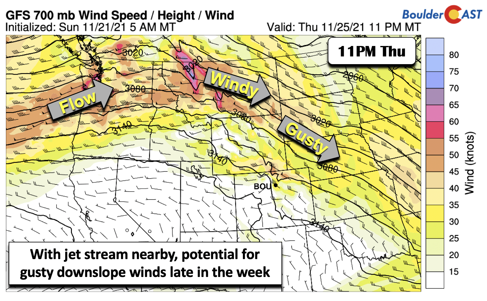
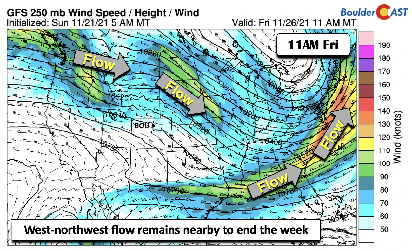
On Thanksgiving day, we will likely remain in a chillier pattern, with highs around the lower 50’s. As the flow aloft will still be out of the west and northwest, as well as the jet stream nearby, we need to watch the the potential for gusty winds late Thursday night or Friday. As it stands now, the axis of highest winds is forecast to remain just to our north over Wyoming. However, if the pattern trends southward with the jet stream, it will be something worth watching.
Temperatures should moderate nonetheless by late Thursday and Friday as the deepest cold air and trough pushes into the Midwest and eastern sections of the country. For now, expect highs getting back into the 60’s for Black Friday. Good online or in-store shopping weather, we reckon.
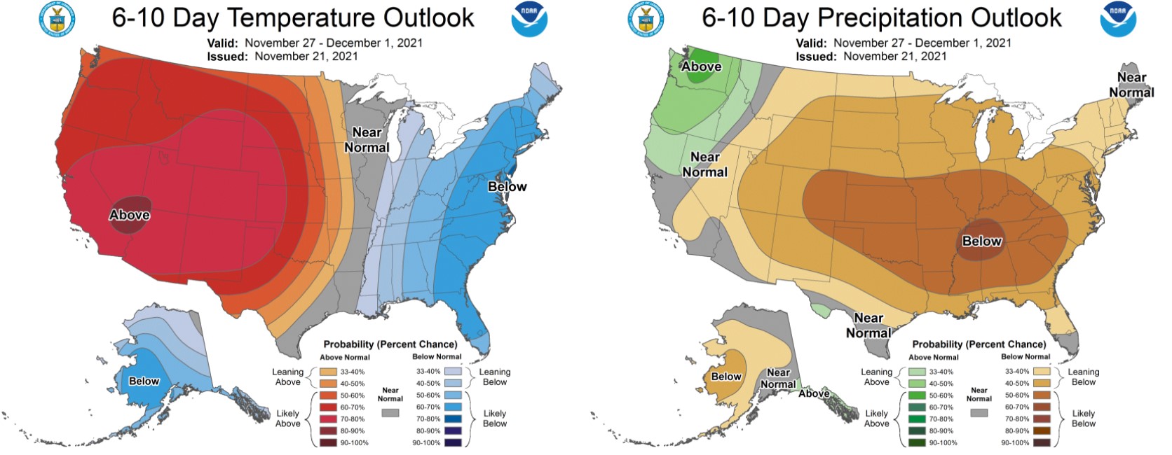
There’s very little hope for any significant weather systems to reach Colorado through the end of the month and thus Denver will likely need to wait until sometime in December for its first snowfall. The Climate Prediction Center outlook for the last five days of November has greatly elevated odds of warm and dry condition for our entire state. Hopefully things begin to change soon, but right now we just don’t see any indication of that at all in the extended.
From all of us at BoulderCAST, have a blessed and relaxing Thanksgiving with your friends and family!
Stay up to date with Colorado weather and get notified of our latest forecasts and storm updates:
We respect your privacy. You can unsubscribe at any time.
Forecast Specifics:
Monday: Sunny and well above average with highs in the middle 60’s on the Plains and middle 50’s in the Foothills.
Tuesday: Mostly sunny early becoming partly cloudy and breezy in the afternoon. Highs in the middle 60’s on the Plains and middle 50s in the Foothills.
Wednesday: Mostly cloudy and colder with a slight chance of snow. Highs in the 40’s with dropping temperatures in the evening. Temperatures top out only in the lower 30’s in the Foothills.
Thanksgiving Day: Partly sunny and cool with highs in the 50’s for the Plains and lower 40s in the Foothills.
Friday: Partly sunny and warmer with highs in the lower to middle 60s on the Plains and lower 50s in the Foothills.
Mountains: Warm and dry conditions will be in place through Tuesday. Light snow will be likely Wednesday and Wednesday night, along with colder temperatures. Gusty winds are possible Tuesday through Friday. Drier and moderating temperatures are favored to end the holiday week.
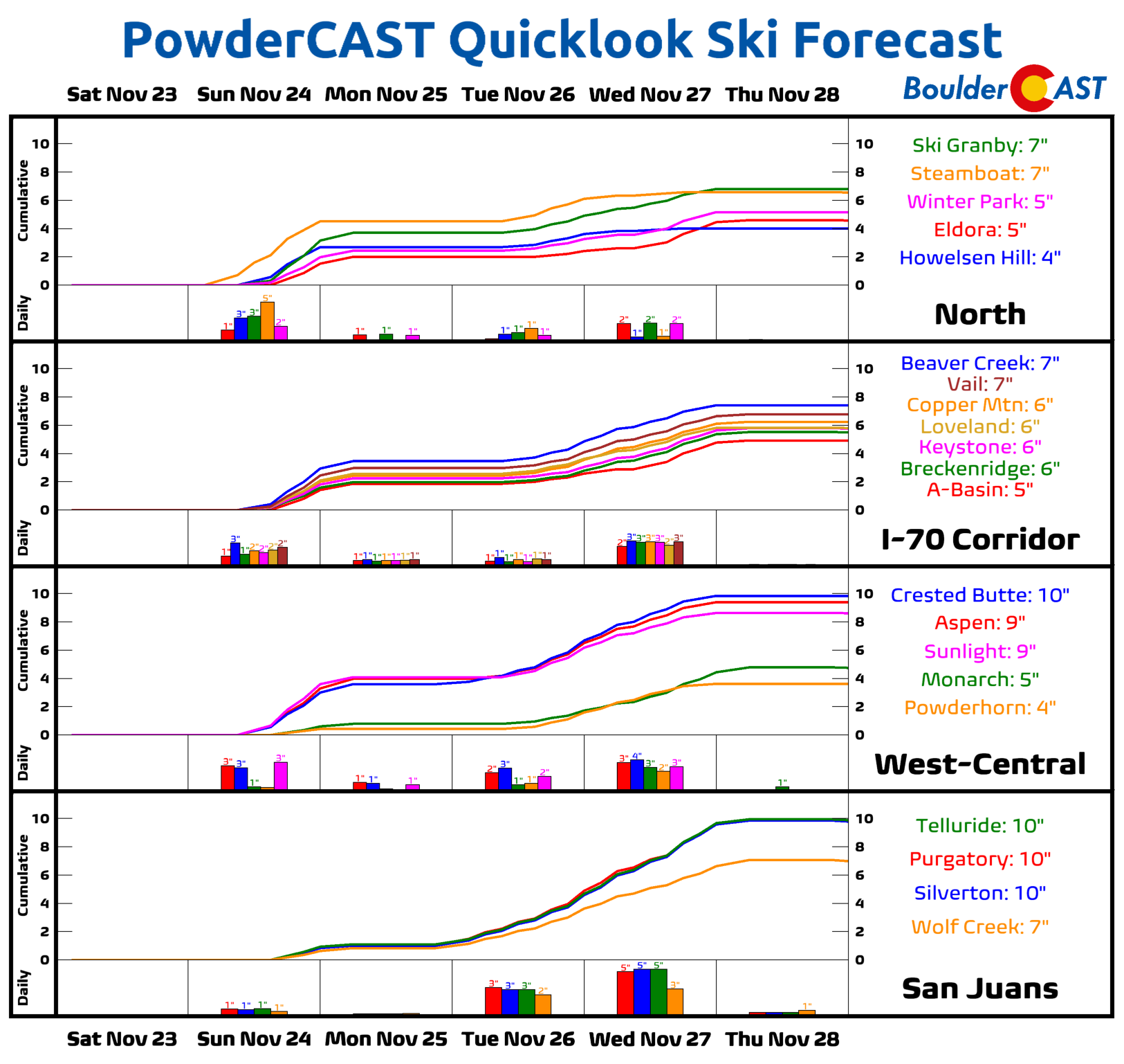
Help support our team of Front Range weather bloggers by joining BoulderCAST Premium. We talk Boulder and Denver weather every single day. Sign up now to get access to our daily forecast discussions each morning, complete six-day skiing and hiking forecasts powered by machine learning, first-class access to all our Colorado-centric high-resolution weather graphics, bonus storm updates and much more! Or not, we just appreciate your readership!
.
Spread the word, share the BoulderCAST forecast!
.




You must be logged in to post a comment.