We sure hope you enjoyed the recent warmth and sunshine! On Monday, we alerted you to the likelihood that we would see our next round of snow at the end of the week. With the models now trending a little bit snowier over the course of the last 24 hours, we provide a update on when the snow will start and how much to expect.
Here we are on Wednesday night. Forecast models have trended upwards in snow amounts through the week. Earlier in the week, it looked like a 1-2″ snow event at best, to just a few flurries at worst. As of now, uncertainty is still relatively high, but there is a greater potential of some heavier snow.
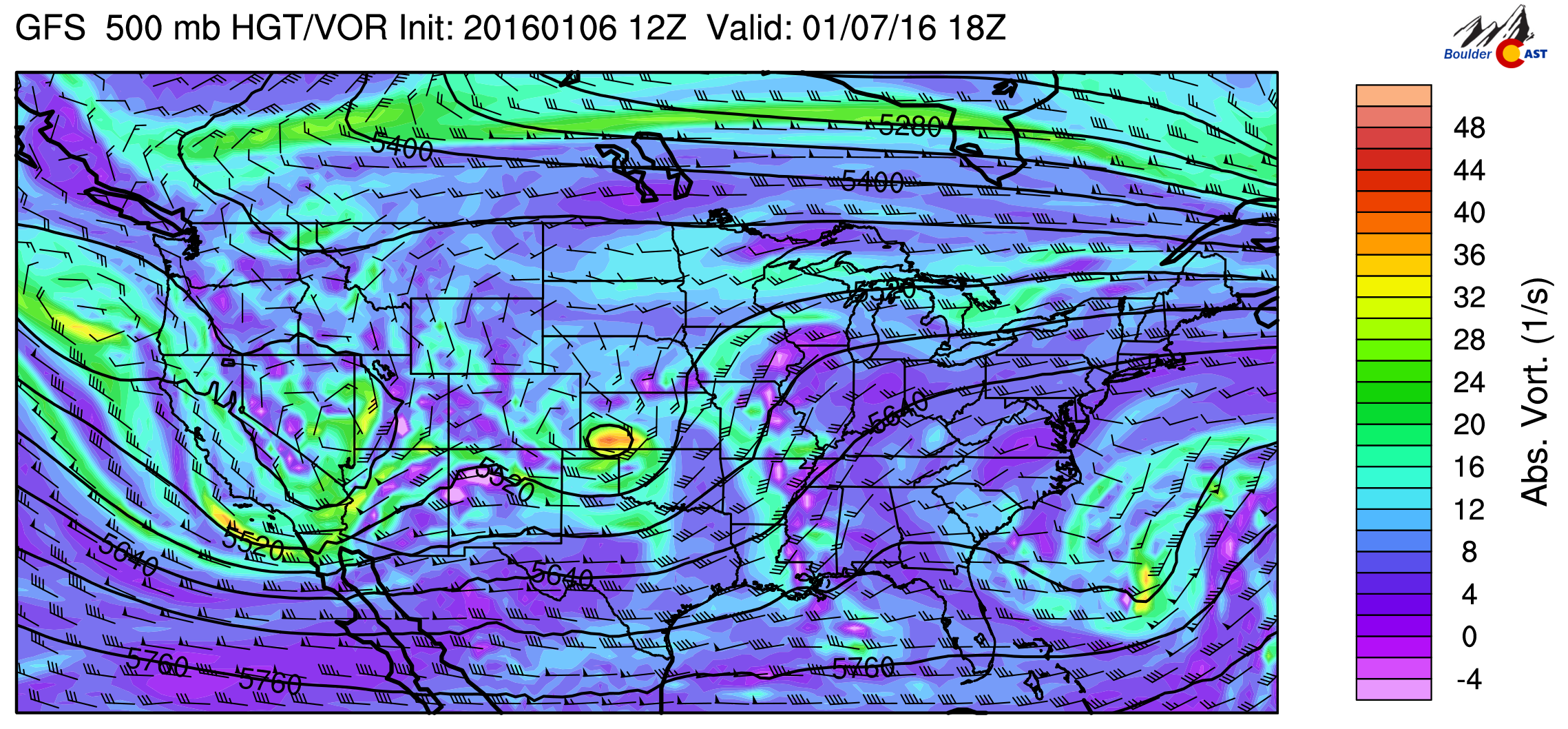
The drivers behind the snow are two shortwaves sliding eastward from California. Both can be seen below in the 500mb map for Thursday morning.
The energy over Kansas will bring us snow Thursday morning and afternoon, while the dip in the jet seen in California will move across Colorado on Friday, bringing a second wave of snow late Thursday night into Friday morning.
First Wave
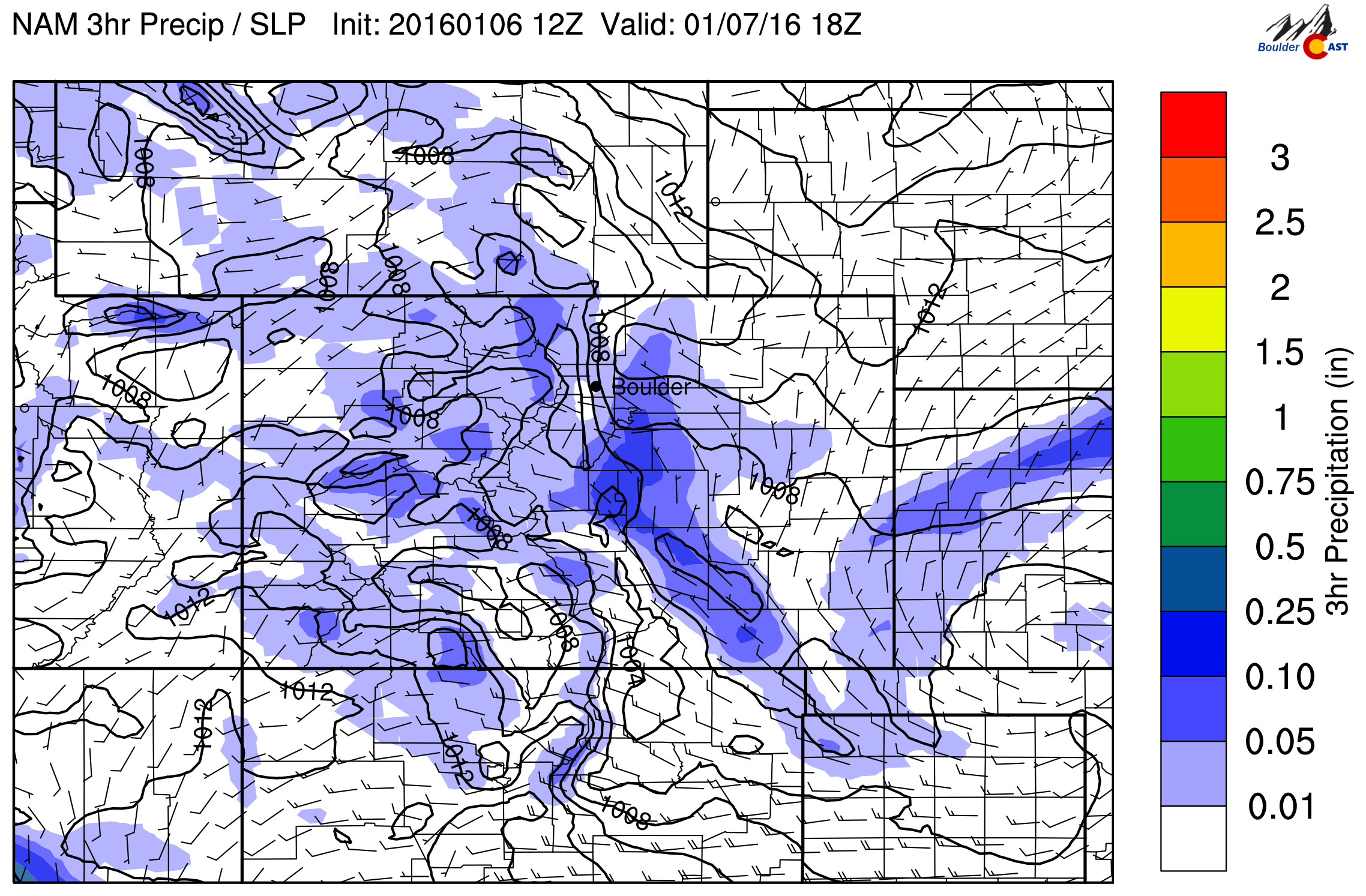
Tomorrow morning, snow will increase across the region from the south, beginning in the Mountains first overnight. This first wave is currently the most uncertain one. The GFS and NAM want to develop some heavier snow northeast of Denver, while downsloping Boulder for the most part.
Snow looks to begin across the Plains late morning, continuing lightly, on and off through the day. Without much forcing, most areas should get less than 1″ by Thursday evening. Depending on the location and if the heavier band even forms, harder hit areas could be in the 2-4″ range, but as of now, that would likely remain east of Denver.
Second Wave
After a slight lull in the action (though flurries will probably continue), snow will pick up once again as the main push of cold air moves in late Thursday evening. This we are quite confident about. This second wave has more going for it….actual upslope (thought very weak), a fair amount of deep moisture, some mid / upper-level dynamics, and a lengthy duration.

GFS 800mb wind and temperature for 11pm Thursday evening. Notice the colder air and NE-erly upslope flow across the Plains.
The most favorable time for snow will be between midnight Thursday night and noon Friday. Snow will decrease in coverage Friday afternoon as the system pulls away and downslope flow takes over. We may see a few breaks in the clouds, but don’t count on it. Temperatures will be cold, with highs in the mid 20’s.

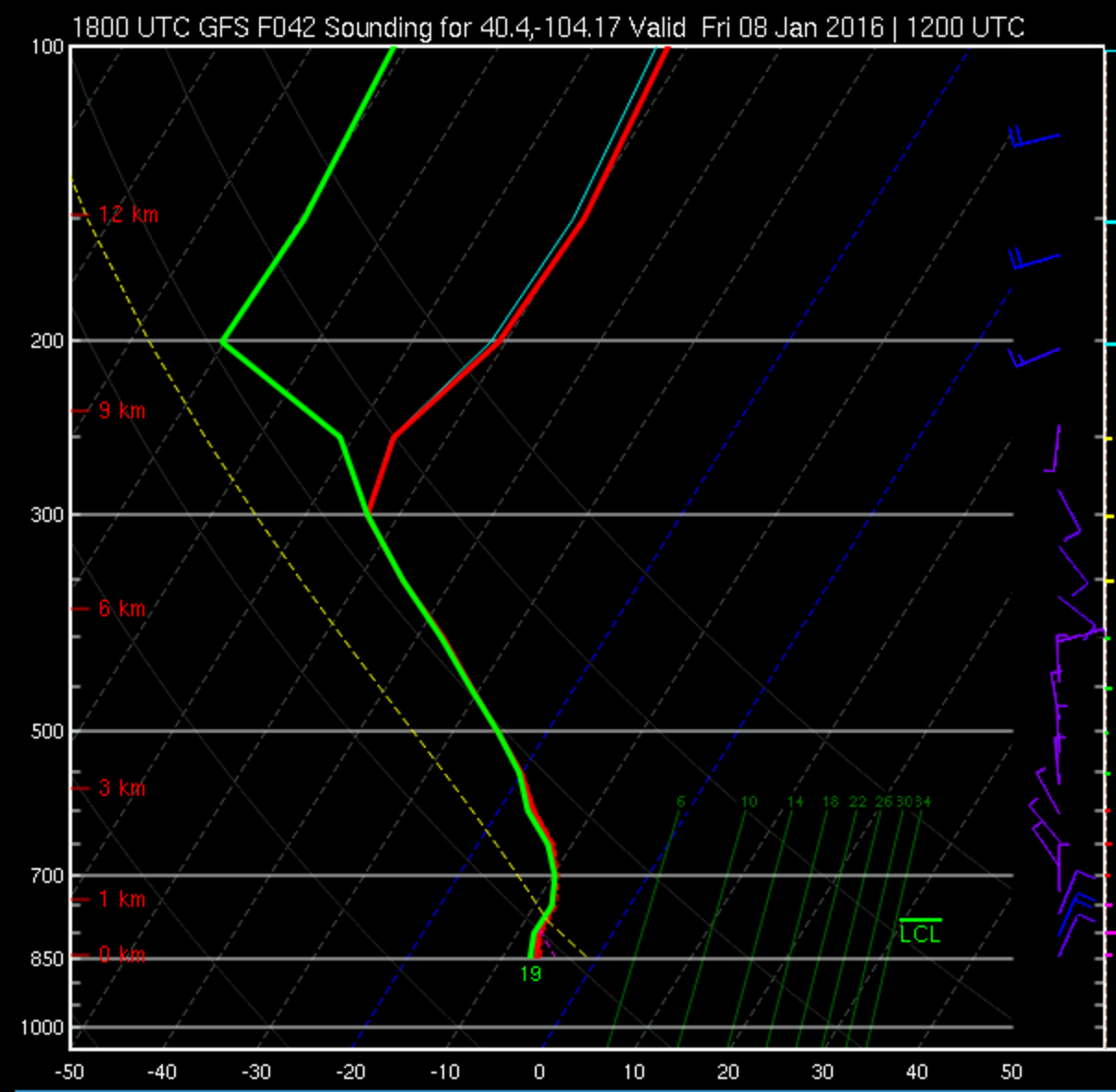
GFS forecast atmospheric sounding for 5am Friday. Notice the deep saturated layer, all the way up to 400mb (green dew point line hugging the red temperature line)
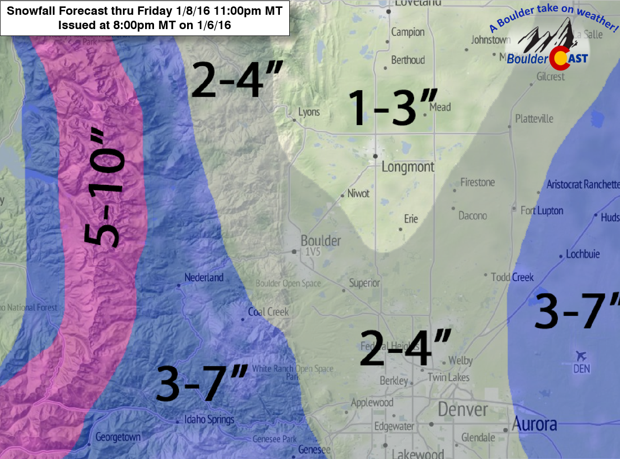
Snow Forecast:
The GFS is indicating 1-4″ for most of the Denver Metro area, but does show limited snow for the western suburbs of Denver, with the NAM being similar. The SREF and high-resolution NAM are more like 4-6″ for everyone! The long duration of the snow (24+ hours) and cold temperatures (15 to 1 or higher snow to liquid ratios) should give everyone some decent snow. For now, we will play the middle ground on the Plains, forecasting as such:
Plains: 2-4″, with slightly more possible east of Denver, and maybe a little less from Longmont area to Loveland
Foothills: 3-7″ (more to the south, less to the north)
Mountains: 5-10+”
There are a lot of nuances that could impact the forecast over the next 24 hours. We will update you if we see fit. Enjoy the end to your week!


You must be logged in to post a comment.