Persistent zonal flow this week will keep chances for snow across the Mountains. The lower elevations will generally be dry and quite warm, but a late-week storm system will likely change this.
T
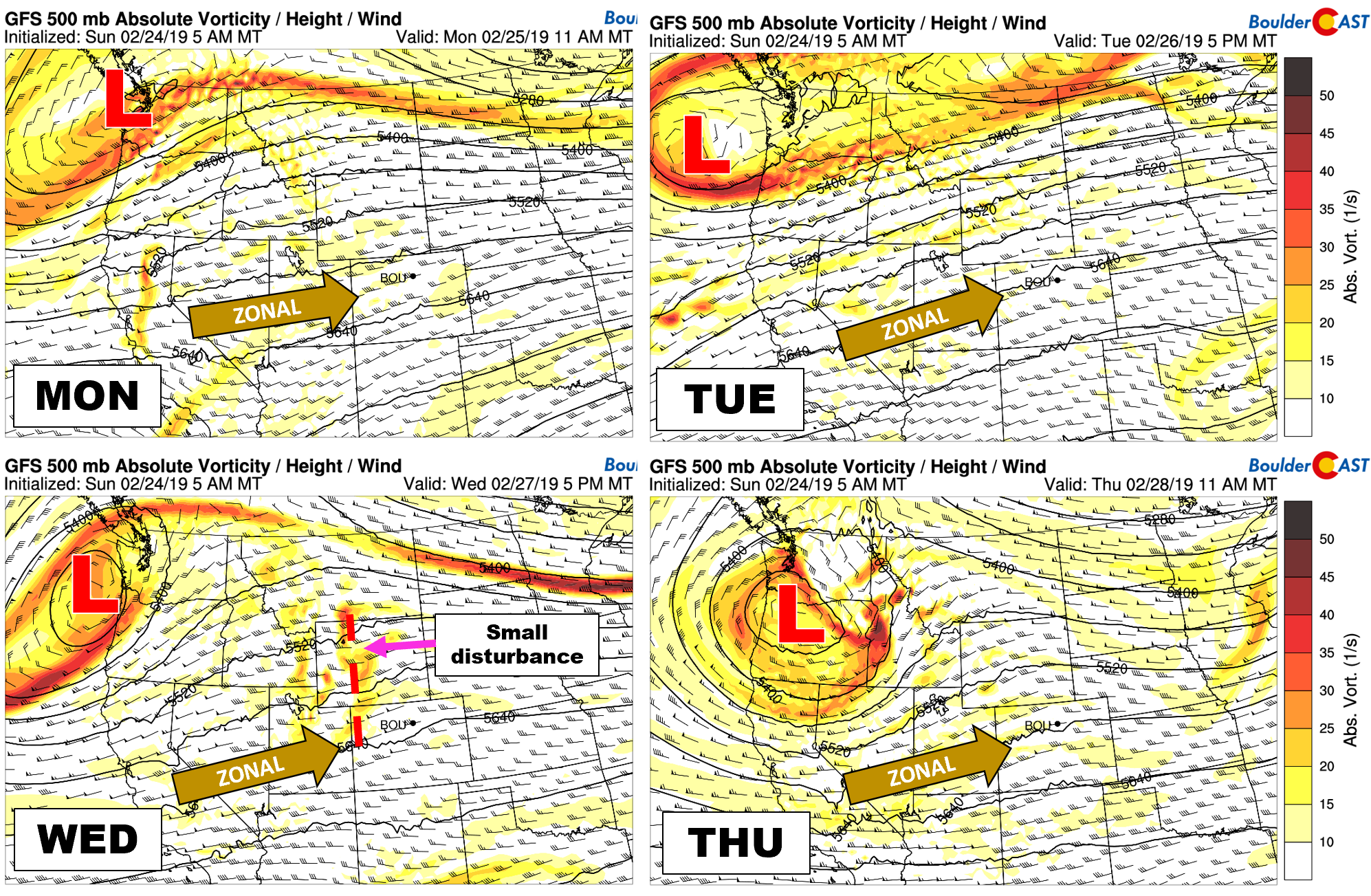
he weather pattern for the upcoming week will be dominated be persistent zonal flow across much of the continental United States. Here in Colorado specifically, we will see moderate to strong west-southwest flow through Thursday at 500 mb. Conditions will remain tranquil and mild statewide on Monday and Tuesday. By Wednesday and Thursday, however, it looks like a few weak disturbances will enter the picture and progress quickly through our region from west to east. At this time, it appears that these waves will lead to only scattered light snow in the Mountains with dry weather holding in the Denver Metro area.
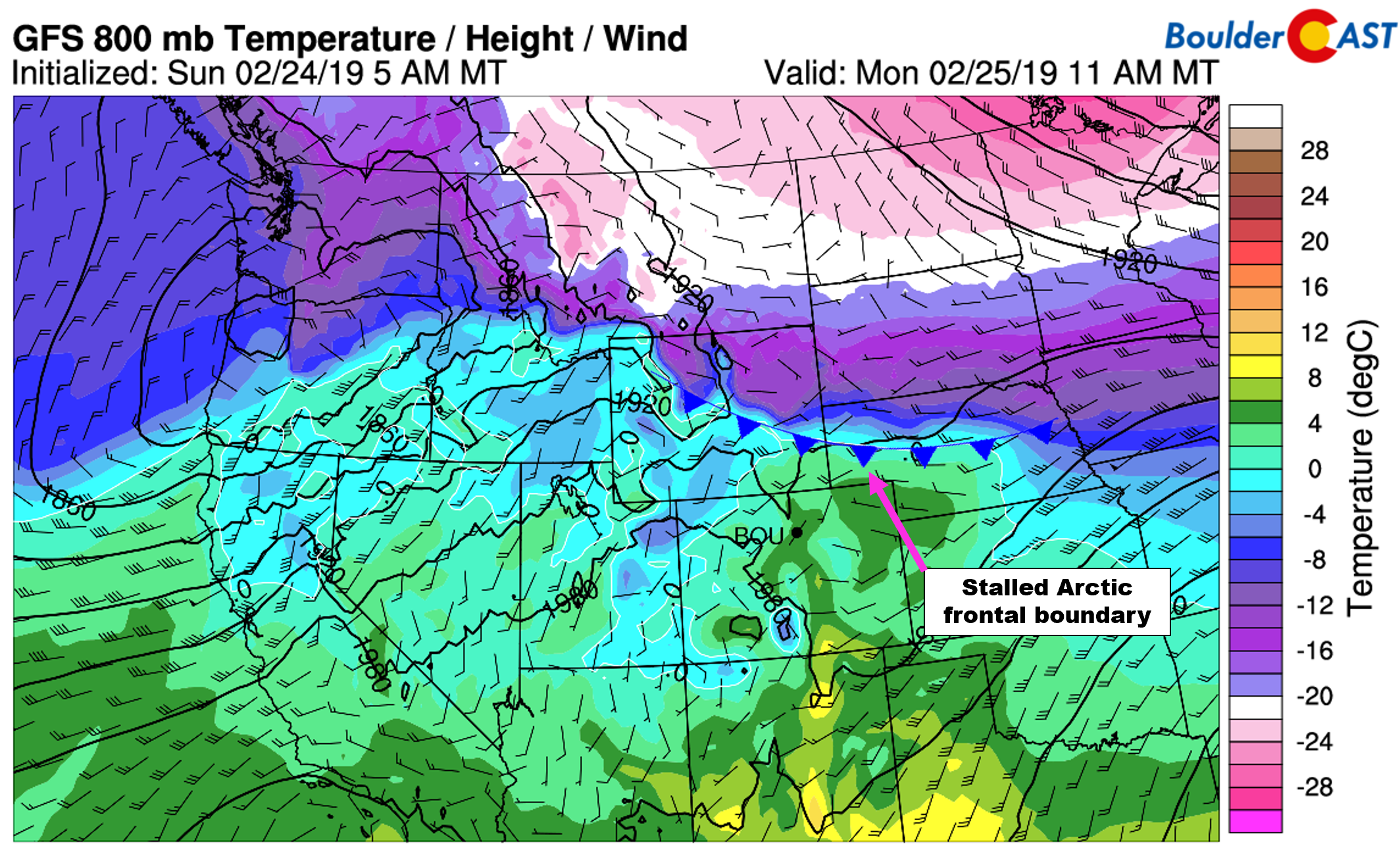
We should also mention that not too far to our north this entire week will be a stalled Arctic frontal boundary. Today this front is located a little bit north of Cheyenne in Wyoming. Colorado will be on the warm side of this front early in the week, with temperatures in the Metro area topping out generally in the 50’s Monday and Tuesday.
As you can see in the 800 mb temperature and wind forecast map above, winds on both sides of the front are weak and generally parallel to the front itself. Thus, progression will be minimal this week leading to only slight meandering of the Arctic boundary.
There is some uncertainty as to how far south this front moves on Wednesday which could impact our temperatures quite a bit. The passing wave mentioned earlier may offer just enough “oomph” to have this front back into the Front Range. The NAM and GFS temperature forecasts for Wednesday morning are shown below. Both models depict the cold airmass penetrating into northeast Colorado, with the NAM being the colder of the two. Furthermore, both models do show that despite a chilly morning Wednesday, warm downslope winds help to erode the cold air with highs rebounding in to the upper 40’s to lower 50’s by afternoon.
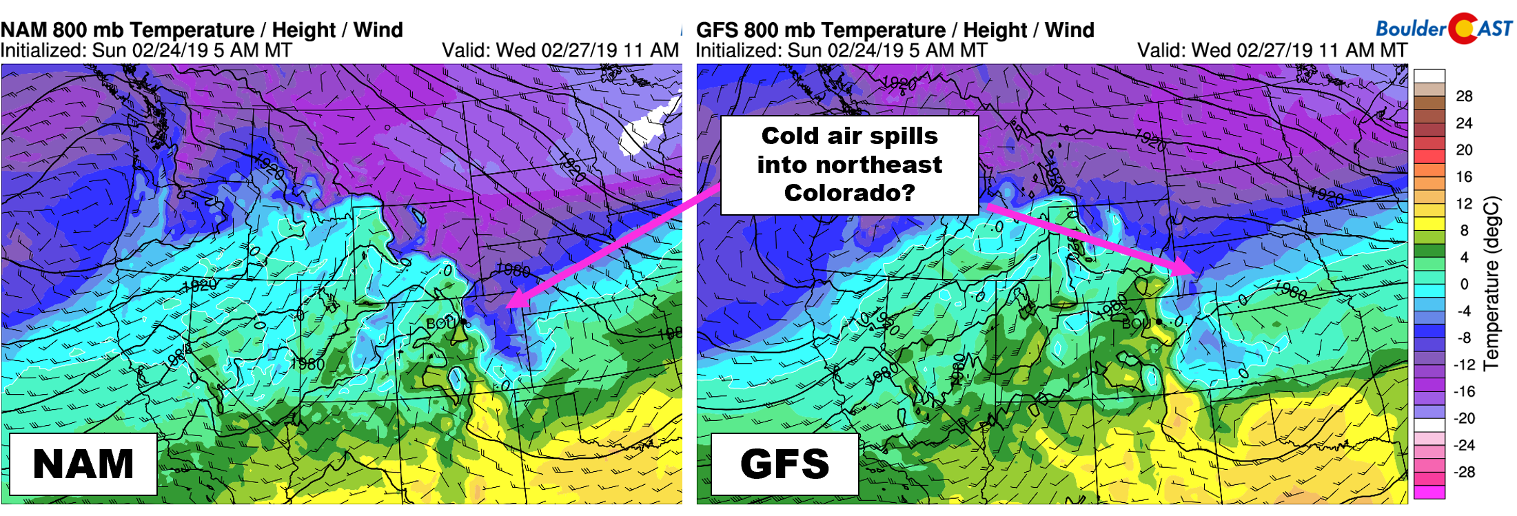
800 mb temperature and wind forecast maps from the NAM (left) and GFS (right) models for Wednesday morning. Differences exist in the placement of the cold air across northeast Colorado
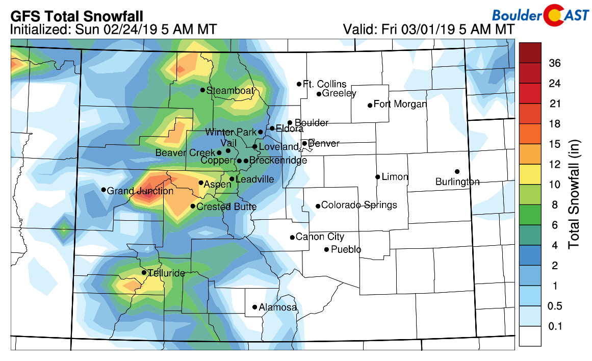
For Thursday, we expect more light snow in the Mountains, but with even warmer weather shaping-up across the Plains. Upper 50’s to lower 60’s are possible. Snowfall amounts in the Mountains should total 3 to 8″ by Friday.
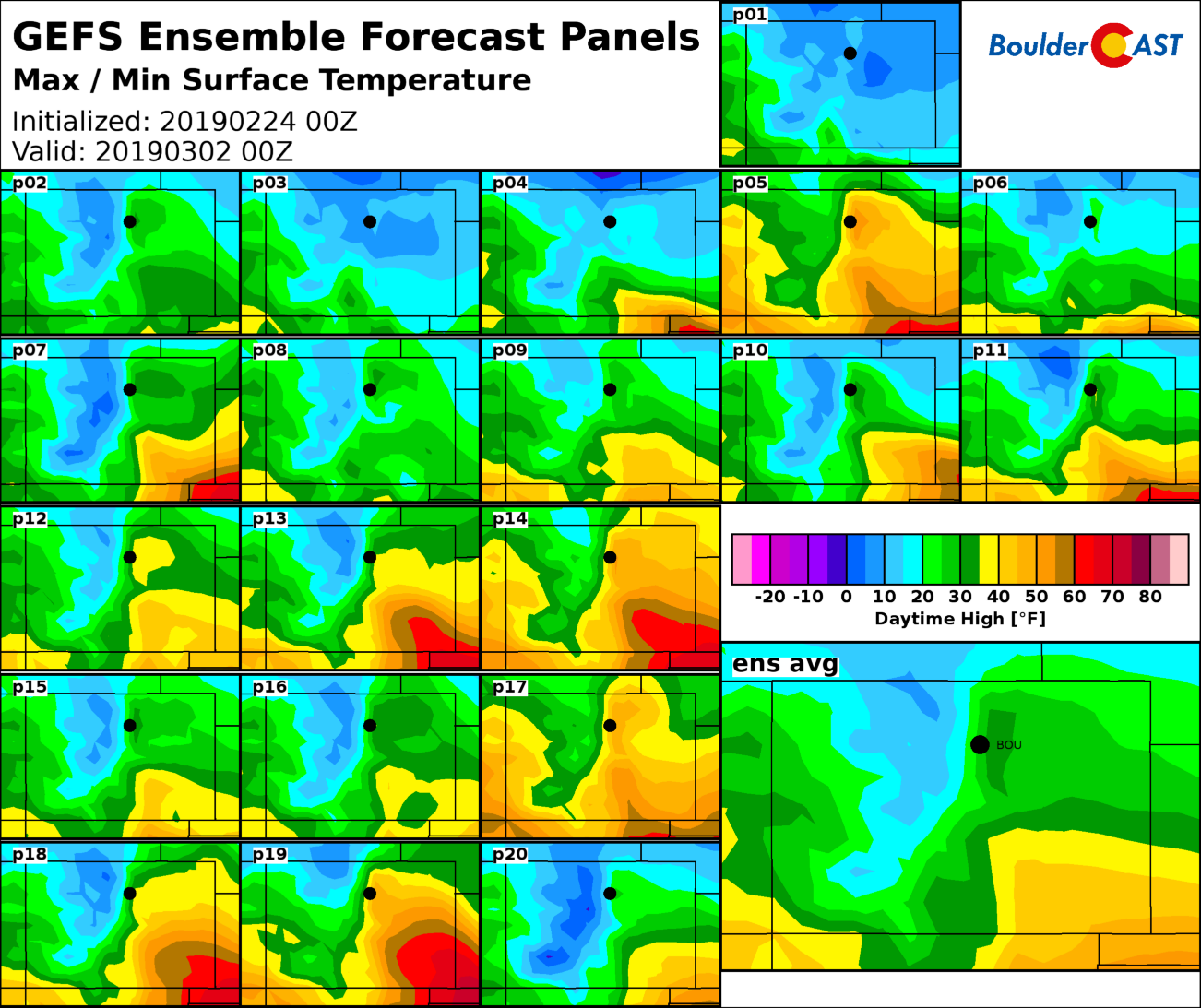
We end the week with a potential storm system moving across the northern Rockies. We really do not think the models have a great handle on this storm just yet. There is a considerable amount of uncertainty in the ensembles in regards to placement of the low and also the front across our region. For example, the GFS ensemble members (below) predict high temperatures Friday afternoon ranging anywhere from lower 50’s to middle teens, with an average somewhere in the middle 30’s.
“Middle 30’s” will be our forecast for now, with a slight chance of precipitation accompanying the trough’s passage Friday. Latest guidance suggests a track too far northward to do much in the the Metro area. We’ll keep an eye on this through the week, though.
Forecast Specifics:
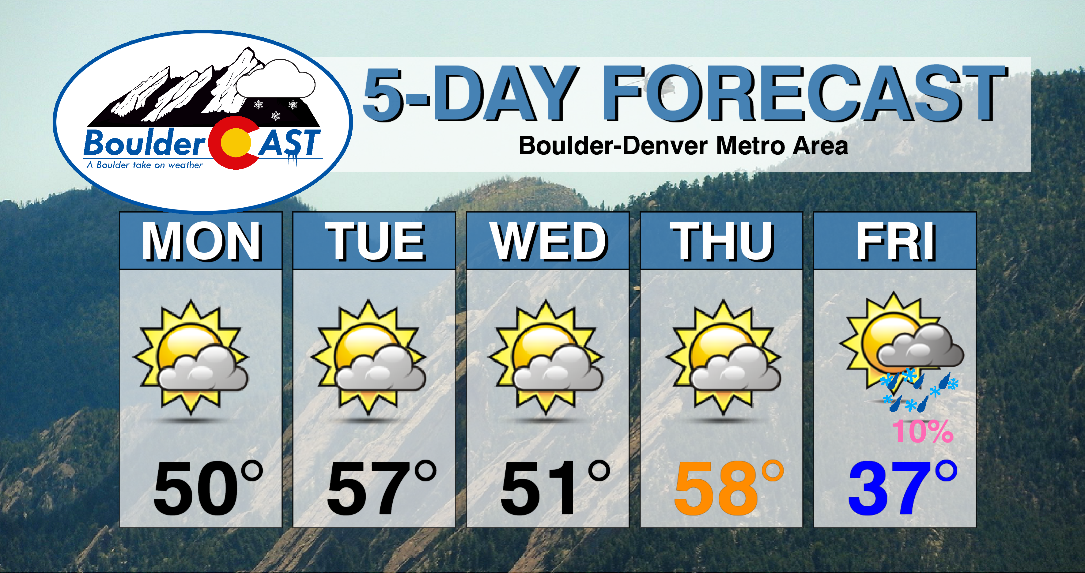
Monday: Partly to mostly cloudy and mild with highs in the lower 50’s on the Plains and upper 30’s in the Foothills.
Tuesday: Partly cloudy and pleasant . Highs in the middle to upper 50’s for the Plains and lower 40’s in the Foothills.
Wednesday: Partly to mostly cloudy and cooler, especially in the morning. Temperatures should warm back to near 50 degrees in the afternoon for the Plains and lower 40’s in the Foothills.
Thursday: Partly cloudy and warmer. Highs in the upper 50’s to lower 60’s on the Plains and middle 40’s in the Foothills.
Friday: Partly to mostly cloudy and with gusty northwest winds and a slight chance of rain or snow showers. Highs in the low to middle 30’s on the Plains and middle 20’s in the Foothills.
High Country: Gusty west winds will be possible throughout the week in the Mountains. Dry weather prevails Monday and Tuesday. Light snow will be possible statewide beginning Wednesday evening and continuing into Friday evening. 3 to 8″ are expected. Check PowderCAST for updated forecasts for all the Colorado ski resorts.
DISCLAIMER: This weekly outlook forecast was created Monday morning and covers the entire upcoming week. Accuracy will decrease as the week progresses as this post is NOT updated. To receive daily updated forecasts from our team, subscribe to BoulderCAST Premium.
.
Share our forecast!




You must be logged in to post a comment.