After a week of Chinook winds and very warm temperatures, big changes are in store for this evening, just in time for the weekend. Read on for the “what”, “when”, and “how much” of our snowfall forecast.
Thus far, December’s temperature in Boulder has been running way above normal. We are yet to see even a trace of precipitation in the city. This is all thanks to a somewhat inactive storm track. Mid-range models are starting to show some hope that this pattern could be shifting. You should already be feeling the first signs of coming change, cooler temperatures, as we speak. Today’s high will only reach into the upper 40’s.
Let’s focus on tonight’s storm. Earlier in the week, this system looked rather disappointing for everyone, with just a few flurries projected for the Plains, and a bit of snow for the Mountains. As the week progressed, it became clear we would all be in store for another round of snow.
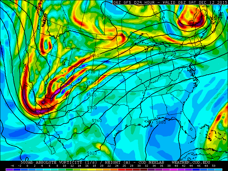
After producing large areas of 10-20″ of rain (yes, that much!) across the Pacific Northwest coastline, an upper-level trough is taking aim on Colorado.
The models are in relatively good agreement on how this feature will move through. It dives south in the Las Vegas area this evening and swoops through Colorado tomorrow afternoon. At the surface, a low moves along the Colorado/New Mexico border, swinging a surface cold front through Boulder after sunset.
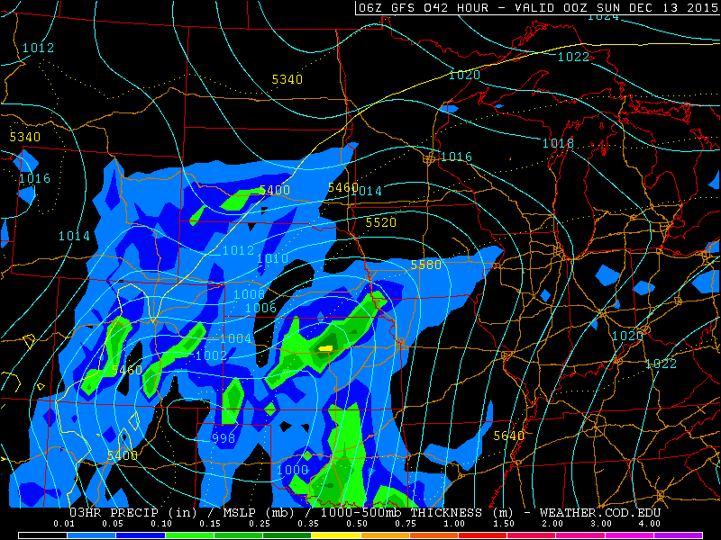
GFS sea-level pressure and precipitation fro Saturday evening. Snow continues across the Front Range.
This sets northeast Colorado in a fairly decent location for upslope and large-scale lift for roughly a 12 to 15 hour period. The track has changed slightly over the last day or so (with the storm taking the scenic route to reach Denver), and thus, arrives a much later. It is already snowing west of the Divide, but it will take a long while for the precipitation to make it’s way down low.
After some isolated rain showers (and higher elevation snow showers) this evening, snow will begin to intensify in the Foothills after midnight. Things will then moisten up for the Plains with snow beginning in the mid-morning hours and continuing on and off through your Saturday.
The system is not very well-organized, which will truly prevent Boulder from picking up substantial snow. We also would like the see the surface low track slightly further north. This would provide a more favorable upslope direction for us. As of now, 700 mb winds are marginal at best, remaining weak and southeasterly for a large part of the event, with a quick shift to northwesterly late Saturday night.
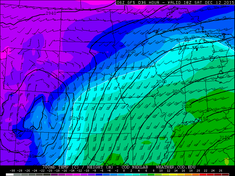
GFS 700mb height, temp, and wind for Saturday afternoon, showing cold temperatures (all snow!) and marginal southeasterly upslope for Boulder
The wildcard for this storm is the jet stream. It takes a huge dip into northern Mexico, with a jet streak stretching from west Texas into eastern Colorado (see below). This places us in a rather favorable region for banded snow, aided by the added lift from the jet streak. At times, rates within these bands could exceed 1″ per hour .The problem is that pinpointing their location ahead of time is nearly impossible.
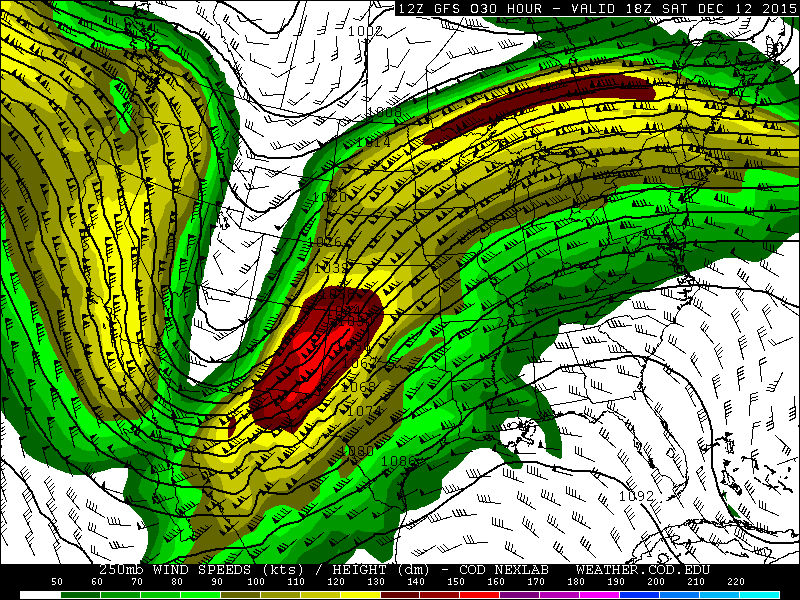
250 mb height and wind forecast from the GFS for Saturday afternoon, showing a powerful jet streak entering Colorado
As such, there may be a sizable disparity in snowfall totals over a relatively small fetch. Temperatures on Saturday will struggle to get above freezing in the afternoon with the cloud cover and colder air mass. Snow will begin to taper off after midnight Saturday night, ending for everyone early Sunday morning west to east.
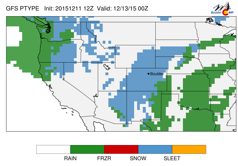
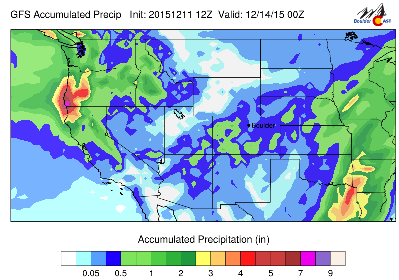
As you can see from the GFS accumulated precip map below, Boulder will likely up between the pockets of more significant snow.
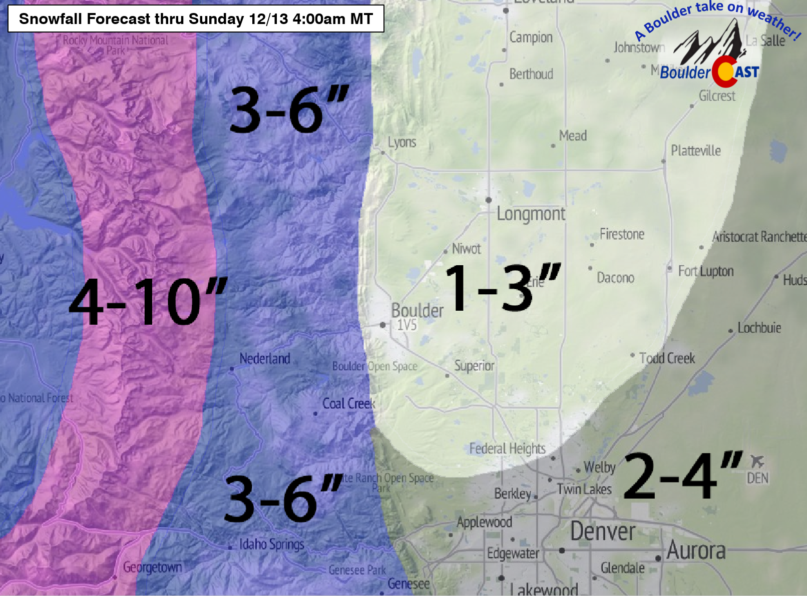
With that, our snowfall forecast is outlined below.
To recap:
- Snow will begin in the Mountains this afternoon and the Foothills late this evening (after midnight). It will spread onto the Plains Saturday morning. Beforehand, we could see some very light rain showers this evening
- Light snow will persist through Saturday afternoon. It could be heavy at times, but short-lived within one of the heavier bands
- 1-3″ in places like Boulder, Longmont, Superior, Louisville, and Lyons
- 2-4″ for Denver proper (could see higher amounts in SE suburbs closer to the center of the low)
- 3-6″ for the Foothills
- 4-10″ for the higher Foothills and Mountains (including just about every ski resort within driving distance!)
- Saturday will remain at or below freezing through the day
- Warmer and pleasant for the Broncos game Sunday! A mix of clouds of sun, with a kickoff temperature near 40 degrees.
- Another chance at snow arriving on Monday evening
If you enjoy our forecasts and weather talk, be sure to recommend us to your friends, family, and colleagues. With winter nearly upon us, there is no time like the present to SUBSCRIBE to BoulderCAST (check the sidebar to the right) or follow us on Facebook and Twitter.
Happy Friday and enjoy the snow!



You must be logged in to post a comment.