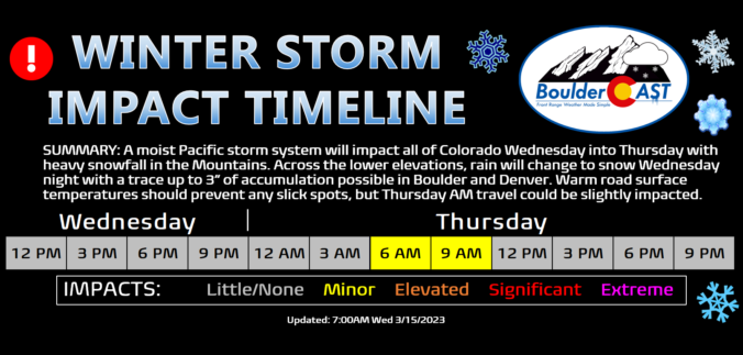
A potent atmospheric river event is ongoing across the southwestern United States right now including portions of western Colorado. After our warmest day in more than four months on Wednesday, this moist system will enter the picture for the Front Range Wednesday night with rain changing to snow across the Plains and Foothills as a cold front slides through. Though the best upslope will be south and southwest of Denver with this event, most everyone will see snowflakes amounting to a several inches in some places and just a dusting in others. Let’s take a look at the expecting timing of the change-over to snow, snowfall amounts, and the travel impacts in the works as winter weather returns to the Front Range.
From spring to winter in the blink of an eye
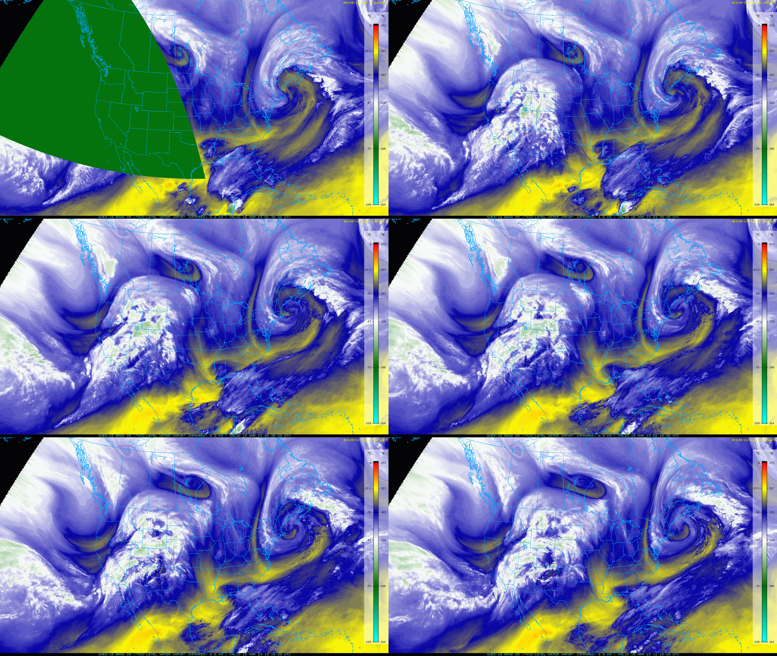
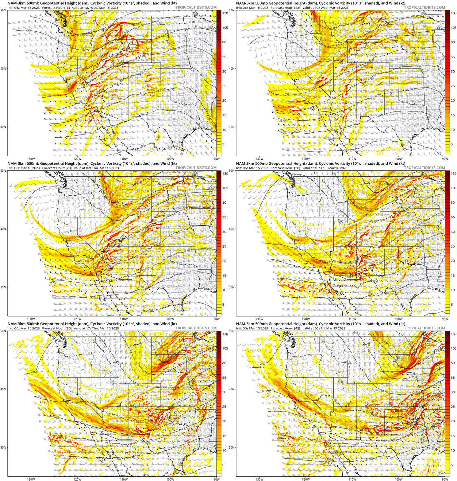
Moisture continues to flow in across the Four Corners region this morning associated with yet another atmospheric river event impacting the area this week. The deepest moisture has pushed into western Colorado overnight with heavy snowfall and rain showers ongoing across much of the western part of the state right now.
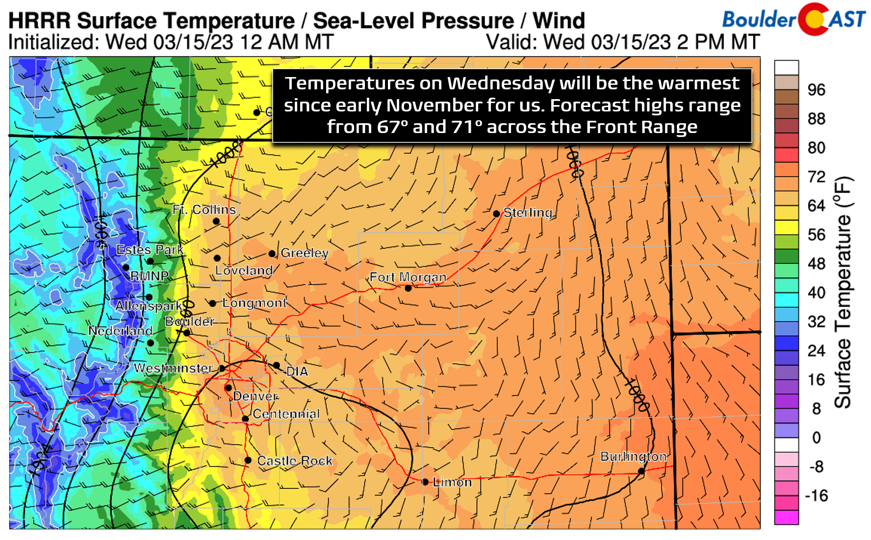
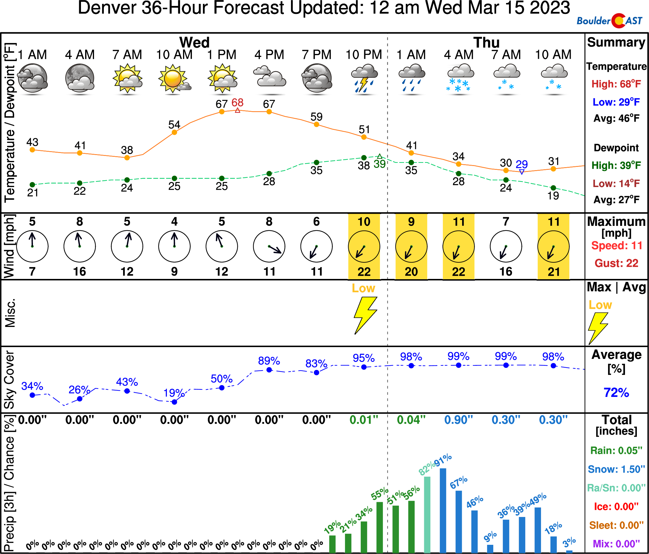
Today will be cloudier than yesterday in our area thanks to all that moisture streaming in aloft, though there will be some sunshine mixed in throughout the day aiding to push our temperatures into the upper 60s to near 70 degrees. This will be our warmest day since November 8th — more than four month ago!
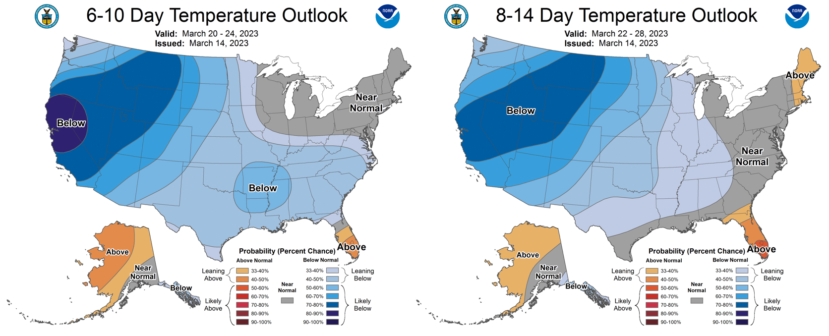
We urge you to take advantage of the nice weather on this glorious Wednesday as long-range models don’t indicate anything nearly as nice as this for the next 10+ days in our area!
As the associated Pacific trough continues to progress across the northern Rockies it will aid in bringing a cold front southward through the Front Range late this evening putting a definitive end to the early spring celebration for now.
We expect the initial front to move through between 8PM and 11PM this evening with rain showers developing around this time as well. The energy alongside the front and for the handful of hours following it will offer the best chance of precipitation for us, with rain showers changing to snow overnight as temperatures tumble. Depending on the exact intensity of the rain, the change-over probably occurs between 1AM and 3AM across the Metro area with temperatures falling below freezing before sunrise. Things will turn to snow quicker in the Foothills. Light snow, with pockets of more moderate snow southwest of Denver in the higher terrain, will continue into Thursday morning or perhaps early afternoon before coming to an end.
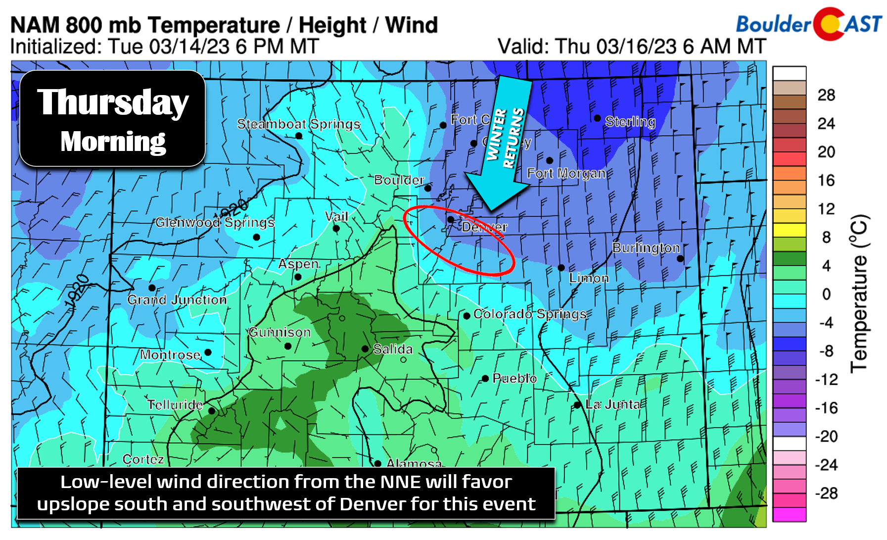
We’re not looking at a lot of snow accumulation from this event as unfortunately the models have aggressively backed off from this system over the last few days. While atmospheric river events such as this generally do not pan out for the Front Range, this one did look quite promising just a few days ago. The energy moving through is ultimately rather limited and brief east of the Mountains which will keep the impacts minor for us. Low-level winds from the north-northeast will mostly favor areas south and southwest of Denver for the best upslope enhancement Wednesday night into Thursday (circled region below).
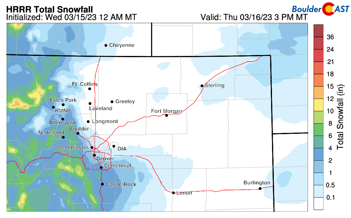
Here’s the latest snowfall prediction from the HRRR model. For the most part it shows just a trace to 2″ across the Denver Metro area, with several inches possible in and near the southern Foothills and Palmer Divide.
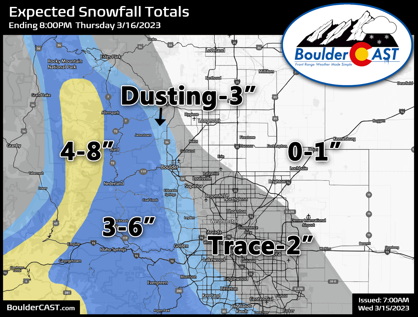
Our snowfall forecast map is shown below covering all snow falling Wednesday night and through the day Thursday. Because of the marginal temperatures early on and the steep rise of the terrain, forecast amounts along the Foothills interface are less certain than elsewhere. We are expecting a good chunk of the precipitation from this event to fall as rain early on, and even after it does change to snow there will be a lot of melting. Most of the accumulation will be confined to grassy and raised surfaces.
Thanks to the near 70-degree warmth on Wednesday, roads should remain just wet across the lower elevations, with some slush/snow-packing developing in the Foothills. We’re not anticipating anything more than nuisance to travel for the Thursday AM commute. Our storm impact timeline pinpoints only Thursday morning for minor issues.
Overall, this clearly won’t be a huge precipitation event for us, but moisture has been fairly hard to come by of late. Boulder has only received 0.05″ of precipitation over the last three weeks. We’ll take anything we can get at this point! Tonight’s rain and snow is welcomed indeed. The other big story with this system will be the sharp drop in temperatures taking us from spring to winter in the blink of an eye. Thursday will have the Boulder-Denver Metro area stuck in the 30s across the Plains with 20s in the Foothills, some 30 to 35 degrees colder than the day prior!
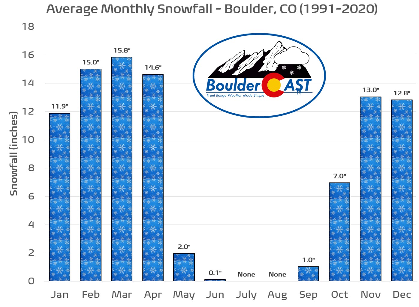
P.S. Two years ago this week our area was pummeled with up to 3 feet of snow by one of the most iconic Front Range upslope snow machines in recent memory. This is just a friendly reminder that March is our climatologically snowiest month of the year and big snowstorms can and do happen this time of year. 2021 proved this is even true in the face of La Niña!
Get BoulderCAST updates delivered to your inbox:
Enjoy our content? Give it a share!




You must be logged in to post a comment.