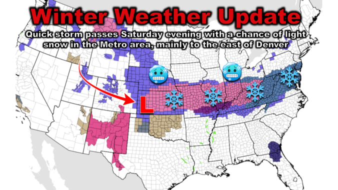
Shallow cold air has surged back into the Front Range overnight, causing temperatures to tumble and dense freezing fog to form. While the higher elevations enjoy sunshine and milder temperatures Saturday, the Plains remain in the 20s. An incoming storm system will bring light snowfall and reinforce the cold air Saturday evening, with the best chances of accumulating snow east of DIA and towards Kansas and Nebraska. We discuss just how cold it will be this weekend, the timing of the snow, and how much to expect. We also look ahead to our next and better chance of snow coming early in the upcoming week.
At a Glance
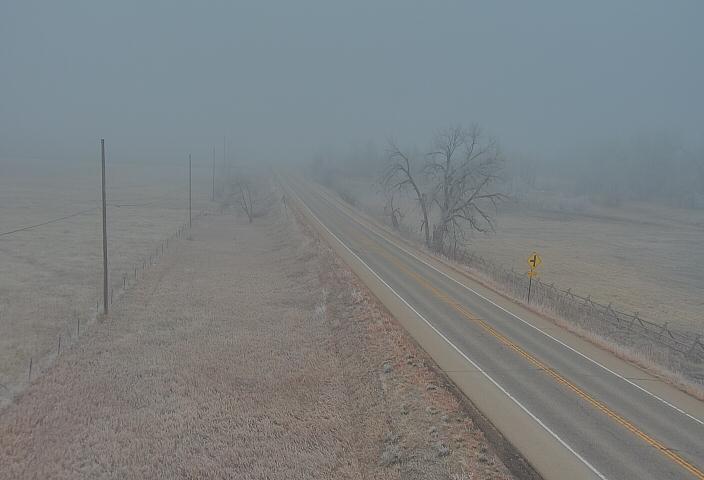
- Shallow Cold Air: Similar to Thursday night, Arctic air surged back into the Front Range, causing temperatures to drop to the lower 20s on the Plains with dense freezing fog early Saturday. The Foothills are warm(ish) and sunny though!
- Light Snow Expected: Light snow is expected to develop Saturday evening, with the best chances east of the Metro area.
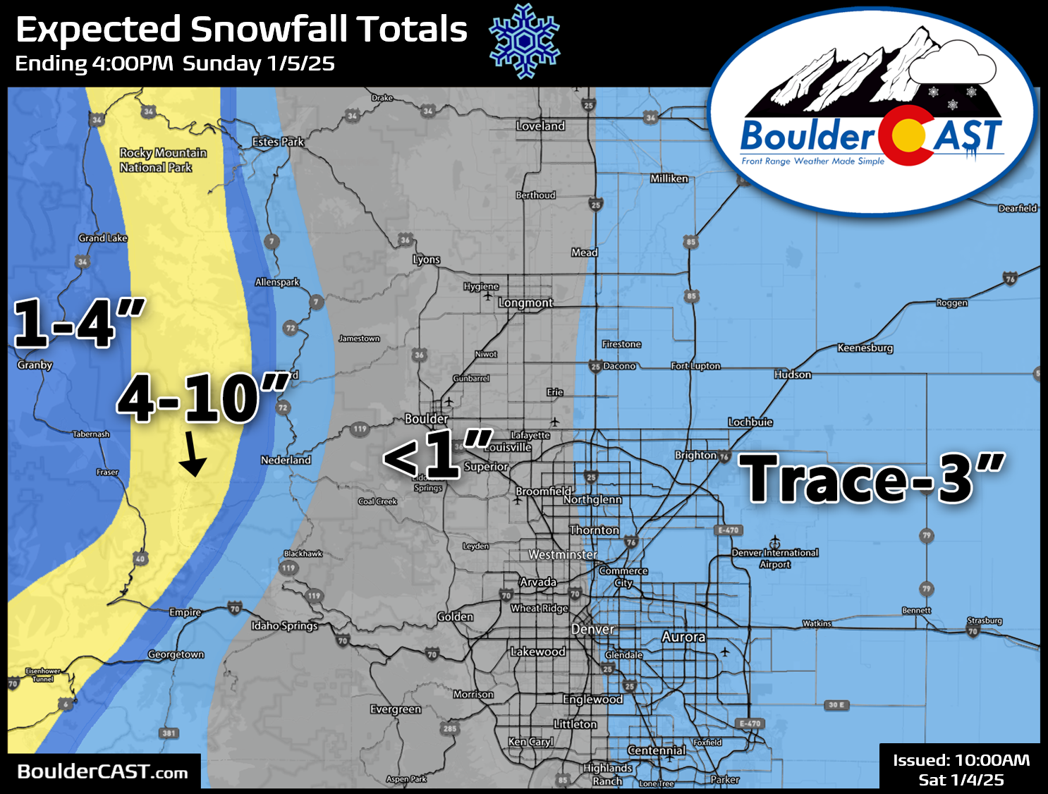
- Snow Accumulation: The best chance of accumulating snow is east of DIA and towards Kansas and Nebraska. Generally totals 1″ or less expected in our area.
- Mountain Snow: The Mountains can expect 4-10″ of snow by Sunday afternoon, with locally up to a foot. Ski traffic will be insane!
Daily Forecast Updates
Get our daily forecast discussion every morning delivered to your inbox.
All Our Model Data
Access to all our Colorado-centric high-resolution weather model graphics. Seriously — every one!
Ski & Hiking Forecasts
6-day forecasts for all the Colorado ski resorts, plus more than 120 hiking trails, including every 14er.
Smoke Forecasts
Wildfire smoke concentration predictions up to 72 hours into the future.
Exclusive Content
Weekend outlooks every Thursday, bonus storm updates, historical data and much more!
No Advertisements
Enjoy ad-free viewing on the entire site.
Light snow Saturday evening, best chances east
Similar to the what happened Thursday night, last night we saw a surge of Arctic air back into the Front Range from the north and east. Temperatures are in the lower 20s on the Plains with dense freezing fog as of Saturday morning. Be careful on sidestreets, overpasses, and sidewalks as they may be slick from the freezing fog (rime ice) and isolated freezing drizzle. Limited visibility may also be an issue in some areas through the day, but most areas have improved.
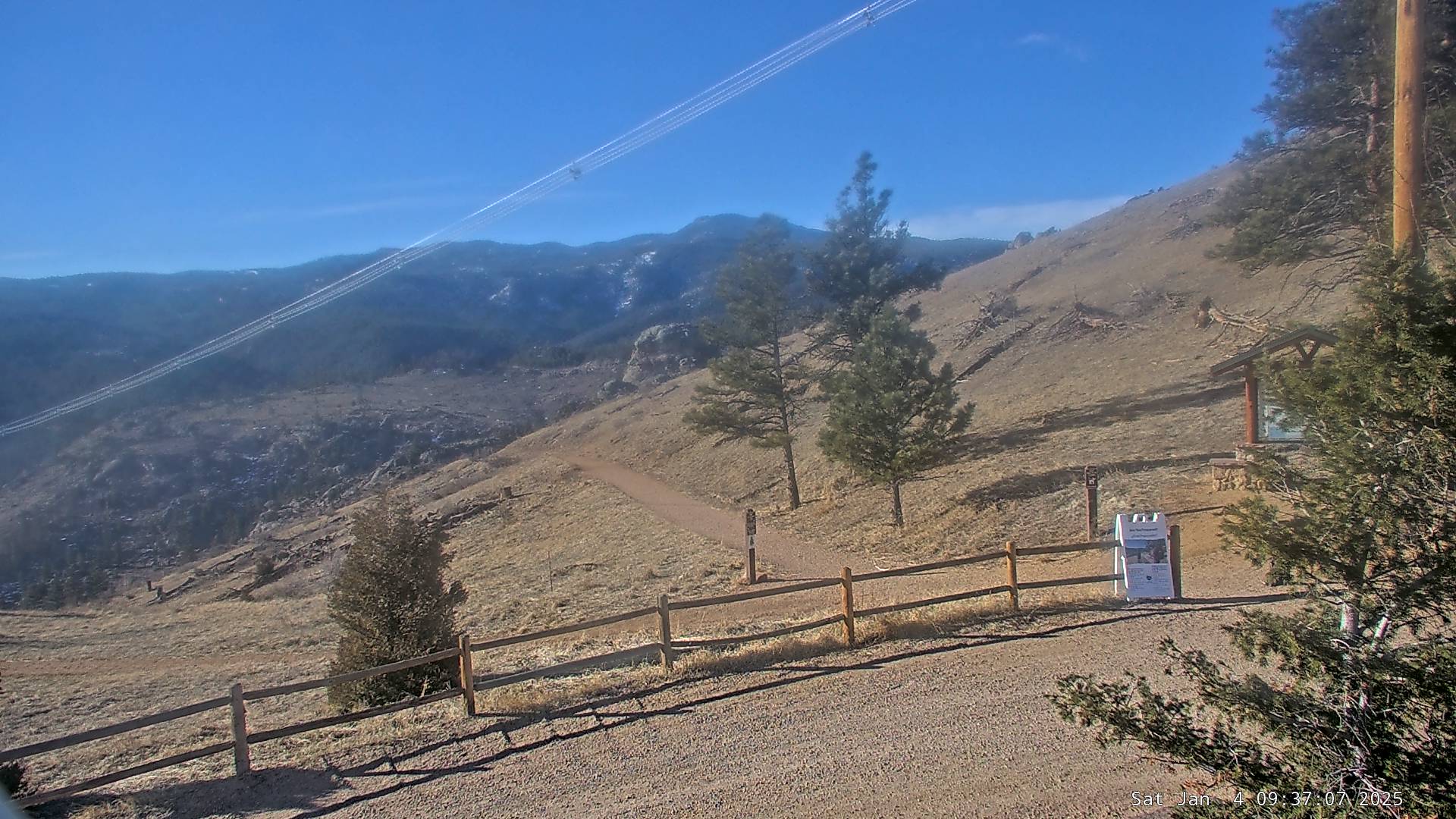
However, go up in elevation only about 1500 feet and places like Nederland are above freezing with the sun shining down from above:
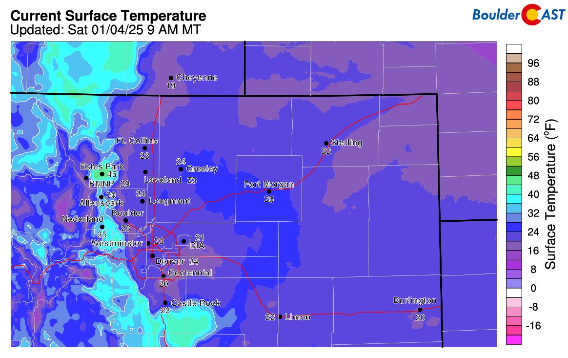
Current temperatures are quite cold this morning across the Metro area, with most locations in the lower 20s. As mentioned, the Foothills are warmer above that cold airmass, even as warm as the middle 40s like in Estes Park. During the day, we may see the cold dense air retreat eastward a tad, but probably not completely with most of us seeing high temperatures below freezing.
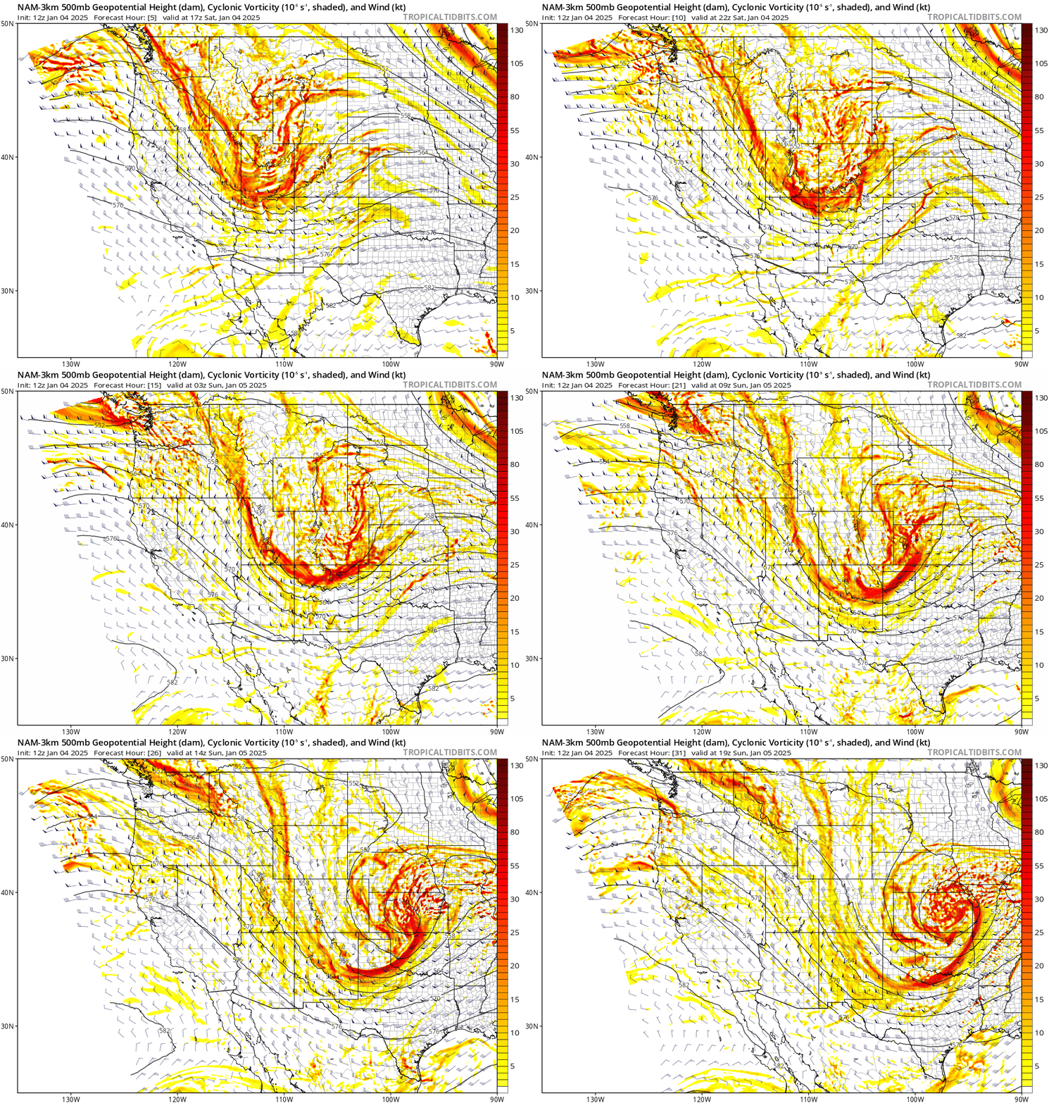
An incoming storm system from the west-northwest today will aid in lift for light snowfall as it passes, as well as helping to draw the cold air back in this evening through early Sunday. The track of this quick-moving storm in the northwest flow once again does not really favor the Denver Metro area, passing just a bit too far north and moving too fast to generate much upslope. Nonetheless, there will be a threat of light snow developing Saturday afternoon/evening in Denver and Boulder as weak frontal forcing and the passing wave team up for modest lift.
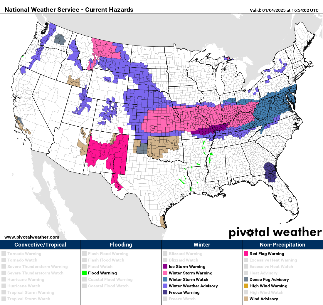
It’s important to note that this storm is of Pacific origins — it’s not a big Arctic blast type of situation. It just so happens that its passage will help funnel in some colder air which is already situated across the northern Great Plains. As the storm kicks out to our east, it will make quite the wintry mess across the rest of the country as it catalyzes a long battle between warm Gulf of Mexico moisture and cold Canadian air.
In general, the global models have not been very optimistic for much snowfall in our area with this disturbance the last few days, and now with short-range models coming in, it still looks like mostly a miss for the Metro area. Pacific moisture flowing in will largely be wrung out by the Mountains to the west, with snow beginning up there during the afternoon continuing into Sunday. Across the lower elevations, resultant downslope will kill off of most of the lift in the immediate Boulder area. The best chance of accumulating snow, more than a dusting or so, will be east of DIA and towards Kansas and Nebraska. The storm will slow down a tad and undergo lee cyclogenesis Saturday night in western Kansas. Wrap-around snow on the backside of this developing low will allow for banded snowfall capable of producing 3-7″ in some areas east along I-70 and I-76 tonight.
Nonetheless, light fluffy snow will be possible across our area anytime after 3PM into the overnight hours, perhaps starting a tad earlier for northern areas around Fort Collins. Snow chance will wane late Saturday night after midnight for most, possibly lingering into early Sunday east of DIA as low pressure wraps up and departs east across Kansas. Our snowfall forecast map for this light event is shown below. The Mountains can expect 4-10″ by Sunday afternoon (locally a foot), enough to make skiing Sunday quite enjoyable if you can get there. For Boulder, less than 1″ is expected, with up to 3″ possible east of DIA.
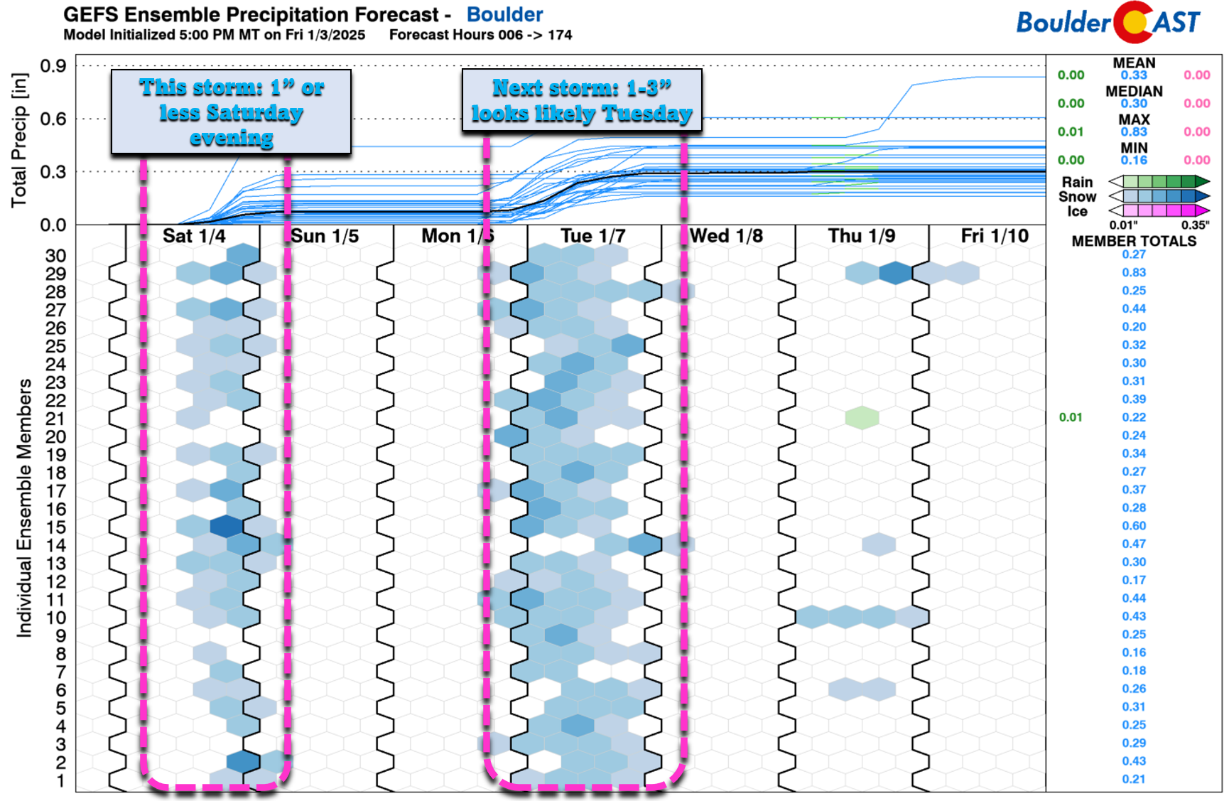
We’re already tracking another round of light snow for us Monday night into Tuesday — a system that will bring a reinforcing blast of cold air and likely better and widespread accumulation for the entire Front Range area. More on that in the days to come!
Stay tuned and be sure to follow us on Twitter, Bluesky, Facebook, and Threads for impromptu weather updates in the coming days, or subscribe to get notified of our long-form updates here. Happy weekend!
Get BoulderCAST updates delivered to your inbox:
Daily Forecast Updates
Get our daily forecast discussion every morning delivered to your inbox.
All Our Model Data
Access to all our Colorado-centric high-resolution weather model graphics. Seriously — every one!
Ski & Hiking Forecasts
6-day forecasts for all the Colorado ski resorts, plus more than 120 hiking trails, including every 14er.
Smoke Forecasts
Wildfire smoke concentration predictions up to 72 hours into the future.
Exclusive Content
Weekend outlooks every Thursday, bonus storm updates, historical data and much more!
No Advertisements
Enjoy ad-free viewing on the entire site.
Enjoy our content? Help us out and give it a share:





You must be logged in to post a comment.