The chance of substantial snow in the Front Range Sunday night into Monday has largely vanished into thin air. We discuss why this happened and the now lighter potential snowfall totals to begin the work week.
She gone!
Back on Friday all the pieces seemed to be coming together for another potential snowstorm in the Front Range Sunday night into Monday as a cut-off low was forecast to follow a swooping track across the Four Corners. We were skeptical with this setup, as the storm’s track was an unusual one that didn’t seem quite right. Plus the movement of these cut-off lows is notoriously poorly forecasted in the weather models which gave us further reason to worry. Despite this, throughout the day this past Friday there was excellent model support suggesting an impactful snow event was in the cards for the Denver Metro area late in the weekend. Our Snowfall Probabilities and GFS snowfall forecast were flying high in the models initialized Friday morning — there was something like a 50% chance for 6″ of snow in more in Boulder and Denver.
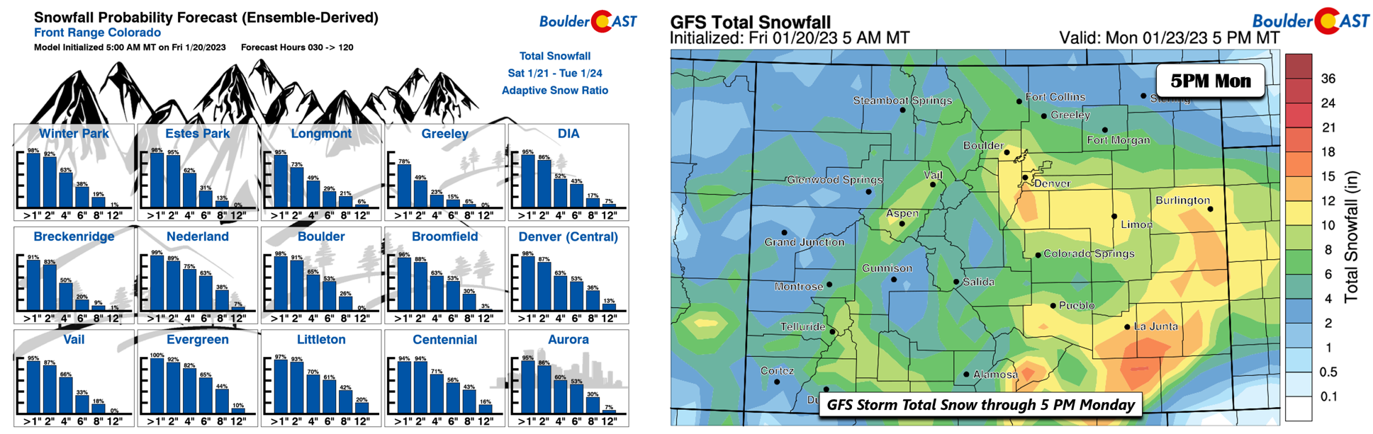
Fast forward to Saturday’s model runs and it was clear something drastic had gone awry. Our Snowfall Probabilities had fallen off a cliff and the GFS was struggling to predict more than 1″ of snow anywhere in Colorado besides the San Juans. The same downward trend in snow was observed in the Euro model as well, though not shown here.

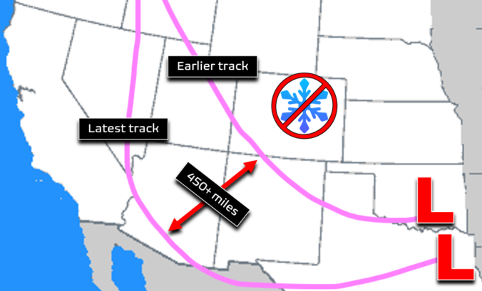
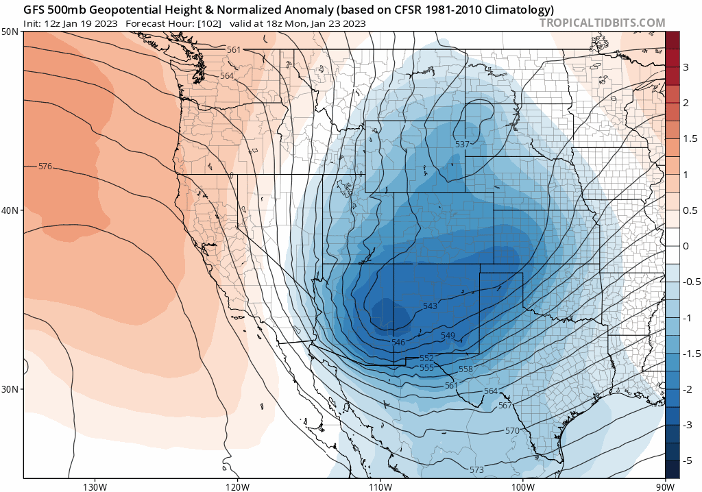
So what the heck happened? It turns out that peculiar and questionable storm track had migrated south and west by nearly 500 miles in just one day’s time. With this change, it took what was an expansive Four Corners low (one that would be favorable for Front Range heavy snow) and morphed it into a strong but tightly-wound system much further southwest raking along the Arizona-Mexico border.
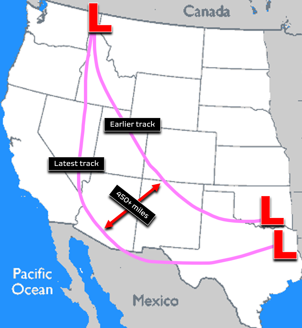
Track forecasts like this are always changing for any storm system of course, but just how rapidly and decisively this storm shifted away from Colorado was remarkable — certainly not something we see everyday or even every year in the neverending trials of forecasting Front Range weather!
12-run (3-day) model trend forecast showing the predicted location of the mid-level low pressure shifting from southern Colorado all the way into southern Arizona. All of these forecasts are for midday Monday.
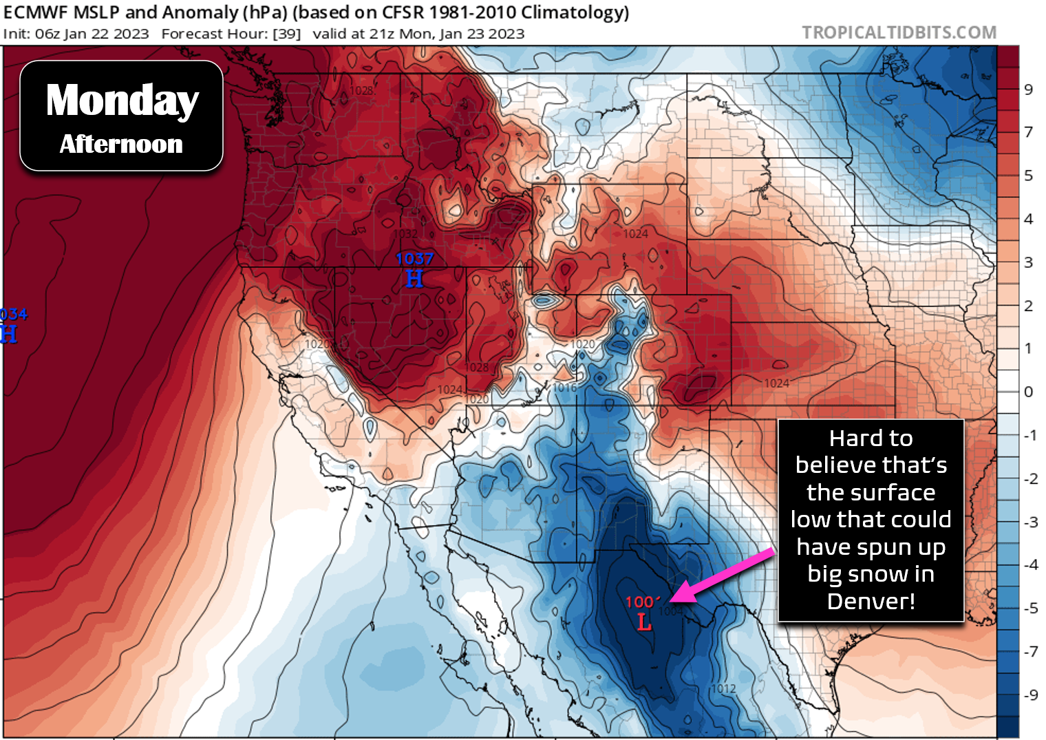
It’s hard to believe the surface low that could have helped amp-up snow in Denver area on Monday will actually formulate way down south in Mexico.
This track shift of nearly 500 miles has taken almost all of the energy, moisture and lift off the table for the Front Range. However, thanks to our terrain, there will still be some light snow accompanying and following the weak cold front Sunday night into the day Monday as upslope ensues. The HRRR simulated radar shows the light snow developing late tonight and persisting for a period of about 12 hours across the area.
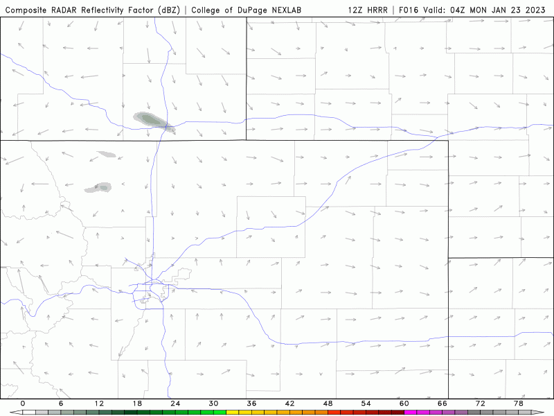
The best chance of snow will come after midnight Sunday night and lasts into the afternoon on Monday. Almost all models focus the light snow and flurries in and near the Foothills with this system and that looks absolutely correct given the weak forcings — terrain will be the main factor with this event.
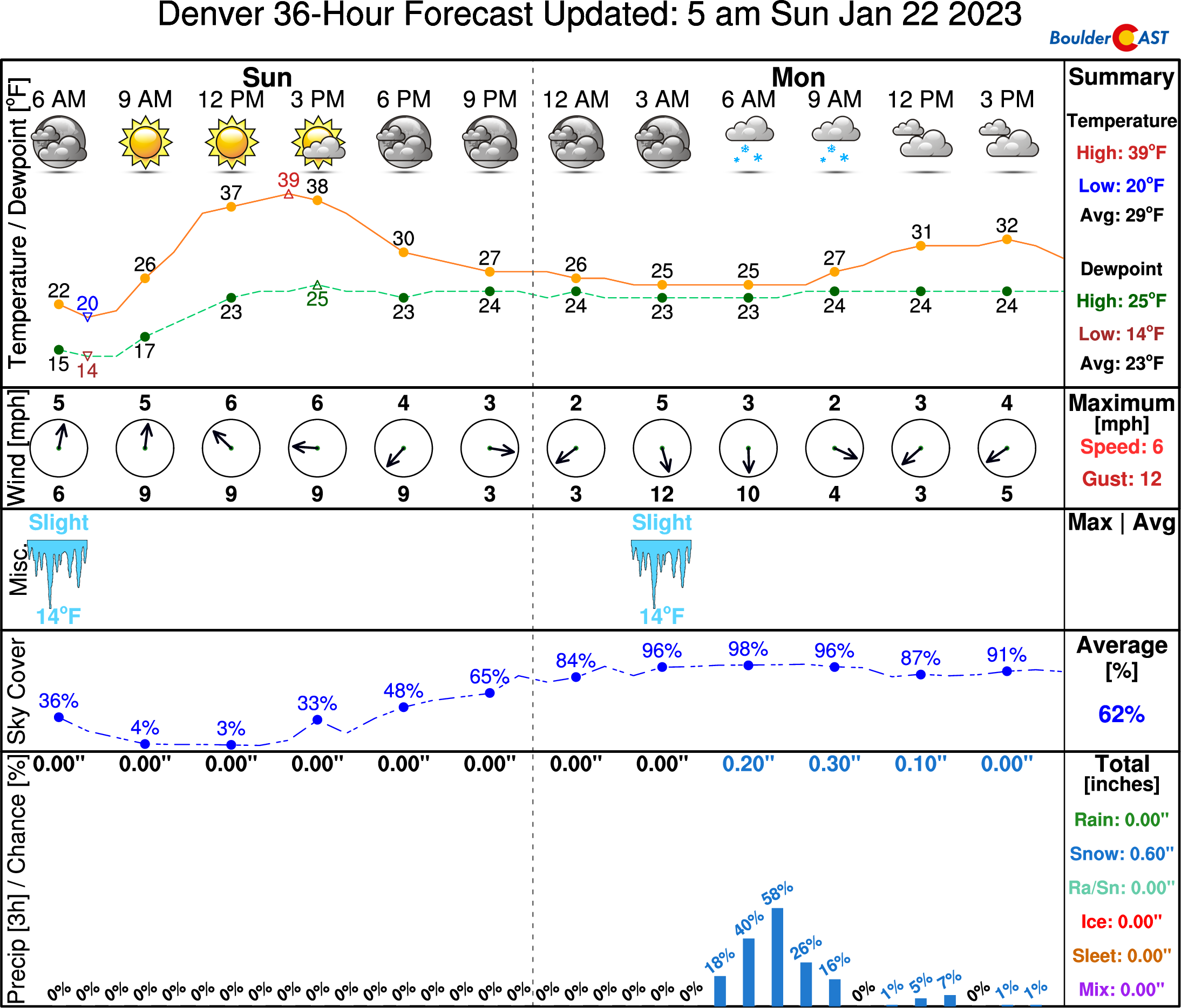
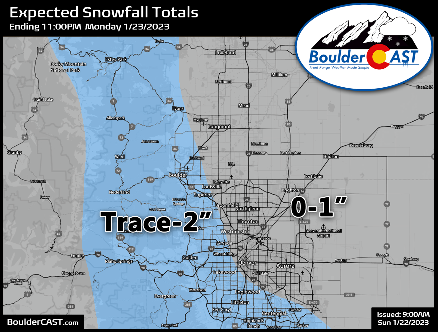
Given that temperatures will be quite chilly in the 20s for Boulder-Denver and in the teens in the Foothills, a dusting to 2″ of fluff is expected by Monday evening with a focus for those highest totals in and near the Foothills west and south of Denver. Our snowfall forecast map for the event is shown below. Nothing to get too excited about, but watch for some marginally slick travel conditions early Monday. Monday will be gloomy, gray and cold with on-and-off light snow.
Our sentiment, and that of many of you it seems, is that we’re all ready for spring — or at the very least warmer and nicer weather. Temperatures will unfortunately stay unseasonably cold through the week ahead with the potential for more light snow events such as this as the western United States is stuck in an unsettled pattern. Stay tuned and check back Monday morning for our usual weekly outlook post. Enjoy the rest of the now fleeting weekend!

Get BoulderCAST updates delivered to your inbox:
Enjoy our content? Give it a share!


You must be logged in to post a comment.