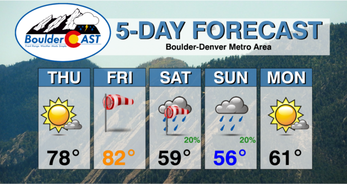
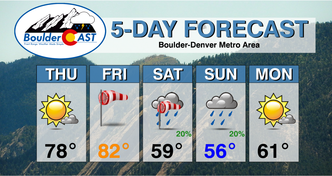
⦁❶⦁ Lesser fire concerns Thursday as winds relax and highs climb into the upper 70s under sunny skies
⦁❷⦁ A very strong storm will move across the Rockies on Friday creating a slew of weather impacts for the state — extreme fire danger, high winds, dust storms, mountain snow and severe thunderstorms
⦁❸⦁ WARNING: Extremely high fire danger Friday afternoon and evening with wind gusts 40+ MPH everywhere in the Front Range
⦁❹⦁ Cooler temperatures in the 50s with more clouds and a chance of rain showers both days this weekend
Do you want the BoulderCAST Weekend Outlook forecast discussion delivered to your inbox every Thursday morning? If so, join BoulderCAST Premium where we talk Boulder and Denver weather every single day.
A
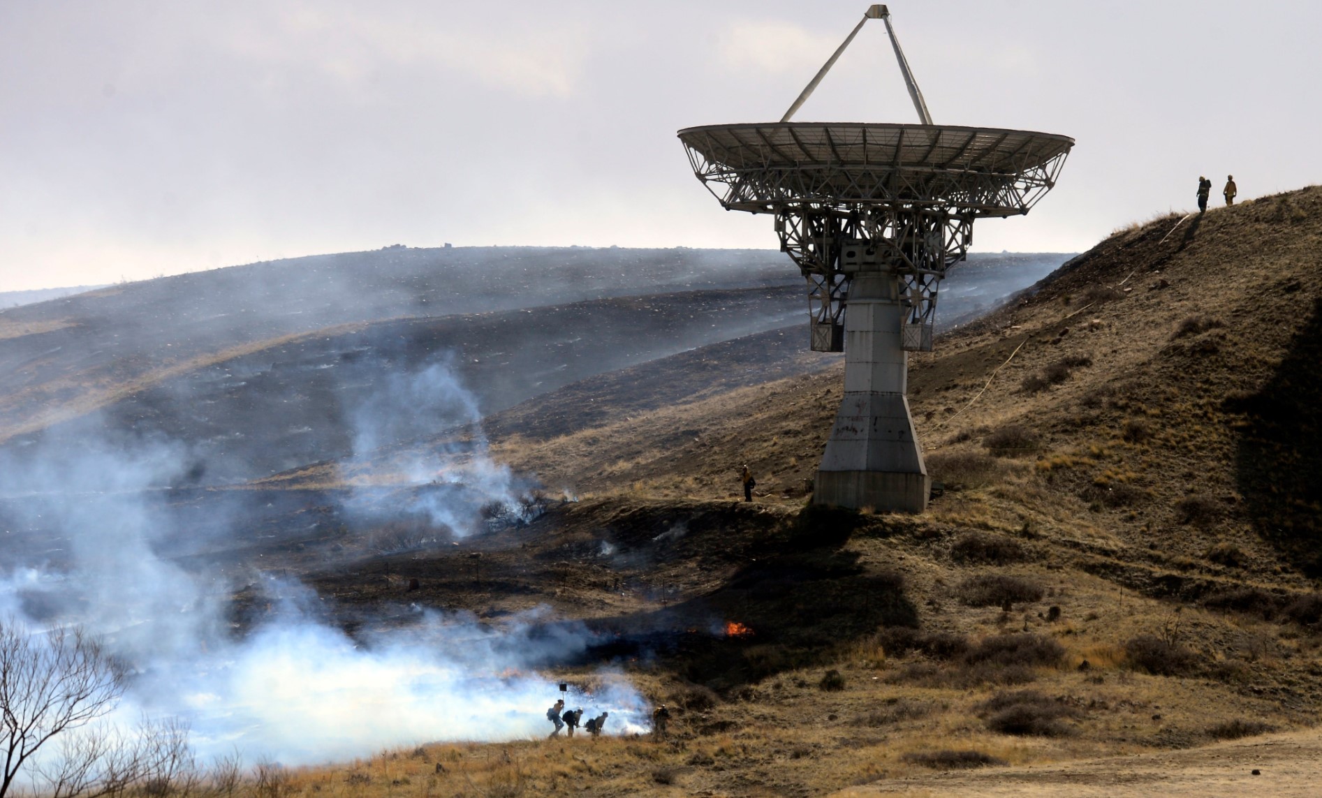
nother day, another series of fire starts yesterday across the area. The most notable was the Table Mountain Fire southwest of Longmont in Boulder County which ignited during the late afternoon hours and quickly burned around 20 acres of grassland. The cause is still unknown (or is it?), but we don’t believe any structures were burned. As you can see in the image below, the fire got very close to NOAA’s receiving dish.
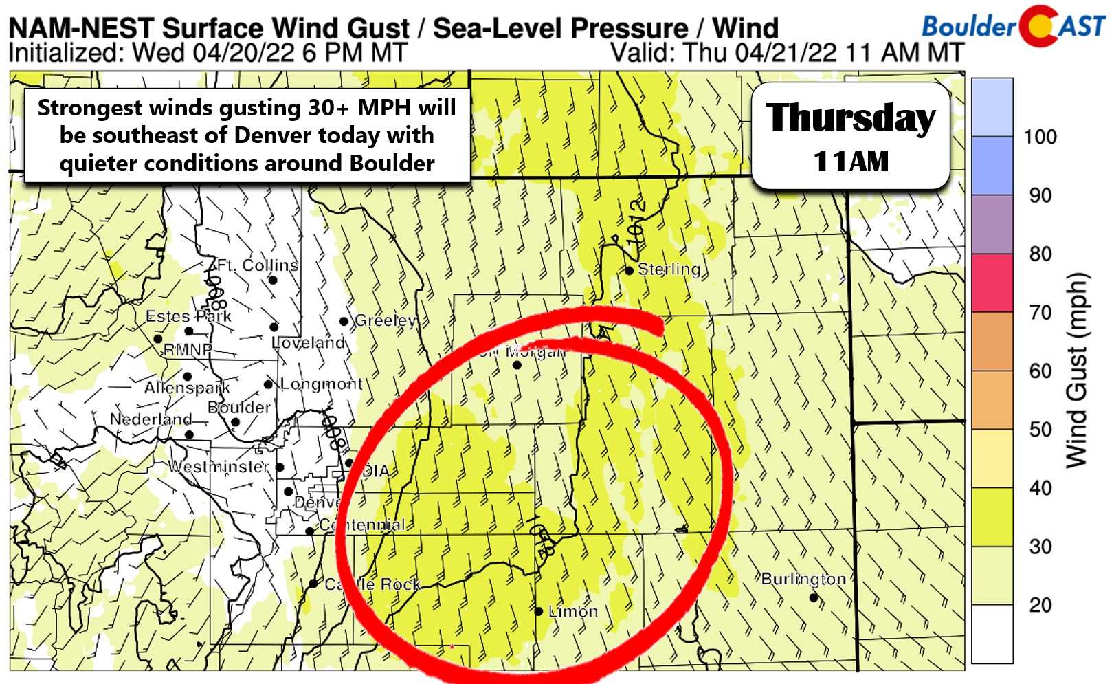
Similar to yesterday, we aren’t quite going to reach Red Flag criteria this afternoon, but conditions are still primed for fire ignitions and limited growth. Highs will reach around 80 degrees across the area with mostly sunny skies. South winds will be gusty east of Denver, but should be fairly calm around Boulder and much of the Denver area today with a Denver cyclone pattern in-place.
Mother Nature turns the dial up further tomorrow in what is shaping up to be an extremely dangerous fire day for most of eastern Colorado. The aforementioned strong storm system moves ashore into California tonight and intensifies across the Rockies on Friday. In the process, the pressure gradient tightens over our area as the upper-level jet pushes through. This is the system we cautioned to watch in our weekly outlook posted on Monday. The low pressure has ended up taking the more northern track which means primarily wind for the Front Range — with all the winter weather aligning across Montana and the Dakotas (again)!
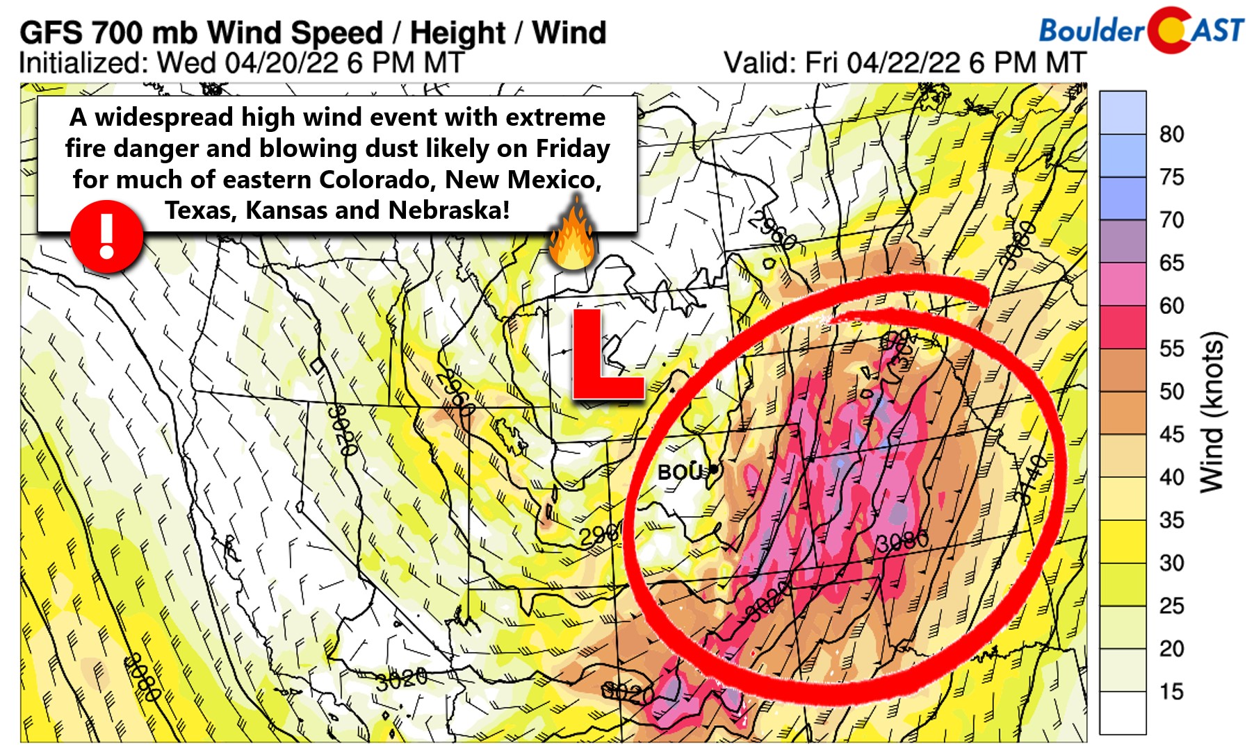
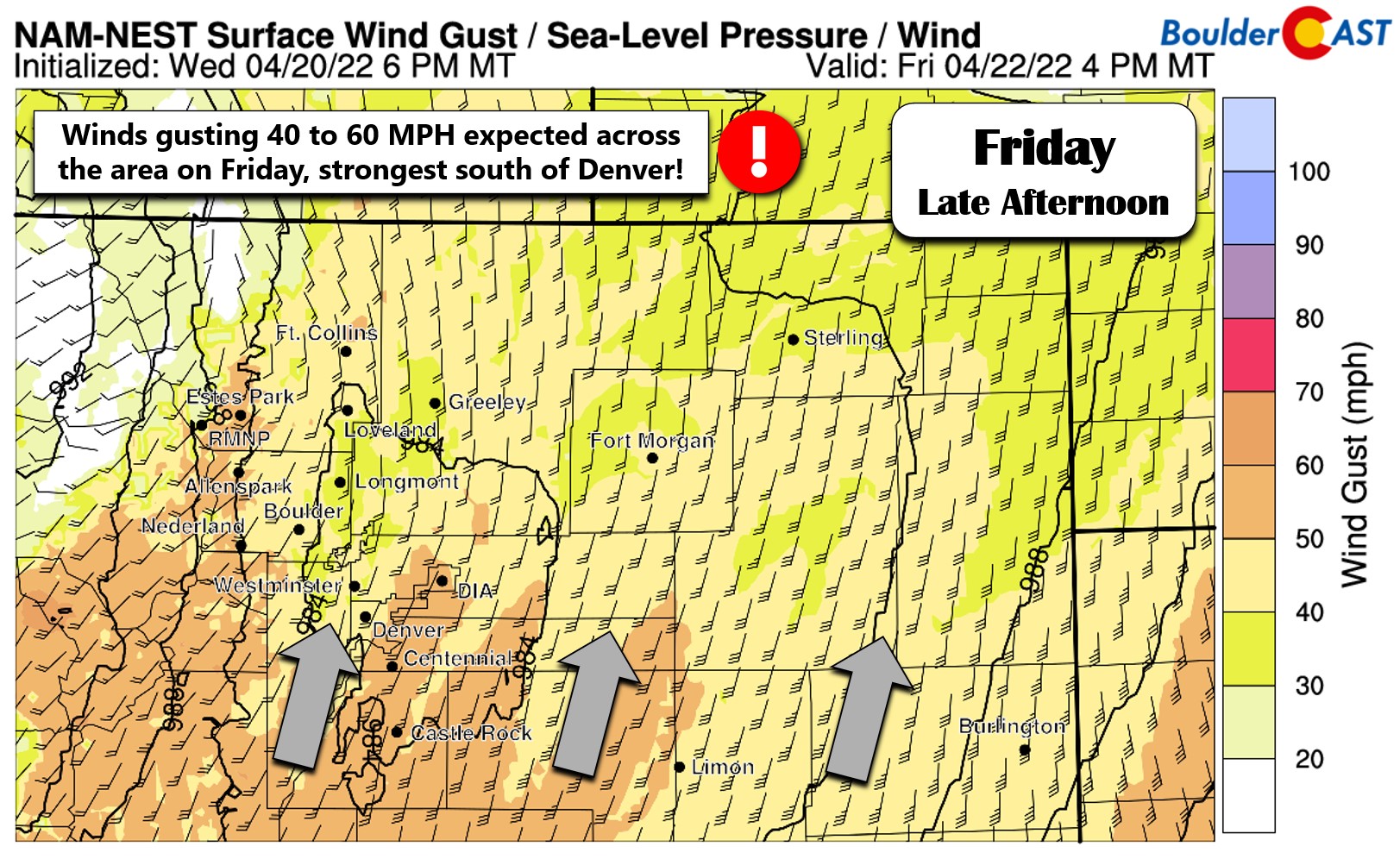
Winds on Friday will be very blustery — look for gusts of 40 to 65 MPH across much of eastern Colorado during the afternoon and evening hours. The strongest winds will be south and southeast of Denver, but we’ll still get some impressive gusts here as well.
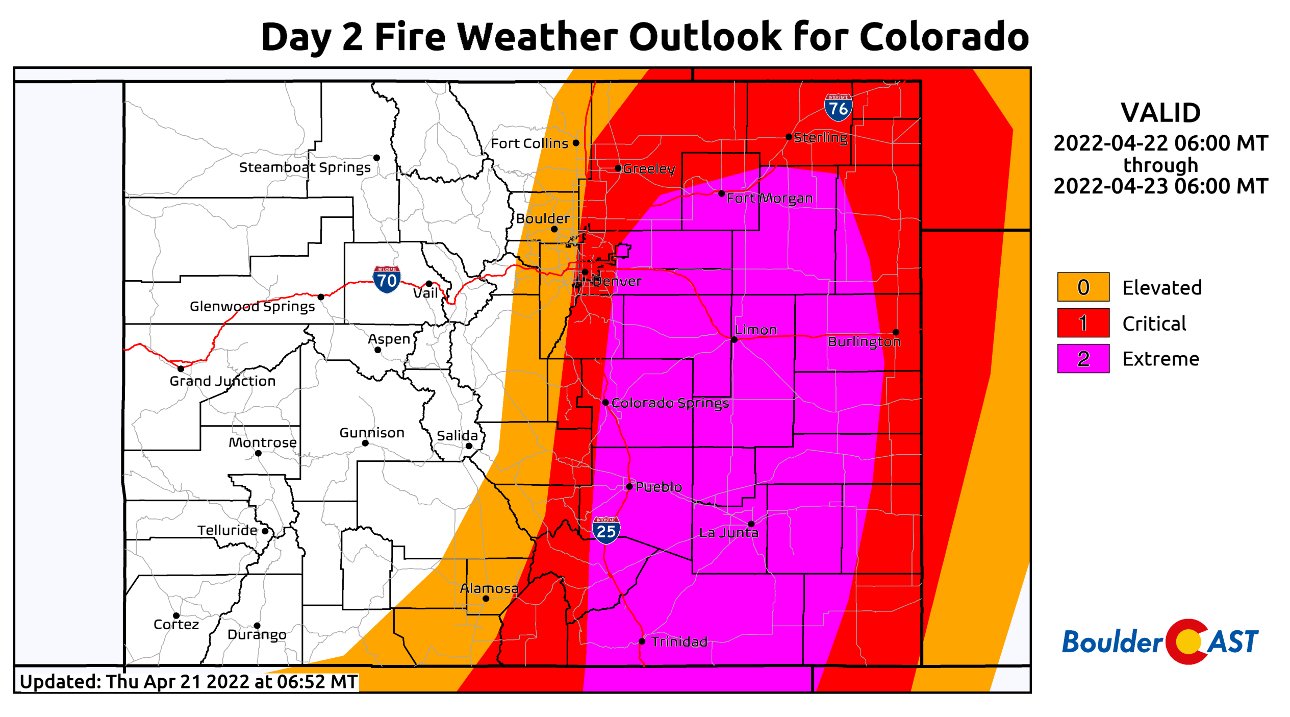
These winds combined with dry fuels and relatively humidities around or even below 10% will create exceptional fire danger for pretty much everywhere east of the Continental Divide on Friday. The Storm Prediction Center has included the rarely-used “Extreme” category in their fire weather outlook for Friday across eastern Colorado (see below). Another aspect of Friday’s winds to keep in mind is the directionality. Winds will be blowing from the south-southwest instead of the usual west direction (see above) — just be aware of this as it will play a role in which direction any potential wildfires or grassfires will rapidly be moving.
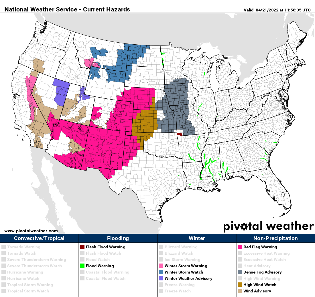
This is a massive storm with wide-reaching impacts. Red Flag Warnings (and some High Wind Watches) are posted for a huge area of the southern Rockies and Plains!
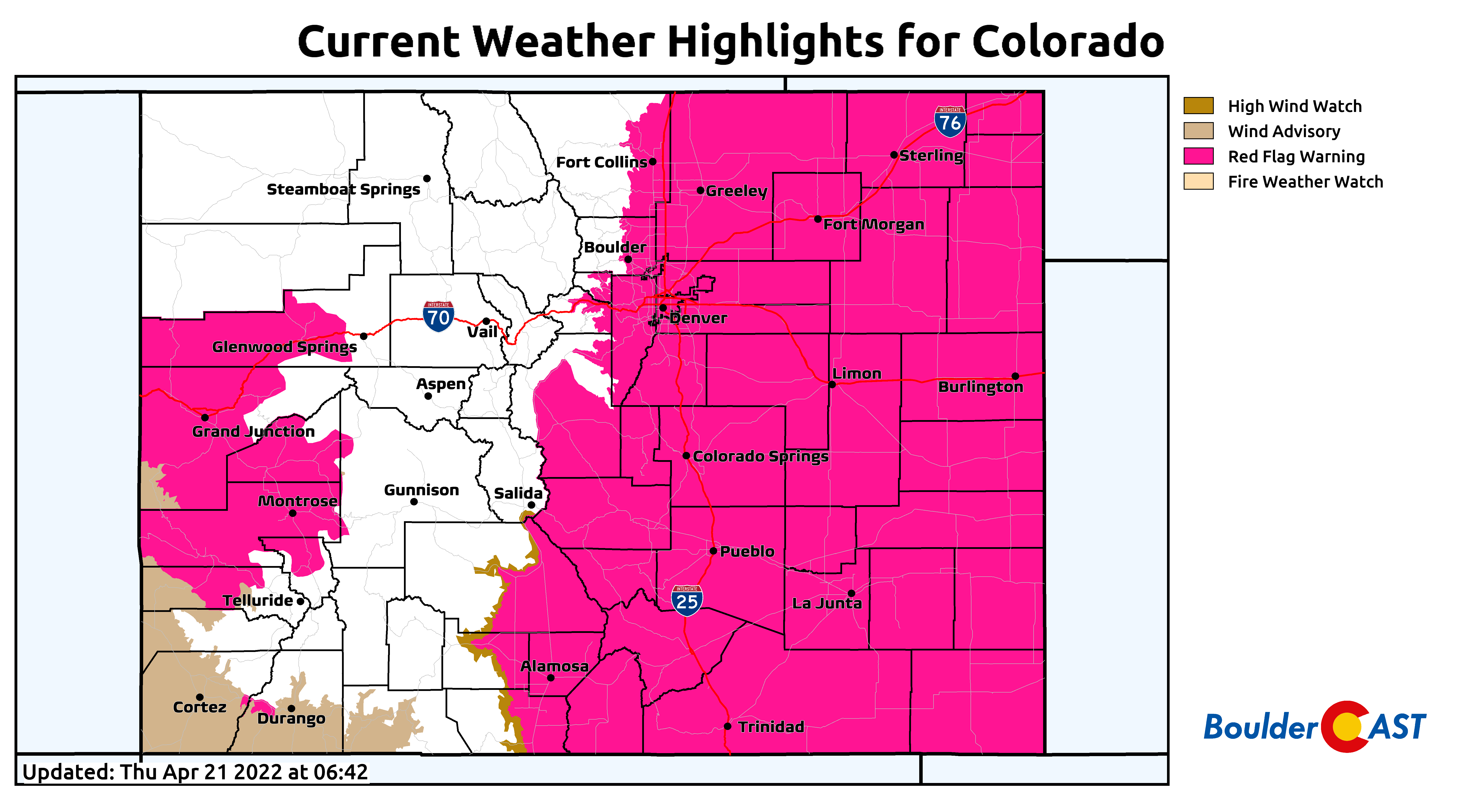
Here’s a closer look at just Colorado. The Red Flag Warning in effect for the Denver area runs from 11AM to 9PM on Friday. After this time humidities will begin to recover and fire danger will go down.
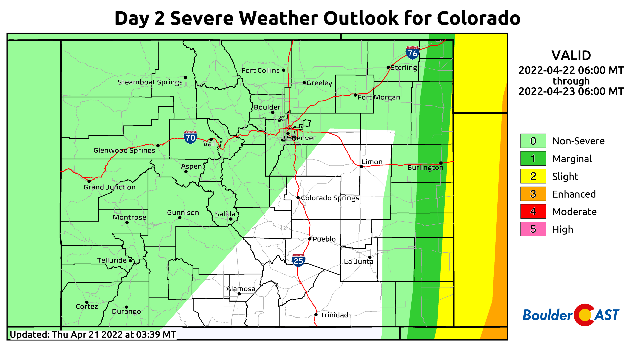
Further east across the Plains of eastern Colorado, the concern for Friday also includes widespread blowing dust and even the risk of a few severe thunderstorms firing along a dry line near the Kansas border. Any severe storms should be isolated and way east of the Denver area, but they will be capable of producing large hail and severe wind gusts. We should mention that there is a chance of a few rain showers across our area Friday evening. These will be sparse and not amount to much given the downslope pattern, unfortunately. Highs Friday will be in the lower 80s with increasing clouds and just meager rain chances in the evening.
A cold front will move through Friday night bringing a big drop in temperatures for the weekend. However, the winds will stick around with a bora-type event unfolding for Saturday. Gusts of 25 to 40+ MPH will be possible out of the northwest with elevated fire danger once again (though humidities should be high enough to prevent true Red Flag conditions). Temperatures both Saturday and Sunday will be much cooler in the 50s with slight chances for showers across the Metro area. Travel safely if heading up into the Mountains as snow will accumulate on the passes. Quieter conditions return on Monday with temperatures warming back into the 60s and sunshine expected.
Remember, our daily forecasts are Premium content. Periodically, we open this forecast up to all of our readers. Today is one of those days!
Help support our team of Front Range weather bloggers by joining BoulderCAST Premium. We talk Boulder and Denver weather every single day. Sign up now to get access to our daily forecast discussions each morning, complete six-day skiing and hiking forecasts powered by machine learning, first-class access to all our Colorado-centric high-resolution weather graphics, bonus storm updates and much more! Or not, we just appreciate your readership!




You must be logged in to post a comment.