Rain and snow return to the forecast Friday and Saturday, but better weather lies ahead for Sunday. Read on for our updated forecast covering the entire weekend.
W
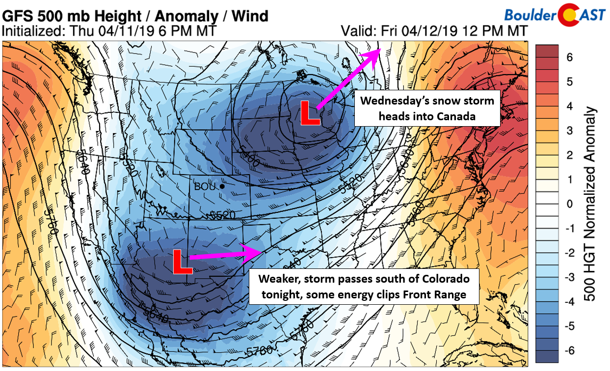
e’ll keep today’s forecast update relatively short. We’re just as ready for the weekend as you! The winter storm which impacted Colorado on Wednesday is now positioned in Minnesota. It is moving slowing northeastward into Canada and weakening rapidly. A secondary Pacific disturbance has dropped southward all the way to near Tucson, AZ this morning. It will be the energy associated with this system that will bring the chance of light rain and snow to the Front Range this evening and tonight. It’s also evident that an anomalously strong trough is entrenched across the center part of the United States. Everywhere beneath this trough stands to see well below normal temperatures both Friday and Saturday, including northeast Colorado.
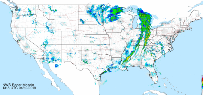
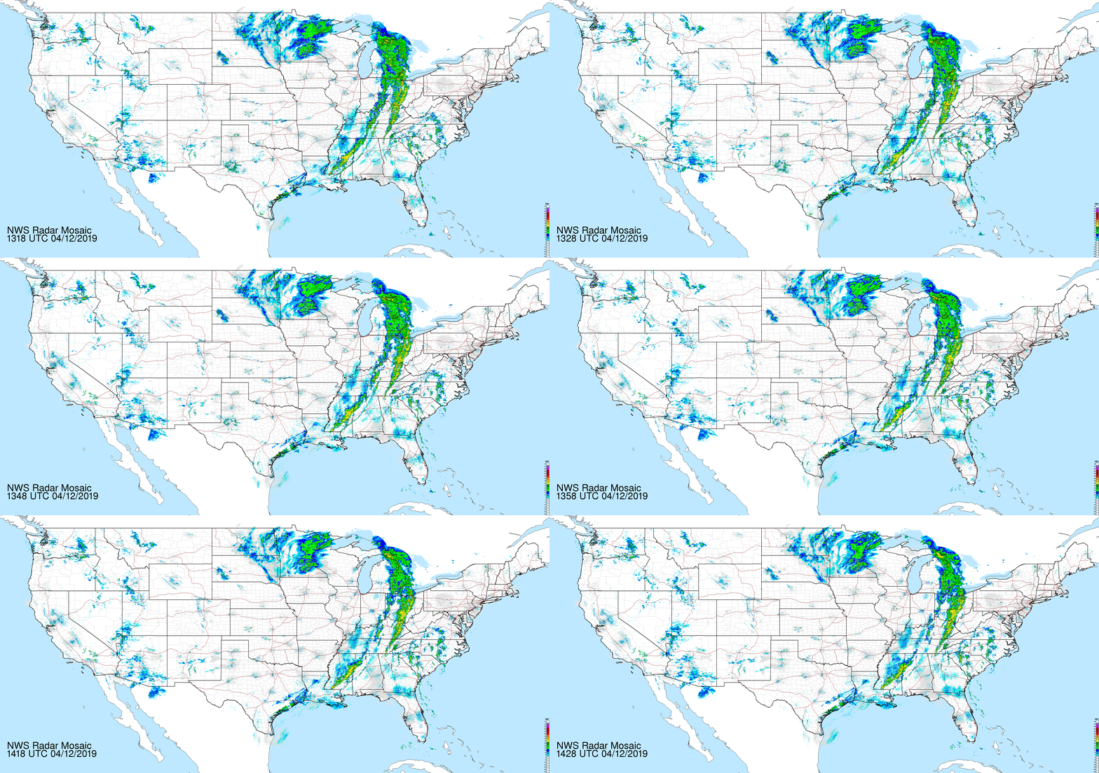
If we take a look at current radar, we see the massive breadth of the lingering storm system in Minnesota. Heavy snow is falling near Minneapolis, with a line of showers and thunderstorms extending to the Gulf Coast along the trailing cold front. We also see some shower activity across the Southwest associated with our incoming weak storm.
As the upper-level energy moves further north and east into central New Mexico Friday evening, it will work in tandem with low-level upslope flow to bring the chance of rain showers changing to snow across most of eastern Colorado. Had a massive winter storm not just pulled colder air into our region, the odds of snow tonight with this weaker, south-track storm would be very low. Ordinarily it would be far too warm. We can thank the exiting “bomb-not-a-bomb” cyclone for leaving behind the cold air!
In the 800 mb temperature and wind forecast map below for midnight Friday night, you can see the east-southeasterly winds pumping into particularly southeastern Colorado, but also the Boulder/Denver area. Southeasterly flow is definitely better upslope for the Colorado Springs region, compared to Denver, so amounts overall will be light in our neck of the woods.
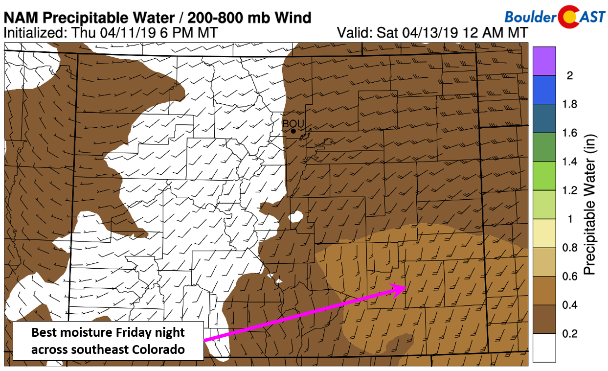
Moisture is also fairly limited across the region, with the highest values staying across southeast Colorado, and even then, we’re only talking PWAT near 0.5″.
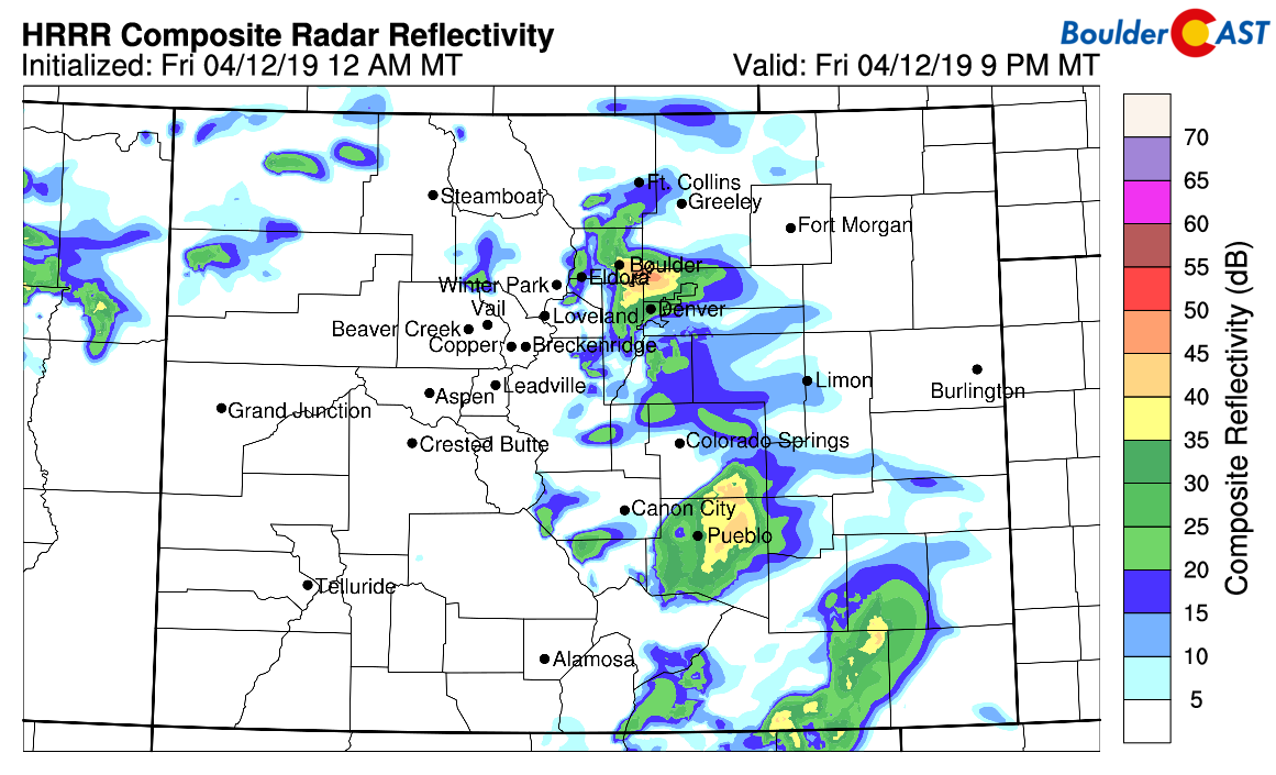
In addition to the shallow upslope component, the HRRR model is showing some convection as well across the Metro area, likely resulting from steep lapse rates aloft. This could create pockets of moderate to heavy snow with rates near 1″ per hour. Given that most of the precipitation will be occurring during the night-time hours, snow will accumulate more effectively as well.
In summary, the best energy and moisture will remain across southern Colorado and New Mexico. However, a combination of the upslope and isolated convective snow showers may allow light accumulations across the Front Range. It really could go either way. Post convection in the early morning hours and around sunrise Saturday, spotty freezing drizzle and fog is also possible.
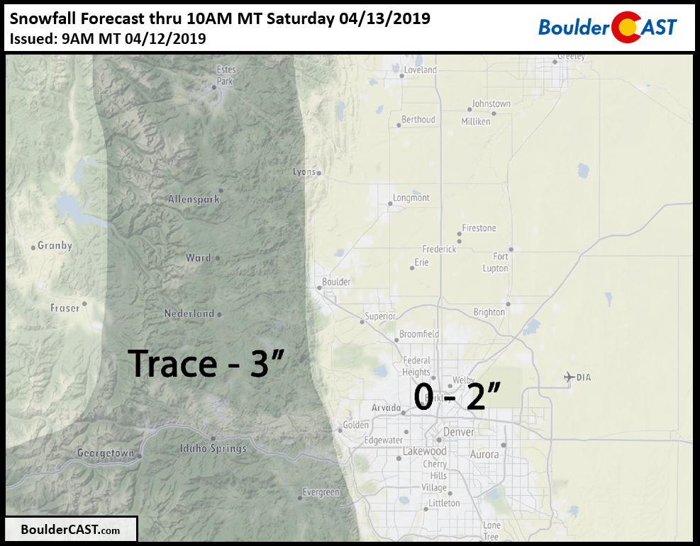
Overall, we’re expecting many areas to see little to no snow overnight, but a few spots could see up to 2″ across the Plains, with a little more possible in the Foothills and Palmer Divide. The primary time for any accumulation will be from 8PM Friday to 6AM Saturday, though snow showers are possible earlier in the day Friday. Our snowfall forecast map is shown below.
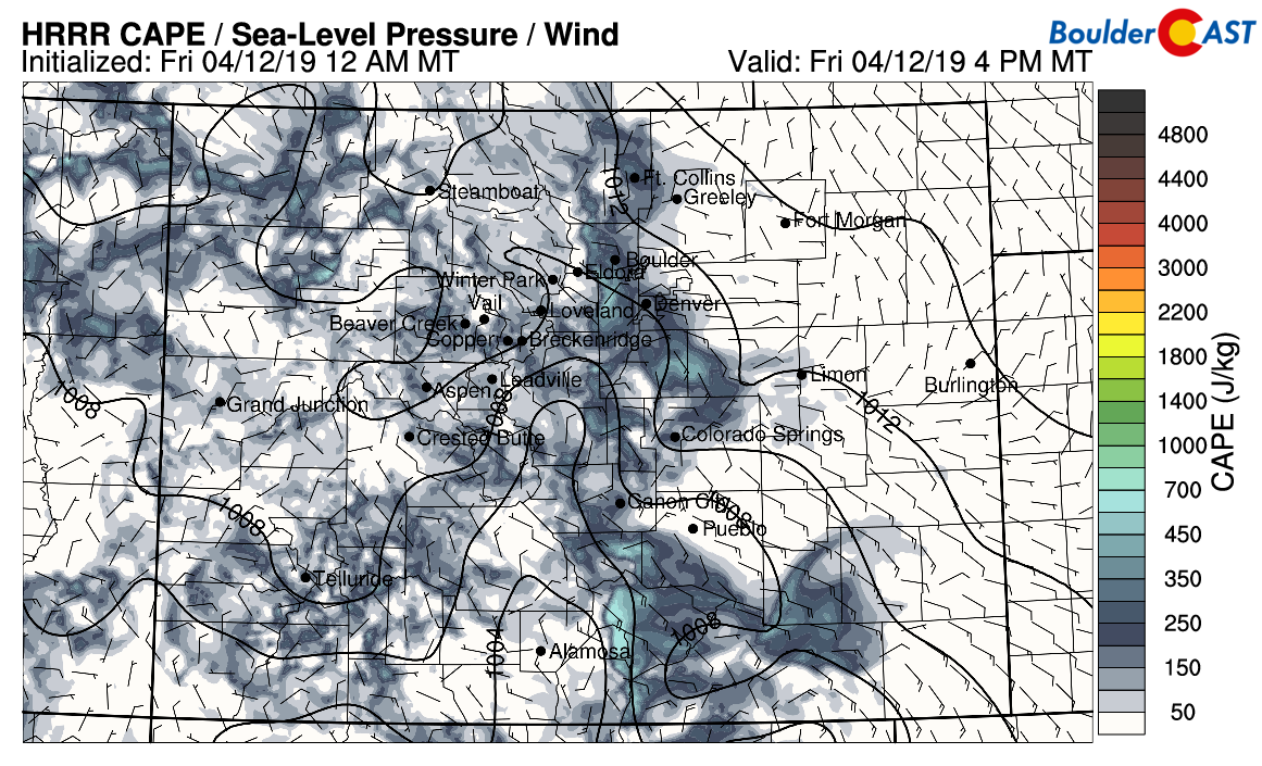
Saturday will begin with low clouds and lingering flurries or freezing drizzle across the Plains, but skies should become partly cloudy by mid-day. Models are showing a fair amount of instability across the higher elevations during the afternoon, with scattered thunderstorms breaking out as a result. Some of these will spill eastward onto the more stable and chilly Plains during the afternoon and evening as a rain/snow mix. A quick inch or two of snow accumulation could be possible with these showers, but only in the higher elevations. No accumulation is expected across the Plains. Highs Saturday in the middle 40’s.
Everything quiets down Sunday as high pressure builds into Colorado from the west. Look for dry conditions, sunshine and temperatures returning to the 60’s. It will be a great day for outdoor activities…maybe do a hike, or hit the slopes!
Weekend Forecast Specifics:
Friday: Generally overcast with a few breaks in the clouds possible through the day. Widely scattered isolated rain/snow showers develop through the afternoon, evening and continue into the overnight hours. Up to 2″ of snow accumulation possible by sunrise Saturday, though many areas will see nothing stick. Highs in the upper 30’s to lower 40’s.
Saturday: Low clouds, flurries, and patchy freezing drizzle in the morning, then partly cloudy with highs in the middle 40’s. Scattered showers and thunderstorms will roll off the higher elevations in the late afternoon and evening, leading to another chance of rain/snow. No accumulation expected.
Sunday: Sunny and pleasant with highs in the middle 60’s.
Monday: Mostly sunny with highs in the lower 70’s.
Share our forecast:
.




You must be logged in to post a comment.