Enjoy the warmth these next couple days. A pattern shift will bring cooler, unsettled weather to the Front Range beginning Thursday night and continuing through the upcoming weekend.
H
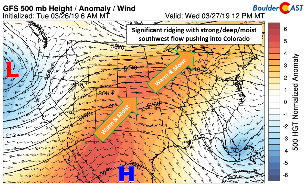
appy Wednesday! Today has been the warmest day thus far in 2019, hitting 74 degrees at BoulderCAST Station. This is because Colorado is embedded deep within the western flank of a large ridge of high pressure today.
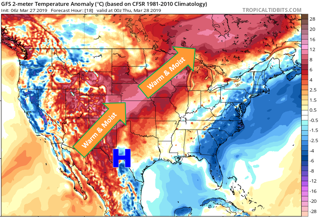
The resulting southwesterly flow has been pumping warm air and upper-level moisture into our region. Within this fetch of warm air stretching from the Desert Southwest into eastern Canada, temperatures will soar some 15 to 30 degrees above normal for this time of year. Highs around Boulder and Denver are reaching into the mid 70’s this afternoon.
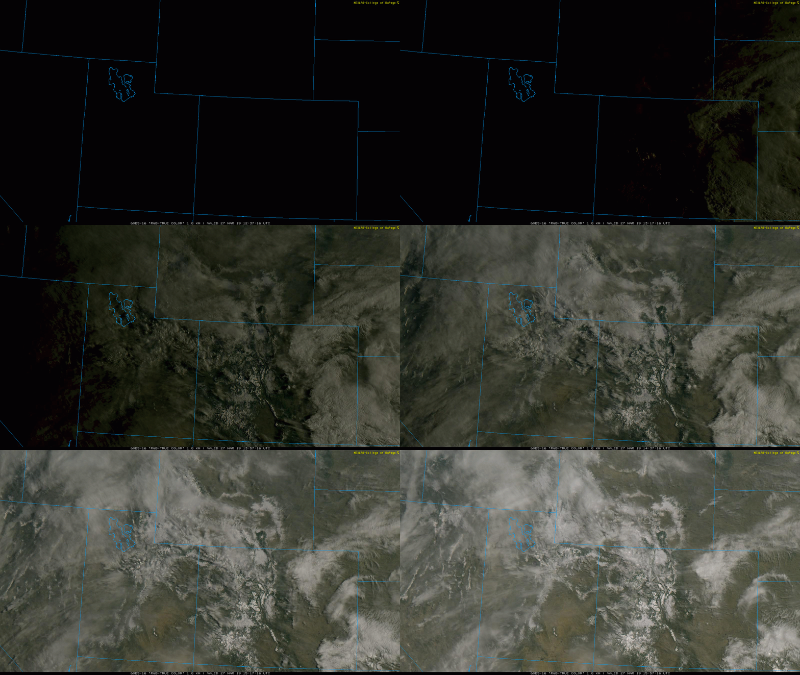
A clear sign of the moisture influx is the copious upper-level cloud cover that has been present yesterday and will be today and Thursday as well. Can you spot the wispy cirrus clouds streaming through in the visible satellite animation from GOES-East below?
We’ll have one more day of very warm temperatures on Thursday, though it won’t be quite as warm as Wednesday. This slight drop is related to a weak “cool” front back-dooring into northeast Colorado (see below). Despite this, highs Thursday should easily reach the upper 60’s to lower 70’s.

NAM low-level temperature forecasts for Wednesday (left) and Thursday (right). Notice the cool airmass bumping up against the Front Range on Thursday.
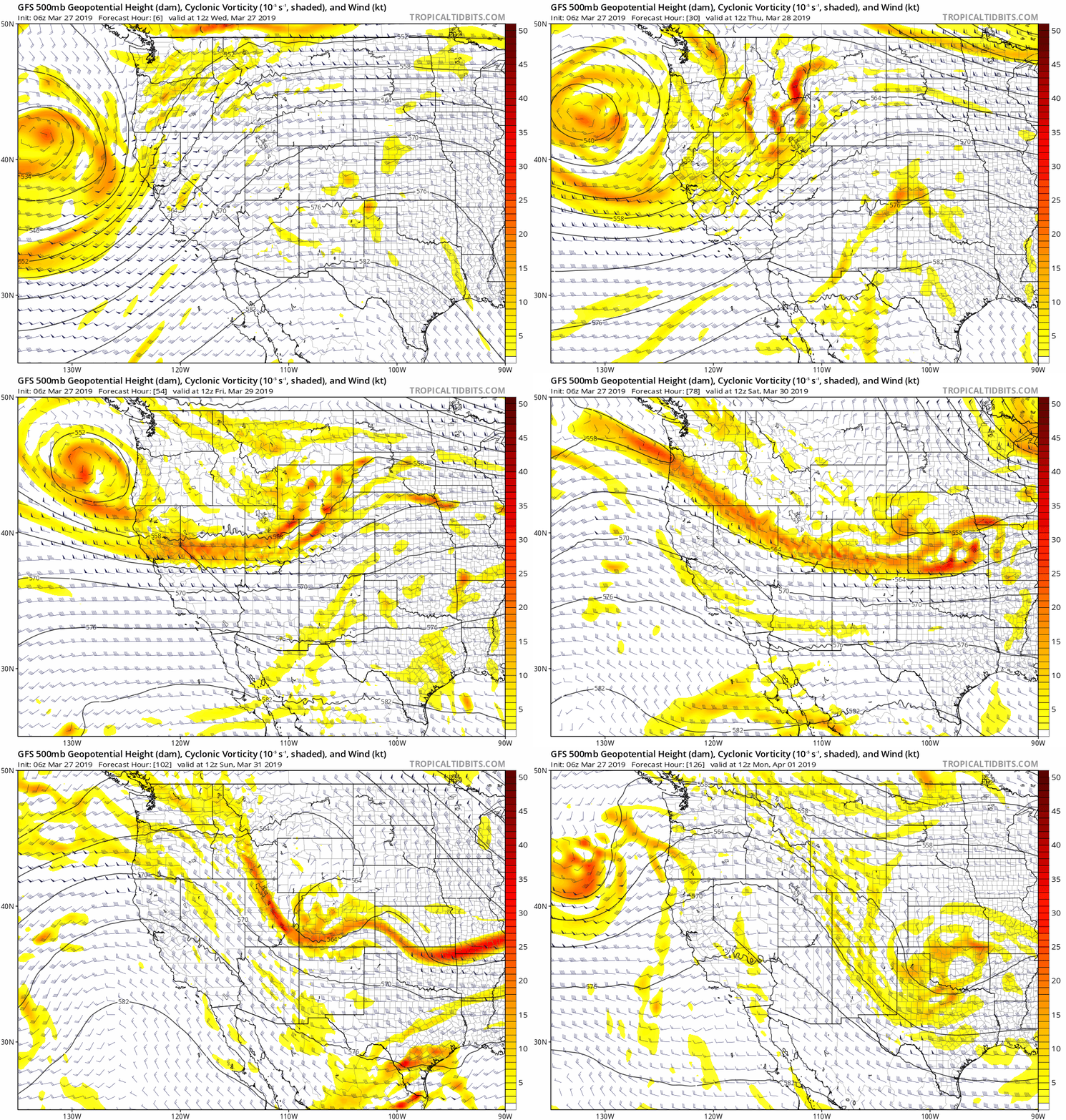
Things will begin to quickly change for us Thursday night as the ridge quickly shifts eastward to be replaced by a troughy, unsettled pattern across the northern Rockies. This troughy set-up will play out as a series of weak storms impacting Colorado (see below). This is in stark contrast to what model solutions were showing earlier this week (i.e. a single, potent storm).
Nonetheless, the end result will be a lengthy period of gloomy and cool weather for the Metro area. It all begins with instability and nearby “cool” front leading to a chance of isolated thundershowers Thursday afternoon and evening, though most of the action will be east of Denver where CAPE values will exceed 1200 J/kg.
After this, we then transition into a shallow upslope scenario Thursday night through much of Saturday as the main cold front arrives. You know the drill….low clouds and light precipitation will be common during this time… Temperatures should be warm enough that all precipitation falls as rain across the lower elevations through Friday afternoon. However, by Friday evening and night, as temperatures cool, snow levels will lower to encompass the entire Metro area. We still don’t see much (if any) support for accumulating snow across the Plains. Precipitation rates will be too low and both ground and air temperatures too warm, especially when combined with that pesky late March sun. At most, a dusting to 1″ of slush could occur on grassy and elevated surfaces by sunrise Saturday. Low clouds and light precipitation will remain socked in during the day Saturday with unseasonably cold temperatures in the 30’s to lower 40’s. Sunday is looking nicer with highs in the 50’s, but some models do show lingering precipitation remaining over our area. If we had to bet on the more pleasant day this weekend, Sunday would take the cake.
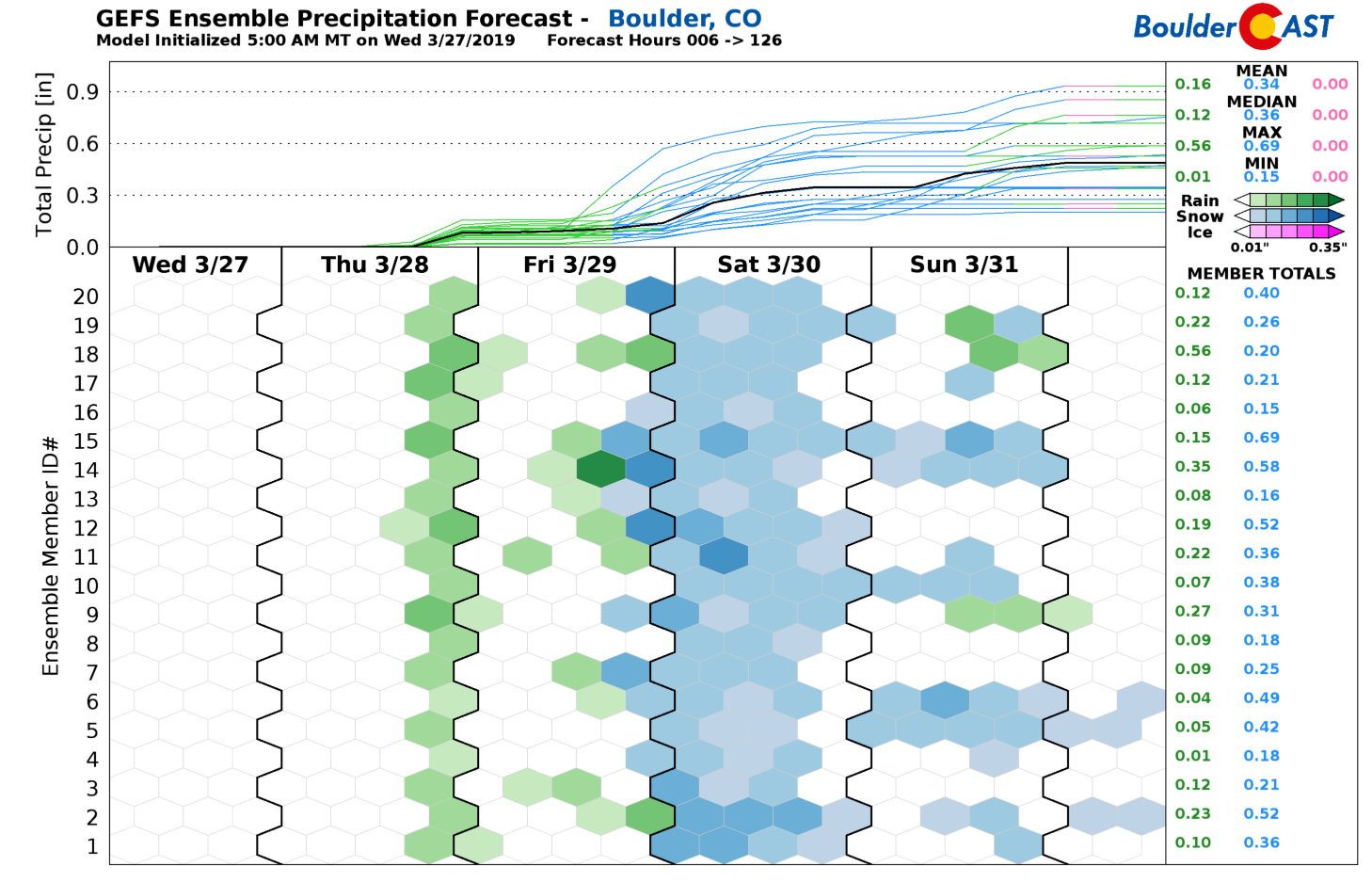
All in all, the take-away here is the extended duration of the unsettled weather. Admittedly, the timing and intensity of each individual piece of energy moving across Colorado in the coming days is not ironed-out by the models yet, not by any stretch. There is a lot of variability in regards to the specifics. However, the broad-brush of unsettled times remains the same across all model guidance. Precipitation chances will exist from Thursday afternoon through Sunday, though overall amounts and rates will likely be light. The best chances are Friday afternoon, evening, and night, with some snowflakes Friday night and early Saturday. By the end of the weekend, we’re looking at between 0.2 and 0.6″ of precipitation, most of which will be rain, or a melty snow. Unfortunately, there is no real chance for any spring snowstorms in the (near) future. Color us disappointed!
Forecast specifics:
Wednesday: Sunny with high clouds and very warm. Highs in the middle 70’s.
Thursday: Partly sunny and warm with isolated late afternoon and evening thunderstorms. Highs upper 60’s to near 70.
Friday: Some sunshine possible in the morning with increasing clouds, isolated light rain showers, becoming more widespread by evening. Cooler with highs near 50 degrees. Rain showers change to snow Friday night with little to no accumulation expected.
Saturday: The coldest day in the forecast. Expect overcast skies, low clouds, and snow flurries. Highs in the upper 30’s to low 40’s.
Sunday: Nicer but still cool. Some models do show lingering rain/snow showers, but this seems less likely right now. Partly cloudy with highs in the 50’s.
Spread the word, share this forecast:
.



You must be logged in to post a comment.