A persistent trough of low pressure across the southwestern United States will keep the area cooler than normal through the week alongside the chance of scattered storms each day. However, the weekend looks warmer and certainly drier. We also briefly touch on the tropics across the Atlantic with two potential hurricanes in play.

Some of our team hiked Mt. Massive this weekend. SummitCAST predicted the conditions spot on – mostly cloudy, temperatures in the upper 30’s at the peak, light winds, and a 30% chance of showers and storms.
Tuesday starts out similar to Labor Day
We begin this Tuesday with a persistent trough parked out across the southwestern United States (see below). This trough was actually with us through Labor Day weekend. If you were out and about in the Mountains, you probably came across a few thunderstorms related to the trough. This pattern will be with us much of the week, sending pulses of moisture from the south and keeping the area near or below average in terms of temperature. Only by the weekend will the system fully move out with high pressure settling in from the west.

GFS 250 mb wind speed and jet stream today
The trough will retrograde southwestward through the day today. This will allow a weak area of high pressure to slide down from Montana (below) and bring with it a cold front by Tuesday evening. Ahead of the front, we can expect highs similar to Monday in the lower 80’s under a mixture of clouds and sunshine. We’ll also see some smoke and haze from the northerly winds as the front approaches. This will reduce visibility both today and tomorrow.

GFS 800 mb temperature and wind this evening
As the front approaches, instability will move in due to daytime heating. The front will help focus shower and storm activity across the Front Range Foothills and Plains (see below). The overall look of the precipitation pattern is quite hazy between the models, as evidenced below, with the NAM drier than the GFS.

GFS (left) and NAM (right) 6-hr precipitation this evening
Nevertheless, both models, and in fact the high resolution NAM (not shown), all agree that a line of storms will develop northwest of Boulder and move south-southeast toward the Plains. This gives us confidence that storms appear likely, especially the western parts of the Metro area. We are putting tonight’s chance of storms at 30%. Any storms should taper in the early morning hours Wednesday. There will be the potential for lightning and heavy downpours.

HRRR model simulated radar for 1:00AM Tuesday night. Storms may linger across the Metro area until the early morning hours.
Rain chances persist Wednesday, drier Friday
On Wednesday, much of the same pattern will be around, though we expect things to be a little gloomier. The low pressure system (below) will be in a similar location, across northwestern Arizona.

GFS 500 mb absolute vorticity for Wednesday
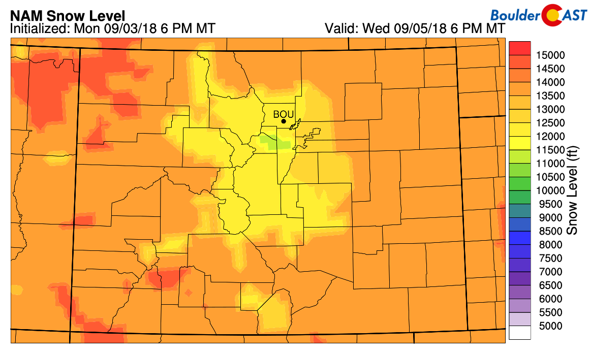
This position will put the area in another prime location for rain showers, with snow in the highest peaks above 12,000 feet.
A southeasterly push of moisture, thanks to the trough, will increase moisture levels to around 1″ of precipitable water, which will make the atmosphere a little more juicy for storms. A wave of energy from the above trough will move through in the late afternoon and evening (or at least predicted in the models), which should help focus lift over the Front Range.

GFS precipitable water values on Wednesday
The front will remain nearby on Wednesday (below), which will also aid in some weak upslope. It will also lower high temperatures significantly into the lower 70’s, a nice taste of autumn weather. A 30% chance of showers seems warranted on Wednesday as well for the afternoon and evening. Expect about a 60% chance in the Mountains, so hike early if you will be planning a visit out west.

GFS 800 mb temperature and wind Wednesday
Much of the same pattern will exist on Thursday, though it appears that the chance of storms decreases somewhat as the trough moves northeast and weakens. That said, a 30-40% chance of storms will remain over the High Country, and about 20% for the Plains. Highs will warm a little with a more southerly push of air. On Friday, the trough finally moves out and drier westerly downslope flow will take over, though we can’t rule out a 10% chance of storms on Friday either. Expect a warm end to the week with low to middle 80’s.
Dry & warm for the weekend
By the weekend, the trough moves out into the Great Lakes (see below). In its wake, a ridge of high pressure will push east from the Pacific Ocean. A persistent westerly flow will take over and lead to dry conditions for much of the state, with only a slight chance of storms over the Mountains.

GFS 500 mb absolute vorticity for Saturday
The westerly downslope flow will create above normal temperatures for us and much of the west and southwest. As evidenced below, we’ll likely see highs warming to the mid and upper 80’s, but maybe not quite 90 degrees. Early next week, it appears another front moves in, but it’s a little too early to tell for sure.

GFS 700 mb temperature anomaly on Saturday
The forecast for the Broncos season opener on Sunday afternoon looks great at this time. It should be dry with temperatures in the mid to upper 80’s with clouds and sunshine.
A brief discussion on the Tropics
With the exception of a few brief stints in June and early July, the Atlantic has been very quiet in terms of tropical cyclones. This is thanks to below normal sea surface temperatures, dry and dusty air from Africa, and elevated wind shear. But the tides have now turned…no pun intended. Conditions across the Atlantic are becoming more favorable and two active cyclones are now present in the basin.
One is Tropical Storm Gordon, located in the Gulf of Mexico. The National Hurricane Center predicts it will become a hurricane just prior to landfall over Mississippi and Alabama, so it will be something to watch this week for sure.

National Hurricane Center outlook for potential Hurricane Gordon
A second cyclone is out further east in the central Atlantic and is forecasted to remain well east of the US coast. Yet it could be a player next week with the atmospheric flow shifting from a ridge of high pressure near Bermuda. The Atlantic is active, so these next few weeks should keep the nation tuned in to potential landfalls.

National Hurricane Center track for Tropical Storm Florence
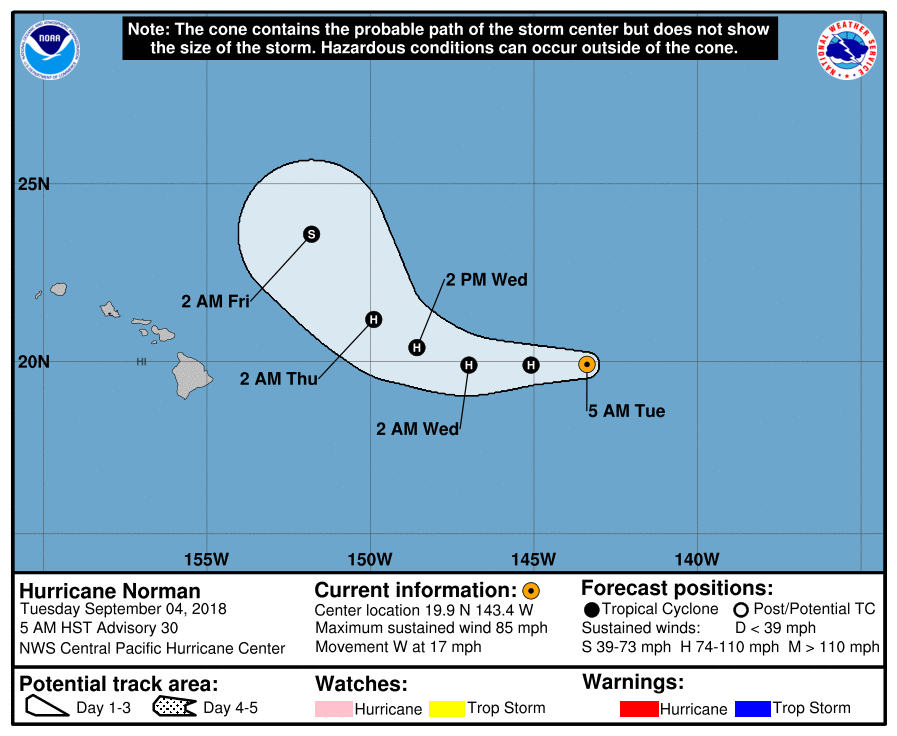
Finally, Hurricane Norman which formed just off the coast of Mexico has progressed into the Central Pacific Ocean over the last week. It is projected to come within a few hundred miles of Hawaii later this week. No major impacts are expected.
Enjoy the shorter week!
Forecast Specifics:
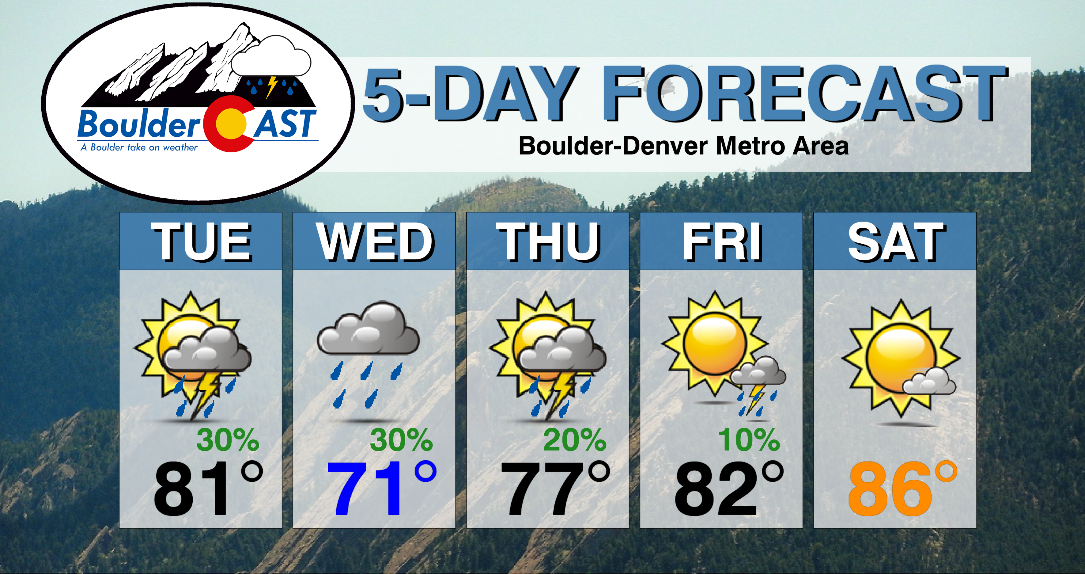
Tuesday: Partly sunny skies with highs in the lower 80’s on the Plains and lower 70’s in the Foothills. Increasing clouds later in the afternoon with scattered showers and storms during the early to late evening. Storms could linger after midnight.
Wednesday: Cooler with mostly cloudy skies. Scattered showers and a few rumbles of thunder developing in the late afternoon and evening, mainly across the higher elevations. High temperatures in the lower 70’s across the Plains and lower 60’s in the Foothills.
Thursday: Morning sunshine, then increasing clouds with isolated storms in the evening. Expect highs in the upper 70’s for the Plains and in the upper 60’s in the Foothills.
Friday: Mostly sunny and warmer, with only a slight chance of storms. Look for highs in the low to middle 80’s for the Plains with lower 70’s in the Foothills.
Saturday: Mostly sunny and dry with highs in the mid to upper 80’s for the Plains and in the middle 70’s in the Foothills.
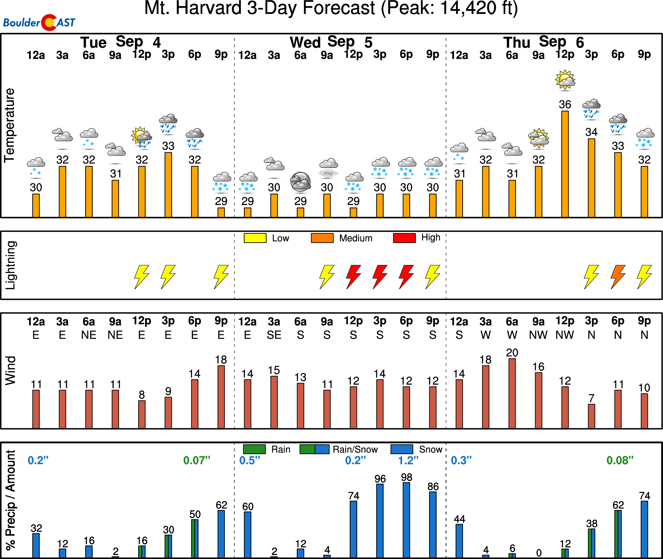
High Country: It will be a relatively active week in the Mountains. Storms appear prevalent each day, with the exception of Friday when the chances decrease. This is all thanks to the persistent trough over the western United States. Check out our SummitCAST page for 6-day forecasts for more than 120 Colorado mountain destinations!
DISCLAIMER: This weekly outlook forecast was created Tuesday morning and covers the entire upcoming week. Accuracy will decrease as the week progresses as this post is NOT updated. To receive daily updated forecasts, subscribe to BoulderCAST Premium.
.
Share our forecast!


You must be logged in to post a comment.