Following a weekend of unsettled and at times, stormy weather, this week will see precipitation chances gradually decrease and highs turning quite warm to end the week. However, there are hints of another active pattern for the coming weekend over Colorado. Read on for our full weekly forecast.
Remember that snow a week ago?
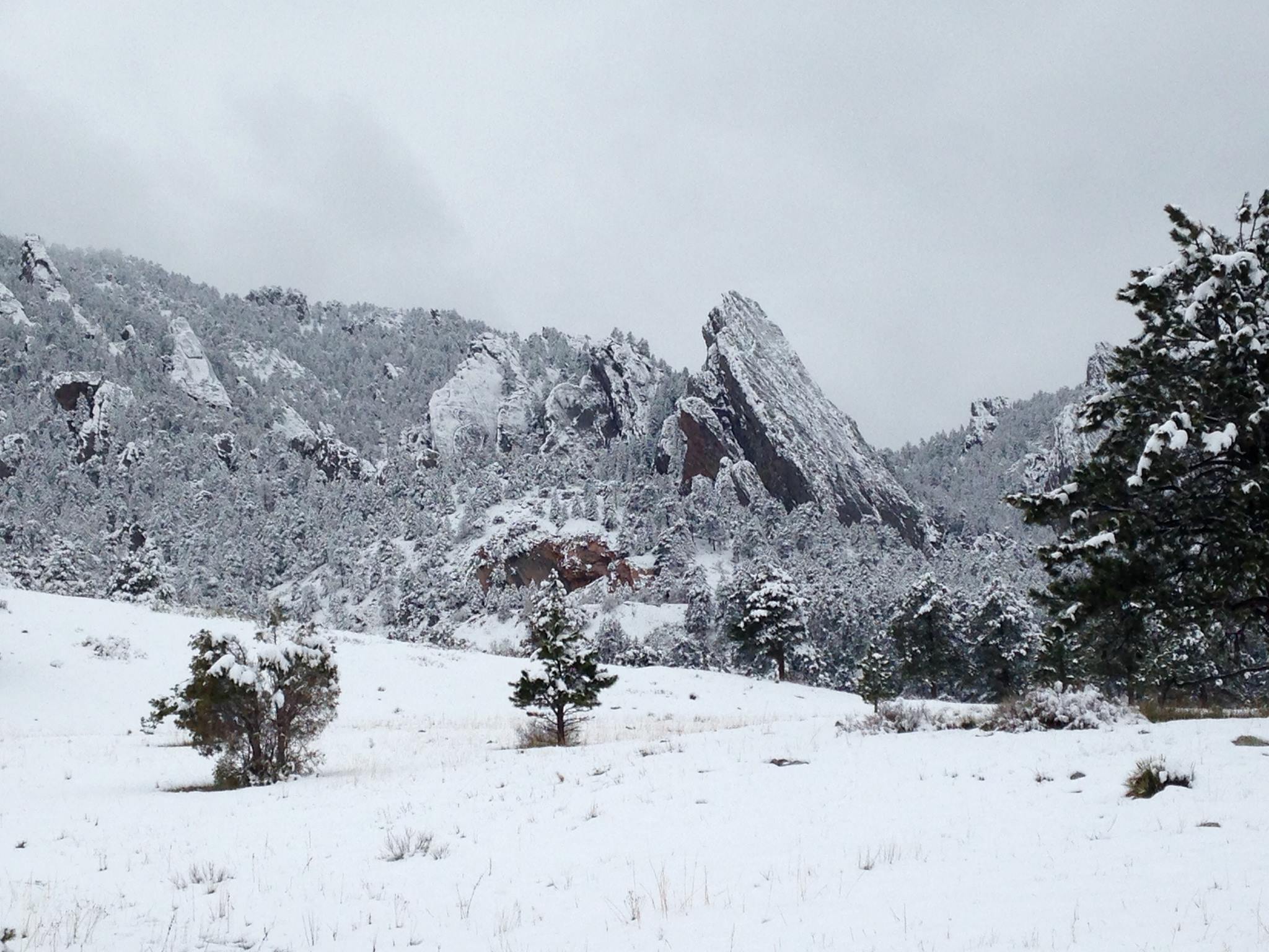
Apologies for a lack of a weekly forecast last week. In a rare occurrence, the stars aligned, and all of our meteorologists were traveling and unavailable. With this absence, we also missed a proper recap for last weekend’s snow event! Despite snowing near-continuously for more than 48 hours, above-freezing temperatures and the late April sun made for a less than impactful event across the Plains, which we stressed. Our forecast called for 2-6″ across most of the lower elevations, with less northeast of Boulder, and 5 to as much as 18″ in the Foothills.
We had concern about how the tailend of the event would play out. Would snow linger across the region into Saturday and Sunday? Would some heavier snow fall overnight, when accumulation odds were much higher? These were the biggest reasons for our wider-than-typical 2-6″ forecast range across the lower elevations. Here is the review map for the event.
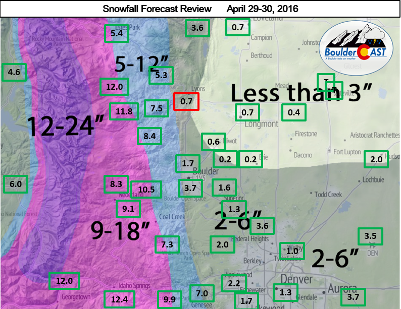
Our original forecast map created on Thursday (Apr 28). The observed storm totals per location are contained in boxes. Green ones indicate that the observed snowfall was within one inch of the given forecast range, while red was outside the scope of our forecast.
Overall, our forecast played out well. Boulder and Denver officially accumulated 3.7″and 3.5″, respectively. 1.0″ of that snow fell after 6pm on Saturday (Apr 30) in Boulder, spilling over into the month of May (as far as records go, May begins April 30 at 6pm). This makes seven consecutive Mays with snow in Boulder!
Let’s hope this is our last snow of the season! We’re all more than ready for summer at this point.
The week ahead
The focus for the week ahead will be the exiting of a broad, cut-off low pressure system, with ridging to take over by midweek, eventually becoming well-entrenched over Colorado. Before that occurs, though, the exiting trough will have an influence on afternoon isolated thundershowers.
On Monday, the aforementioned low pressure system pushes out of Colorado into Nebraska and South Dakota. Its influence is still evident though, with a few shortwaves diving southeast around the base of the trough in eastern sections of the state. Cool air aloft under this trough, evident in the 700 mb temperature plot, will aid afternoon weak instability with daytime heating for scattered rain/thundershowers to develop over the Foothills and traverse east onto the Plains. The surface flow, however, is a westerly downslope, so any rain will be isolated with not everyone seeing the wet weather.
Expect sunshine early, followed by increasing clouds in the mid-to-late afternoon. Highs to reach the upper 60’s.
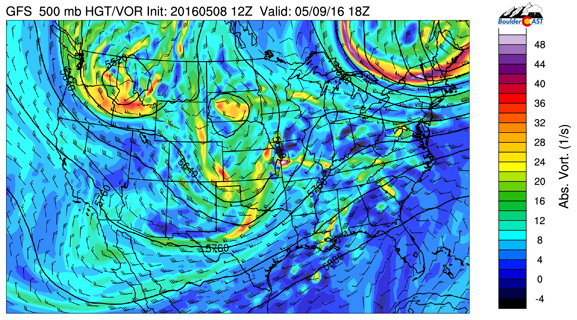
500 mb vorticity from the GFS for Monday
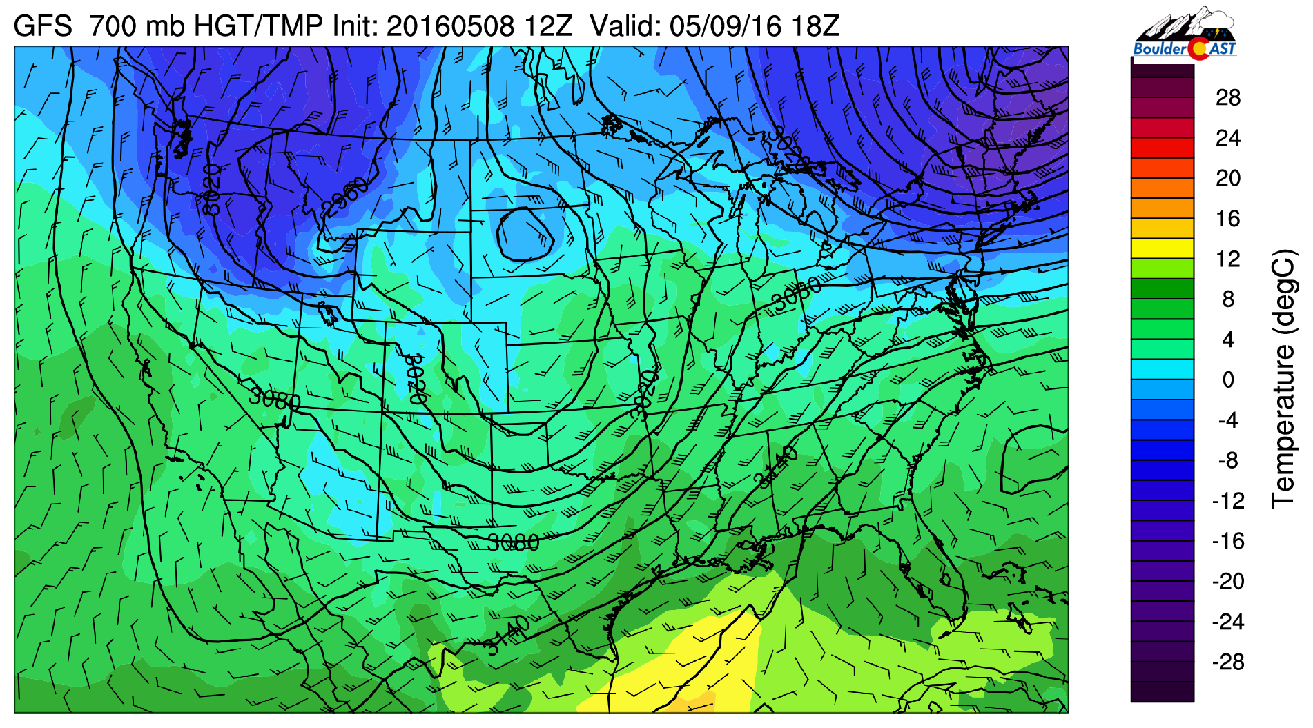
700 mb temperature from the GFS for Monday, showing the cool air aloft to aid afternoon isolated showers Monday afternoon
On Tuesday, another trough of low pressure advects southeastward into Wyoming, with a cold front trailing into Colorado and Utah. Southwesterly flow will ensue across much of the state, with afternoon temperatures in the middle 60’s. Sunshine should be expected in the morning and early afternoon. Cooler air approaching the with cold front and embedded shortwaves moving eastward over the state will help produce another round of isolated to scattered showers/thundershowers. Instability is weaker on this day so any activity will again not be widespread. Look for rain to taper off after sunset.
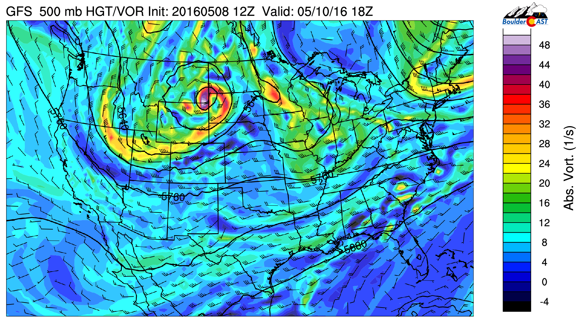
500 mb vorticity from the GFS for Tuesday
Over the High Country, the southwesterly flow along the cold front, will produce rain and snow showers over the mountains Monday and Tuesday. The NAM forecast model is indicating a swath of 2-6 inches of snow over portions of the High Country. The majority of the ski resorts are now closed for the season. A-Basin remains open, so if you are up for skiing, you may want to take advantage of some late season snow for Wednesday.
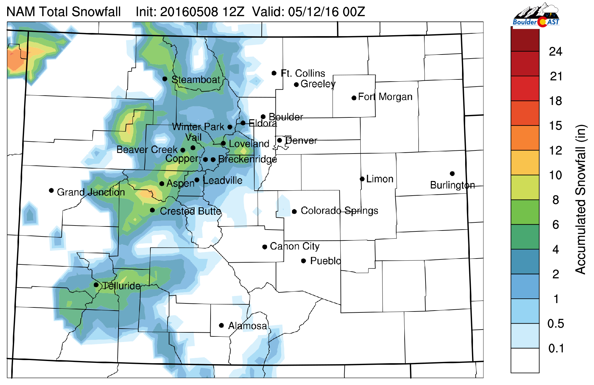
NAM total snow accumulation through Wednesday
Mid-week cooldown
Wednesday is a cooler day with the cold front sliding through late Tuesday night. Below shows the 700 mb temperatures over the United States, with temperatures in Colorado some 5 degC colder than Tuesday. As a result, look for temperatures only rising to the low 60’s under partly cloudy skies. A few very spotty showers look to develop over the High Country and move east, but with downslope flow over the Plains, we will remain dry for the most part.
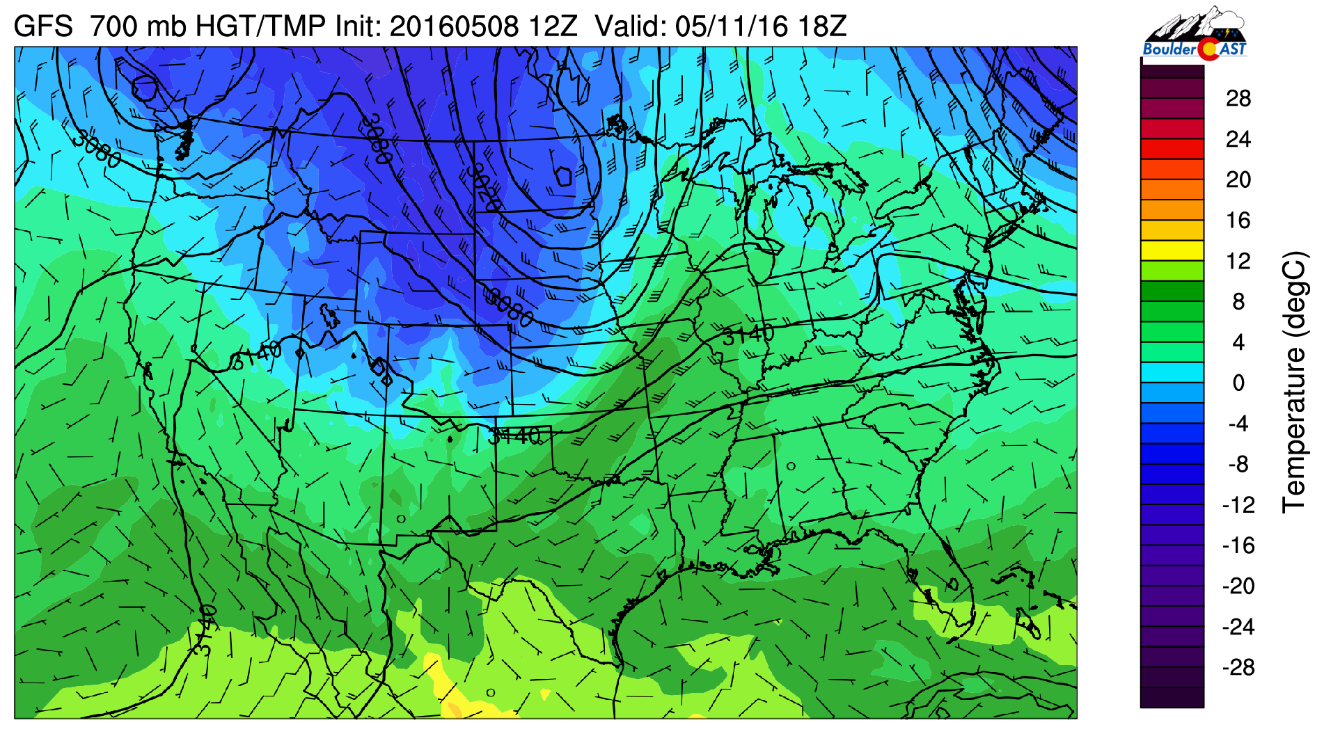
700 mb temperature from the GFS for Wednesday
Ridge builds in to end week
Thursday and Friday will see great weather. In fact, we should rise to the lower 80’s by the end of Friday. As is evident below, the flow is westerly under a building mid-level ridge. Under the ridge, 700 mb temperatures soar to around 11 degC, which supports temperatures in the upper 70’s to 80’s to end the work week. We are forecasting temperatures in the lower 70’s Thursday and lower 80’s Friday. Enjoy the end of your week and maybe do a little work outside!
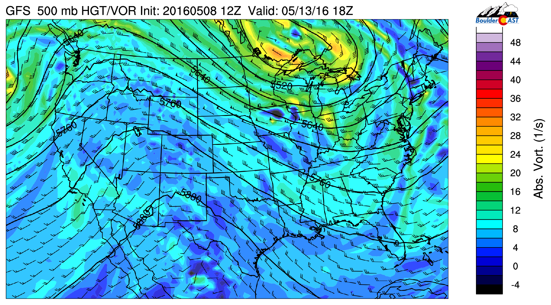
500 mb vorticity from the GFS for Friday
Some hints of active pattern early next week…
Several of the long range forecast models, namely the Euro, GFS, and GEFS, are hinting at a return to active weather late in the upcoming weekend and early next week. Another shortwave moving onshore from west to east is expected to reach Colorado late Sunday and Monday. The Euro is also indicating a backdoor cold front pushing in from the upper Midwest Saturday with upslope conditions. These extended forecast patterns indicate the possibility of cool and unsettled weather in the long-range, which is to be expected for the month of May during a weakening El Niño.
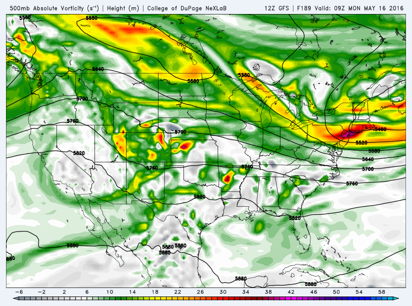
The Forecast:
Monday: Increasing clouds with highs in the upper 60’s over the Plains and upper 50’s in the Foothills. Isolated showers/thundershowers in the late-afternoon and early evening.
Tuesday: Morning patchy clouds, then sunshine building in before increasing late afternoon clouds. Isolated showers late afternoon, tapering off after sunset. In Boulder, the showers will be rather spotty. Highs in the middle 60’s on the Plains and middle 50’s in the Foothills.
Wednesday: Mostly sunny skies with cooler temperatures. Around 60 degrees over the Plains and near 50 in the Foothills. A few showers will develop in the High Country and could reach the Foothills in the afternoon but the Plains will remain dry.
Thursday: Sunny and warmer with highs in the lower 70’s on the Plains and low 60’s in the nearby Foothills.
Friday: Sunny skies and much warmer. Lower 80’s on the Plains and upper 60’s in the Foothills.
High Country: Scattered rain/snow showers will be present over the mountains Monday and Tuesday. On Tuesday, colder air will help produce an additional 2-6″ of snow over portions of the Divide. On Wednesday, isolated rain/snow showers are possible with a few showers with embedded thunder. Thursday and Friday to be mostly dry but not without a weak passing shower in the afternoon from daytime heating. In the extended, rain/snow showers appear to return late Sunday and early next week.




You must be logged in to post a comment.