
Well, they say April showers bring May flowers, but what do May showers bring?? The forecast for the week will feature a similar pattern to what we have experienced over the weekend. The week can be summed up in a few words: stormy at the beginning and end of the week, with slightly drier conditions in the middle.
Pesky low-pressure continues unsettled stretch…
The weather to start our week will be eerily similar to this past weekend thanks to that pesky cut-off system in Utah. Much of Monday and Tuesday will be a play between the mid-level system (see below) and a surface boundary which will continue to produce showers and thunderstorms across the Front Range. Dry times will mainly exist during the first half of each day, followed by showers and storms in the afternoon and evening. Below shows the low-pressure system today over Nevada. Southwest flow is still present to focus lift into Colorado this evening.
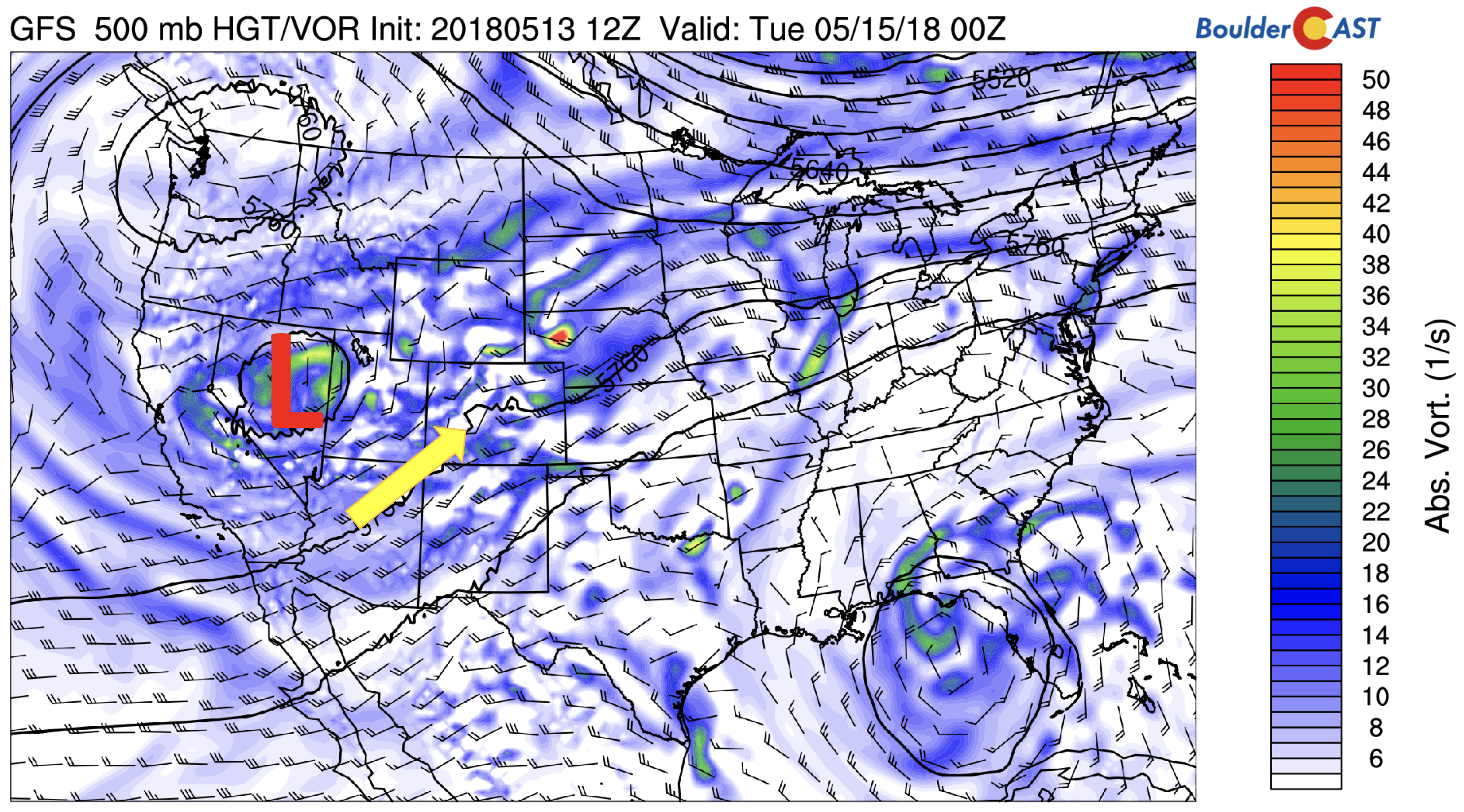
GFS 500 mb absolute vorticity this evening
As mentioned above, the mid-level low will interplay with the surface boundary today and tomorrow (red dashed lines below). On Monday, the boundary will be south and west of the Denver Metro area, slightly south of its position on Sunday. Once again, lots of cloud cover is expected today with temperatures in the lower 60’s. Outside of some morning drizzle, dry weather is expected early on, then showers and thunderstorms will develop in the mid to late afternoon and evening, thanks to unstable air from surface heating (below on right). That should help form storms in the High Country, moving east onto the Plains. The main threats will again be heavy rain and isolated hail. We may see one or two storms produce hail 1″ or larger (severe level) given the shear available in the region.
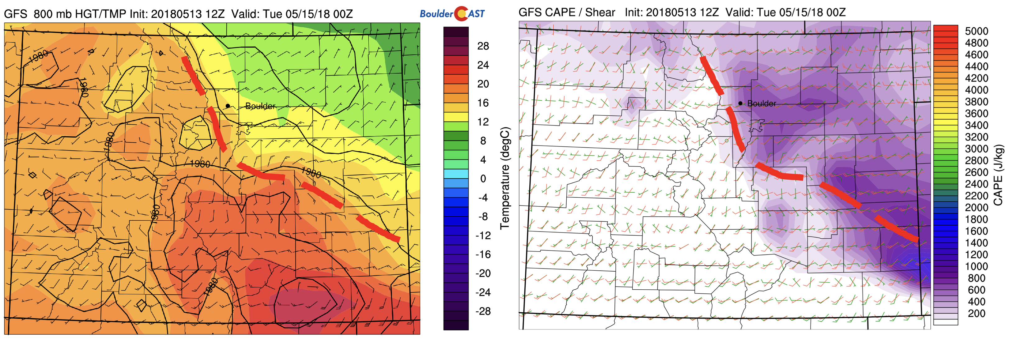
GFS 800 mb temperature (left) and CAPE/Shear (right) this evening
Much of the same pattern exists on Tuesday in the mid-levels, with the cut-off system weakening a little as it moves further northwest into southern Oregon. Another wave of energy though will keep lift over the state of Colorado through the day.
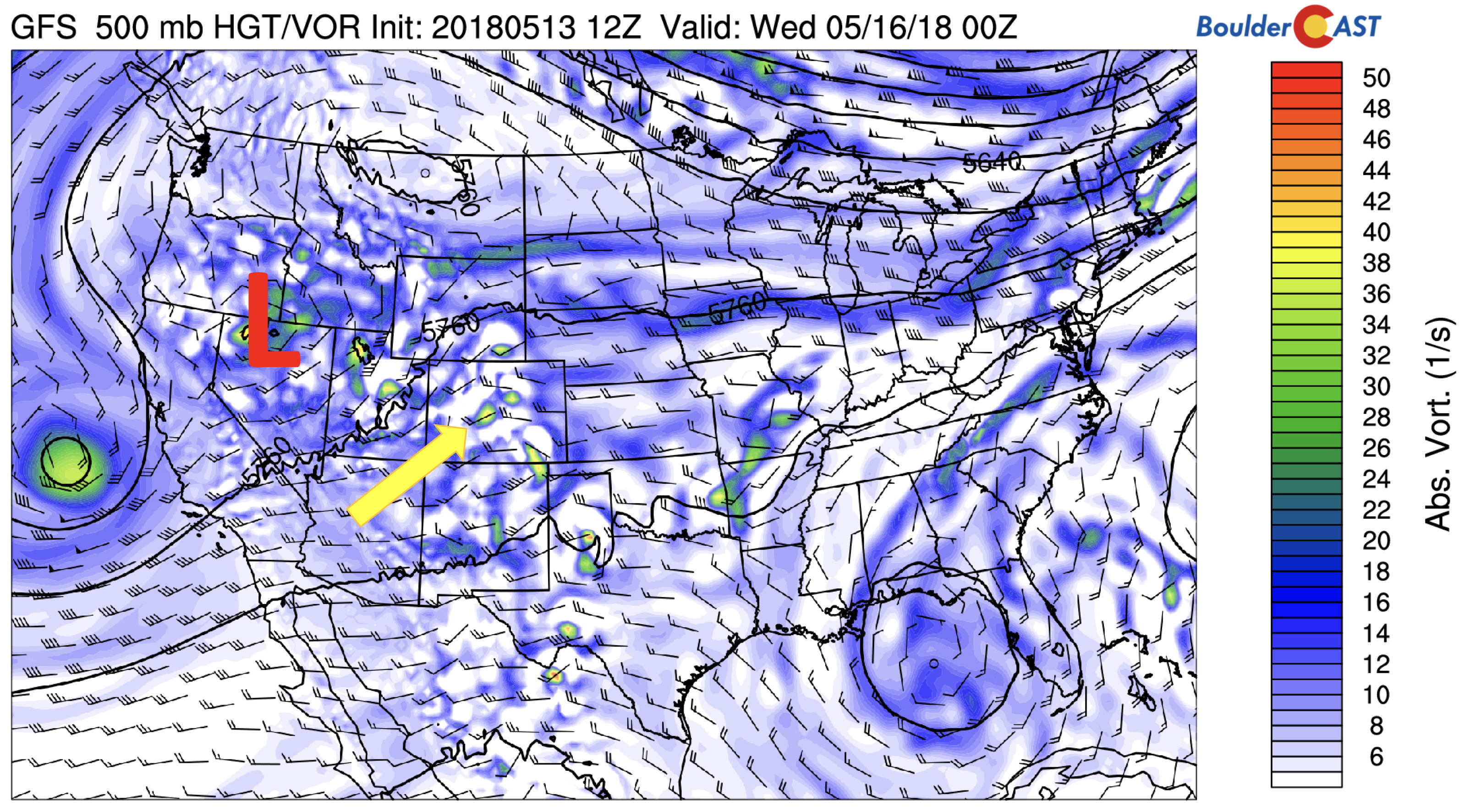
GFS 500 mb absolute vorticity on Tuesday
And a similar pattern stays at the surface, with the surface boundary still to our south and west, with instability approaching 1000 J/kg of CAPE.
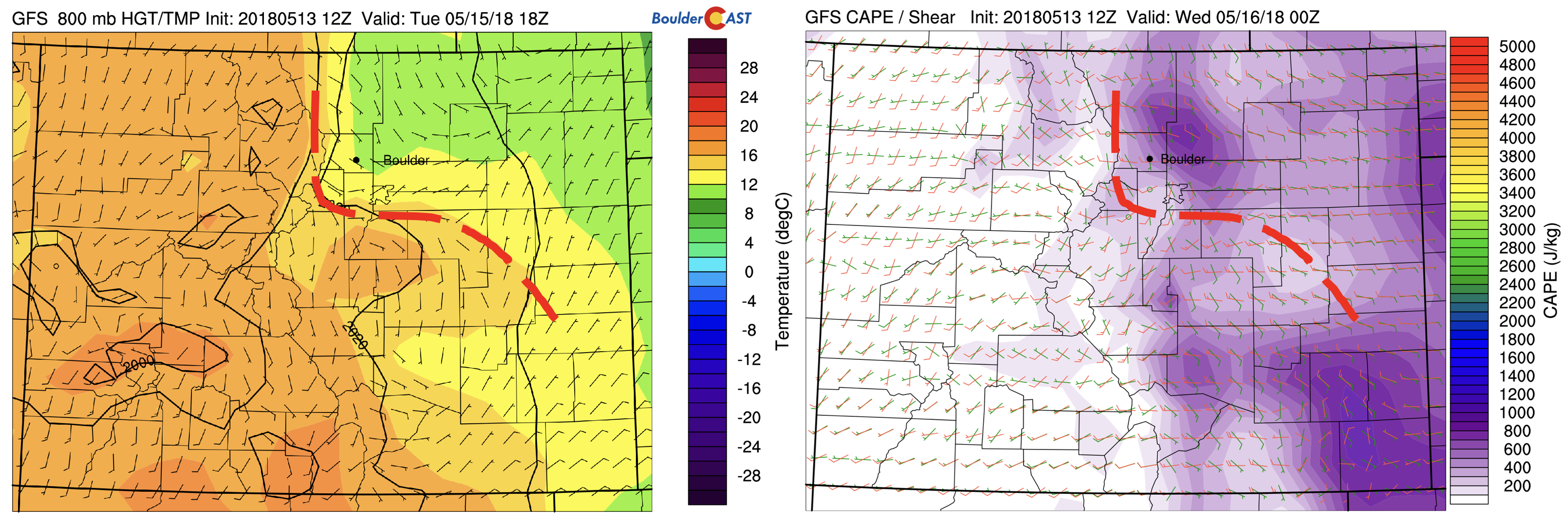
GFS 800 mb temperature (left) and CAPE/Shear (right) this evening
Slightly drier Wednesday
On Wednesday, the original cut-off low will have dissipated. A weak ridge of high pressure develops over the state, which should help to produce more sunshine and warmer weather into the 70’s. However, another slow-moving system arrives over California, which will be a player for us Thursday and Friday. Although the chance of storms will exist on Wednesday, it appears to be a drier day thanks to the energy focused west of Colorado in Utah.
GFS 500 mb absolute vorticity Wednesday
A wet end, or so it seems…
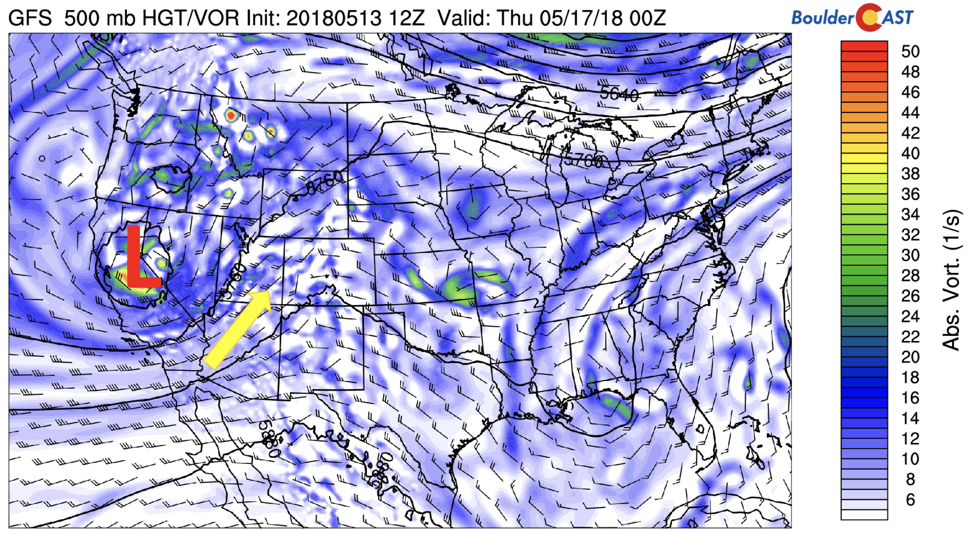
That secondary system over California on Wednesday appears, at least initially, to move into Utah and Nevada Thursday and Friday. This would put it in a very similar spot as the system earlier in the week and this past weekend. That will help focus once again lift and moisture over Colorado.
GSF 500 mb absolute vorticity on Thursday
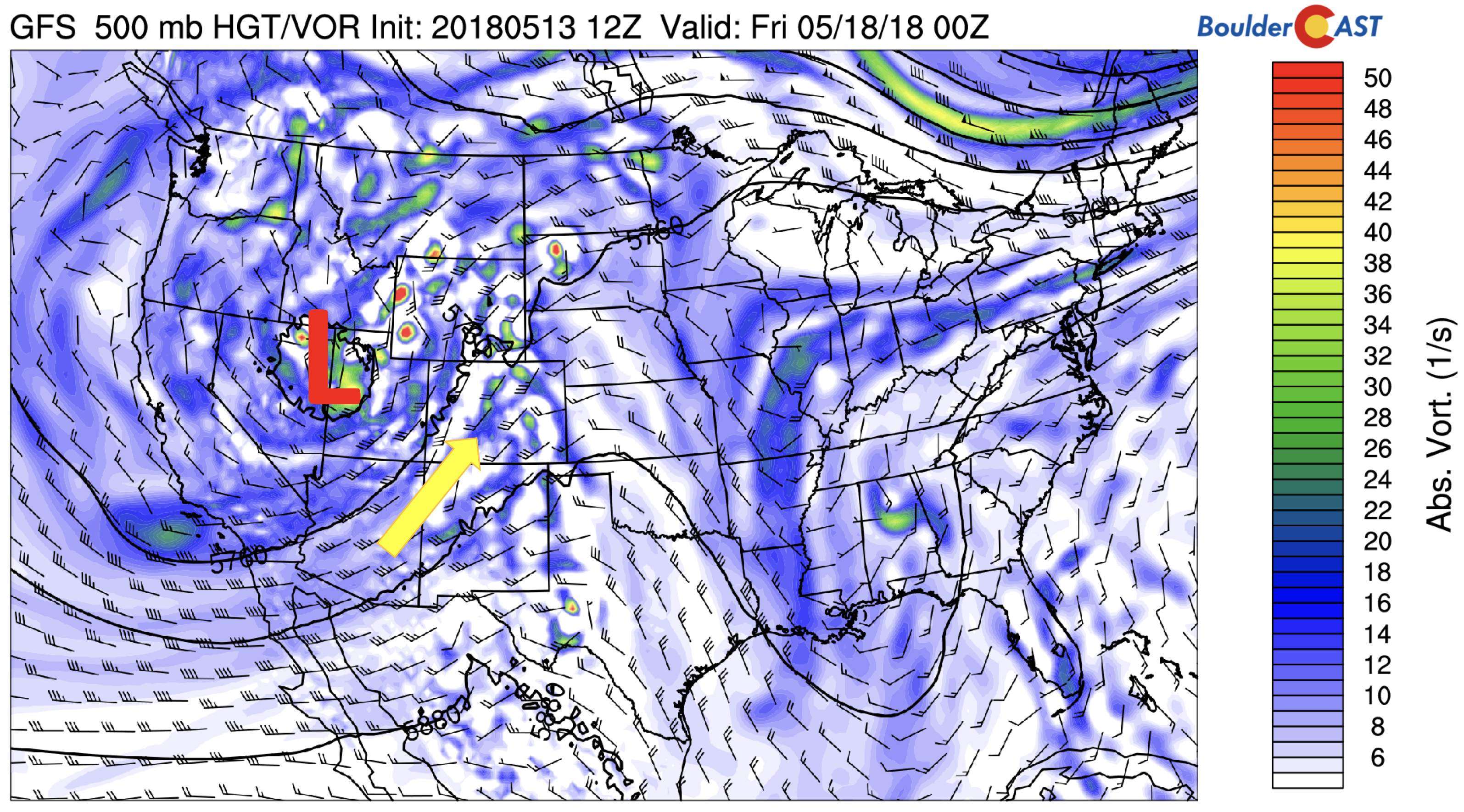
The models are hinting that the system will push east on Friday to allow a cold front to dive southward from the north (below). This would also be similar to what happened a week ago. Time will tell if this verifies, as models have a difficult time with cut-off systems. Our forecast nonetheless calls for a wet and cooler end to the week, with the threat of showers and thunderstorms in the afternoon and evening, especially Friday evening and night.
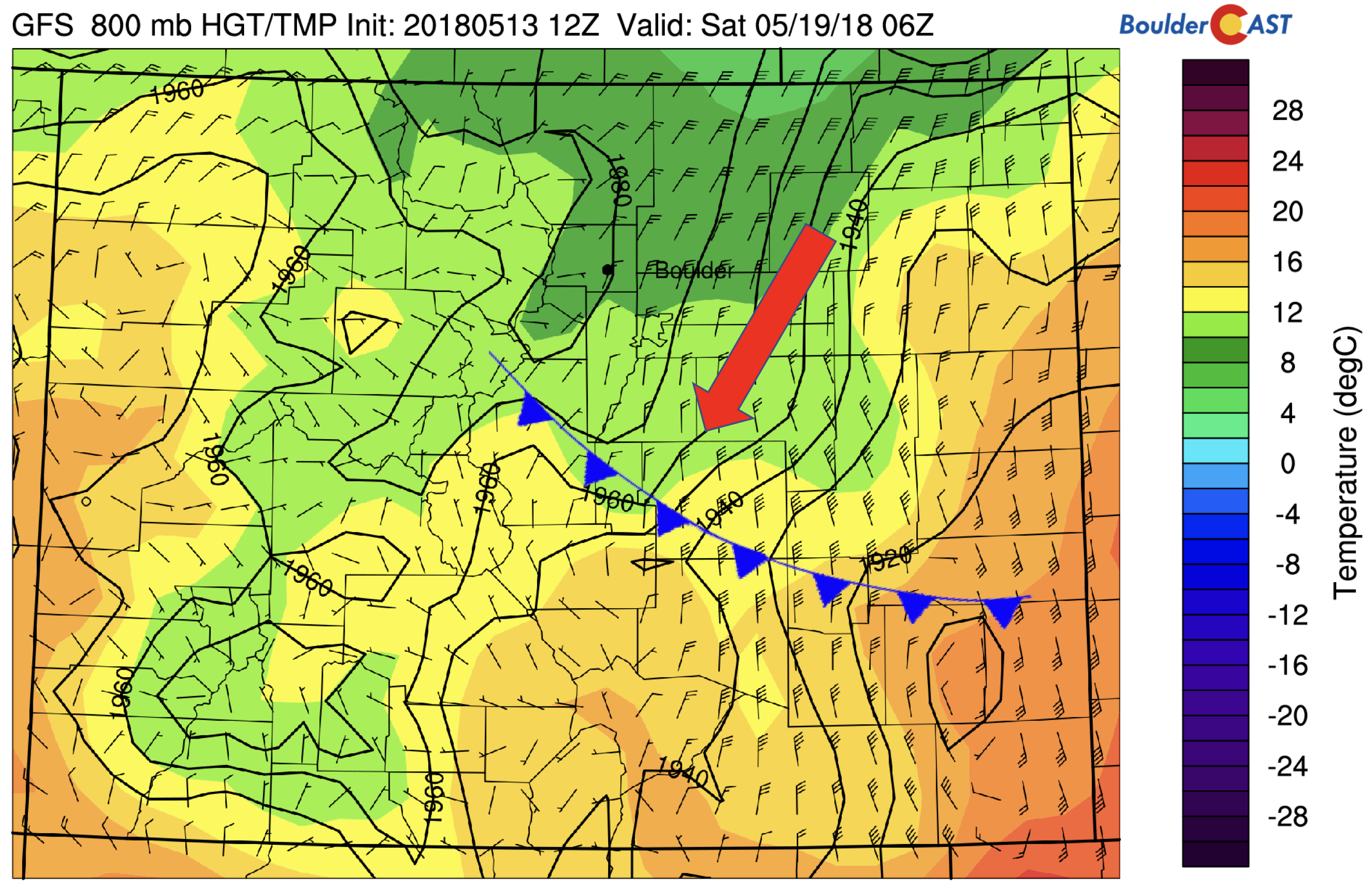
GFS 800 mb temperature Friday evening
Below shows the GFS predicted total precipitation through Friday. Much of the state east of the Divide is poised to see 1 to 2″ of rainfall, with possibly 4″ in northeast Colorado. Models have a difficult time on convection and thunderstorms, so this is not a certainty…but it let’s you know how wet the week could turn out…
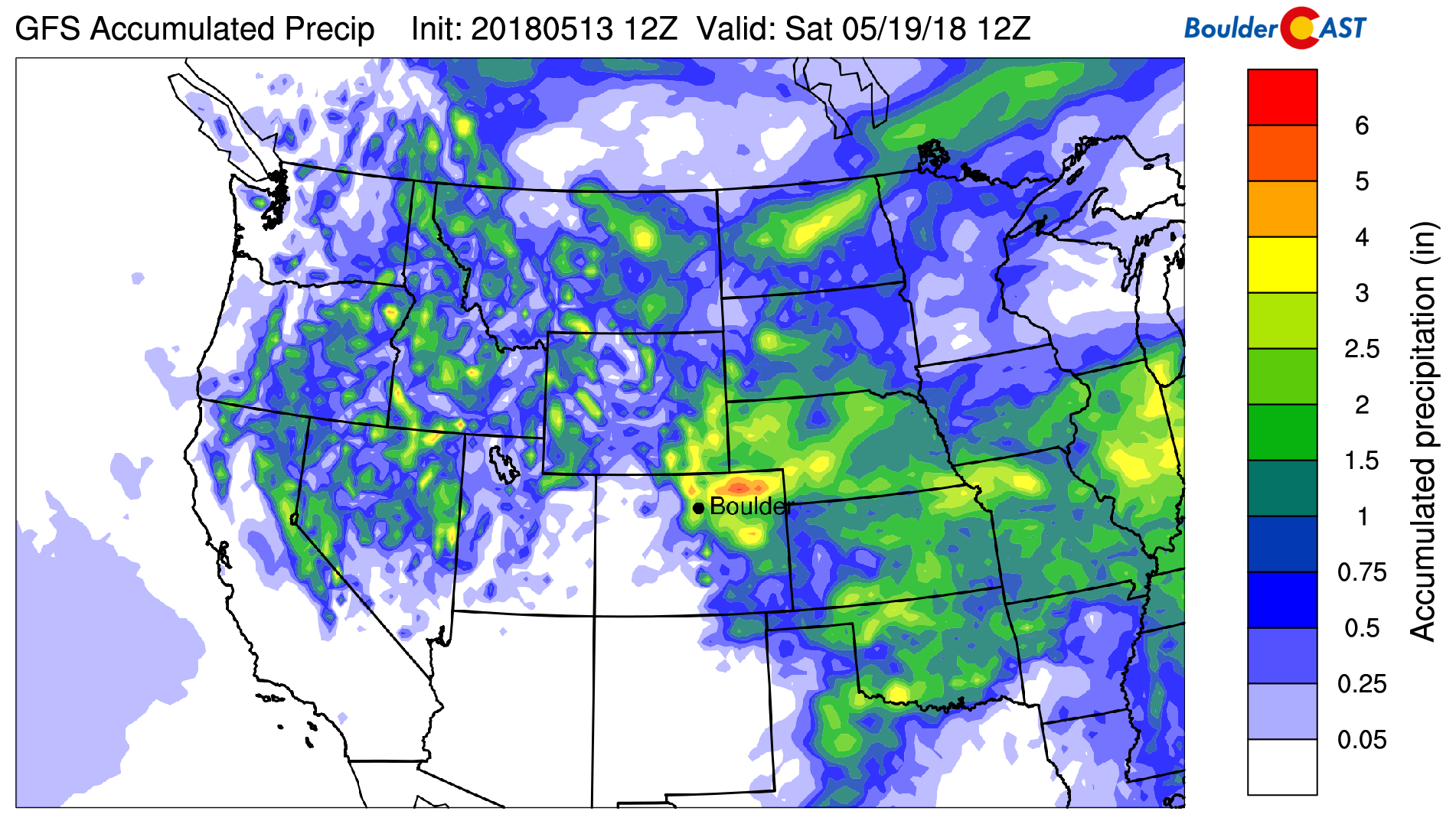
GFS total precipitation accumulation through Friday
Forecast Specifics:
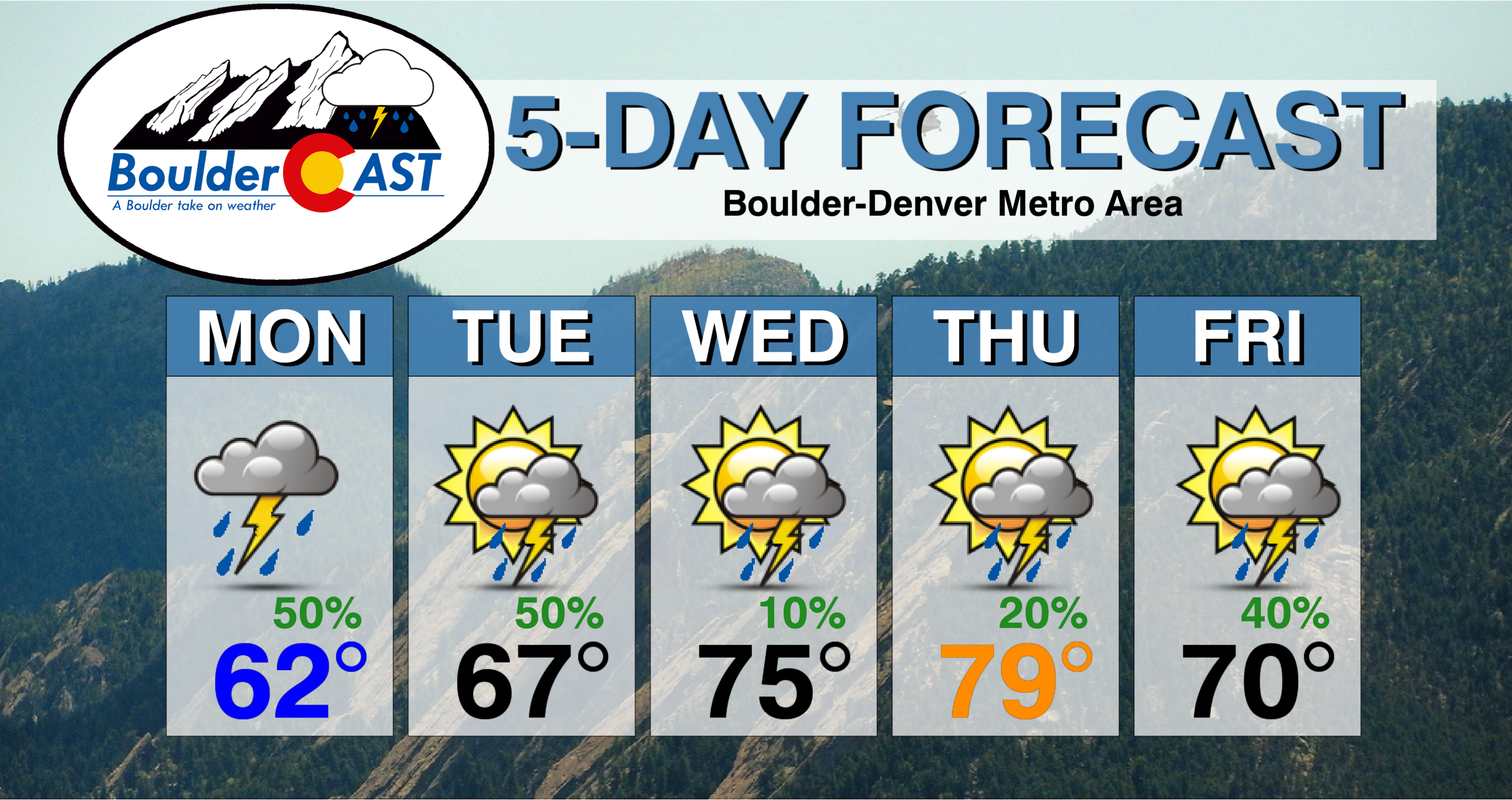
Monday: Patchy morning drizzle, then mostly cloudy and cool with scattered showers and thunderstorms developing in the mid to late afternoon and continuing into the evening. One or two storms across the Metro area could turn severe with hail larger than 1″ in diameter. Highs over the Plains in the lower 60’s with middle 50’s in the Foothills.
Tuesday: Partly sunny in the morning, then mostly cloudy with scattered showers and thunderstorms in the late afternoon and evening. Storms could produce heavy rainfall and small hail. Highs in the mid to upper 60’s on the Plains and low 60’s in the Foothills.
Wednesday: More sunshine expected. Mostly sunny skies, with increasing clouds in the afternoon and a chance of isolated thunderstorms in the early evening hours. Temperatures warmer in the low to middle 70’s for the Plains and middle 60’s in the Foothills.
Thursday: Mostly sunny skies becoming mostly cloudy with widely scattered showers and thunderstorms possible in the afternoon and evening. Highs in the mid to upper 70’s on the Plains and middle 60’s in the Foothills.
Friday: Partly to mostly cloudy with scattered showers and thunderstorms possible in the evening and overnight into Saturday. Highs in the upper 60’s on the Plains with upper 50’s in the Foothills.
High Country: Mountain weather this week will be dominated by the mid-level system. Scattered showers and storms are expected today and tomorrow with the southwest flow and moist air over the region. Be sure to keep and eye on the skies if you are hiking these next few days. With weak high pressure on Wednesday, drier weather is expected midweek. A more unsettled pattern returns Thursday and Friday with the approach of another storm system, with isolated to scattered storms and even some snow at the higher elevations about 11,000 feet.
DISCLAIMER: This weekly outlook forecast was created Monday morning and covers the entire upcoming week. Accuracy will decrease as the week progresses as this post is NOT updated. To receive daily updated forecasts, subscribe to BoulderCAST Premium.

.
Share our forecast!
.


You must be logged in to post a comment.