Much of our region has missed out on the monsoon thunderstorms so far. As we move into the last week of July, Boulder’s monthly rainfall total rests at just 0.32″. Normal for the month of July is right around 2″, so this is well below average. The week ahead will offer a resurgence of monsoon moisture to northeast Colorado. However, as always, not everyone will see the much needed soaking rains.
Monday is driest and warmest
We begin the week under the influence of a wide, somewhat disorganized ridge of high pressure. This ridge (and the associated lack of moisture) was responsible for the diminished storm chances and near 90-degree temperatures over the weekend.
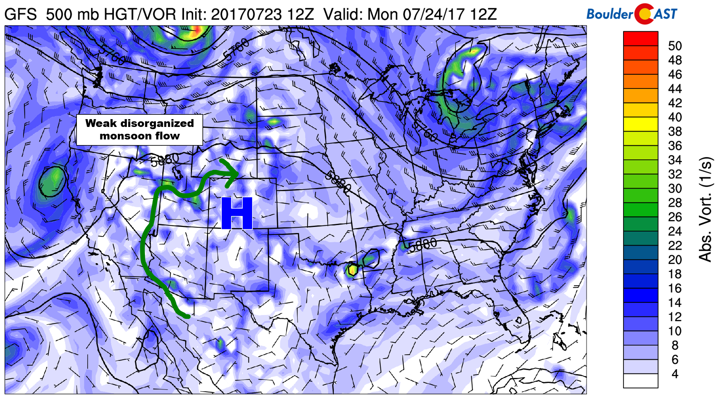
GFS 500 mb vorticity map for Monday showing a weak ridge across Colorado, with limited monsoonal flow.
This trend will continue into this evening with only isolated afternoon storm chances across the region today and highs in the mid 90’s.
Turning wetter quickly
By Tuesday morning, most model guidance suggests that the high pressure will intensify across northern Texas. This will enhance low and mid-level monsoon flow into the Desert Southwest and ultimately Colorado.
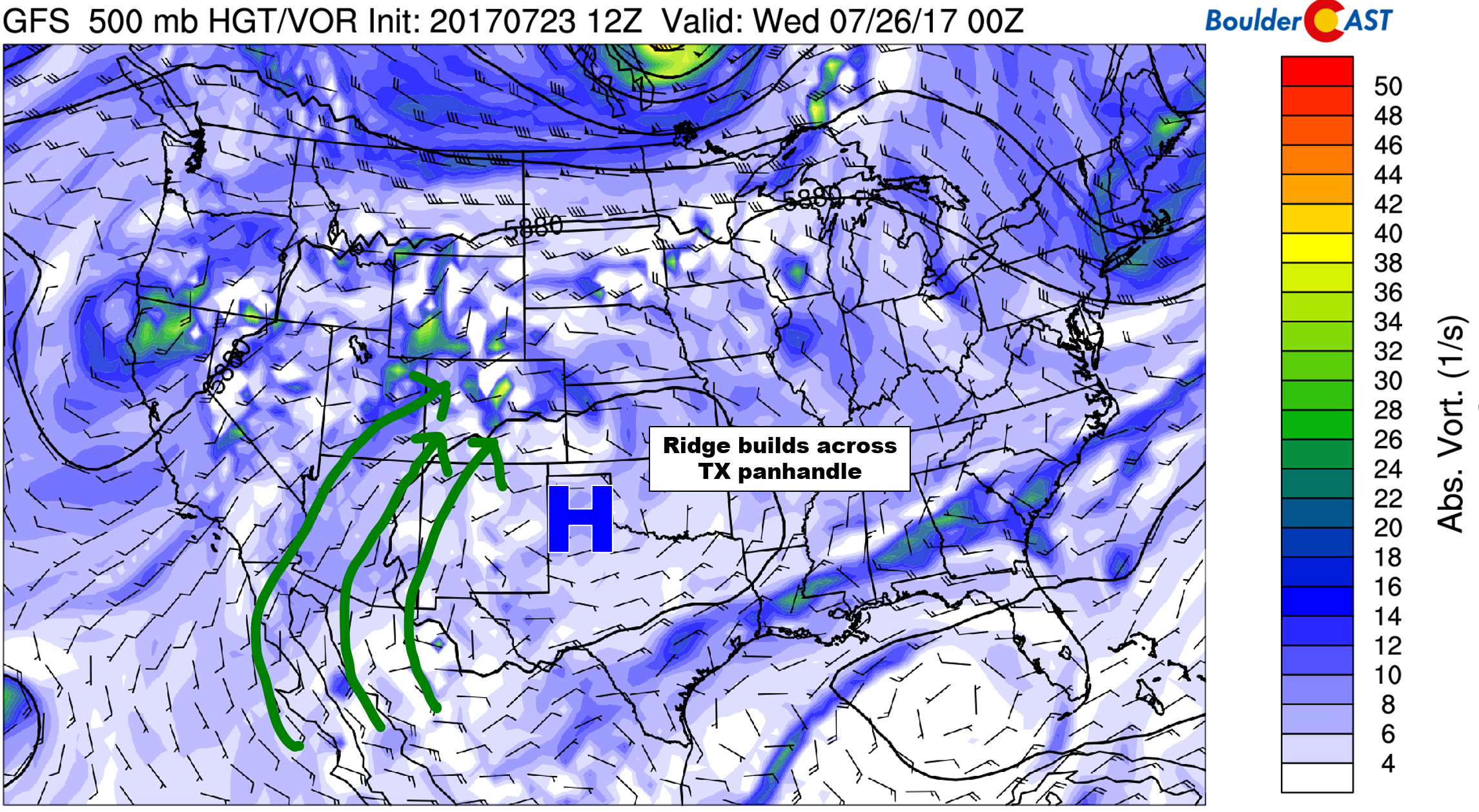
GFS 500 mb vorticity for Tuesday evening. As the ridge intensifies to our south and east, more substantial moisture will invade the region.
The map below shows a plethora of moisture across the entire Mountain West. As a result, thunderstorms will flourish during the afternoon and evening hours beginning Tuesday and continuing through the rest of the week for Colorado.
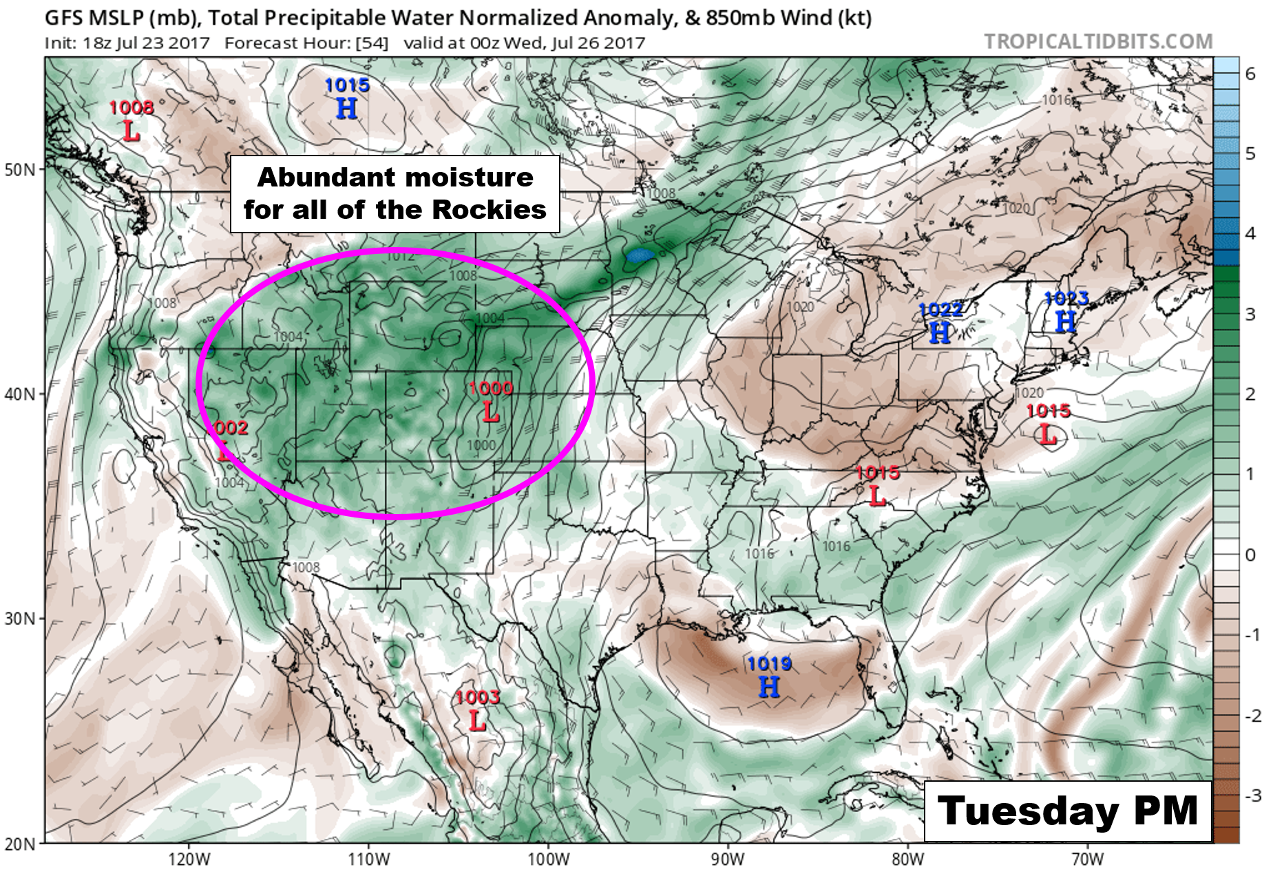
GFS forecast precipitable water anomaly for Tuesday evening. A soupy airmass is in place across all the Mountain states.
Storms will be further enhanced on Wednesday by a summertime, backdoor cold front. The 800 mb temperature map below from the NAM model clearly shows the northeasterly flow and chilly air across northeast Colorado. We have drawn in the position of the cold front as of noon Wednesday (well south of Denver already).
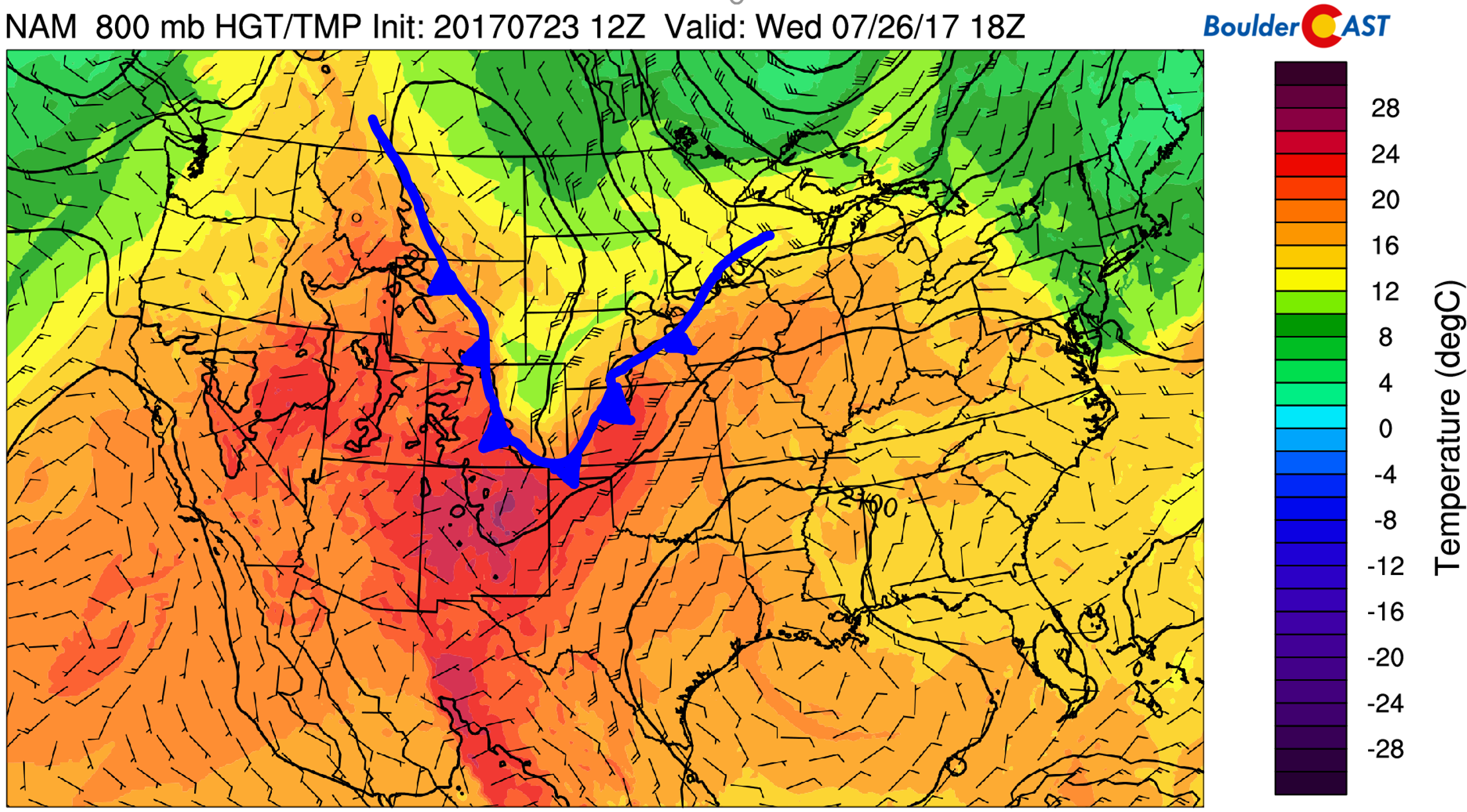
NAM 800 mb temperature and wind forecast map for Wednesday afternoon. A cold front has already moved through Denver.
Juicy air, daytime heating, upslope, and frontal instability will work in tandem to make Wednesday our most unsettled day of the week. Though admittedly, Thursday won’t be far behind. High temperatures may remain the the upper 70’s with scattered to widespread showers and thunderstorms forming after the lunch hour. We’ll also need to be on-guard for flash flooding, especially in and near the Foothills where upslope may help keep the heavier cells from moving much.
Much of the same pattern will exist on Thursday, though the impact of the front will be reduced. Enough moisture will be present to warrant widespread storms across the Foothills with scattered storms on the Plains. Highs Thursday will be similar to Wednesday, probably around 80 degrees.
Weekend should be quieter
As we progress towards the weekend, the ridge is expected to shift westward into Idaho and Utah, bringing a drier northwesterly flow to Colorado.
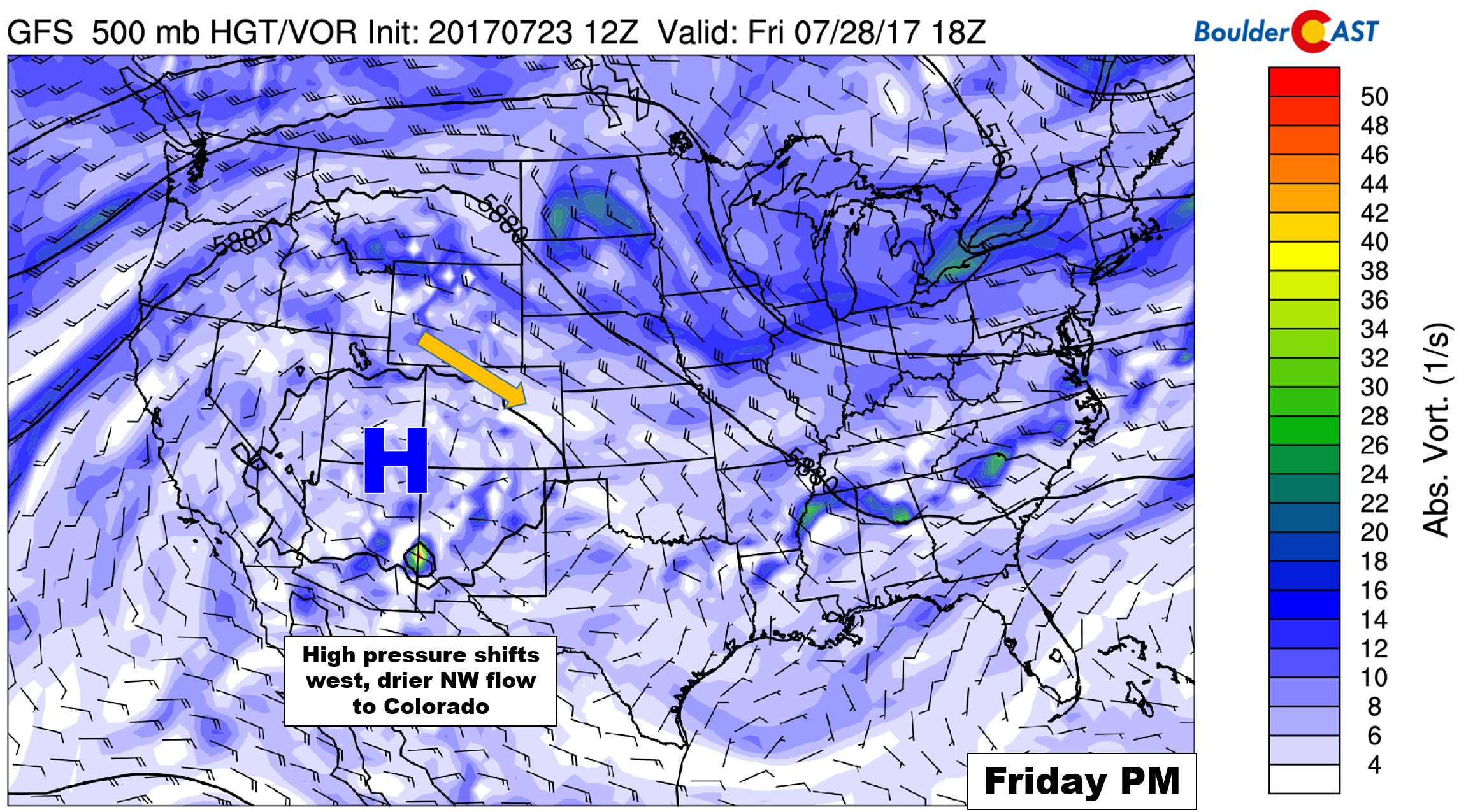
GFS 500 mb vorticity map for Friday afternoon. With the ridge axis now to our west, moisture will decrease as drier northwest flow takes hold.
This would lend to less storms overall and warmer temperatures. Expect isolated to widely scattered afternoons storms Friday with temperatures rebounding back into the upper 80’s.
Overall, this week will offer fair to good chances of rain for everyone and cooler temperatures. Don’t expect rain every day for all locations, but between now and Friday evening, we all should see something.
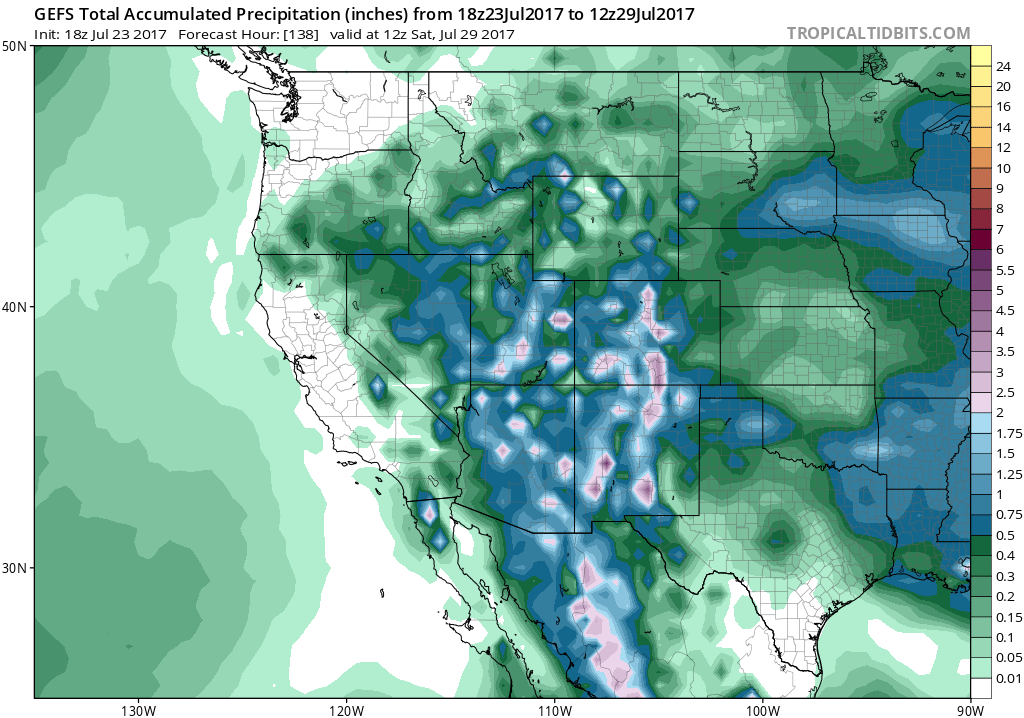
GFS ensemble forecast precipitation accumulation through Saturday morning. Up to 3″ of rain is projected for the higher elevations across Colorado.
Forecast Specifics:
Monday: Partly cloudy early with mostly cloudy skies in the afternoon. Isolated storms are possible, especially across the Foothills south of Denver. Highs across the Plains will be in the mid 90’s with low 80’s in the Foothills.
Tuesday: Partly cloudy in the morning with overcast skies taking hold during the afternoon. Expect scattered showers and storms during the afternoon and evening. Highs will push to near 90 across the Plains, with upper 70’s in the Foothills.
Wednesday: Probably the wettest and coolest day of the week. Look for mostly cloudy skies, cooler temperatures and widespread showers and storms. Storm chances will be highest in the areas near and along the Foothills. Locally heavy rain and flash flooding may be possible with some storm cells. Temperatures will top out near 80 degrees on the Plains and in the upper 60’s in the Foothills. Some storm activity is expected to linger into the overnight hours.
Thursday: Increasing clouds with scattered afternoon and evening thunderstorms, primarily across the higher elevations. Expect temperatures to remain cool, near 80 degrees on the Plains with upper 60’s in the Foothills.
Friday: Morning sun will give way to partly cloudy afternoon skies. Storm chances will be lower, but we still think isolated to widely scattered storms are likely across the Metro area. Highs climb a few degrees into the mid 80’s for the Plains, with mid 70’s in the Foothills.
High Country: Moisture and mountain peaks never sit well during the summer months in Colorado. This week will be very stormy in the higher elevations. Expect scattered storms on Monday and Friday, with widespread activity Tuesday through Thursday. Locally heavy rainfall could cause flooding Wednesday and Thursday along the Front Range. Plan your explorations to include storms forming around the lunch hour each day this week.
Find the best days to hit the mountains with SummitCAST.
Share our forecast:
Mon
Tue
Wed
Thu
Fri


Temperature
95
90
80
81
87


Precip Chc (Plains)
10%(pm)
30%(pm)
50%(pm)
40%
20%(pm)


You must be logged in to post a comment.