
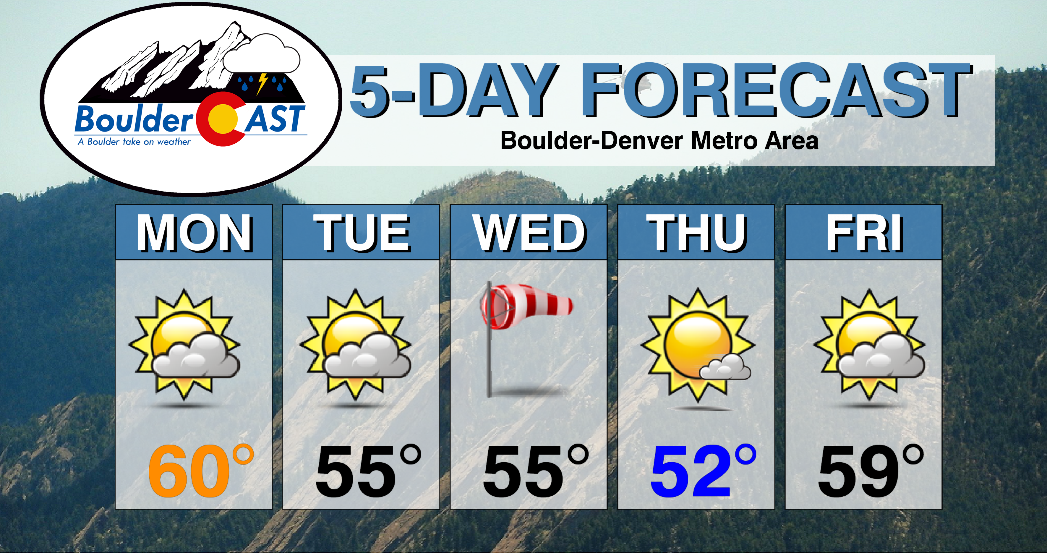
The week ahead will feature overall above average temperatures, along with a few periods of gusty downslope winds. The Mountains will also pick up more snowfall in the middle of the week. Finally, we discuss what Mother Nature may have in store for the region on Christmas.
Mild weather remains to start the week
We begin the week similar to the weekend…on the mild side! Below shows the mid-level pattern across the country today. A system is located across the Northeast. High pressure is situated in the mid-section of the country. Out west, two low pressure centers are over southern Nevada and western Texas. These two systems will be responsible for increasing our clouds later this afternoon as mid and upper level moisture funnel into Colorado. Before that, highs will reach the upper 50’s to lower 60’s in most areas, making for another warm day. Enjoy it…we should be in the low to middle 40’s this time of year!
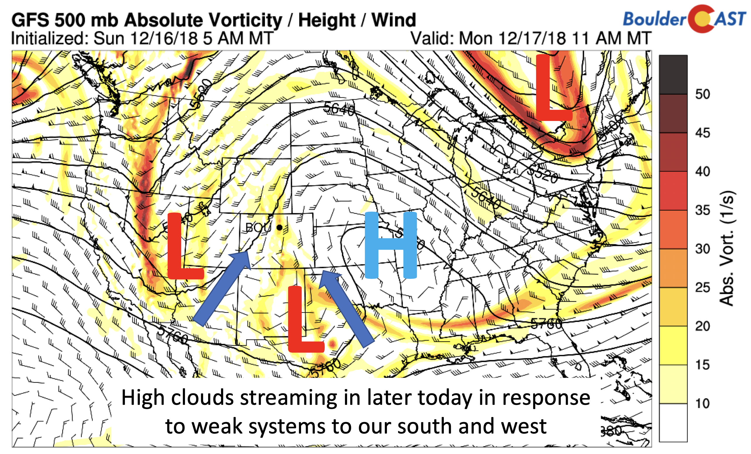
GFS 500 mb vorticity across the nation today
The image below shows the clouds will be streaming northeast this afternoon thanks to the system in Nevada. A milky sky should take over as the afternoon wears on as a result.
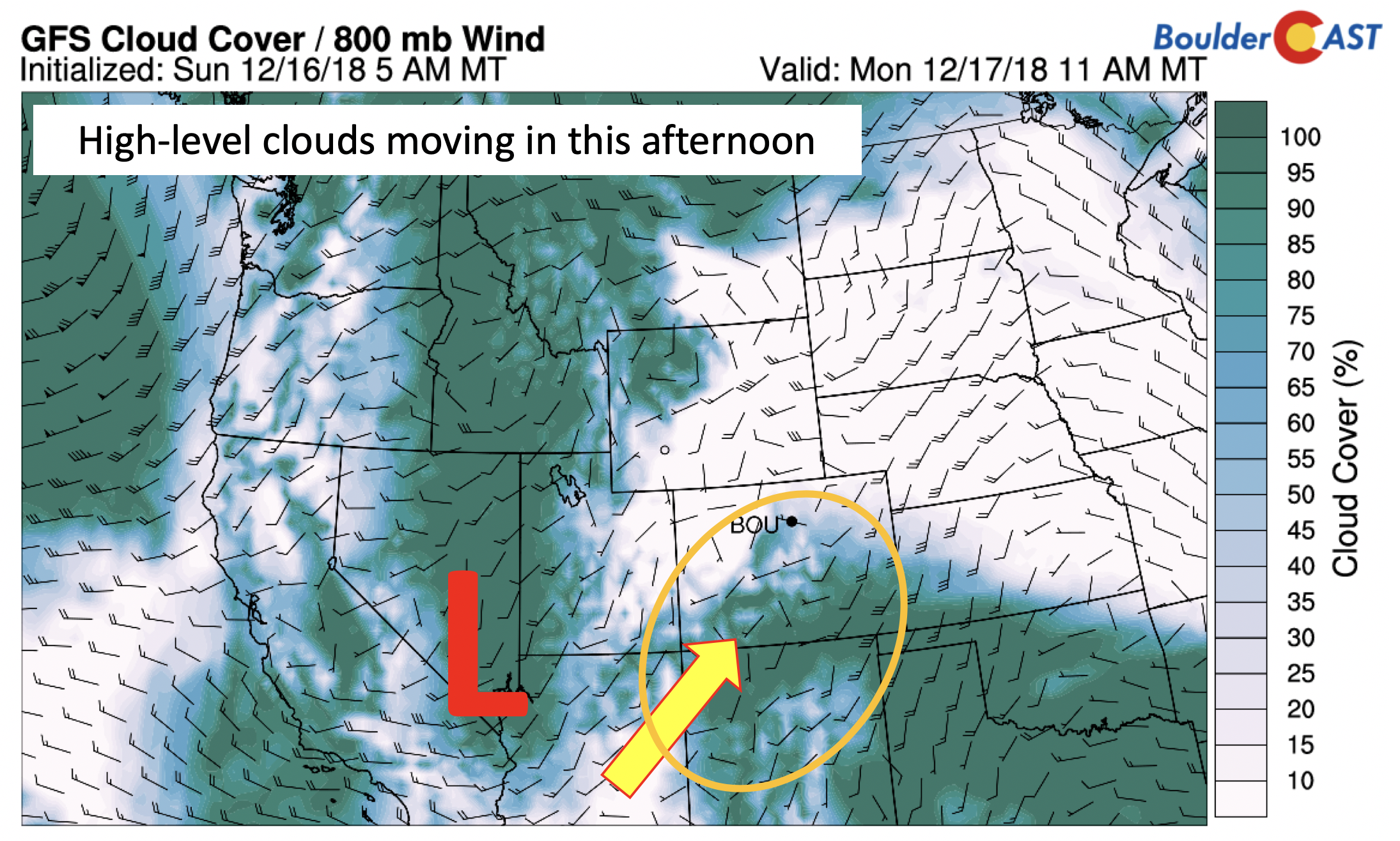
GFS cloud cover forecast later today
The same system in Nevada today will usher in minor lift over the higher terrain tonight, with some of the mountains possibly seeing up to 1″ of snow. Most of this will be light given the weak nature of the system.
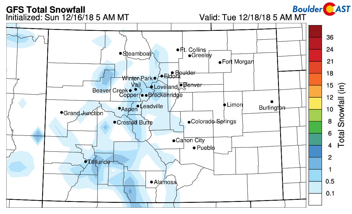
GFS total snowfall forecast tonight
“Slightly” cooler Tuesday
On Tuesday, the aforementioned system in Nevada treks eastward through the day. In its wake, it will help to bring through a weak surface trough over eastern Colorado (below). While the overall airmass is relatively unchanged, weak northerly winds and morning clouds with the system overhead should lower highs a tad in the middle 50’s across the region.
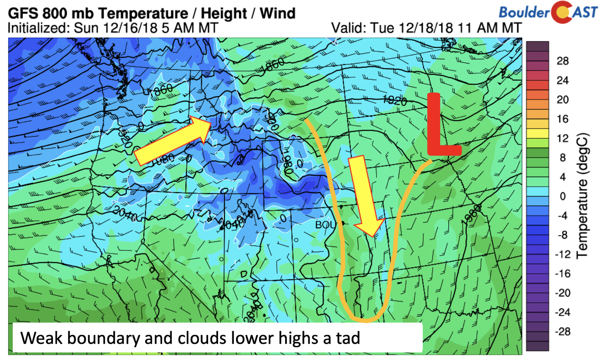
GFS 800 mb temperature on Tuesday
Gusty Wednesday with mountain snowfall
On Wednesday, the upper-level jet stream dives southeastward, stretching from Washington into New Mexico (below on left). Winds at near 30,000 feet up will approach 170 mph! At the lower levels (below on right), winds will be out of the northwest in response to the jet forcing. A northwest wind on the Plains will spell out downslope Chinook wind potential. These surface winds may approach 50 mph in the Foothills and Plains. It’s too early to tell, but a Wind Advisory may be issued for midweek so stay tuned for that. It really comes down to exactly where the overhead jet stream aligns to determine if we will see the strongest winds. The downslope winds will make for another mild day in the middle 50’s under partly cloudy skies.
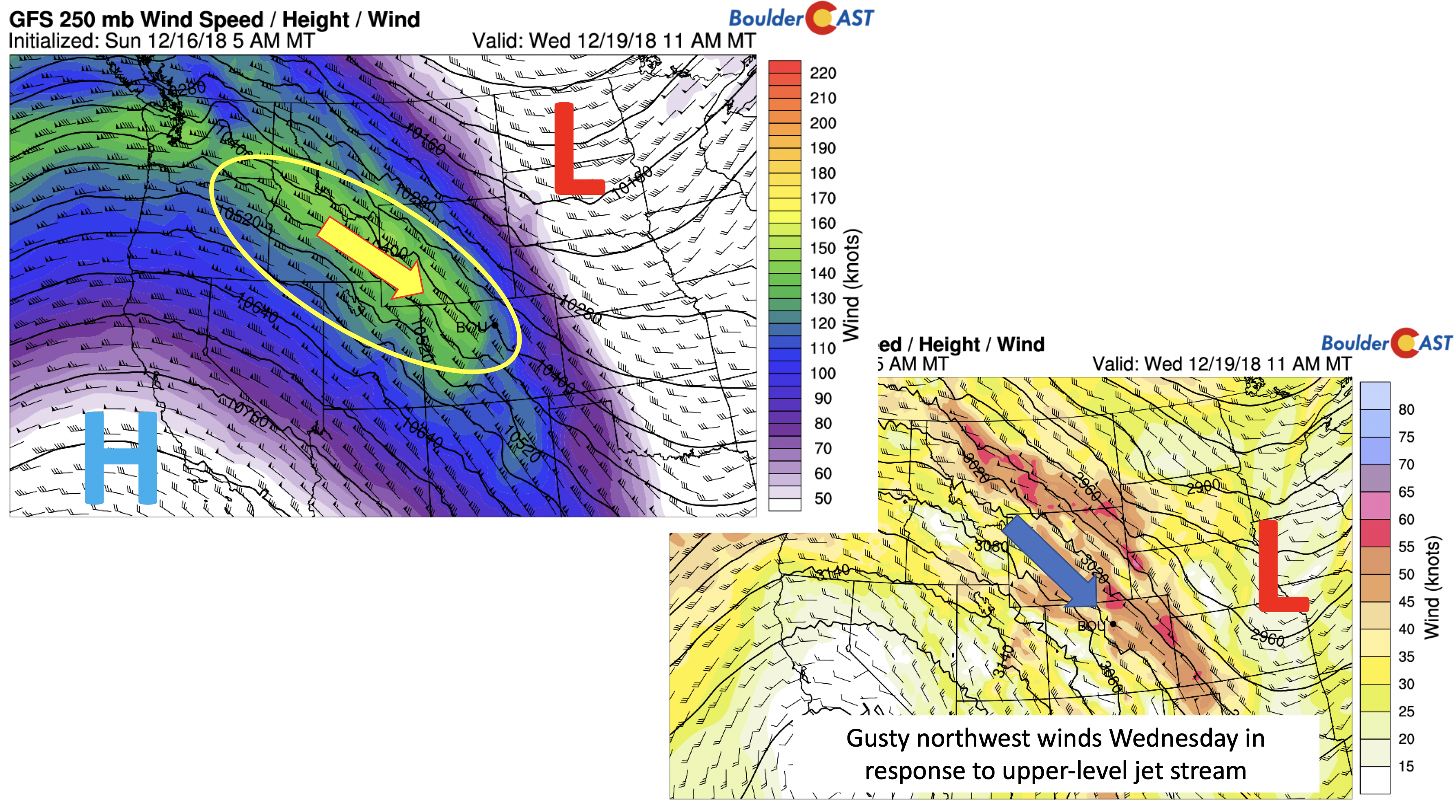
GFS 250 mb jet stream (left) and 700 mb winds (right) for Wednesday
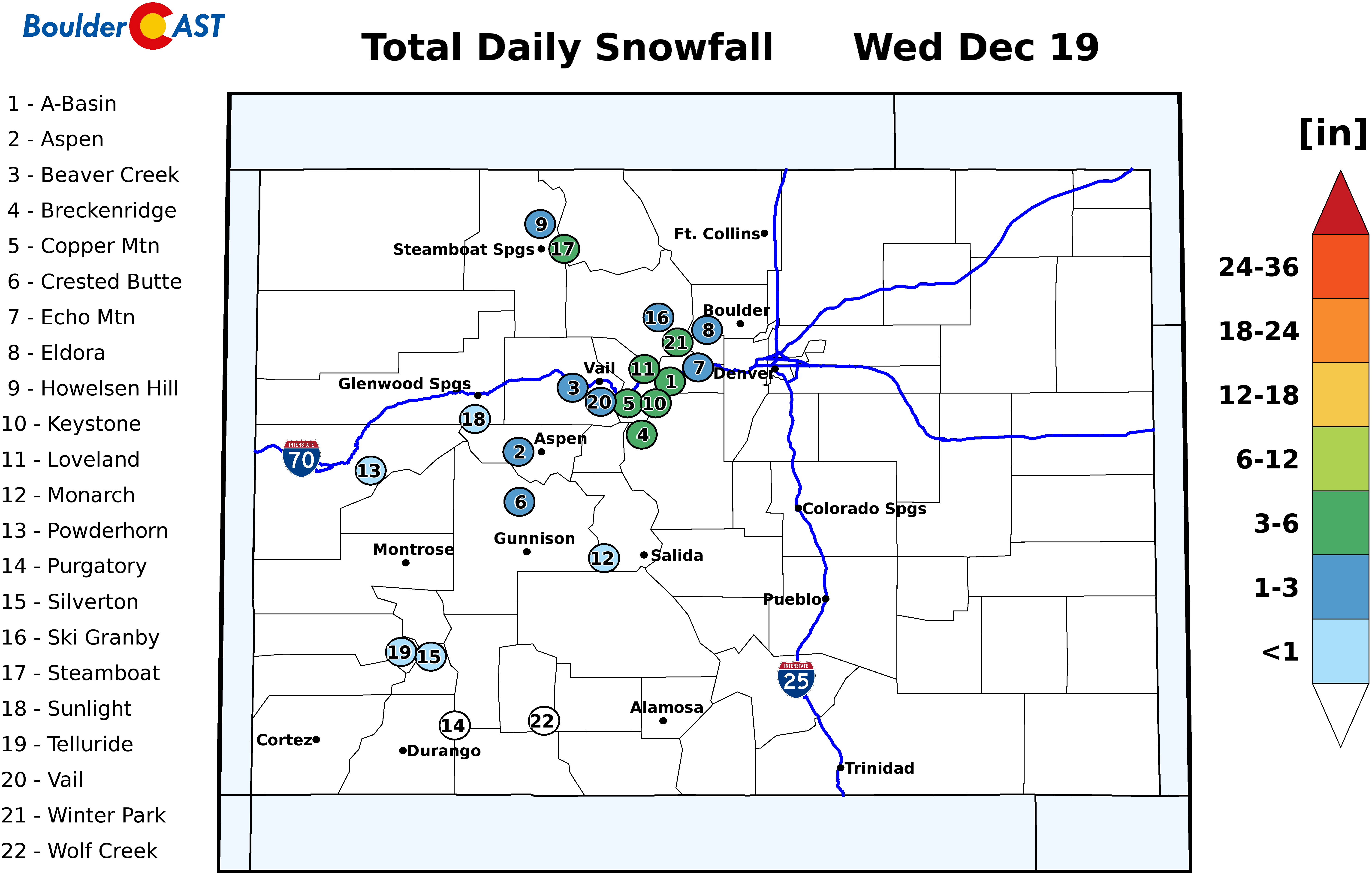
While downslope winds will ensue Wednesday on the Plains, the northwest winds will create upslope conditions over west and northwest Colorado. The NAM model total precipitable water is shown below, along with the predicted snow to liquid ratio (a ratio of the amount of snow per 1″ of liquid water). Although this pattern is generally moist with the jet streaming in from the Pacific, the moisture is quite lacking, with precipitable water values less than 0.2″. Nevertheless, upslope will be quite strong along northwest facing slopes like Steamboat, Winter Park, Aspen, and Vail. The colder air and low moisture content may lead to snow ratios above 17:1!
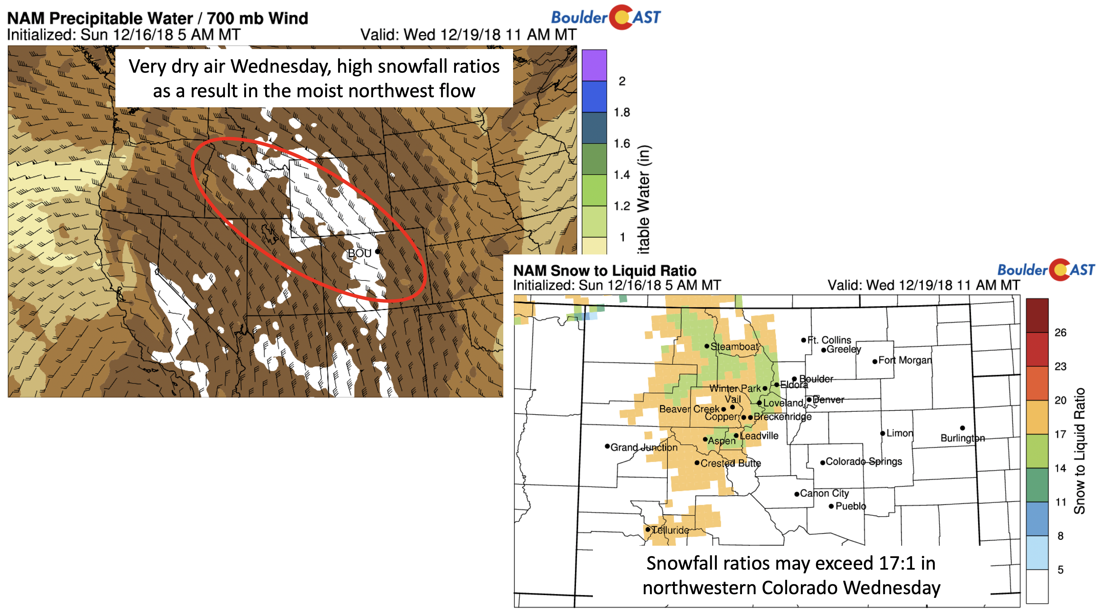
NAM total precipitable water Wednesday (left) and predicted snow to liquid ratio (right)
The high snowfall ratios combined with prolonged upslope will favor snow amounts in the 4 to 10″ range over west and northwest ski resorts (below). We think the NAM is better than the GFS here given its higher resolution. As it stands now, a good powder day will likely exist for Thursday – so be sure to check out PowderCAST as we get closer!

NAM total snowfall for Wednesday
Coolest day Thursday…still above average
While still above average, Thursday will be our “coolest” day of the week. As the jet dives further south, colder air dips down in the northerly flow. At the same time, winds will shift to be out of the northeast during the beginning part of Thursday. Highs in the lower 50’s look reasonable at this stage of the game.
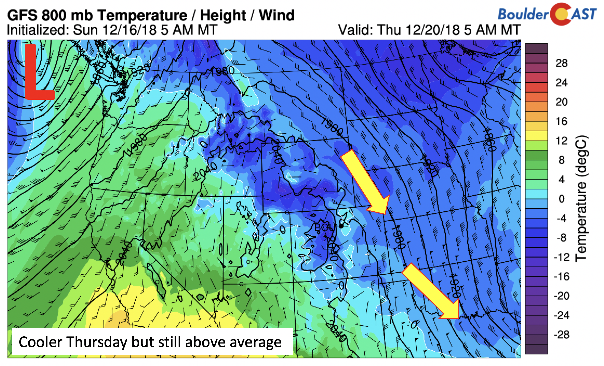
GFS 800 mb temperature Thursday
The diving jet stream will favor a rapidly developing system over the eastern U.S. (below). While much of the East will see rain as a result of the warm temperatures, some snow may develop on the back-side of the storm (Midwest and Great Lakes) as it pulls down colder air. Those of you traveling later this week for the holiday should be on alert for possible flight delays in both the East and Pacific Northwest.
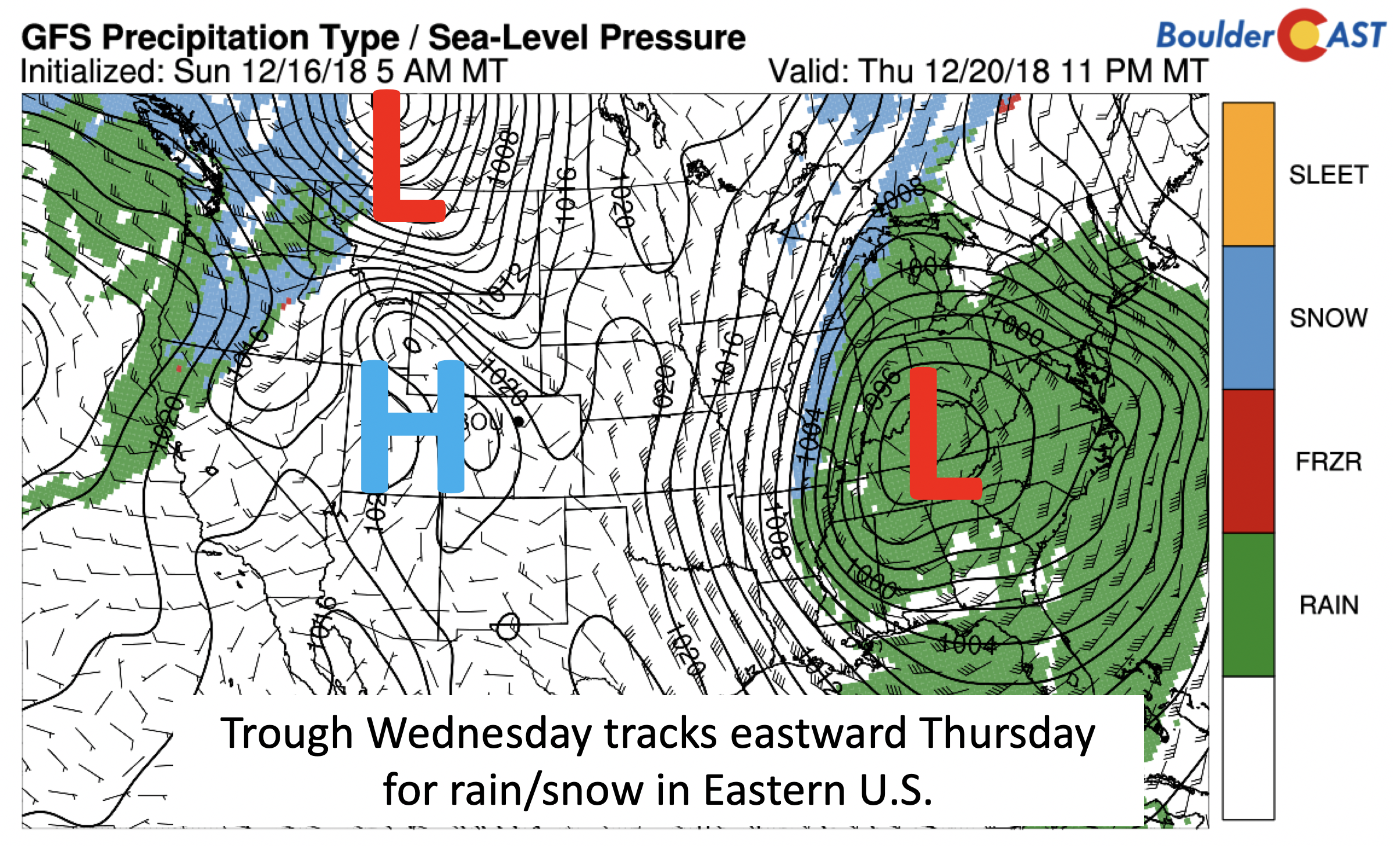
GFS sea-level pressure and precipitation type across the nation Thursday
Windy Friday?
The week will end on the warm side once again. The low-level temperature anomaly (below) exceeds 3 to 4 standard deviations under a re-strengthening ridge. West-southwest flow will ensue leading to highs possibly back where we started on Monday…in the lower 60’s!
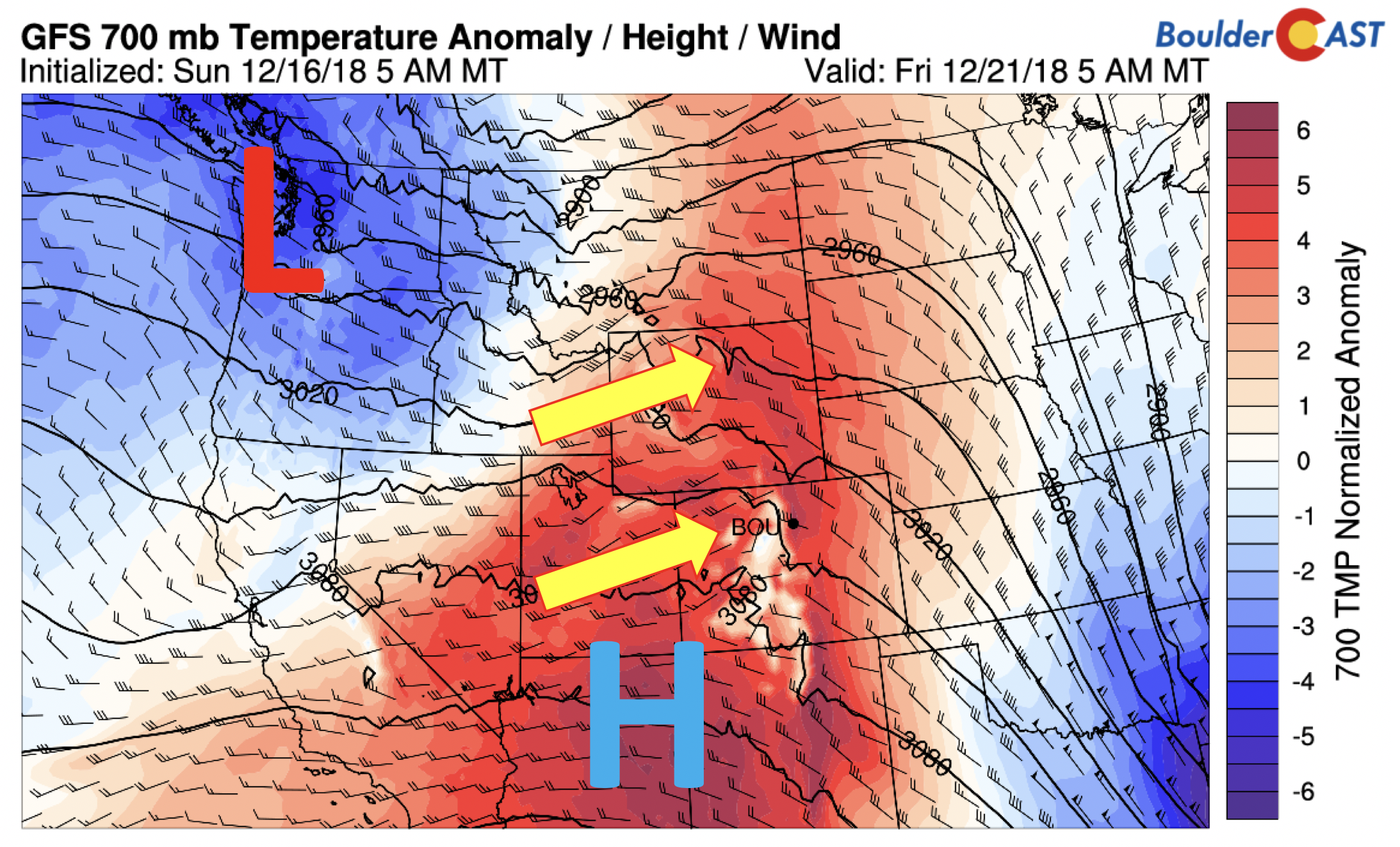
GFS 700 mb temperature anomaly on Friday
On the other hand, clouds may be on the increase as well Friday thanks to the trough in the Pacific Northwest. At the same time, the winds will turn from a westerly direction to a northwest direction (below). That combined with the jet overhead once again may lead to another gusty afternoon and evening. Our confidence in this set-up is low this far out, but we’ll be watching this as the week progresses.
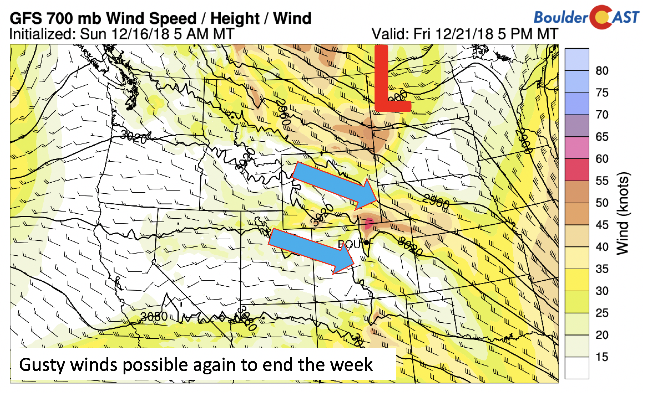
GFS 700 mb wind on Friday
Christmas holiday first look forecast
As we go into the weekend, we turn our attention to the Christmas holiday. What will Mother Nature have in store for us? The NOAA Climate Prediction Center (below) is indicating that during the week of Christmas, there will be the potential for below average temperatures across the west and above average precipitation. This would thus hint at a possible “white” Christmas.
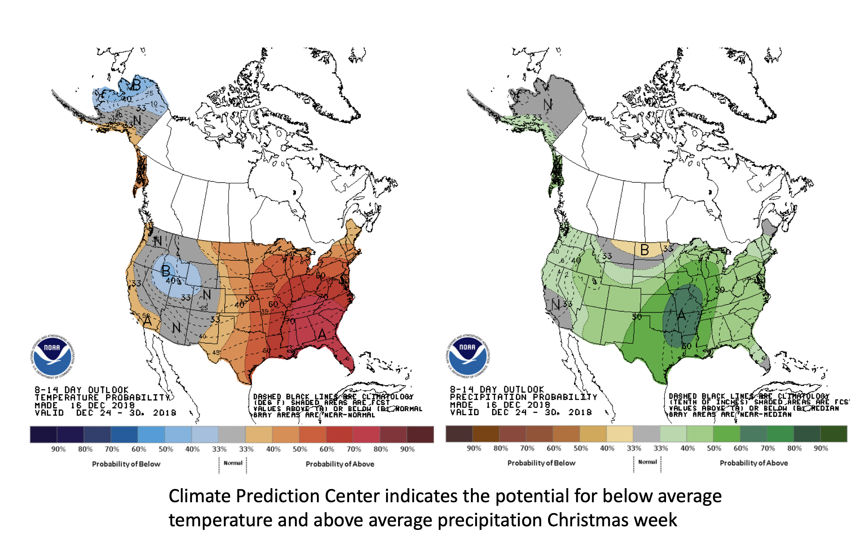
Climate Prediction Center Christmas week outlook
What is leading to the above outlook? While there is considerable spread in the long-range ensembles, many of the global forecast models are indicating a more active pattern next week beginning around the 25th. The four models shown below are the GFS, the next-generation FV3 GFS (will be operational next year), the Canadian, and the ECMWF model. As you can see, all four show either a more southern jet stream and/or a deep trough developing over southern California or Utah between the 25th and 26th. Our confidence in a white Christmas is relatively low at this point, given large model spread. Nevertheless, signs of a more active pattern next week appear a strong possibility. So, we can only hope the weather will surprise us – stay tuned!
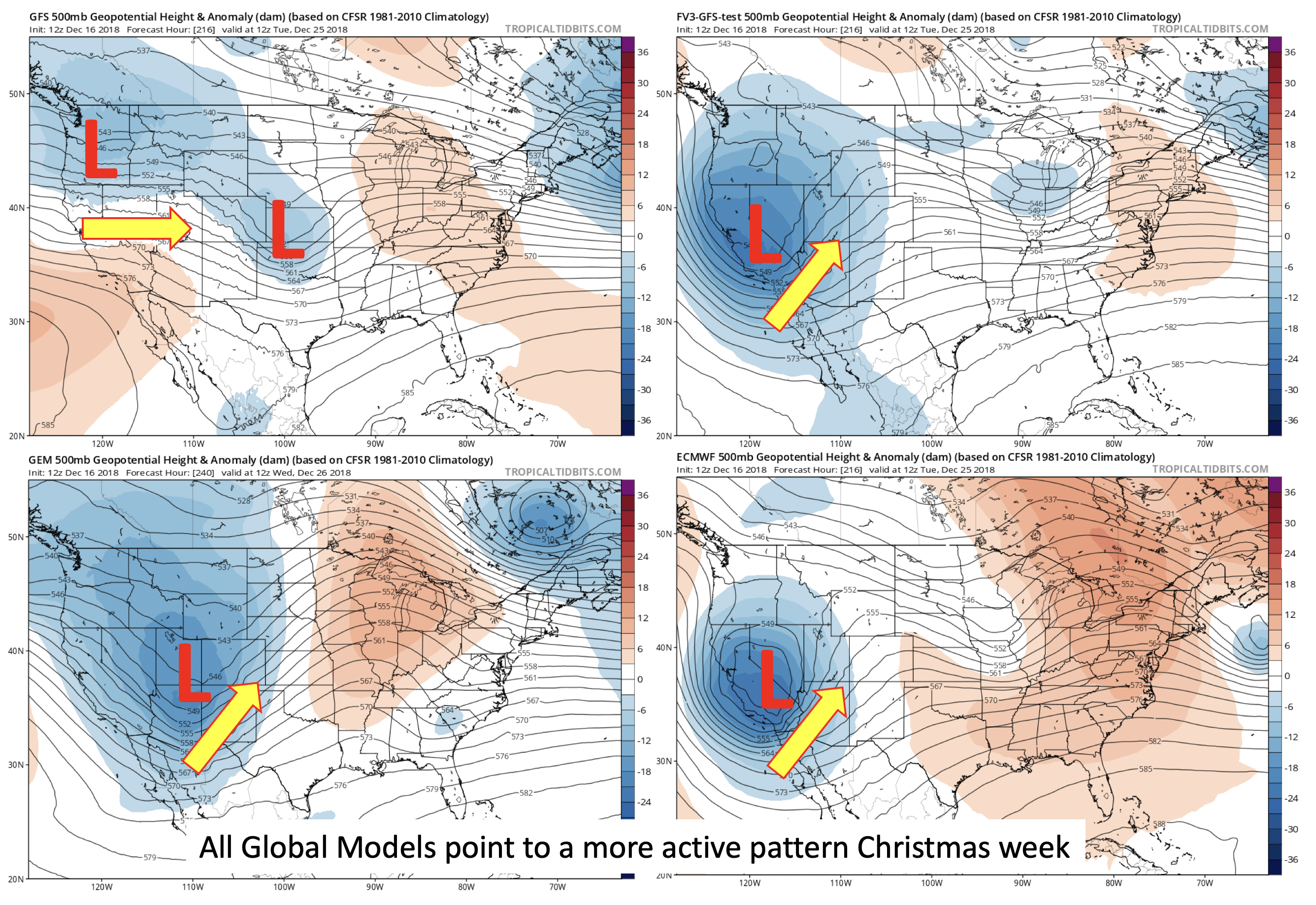
GFS (left), next generation FV3 GFS (right), Canadian (bottom left), and ECMWF (bottom right) for December 24-25, 2018
Have a great week! Happy Holidays!
Forecast Specifics:
Monday: Mostly sunny with high clouds increasing in the afternoon. Highs in the lower 60’s on the Plains and near 50 in the Foothills.
Tuesday: Morning clouds, giving way to afternoon sunshine. Highs in the middle 50’s on the Plains and in the upper 40’s in the Foothills.
Wednesday: Breezy and mild with northwest winds gusting possibly over 45 mph under partly cloudy skies. Highs in the middle 50’s on the Plains and middle 40’s in the Foothills.
Thursday: Cooler under mostly sunny skies. Highs in the lower 50’s on the Plains and lower 40’s in the Foothills.
Friday: Increasing clouds with highs near the upper 50’s to lower 60’s on the Plains and upper 40’s in the Foothills.
High Country: Light snow showers will be present across the west and southwestern slopes of the state Monday night, with amounts light, generally less than 1″. Very windy and snowy conditions will exist starting Tuesday night and continuing Wednesday. Wind gusts over 60 mph will be likely for many of the mountain peaks. Snow on Wednesday may be in the 4 to 10″ range, with locally higher amounts along northwest facing slopes. Drier and breezy conditions take over to end the week. Check PowderCAST for forecasts for all the Colorado ski resorts.
DISCLAIMER: This weekly outlook forecast was created Monday morning and covers the entire upcoming week. Accuracy will decrease as the week progresses as this post is NOT updated. To receive daily updated forecasts, subscribe to BoulderCAST Premium.

.
Share our forecast!


You must be logged in to post a comment.